
The Watchet to Minehead walk is a coastal route of around 8 miles (13 km) along the West Somerset Coast Path, linking Watchet harbour with Minehead via Blue Anchor and Dunster Beach. The West Somerset Coast Path connects directly to the start of the South West Coast Path. This guide covers the full route, terrain, transport options and key highlights along the way.
The West Somerset Coast Path is a long-distance coastal route running for around 58 miles (93 km) from Steart on the River Parrett to Minehead, linking the Somerset Levels with the start of the South West Coast Path. Today, this entire stretch forms part of the King Charles III England Coast Path, following the Bristol Channel along one of the most varied and geologically interesting sections of the Somerset coastline.
Along its length, the route passes through Kilve, West Quantoxhead, Williton, Watchet, Blue Anchor and Dunster Beach, combining fossil-rich cliffs, intertidal rock platforms, and shingle ridges formed by one of the world’s highest tidal ranges.
This guide focuses on one of the most accessible sections of that wider route, the Watchet to Minehead walk via Blue Anchor and Dunster Beach, a distance of roughly 9 miles (14 km). The opening stretch from Watchet includes a steady climb to around 270 ft (82 metres), with elevated views across the Bristol Channel towards South Wales on a clear day. From Blue Anchor onwards, the route becomes largely flat and easier underfoot, with options to follow level paths rather than the rougher shoreline.
With railway stations and bus links running close to the route, this section is particularly flexible, allowing you to tailor the distance to suit your time. Whether walked as a shorter coastal stroll or a longer day out, it offers a varied and rewarding introduction to the wider West Somerset Coast Path.
Here, we outline a relaxed coastal walk from Watchet to Minehead, with an optional detour to Dunster village.
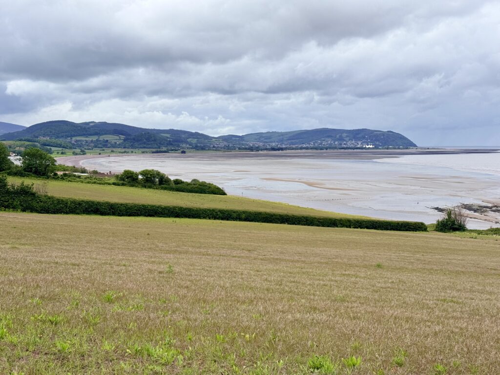
Watchet to Minehead walk at a glance
Distance: 8 to 9 miles (13 to 14.5 km)
Time: 3.5 to 5 hours
Difficulty: Moderate (short climb near Watchet, then mostly flat)
Best for: coastal views, fossils, wildlife and flexible route options
Start at Watchet Harbour and finish in Minehead, with options to shorten the walk using the West Somerset Railway or First Bus Somerset Number 28.
Practicalities
- Start: Watchet Harbour, Somerset
- Finish: Minehead, Somerset
- Difficulty: Moderate
- Length: approx. 8 to 9 miles (13 to 14.5 km), allow 3.5 to 5 hours
- Terrain: Initial climb out of Watchet and corresponding descent into Blue Anchor of approx. 80m (260ft), steep in places and can be muddy after rain. After this, the route becomes mostly flat, following the coast path with shingle-beach sections and a promenade into Minehead.
- Maps: Ordnance Survey Explorer OL9 (Exmoor) covers the full route in detail, while Landranger 181 (Minehead & Brendon Hills) provides a useful wider overview.
- Parking: Watchet Harbour car parks; Minehead seafront parking
- Public Transport: Rail stations at Watchet, Blue Anchor, Dunster and Minehead (West Somerset Railway seasonal services). First Bus 28 also offers regular, inexpensive service between the towns and villages.
- Nearest towns: Watchet, Minehead
- Facilities: Cafés, pubs and toilets at Watchet, Blue Anchor, Dunster Beach and Minehead
- Dog Friendly Walk: Yes, but check seasonal beach restrictions
- Best for: coastal views, fossils, easy walking, wildlife, history
West Somerset Coast Path map: Watchet to Minehead
Watchet: Start of the Watchet to Minehead Walk
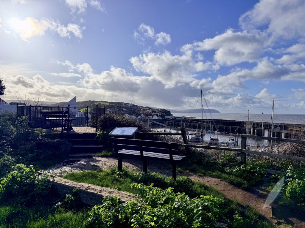
The walk begins at Watchet, a historic harbour town on the Bristol Channel with long links to maritime trade, iron ore exports and the West Somerset Railway. The marina, harbour walls and surrounding streets provide an easy starting point, with cafés, independent shops, a bus stop and a railway station all within a short distance. For a complete guide to the town, see our page, “Things to do in Watchet, Somerset: A Complete Visitor Guide.”
A short walk around Watchet Harbour gives a clear sense of the town’s connection to the sea. Fishing boats and yachts sit within the marina, while the harbour walls look out across the Bristol Channel towards South Wales. Around the quayside are reminders of the town’s maritime and literary past, including the statue of the Ancient Mariner and the memorial to Yankee Jack, a local sailor and sea shanty singer.
East Quay
Next to the marina, East Quay adds a more contemporary element to the waterfront. Its galleries, studios and café overlook the basin and have become a focal point for visitors, sitting comfortably alongside what is now largely a leisure marina rather than a working port.
West Somerset Railway
Watchet Station is also a popular stop on the West Somerset Railway, one of the longest heritage railways in England. The line reached the town in the nineteenth century and later extended to Minehead, opening up the coast to trade and tourism. Steam trains still arrive beside the harbour during the season (April-October), adding to the atmosphere around the station.
Beyond the harbour, the coastline is known for its geology and fossils. The cliffs contain layers from the Triassic and Jurassic periods, and ammonites and other finds are regularly uncovered after rough weather. This stretch of coast provides an early glimpse of the landscapes that continue west towards Blue Anchor and Dunster Beach, setting the scene for the walk ahead.
Stage 1 – Watchet to Blue Anchor Walk
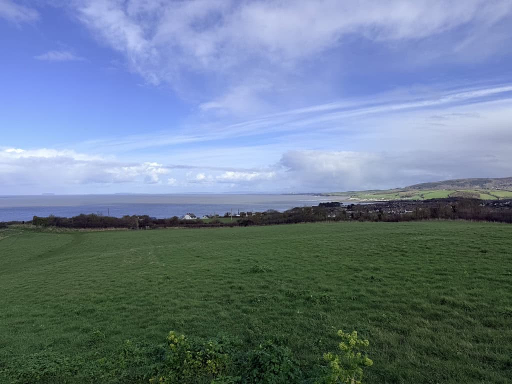
Leaving Watchet, keep the harbour to your right and climb steadily up Cleeve Hill along the B3191, which is currently closed to vehicles beyond Watchet due to cliff erosion. The climb towards Daws Castle is moderate, and the lack of traffic makes this an unexpectedly peaceful section. Daws Castle itself is the earthwork remains of an Iron Age hillfort, later reused in the Saxon period as a defensive site guarding the Bristol Channel.
At Daws Castle, the King Charles III England Coast Path leaves the road to the right, crossing open ground before entering woodland. From here to Blue Anchor, the route weaves in and out of trees, with a mix of shaded paths and more open stretches. A short descent leads into a small valley, with a track to the left leading to Warren Bay Holiday Village, while a track to the right drops down to the rocky beach typical of this part of the coast.
Another steady climb takes you to the highest point of the route, around 270ft (83 m), before the path begins to descend through woodland and then fields. It is on this descent that the views really begin to open up, with your first sight of Dunster Castle, Dunster Beach and, in the distance, Minehead, your destination for the day. A short stretch along the road then leads down to the beach at Blue Anchor.
The coast path between Watchet and Blue Anchor is narrow in places and unsuitable for pushchairs. It also passes close to unstable cliff edges, so children should be carefully supervised, and dogs, even the best-behaved, should be kept on leads. After wet weather, the path can be muddy, so decent footwear is recommended.
Blue Anchor, Somerset: Coastal Walk and Fossil Hunting
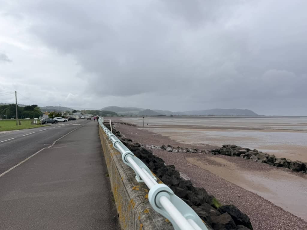
Blue Anchor is one of the key geological locations along this stretch of coast. The cliffs here clearly reveal distinct layers formed over millions of years, with red Triassic rocks showing beneath darker Jurassic deposits. These exposed strata provide a visible record of changing environments, from arid desert conditions in the Triassic period to the warmer, shallow seas of the Jurassic.
The shoreline around Blue Anchor and towards Watchet is particularly well known for fossil hunting. After storms or high tides, it is not uncommon to find fragments of ammonites, bivalves and other marine fossils washed out from the cliffs and scattered across the foreshore.
Blue Anchor is not a traditional sandy seaside beach. The beaches along this stretch of the Somerset coast are a mix of shingle, rock, mud and intertidal sand, so the experience is very different from a classic sandy beach.
The Bristol Channel has one of the highest tidal ranges in the world, and at low tide the sea can retreat a considerable distance, exposing wide areas of mudflats. As a result, paddling or swimming is often impractical and unsafe. Water quality can also vary, particularly after periods of heavy rain, so it is worth checking current conditions before planning a swim.
That said, Blue Anchor does offer a range of useful facilities. There is free parking near the beach, public toilets, a pub, the Smugglers Inn, and a café, Driftwood Café, which is a popular stop for walkers. Blue Anchor is also home to several holiday parks, including Hoburne Blue Anchor and Beeches Holiday Park, which provide accommodation and on-site amenities.
Transport links are also good for walkers. Blue Anchor railway station is on the West Somerset Railway line, while a short walk inland to Carhampton gives access to the First Bus 28 service between Watchet and Minehead.
In all but the best weather, Blue Anchor can feel exposed. However, for those staying locally, the surrounding area has plenty to offer. The nearby countryside offers excellent walking and wildlife watching, with Exmoor just a short drive away, along with a wider choice of activities in Watchet, Dunster, Minehead and the surrounding villages.
Fossil rich shores along the West Somerset coast
While the official UNESCO Jurassic Coast lies further south, the Somerset coastline around Blue Anchor, Kilve and Lilstock shares similar geology and contains some of the most important fossil beds on the West Somerset coast.
At Blue Anchor, the cliffs expose layers rich in evidence of ancient marine life. Fossils found here include ammonites, fish remains, shark material and fragments from the late Triassic Bone Bed. Early Jurassic ammonites such as Psiloceras are particularly significant.
Further west, near Kilve and Lilstock, broad intertidal rock platforms are revealed at low tide. These expose layered mudstone and limestone, where fossils continue to appear through natural erosion.
Storms and tides regularly uncover new material while gradually wearing back the cliffs, so conditions and visible features can change from one visit to the next, making this a particularly interesting stretch of the West Somerset Coast Path to explore.
Stage 2 – Blue Anchor to Dunster Beach Walk
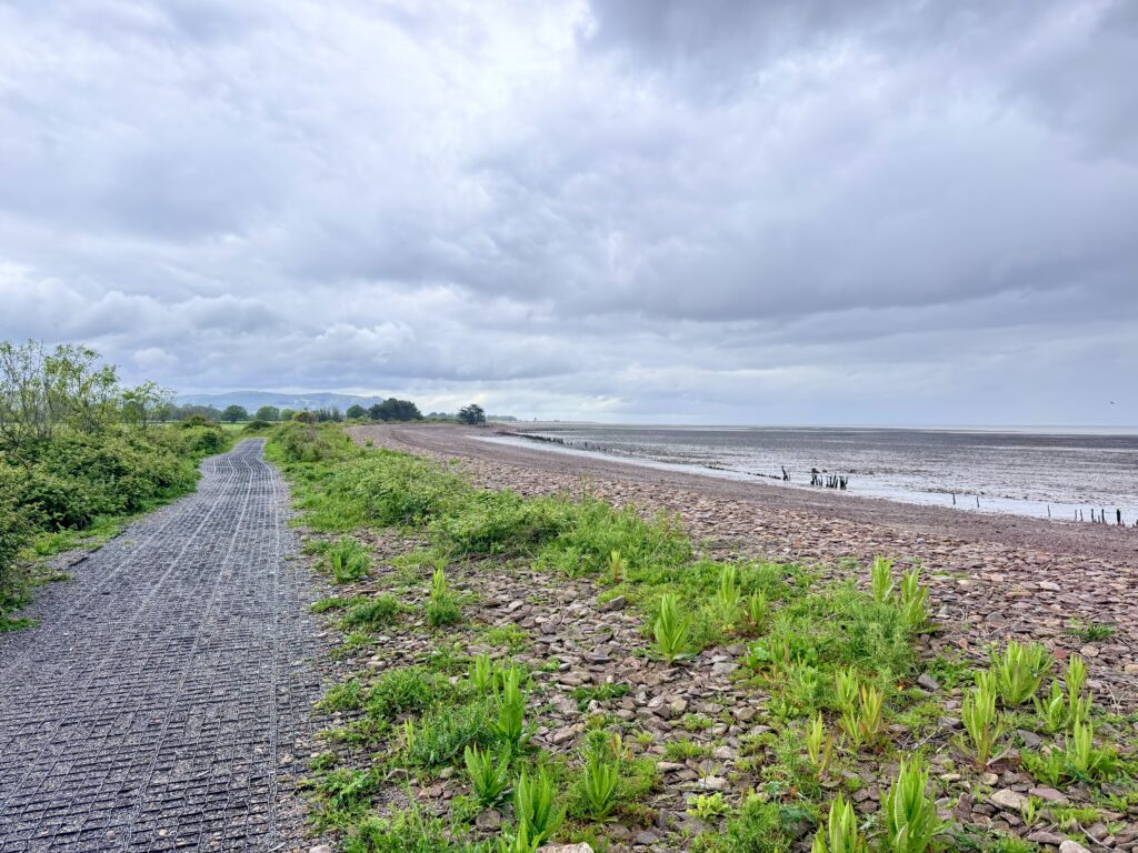
At the western end of the sea wall at Blue Anchor, you need to descend the steps onto the beach, as the King Charles III England Coast Path follows the shoreline for a short distance, passing close to private land. At high tide, and particularly in poor weather, this section can become difficult or even impassable, so it is important to check tide times before setting out. We recommend using a reliable tide table service such EasyTide, provided by the UK Hydrographic Office.
If conditions allow, it is possible to continue along the beach towards Dunster Beach. However, the mix of rocks and shingle can make this slow and hard going. A better option for most walkers is to follow the path at the top of the beach, which begins as loose shingle, becomes a firmer track and then joins a paved multi-use route, part of the Steam Coast Trail.
This is a pleasant and straightforward stretch of around 2 to 2.5 miles (3 to 4 km), with the West Somerset Railway running alongside for much of the way. Views of Dunster Castle, with Exmoor behind, add interest as you approach your destination.
What is the Steam Coast Trail?
The Steam Coast Trail is a developing walking and cycling route along the West Somerset coast, designed to link coastal communities between Minehead and Williton. On this walk, the most useful section is between Blue Anchor and Dunster Beach, where it provides an easier alternative to the rougher shoreline.
This stretch runs close to both the coast and the West Somerset Railway, which is where the trail gets its name. In places, you can walk with the beach on one side and the heritage railway line nearby, making it one of the most distinctive parts of the Watchet to Minehead route.
Between Blue Anchor and Dunster Beach, the path begins as a rougher beachside track before becoming firmer and, in places, surfaced. It is generally easier underfoot than walking directly along the shingle, although conditions can still vary after bad weather.
Dunster Beach, Somerset: Coastal Walk and Beach guide
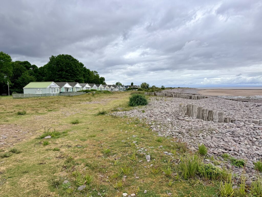
Dunster Beach opens out into a wide, exposed stretch of the Somerset coast, with views over the channel towards Wales.
Here, the shoreline is a mix of shingle, mud and intertidal sand rather than a continuous sandy beach. The very large tidal range in the Bristol Channel means the sea retreats a long way at low tide, exposing wide expanses of shoreline that are very different from a typical seaside beach. That said, it remains a good place to pause, walk and take in the scenery, with a quieter, more open feel than many nearby coastal spots.
The shoreline is backed by a large shingle ridge, with dunes and wetland areas forming in the more sheltered ground behind. The pebbles are mainly derived from Devonian sandstone eroded from the Exmoor coast, many marked with distinctive white quartz veins. Over thousands of years, these have been carried eastwards by longshore drift and tidal movement following the end of the last Ice Age. The ridge continues to shift under the influence of tides and storms, with wooden groynes helping to trap pebbles and slow erosion, while marram grass stabilises the dunes.
Compared with the cliffs further east, the landscape here is lower and more open, with wide areas of sand visible at low tide and a constantly changing shoreline of shingle, sand and mud. Behind the beach, dunes, rough grassland and wetland areas support a wide range of plant and animal life. In summer, wildflowers such as Viper’s Bugloss, Carline Thistle and Evening Primrose bring colour to the dunes, while the shoreline and wetter ground attract birds including curlew, oystercatchers, turnstones and little egrets.
Set just behind the beach is Dunster Beach Holidays, a long-established collection of chalets and open green spaces that gives this area a more settled, low-key feel. Some of the chalets are modern, while others are more traditional, but overall, it remains a relaxed place to stop. For walkers, it provides a useful break point, with the Kingfisher Café, benches, open greens and direct access to the coast all close to the path.
There is also beachside pay-and-display parking here, making it a practical access point for exploring this section of the coast.
Optional Detour – Walk to Dunster Village
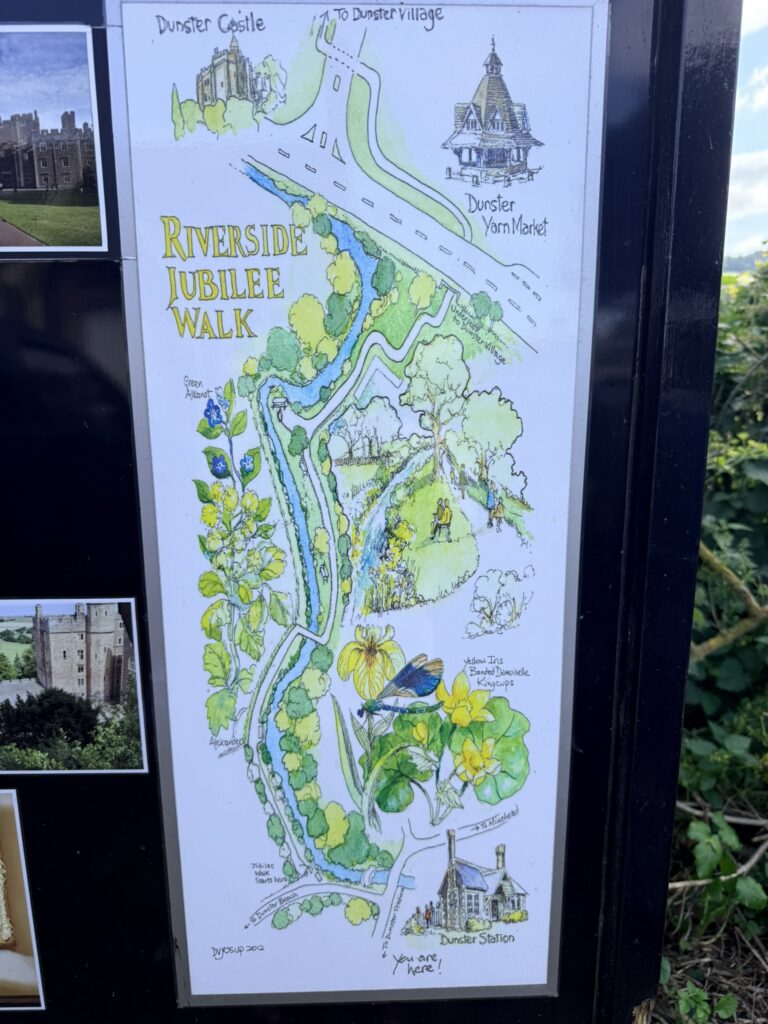
From Dunster Beach, you can turn inland along Sea Lane, which links the beach to the A39. On the right is Dunster railway station on the West Somerset Railway. Continuing along Sea Lane, look for signs for the Riverside Jubilee Walk, which leads inland to Dunster village.
The Riverside Jubilee Walk follows the banks of the River Avill, offering a quieter, more scenic route into the village. It is hard to imagine now, but medieval Dunster once had its own port here before the river silted up in the 17th century, leaving Minehead as the nearest harbour.
Dunster itself is one of Somerset’s best-preserved medieval villages, known for Dunster Castle, the Yarn Market, its historic high street and a good range of independent shops and cafés. The detour from the coast is around 1 mile each way and, like other points along the route, can easily be combined with a return by bus or a rail trip.
Stage 3 – Dunster Beach to Minehead Walk
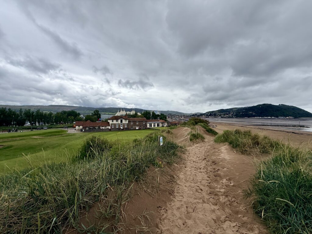
From Dunster Beach to Minehead, the route follows the shoreline, with several Second World War pillboxes visible along the way. At the far end of Dunster Beach, the path bears slightly right, running between Minehead Golf Course on the left and the beach on the right.
There is also the option to turn left onto Station Road towards Dunster village. This can be useful in poor weather or during very high tides, as the coastal path here runs close to the beach.
Walking alongside the golf course, the signage makes it clear that walkers should keep to the path. Some of it can feel a little over the top, but this is a well-used stretch and easy to pass through without issue. There is a slight sense that walkers are not especially welcomed, but this is a public footpath, so as long as you keep to the route and stay aware, you are perfectly entitled to be here.
The route continues along the back of the beach, crossing low dunes, which makes this section unsuitable for pushchairs or cycles. It then drops down onto Warren Road, where the walk becomes easier along the seafront. Passing Butlin’s Minehead on your left, you continue into Minehead finishing at Minehead Railway Station and the town centre, a natural end point for the walk.
Minehead: End of the Watchet to Minehead Walk
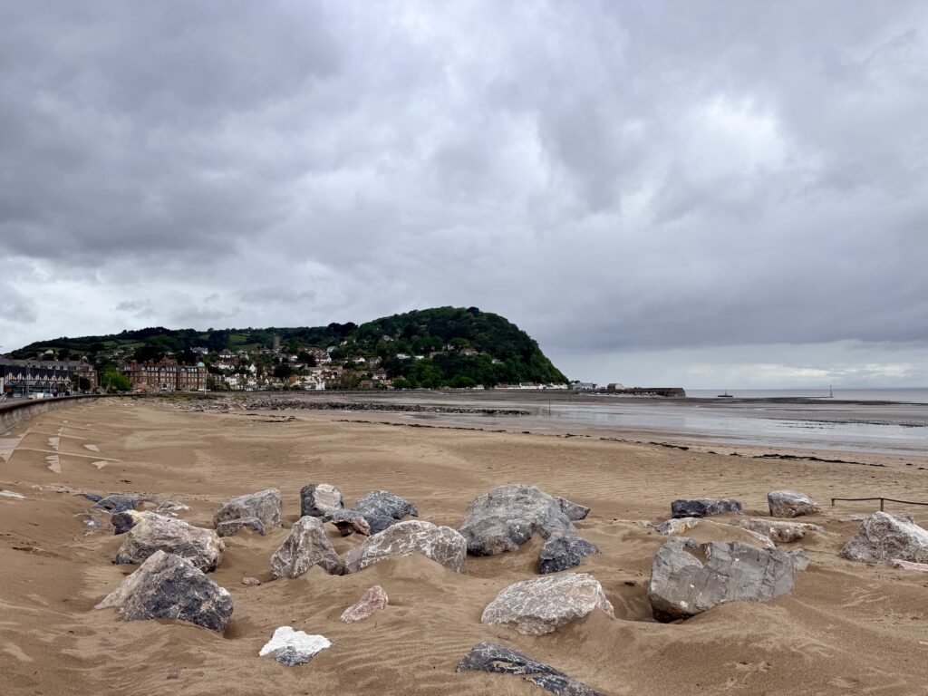
Minehead makes a natural endpoint for the walk and, in good weather, is an enjoyable place to spend some time. The town’s main draw is Butlin’s, which dominates this part of the seafront and remains one of the area’s biggest attractions, particularly for families.
Alongside it is Minehead Beach, a long stretch of sand and shingle. There is plenty of space for a walk, with broad sandy areas suitable for traditional seaside activities such as sandcastles and beach games, although some sections are pebbly; tides here are significant, with the sea retreating a long way at low tide, so the best time for swimming is usually around high tide.
It is well worth continuing your walk a little further to Minehead Harbour, where you will find the statue marking the official start of the South West Coast Path, a popular photo spot and a fitting place to pause at the end of the route. The harbour itself has a more traditional feel, with fishing boats and cafés back along the coastline you have just walked.
The town centre is centred around The Avenue, a broad, tree-lined street with a mix of independent shops and cafés, and places to eat. It is at its best in the sunshine, with a relaxed, seaside feel. Just a short walk away, Blenheim Gardens offers a quieter space to sit, with well-kept lawns, seasonal planting, and a café that makes a good stop before heading back.
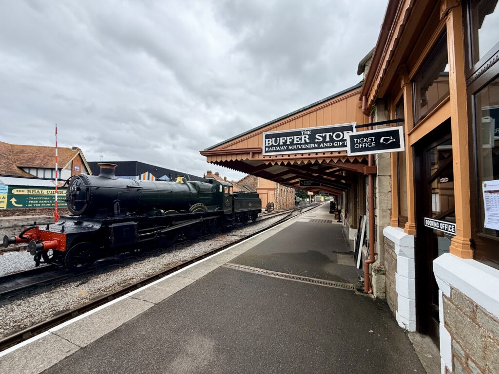
Another highlight is the West Somerset Railway, which terminates in Minehead. As the longest heritage railway in England, it is a major attraction in its own right. If you time it right, you may see steam trains arriving and departing, and the turntable used to reverse engines for the return journey is particularly interesting to watch.
For the return journey, First Bus Somerset service 28 runs regularly. It can be caught outside Butlin’s main entrance or near Minehead Railway Station, making it straightforward to get back to your starting point without retracing your steps.
For a complete guide to the town, see our page, “Things to do in Minehead, Somerset: A Complete Visitor Guide.”
Minehead to Dunster, Blue Anchor and Watchet walks: route options and transport.
One of the real strengths of this stretch of coast is its flexibility. With both the West Somerset Railway and the number 28 bus running broadly parallel to the route, there are numerous ways to plan your walk without needing to retrace your steps.
You could, for example, walk from Minehead to Dunster Beach as a shorter, easier option, or extend it into a longer Minehead-to-Blue Anchor walk by continuing along the coast. From Blue Anchor, it is a straightforward and very enjoyable section onwards to Watchet, making the Blue Anchor to Watchet walk another popular choice with varied terrain, woods, fields and harbour interest at the end.
Equally, these routes work just as well in reverse, so a Watchet to Blue Anchor walk or Blue Anchor to Minehead walk can be easily planned depending on where you choose to start and finish. The railway stations at Minehead, Dunster (via a short walk), Blue Anchor and Watchet give you plenty of flexibility. At the same time, the bus provides a reliable alternative if train times do not quite line up.
This makes it easy to tailor the distance to suit your time and energy, whether you are looking for a short coastal stroll or a longer day walk linking several of Somerset’s seaside towns and villages.
Coastal safety on the West Somerset Coast Path
Coastal walking along the West Somerset Coast Path is a rewarding and generally safe activity, but it is still a natural environment where care is needed. The coastline along the Bristol Channel is exposed and constantly changing, and slips and falls remain one of the most common causes of serious incidents on UK coasts.
Be cautious around all edges, not just high cliffs. Uneven ground, loose shingles, and wet surfaces can all increase the risk of slipping. Keep a safe distance from cliff edges and avoid walking directly beneath them, as rockfalls can occur without warning.
Always check tide times before setting out, especially if you plan to walk along the beach. The Bristol Channel has a huge tidal range, and the sea can return quickly, cutting off sections of the route. Getting caught by the tide is one of the most common reasons for lifeboat callouts.
Weather conditions can change quickly along the Somerset coast, so take appropriate clothing, water and sturdy footwear. You can check the forecast via the Met Office or BBC Weather before setting out. Mobile phone reception can be patchy, so carry a fully charged phone and let someone know your route and expected return time.
If you need help, call 999 or 112 and ask for the Coastguard.
Helpful Links for the West Somerset Coast Path
- Booking.com – for most accommodation needs. Look out for options that include free cancellation.
- Easy Tide – Free UK tidal prediction service, providing tidal data and tide times for the current day and 6 days into the future.
- Expedia – good for flights and packages.
- Get Your Guide – find and book things to see. Includes unusual things to do.
- Hostelworld – Hostel-focused booking platform that fosters backpack connections.
- MetOffice – Weather forecasts from the UK official meteorological office.
- National Express – UK-based coach operator providing long-distance bus services
- Omio – Book travel tickets by comparing trains, buses and planes in one search.
- Rental Cars – to search out and book hire cars.
- Rome2Rio – Great for comparing local transport options (and for locating bus stops).
- Ticketmaster – What’s On – Major Events – Venues – Bookings
- Trainline.com – our go-to online platform for booking train and bus tickets, offering route planning, price comparisons, seat reservations, and ticket sales.
- Traffic England – for live traffic updates on major roads.
- Traveline SW – Comprehensive public transport information from A to B by bus, coach, train, ferry in South West England and Great Britain.
- TripAdvisor – for reviews of… pretty much everything. Our go-to before booking anything.
- Vrbo – Great for self-catering and vacation holiday home rentals.
West Somerset Coast Path FAQs
How long is the Watchet to Minehead walk?
The Watchet to Minehead walk is around 8 to 9 miles (13 to 14.5 km), depending on your exact route. Most walkers allow between 3.5 and 5 hours.
Is the Watchet to Minehead walk difficult?
The walk is generally moderate. There is a steady climb out of Watchet and a descent into Blue Anchor, but beyond that the route is mostly flat and easier underfoot.
Can you walk the West Somerset Coast Path?
Yes. The West Somerset Coast Path can be walked in sections, with Watchet to Minehead being one of the most popular and accessible stretches.
Can you shorten the Watchet to Minehead walk?
Yes. You can shorten the route by starting or finishing at Blue Anchor or Dunster Beach. The West Somerset Railway and the number 28 bus make it easy to plan one way walks.
Is the Watchet to Minehead walk suitable for families?
Parts of the route are suitable for families, especially the flatter sections from Blue Anchor to Minehead. However, the climb out of Watchet and cliffside paths may be less suitable for younger children.
Can you walk along the beach between Blue Anchor and Dunster?
Yes, but only at low tide and in good conditions. The shoreline can be uneven and sections may become impassable at high tide, so it is important to check tide times before setting out.
Are there toilets and cafés along the route?
Yes. Facilities are available at Watchet, Blue Anchor, Dunster Beach and Minehead, including cafés, pubs and public toilets.
Can you do the Watchet to Minehead walk by train?
Yes. The West Somerset Railway serves Watchet, Blue Anchor, Dunster (via a short walk) and Minehead, making it easy to plan a one way walk with a train return.
Is the West Somerset Coast Path well signposted?
Yes. This section follows the King Charles III England Coast Path and is generally well signposted, although some sections, particularly near the beach, require extra attention.
When is the best time to walk the West Somerset Coast Path?
Spring and summer offer the best conditions, with longer days and better weather. Autumn and winter can also be rewarding, but paths may be muddy and exposed sections more challenging.
Is the Watchet-to-Minehead walk worth doing?
Yes. The Watchet to Minehead walk is one of the most varied and accessible sections of the West Somerset Coast Path, offering a flexible way to explore this stretch of the Somerset coastline.
The route links Watchet, Blue Anchor, Dunster Beach and Minehead, combining coastal paths, open shoreline, historic towns and wide views across the Bristol Channel. You can walk the full route in a day, shorten it using the railway or bus, or explore individual sections at your own pace.
Its biggest strength is variety. Along the way, you pass fossil-rich cliffs, shingle beaches, dunes, harbour towns and long stretches of open coast, with constant views towards South Wales on clear days. The West Somerset Railway runs alongside much of the route, adding interest and making it easy to plan one-way walks.
Over to you … have you recently travelled to South West England? What worked for you? What advice would you give to others? Please leave your comments below or join in the discussion in our Facebook Group.
New to South West England or returning after a while? Start with our ‘Travel Basics’ – quick guides packed with tips to help you plan your trip.

Leave a Reply