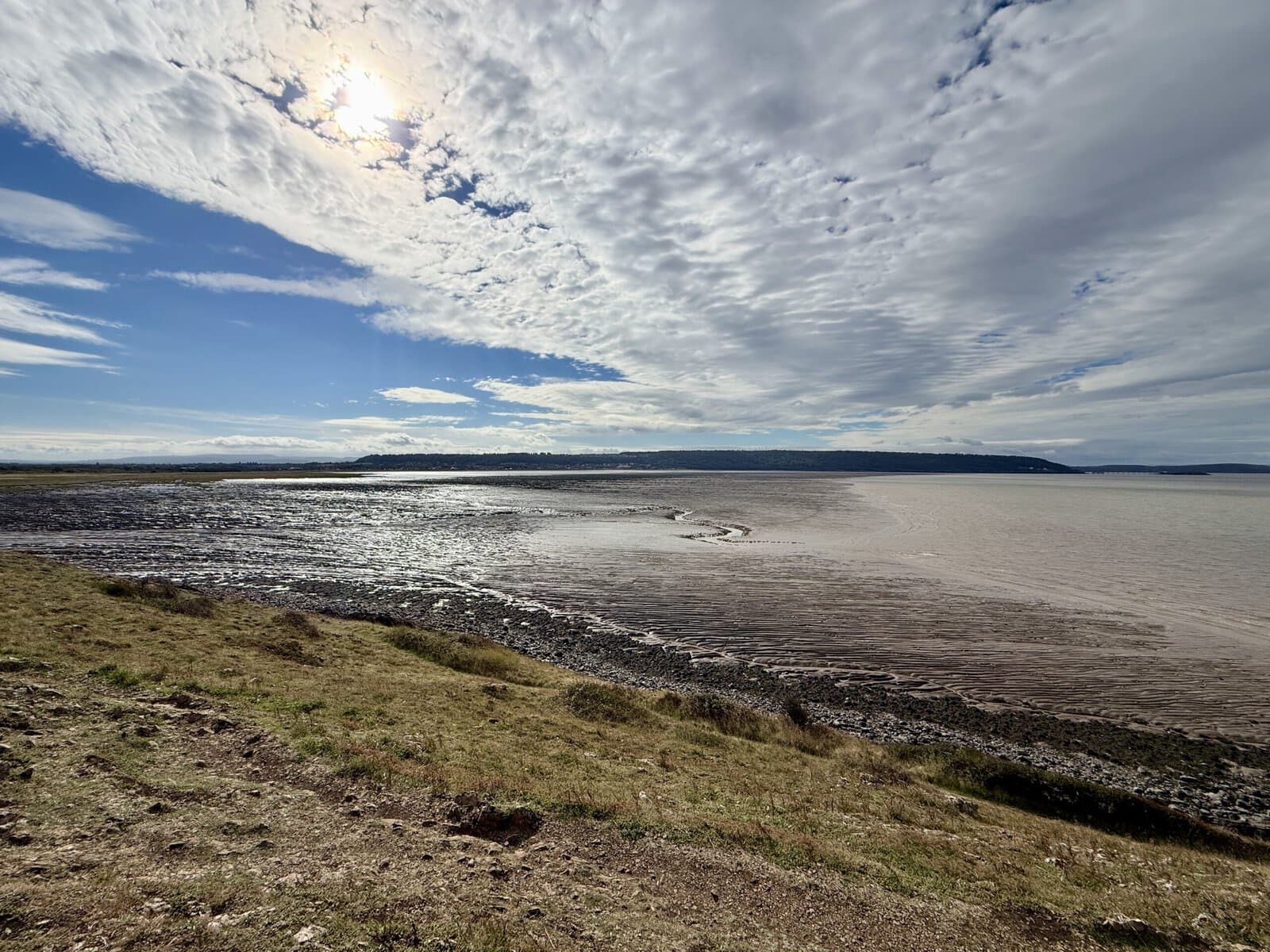
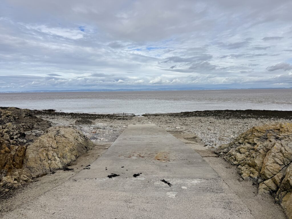
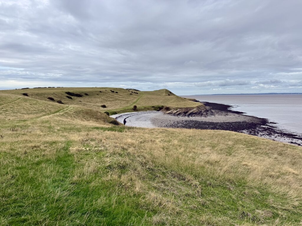
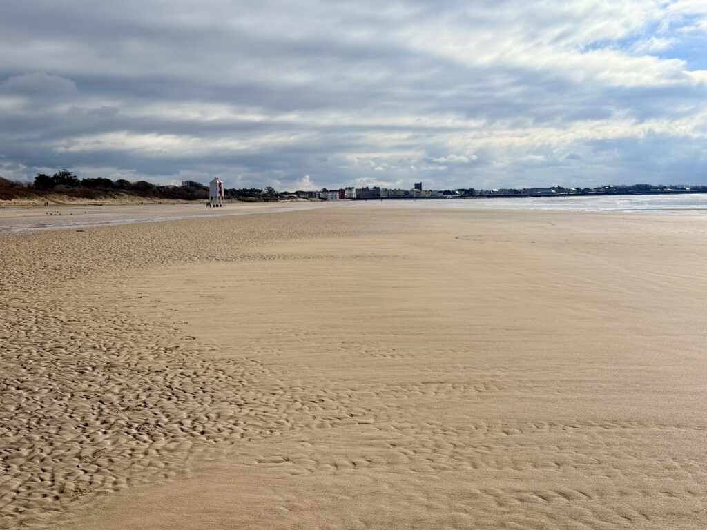
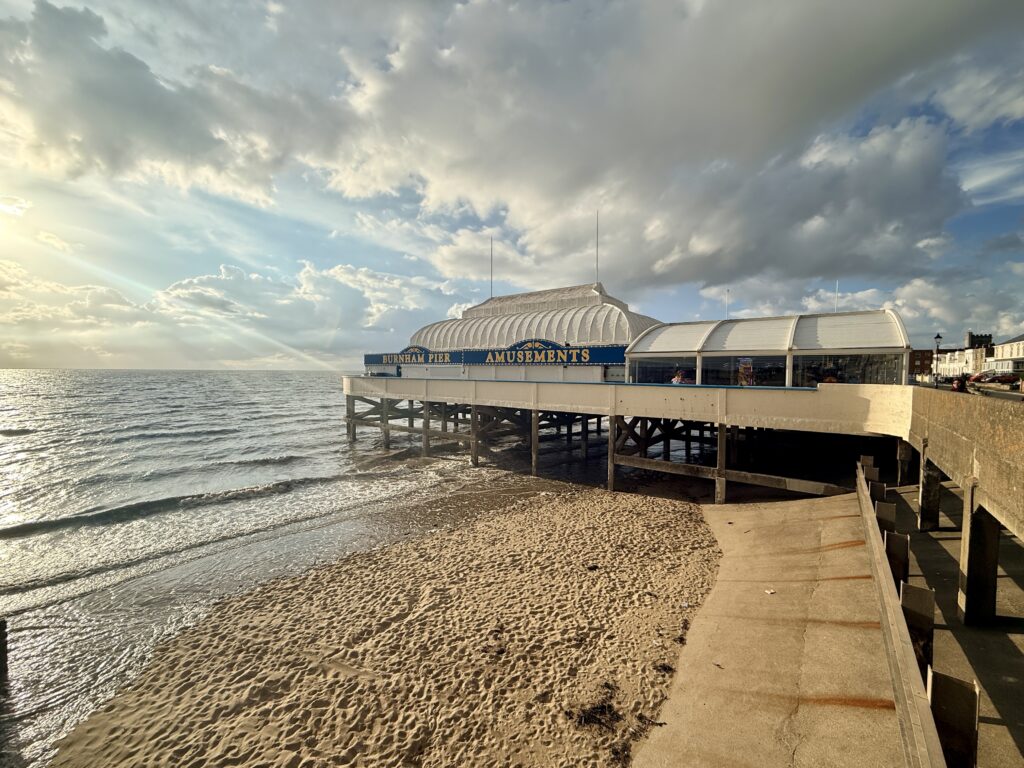
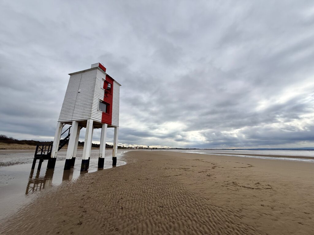
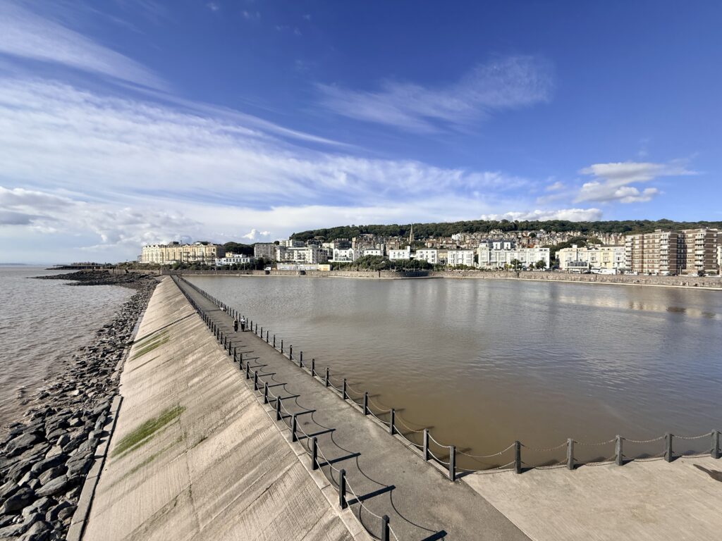
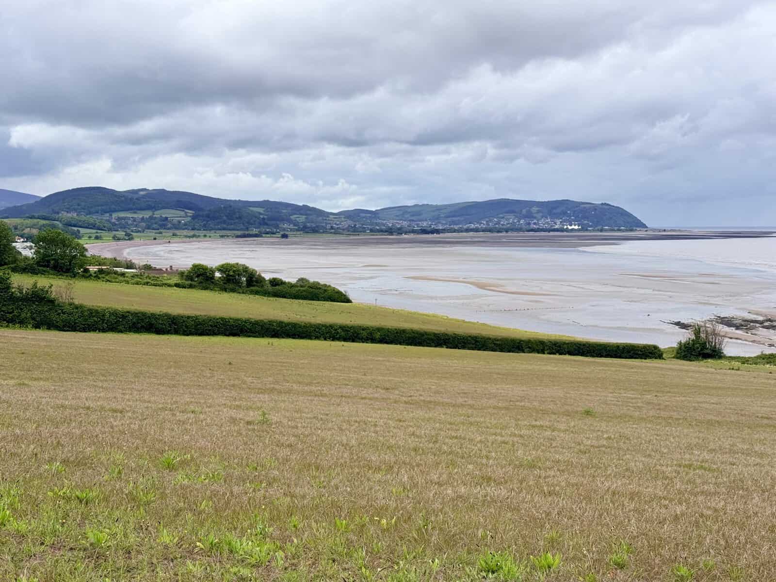
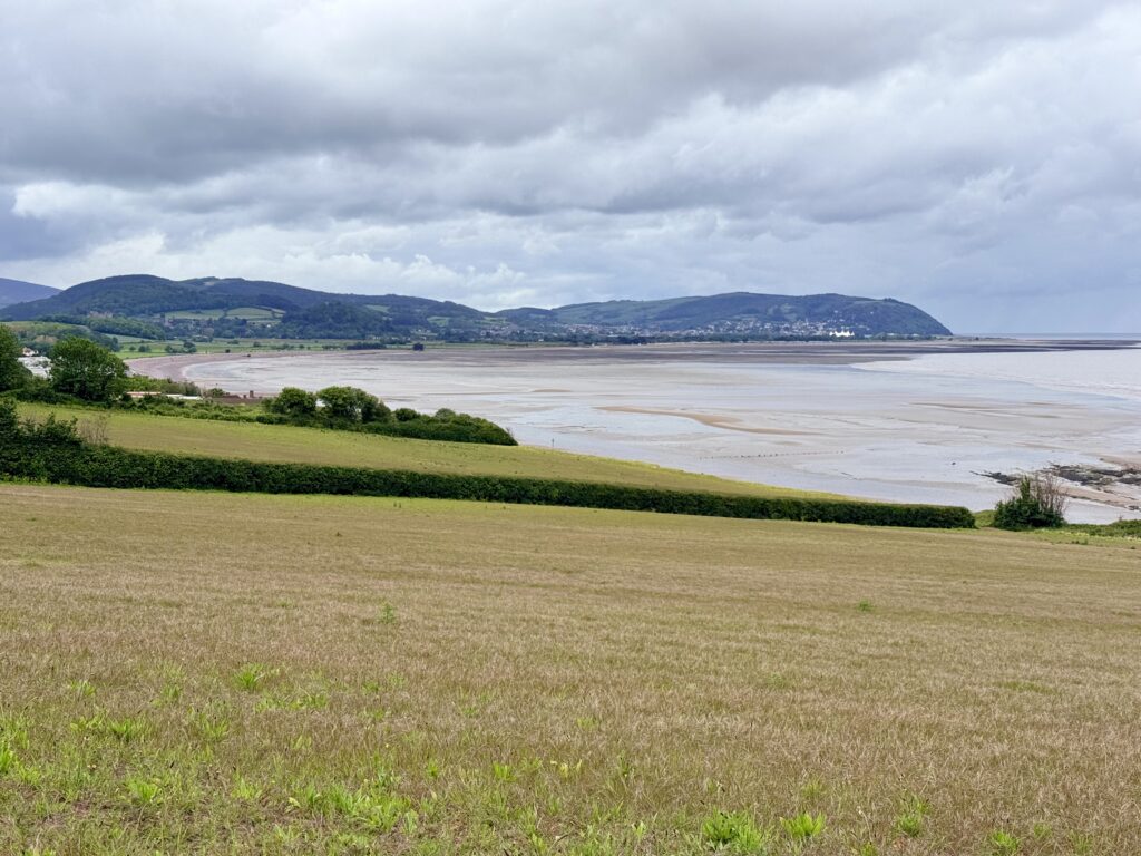
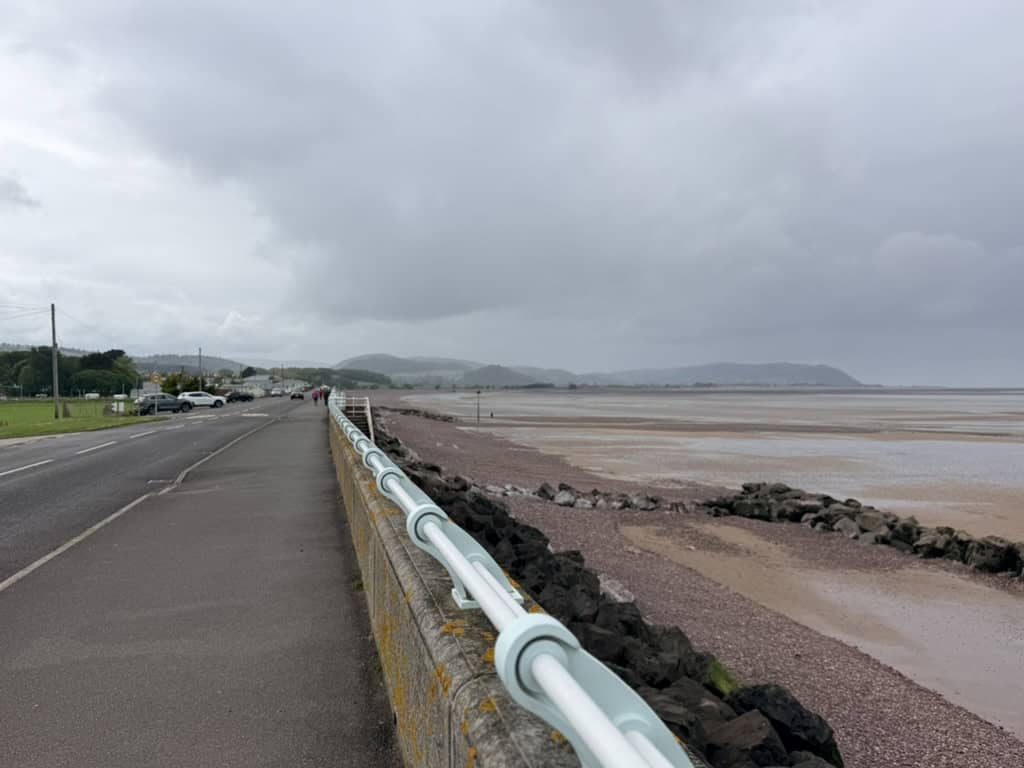
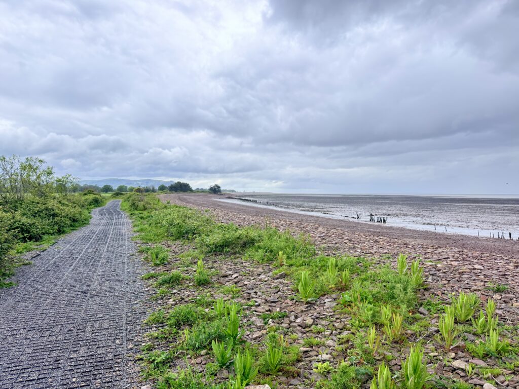
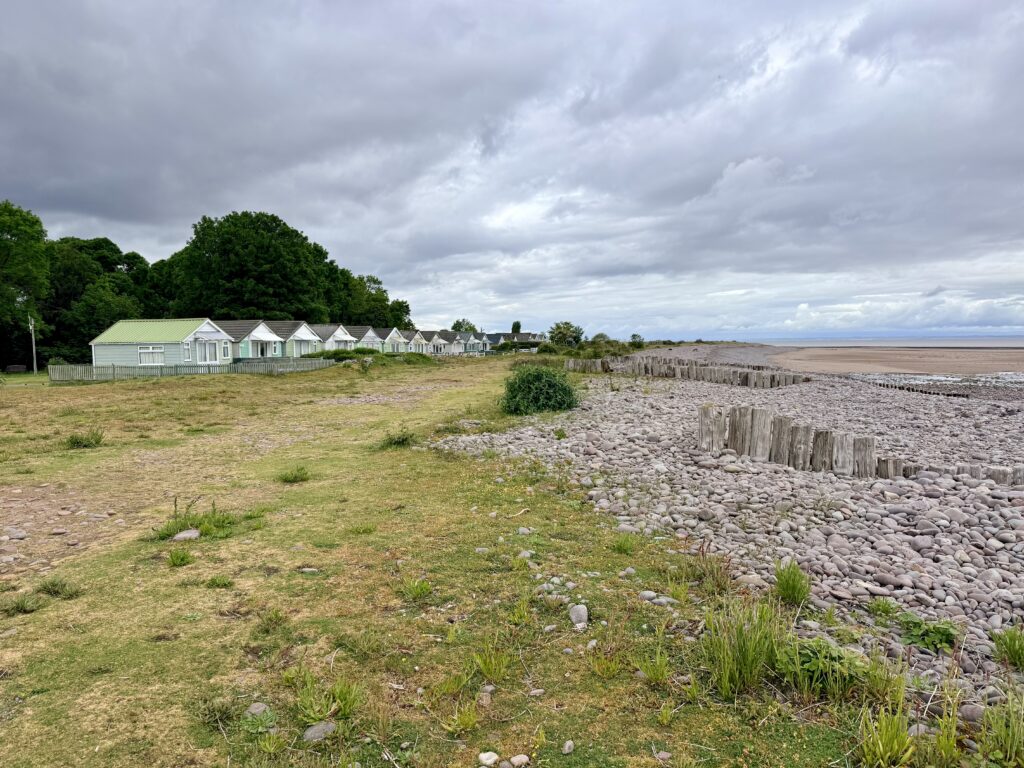
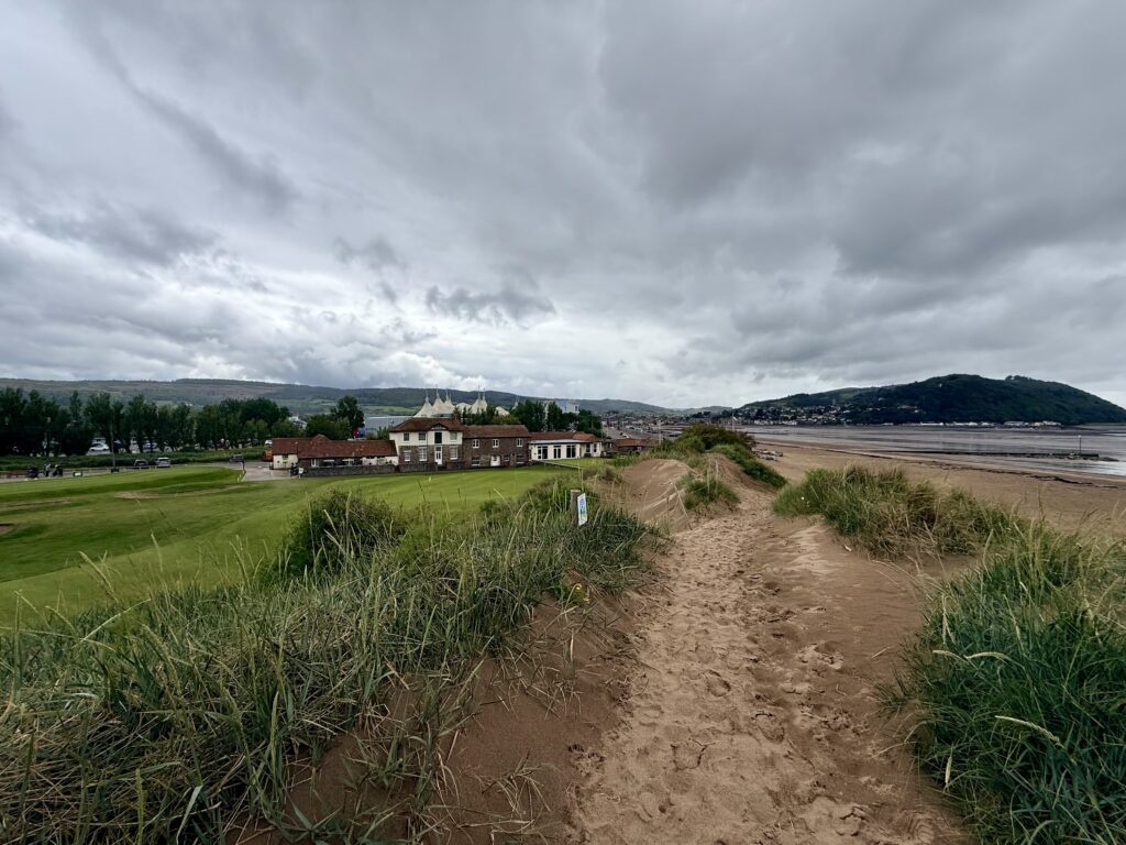
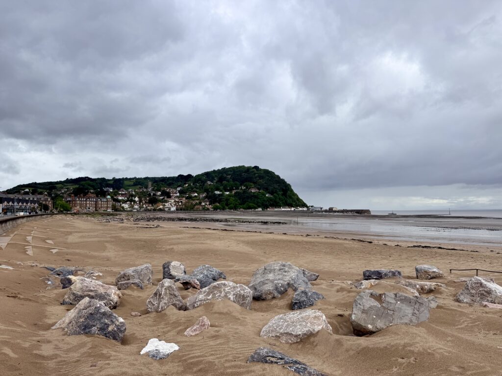
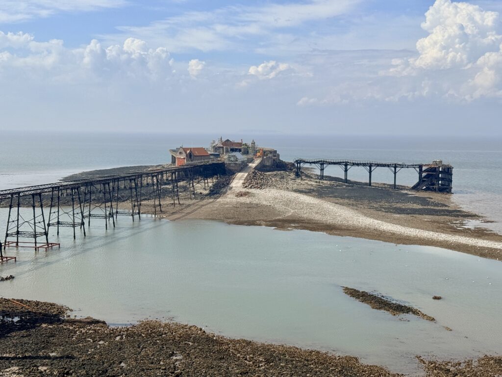
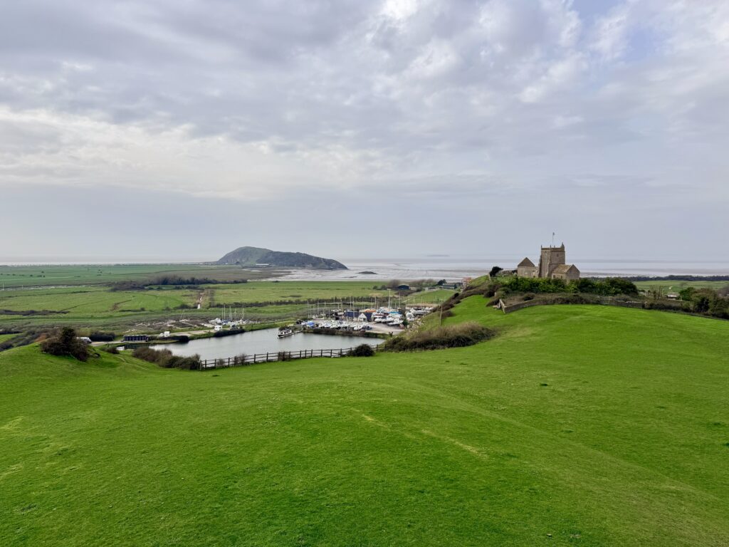
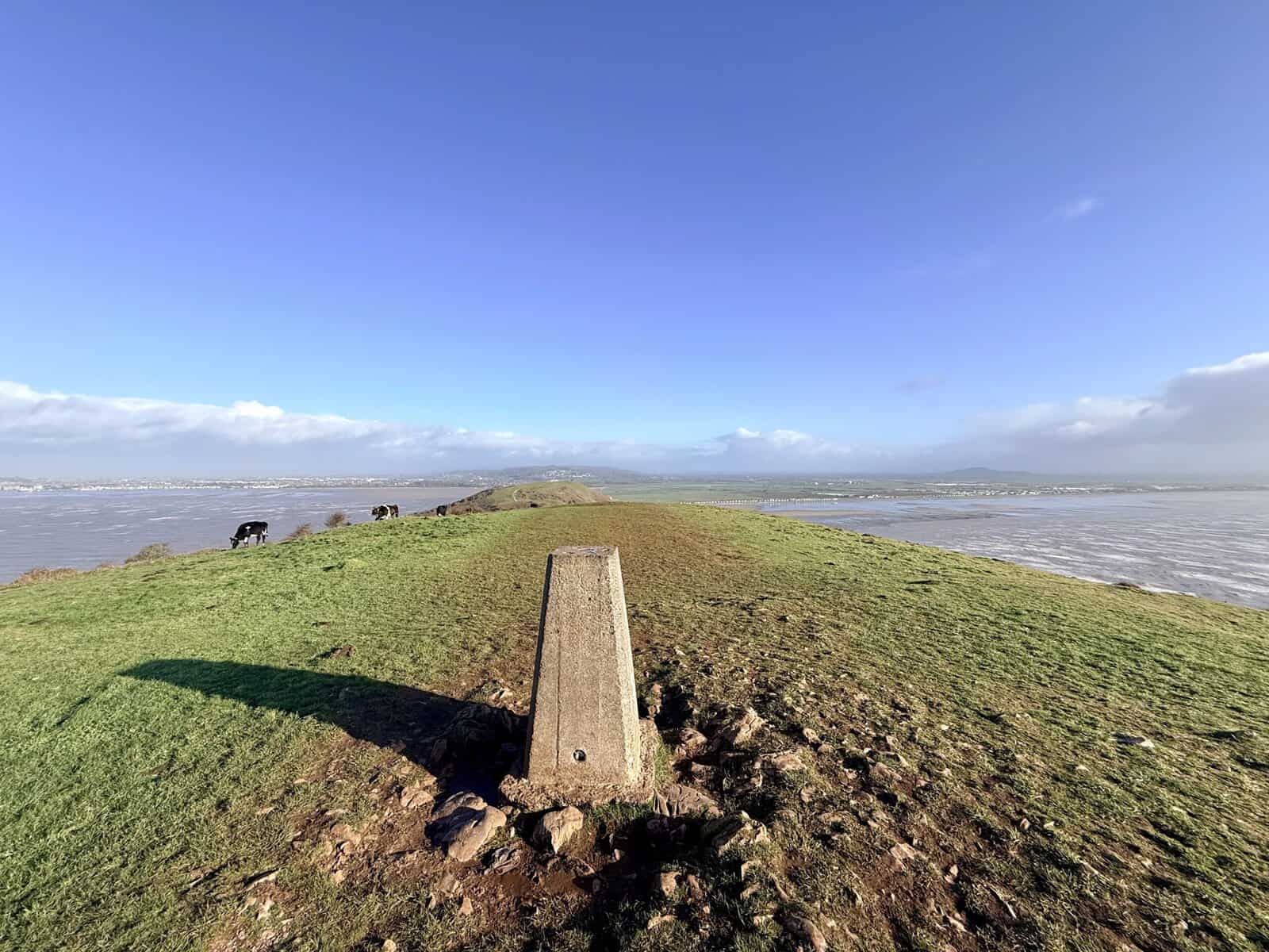
Sand Bay at low tide from Sand Point (Credit: ThisIsSouthWest)
Sand Point had been on our radar since an earlier walk from Weston-super-Mare through Weston Woods to Sand Bay. At the northern end of the bay, the headland doesn’t look particularly dramatic. There is no great cliff rising above the sea as there is at Brean Down, but we knew there was a National Trust car park tucked away at the end of Beach Road and were curious enough to come back and explore.
It turned out to be one of those walks where the further we went, the more there was to see. Within a couple of hours we had climbed to a superb viewpoint, picked our way out towards Sand Point, found quiet pebble coves and beaches, crossed the old landscape of Middle Hope and ended up inside a former military weapons testing site at St Thomas’s Head.
There is much older history here too. Ancient field boundaries survive in the grass, there is evidence of Iron Age occupation and the medieval Woodspring Priory sits just inland. The whole headland feels slightly removed, despite being only a few miles from Weston-super-Mare.
We spent around two and a half hours exploring. We weren’t walking quickly and deliberately took the longer way back because, by then, we didn’t particularly want the walk to end.
Sand Point at a Glance
📍 Location:
Sand Bay, near Kewstoke and Weston-super-Mare
🥾 Route:
Sand Point, Middle Hope and St Thomas’s Head
📏 Distance:
Around 5 miles
⏱️ Walking time:
Allow around 2½ to 3 hours
⛰️ Difficulty:
Moderate, with steps and some rocky, uneven sections
🅿️ Parking:
National Trust Sand Point car park, BS22 9UD
💷 Parking charge:
£5 when we visited, free for National Trust members
🐕 Dogs:
Dog friendly, but livestock graze the headland
🚻 Toilets:
None at the National Trust car park
🥾 Footwear:
Walking shoes recommended, boots in wet conditions
🌊 Tide dependent:
No, although tide times are useful if exploring the shoreline
⭐ Best for:
Coastal views, walking, history, wildlife and picnics
Disclosure:Some of the outbound links on this page are affiliate links to sites that we use and would genuinely recommend. Using them doesn’t cost you extra, but it does help support this free guide. We also provide links to other sites that we believe may be helpful.
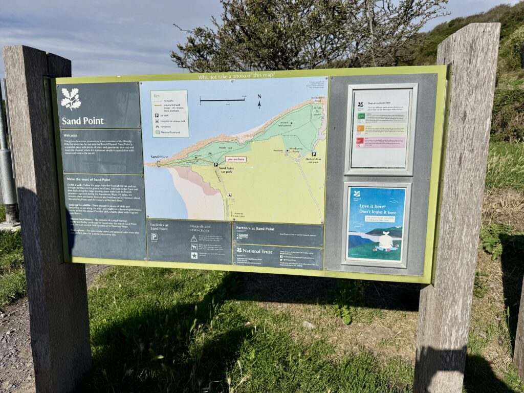
Sand Point information board at the National Trust car park (Credit: ThisIsSouthWest)
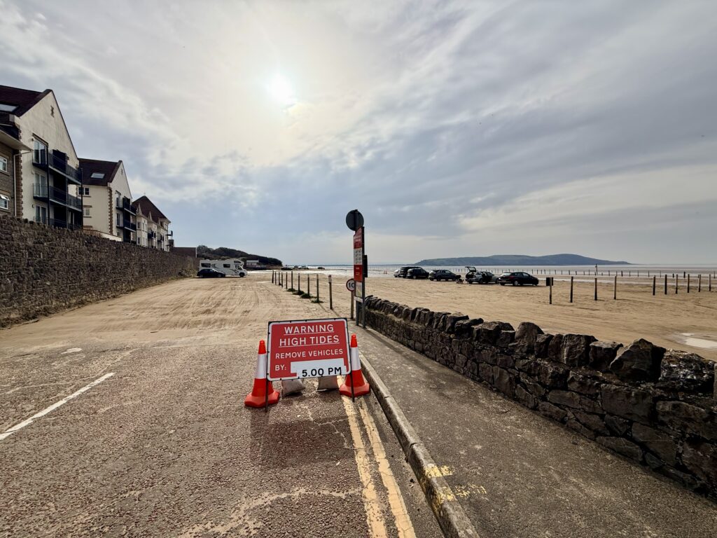
We started our Sand Point and Middle Hope walk from the National Trust car park at the end of Beach Road. The final stretch of the road is single track, although there are passing places along the way. Motorhomes can use spaces before the height barriers, with further parking beyond them for cars. Parking cost £5 for the day when we visited and was free for National Trust members, with payment through JustPark.
There isn’t much else here. There are picnic tables, bins and a useful map showing Sand Point, Middle Hope and St Thomas’s Head, but no toilets. The nearest facilities are back at Sand Road car park, where there is also somewhere to stop for a drink or ice cream. An ice cream van appears to visit the National Trust car park at some times, but we wouldn’t arrive relying on it.
There was plenty of parking when we visited, although we’d expect it to fill much more quickly on a fine summer weekend. Beach Road is narrow, and the National Trust specifically asks visitors not to park along it. Parking is restricted, and vehicles left on the road or in passing places could block other traffic and prevent emergency access. If the car park is full, return to Sand Road car park.
For more information about the wider area, see our Weston-super-Mare visitor guide for the town, seafront and places to visit, or our Weston-super-Mare beaches guide for detailed information about the coastline, facilities, parking and dog restrictions.
Our Sand Point and Middle Hope circular walk
Sand Point walk map
Our map below shows the five-mile circular route we followed around Sand Point, Middle Hope and St Thomas’s Head. You can use it to see the route, distance and main points of interest before setting out.
From the car park to the trig point
Conservation grazing on the climb from Sand Point car park (Credit: ThisIsSouthWest)
There are several paths from the car park. Turning left takes you towards the salt marsh and Sand Bay, while another route heads right before climbing towards Middle Hope. We took the more direct path ahead, climbing the steps through a gate towards the highest ground.
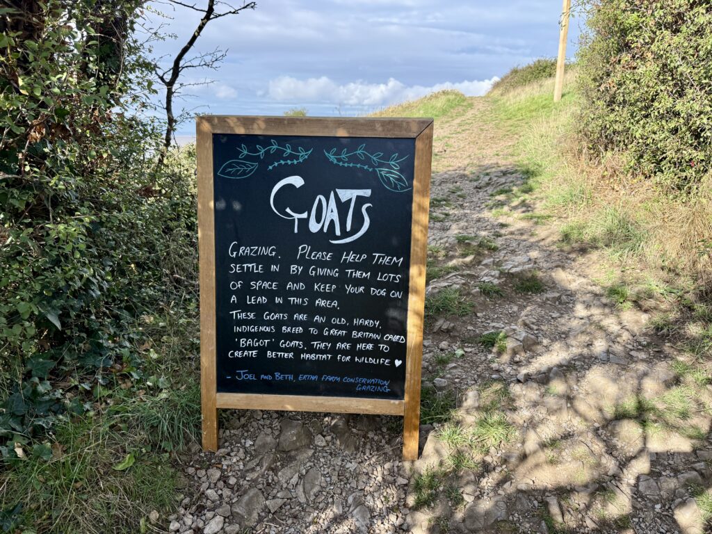
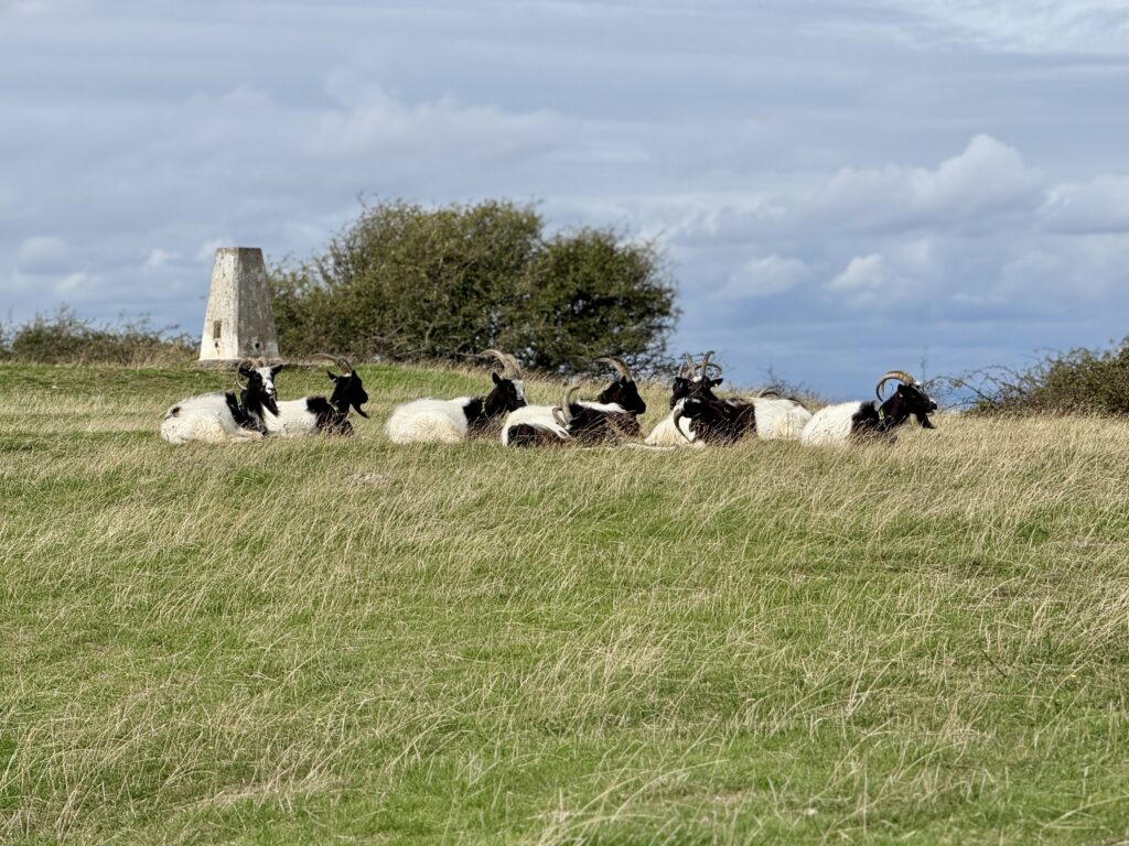
We encountered goats almost immediately. They are part of the conservation grazing on the headland and were a reminder that, although this is a popular place for dog walking, it is also working grazing land.
The climb is moderate rather than difficult. We walked it in walking sandals on a warm, dry day and managed perfectly well, but walking shoes would have been the better choice. In winter or after prolonged rain, we’d opt for boots.
As you approach the trig point the reason for gaining the height becomes obvious. The view opens in almost every direction, taking in Sand Bay, Kewstoke and Weston Woods, with Weston-super-Mare beyond. Steep Holm and Flat Holm sit out in the Bristol Channel and, in clear conditions, you can see across to Cardiff and the Welsh coast. Looking the other way, the coast runs north towards Clevedon with the Severn crossings visible in the distance.
It is a stunning viewpoint in good weather from a headland that looks fairly modest from Sand Bay.
From the trig point to Sand Point
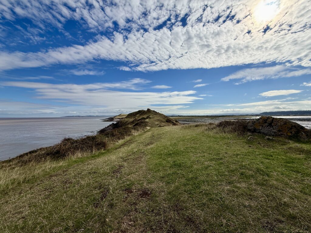
Sand Point, with Steep Holm and Flat Holm beyond (Credit: ThisIsSouthWest)
From the high ground we continued west, gradually descending towards Sand Point itself. The easy grass gives way to increasingly rocky ground as you approach the end.
The rocks are predominantly Carboniferous Limestone rather than granite. The geology around Middle Hope is particularly interesting because volcanic rocks, including tuffs and pillow lavas, also occur amongst the limestone. It is one of several reasons to look a little more closely at what initially seems to be a simple coastal landscape.
The tide was well out during our visit and the view south across Sand Bay was striking. Huge areas of sand and mud were exposed, cut by tidal channels which would later disappear beneath the returning Bristol Channel.
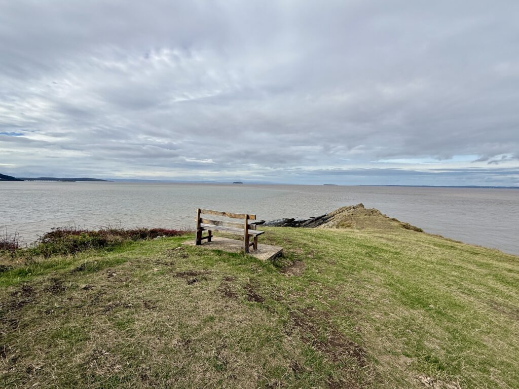
We went as far as the bench overlooking the final approach to the point and were happy to stop there. Whilst it is possible to scramble a little further, the rocks become more awkward and we didn’t think the small gain was worth the additional risk. There are steep drops, the sea is immediately below and this is a relatively remote place to injure yourself. Mobile reception throughout this walk was patchy too.
For most people, the bench makes a perfectly good destination before turning back.
A hidden cove below Sand Point
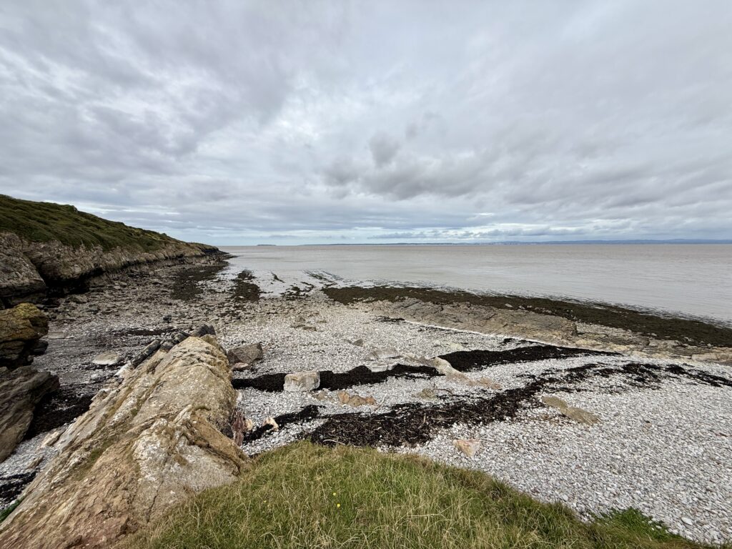
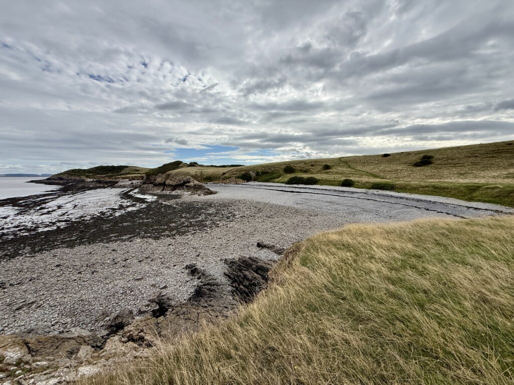
A quiet pebble cove below Sand Point (Credit: ThisIsSouthWest)
We retraced our steps for around 100 metres and then noticed a path dropping towards the northern side of the headland. Another walker had gone that way, which was enough encouragement for us to investigate.
Initially the path is quite narrow and descends through vegetation. The blackberries were ripe when we visited and far too tempting to ignore. After passing through a gate, the path reaches much flatter ground beside the Bristol Channel.
There is a small stony cove here which would make a lovely picnic stop. With the sea on one side and the grassy hillside rising on the other, this part of the walk felt surprisingly secluded. It actually reminded us a little of walking in the Isles of Scilly.
The cove may look tempting for a paddle when the tide is in, but we’d be much more cautious about swimming. The Bristol Channel has a very large tidal range and strong tidal flows, while these little coves have no lifeguard or other facilities. Sand Bay is probably a better choice if spending time by the water is the main purpose of your visit.
Along the shore to Middle Hope
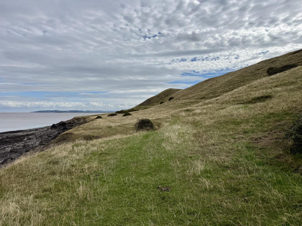
Following the coast towards Middle Hope (Credit: ThisIsSouthWest)
We continued eastwards with the sea on our left and Middle Hope rising gently to our right. This is an easier stretch of walking and probably the most peaceful part of our route.
Another small pebble bay appears further along. This is Middle Hope Beach, a secluded spot with good views up the Bristol Channel towards the Severn crossings. We also passed the remains of an old building beside the route. The National Trust’s circular walk mentions the remains of an old shrimping hut along this stretch of coast, once used by fishermen to boil their catch; we think this was the ruined remains that we saw.
Eventually the obvious route leaves the shore and climbs back towards the ridge of Middle Hope. There are wooden steps across an old wall, although a gate provides an easier way through.
Just a little way on we turned left and carried on towards St Thomas’s Head.
St Thomas’s Head: behind the old MOD fence
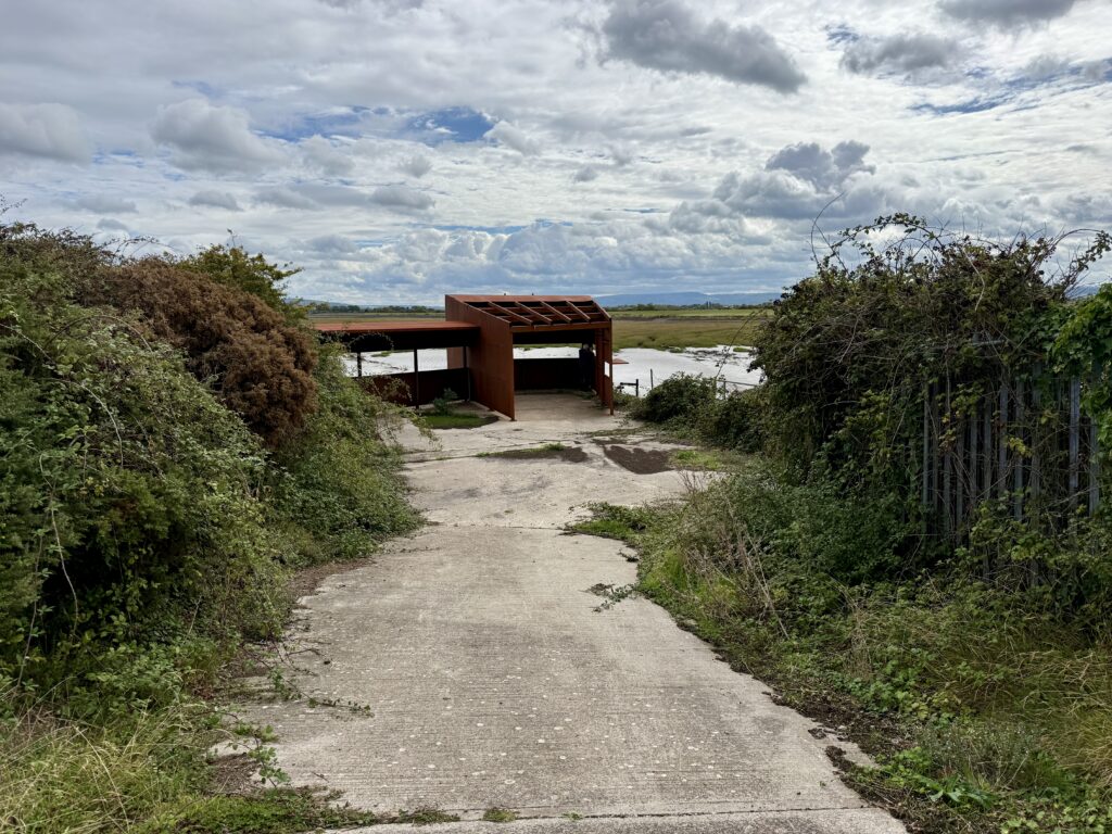
Bird hide at St Thomas’s Head (Credit: ThisIsSouthWest)
This is where the walk becomes particularly interesting.
Following the higher ground towards St Thomas’s Head eventually brings you to an old military fence. At first it isn’t entirely obvious where you are supposed to go. The answer is on a National Trust sign beside the fence.
The fence was originally constructed by the Ministry of Defence to keep people away from the firing range. It remains in place, now partly to protect historic remains from livestock. Rather than climbing it, visitors are directed alongside the fence for about five minutes to an unlocked gate at the end of the gravel track.
We followed the instructions and entered the former military site.
What remains today is mostly concrete rather than buildings. Broad tracks cross the headland, large paved areas hint at structures that have disappeared and routes lead down towards Woodspring Bay and the water at St Thomas’s Head. There is also a bird hide overlooking the bay.
It is quiet now, but it hasn’t always been.
The military history of St Thomas’s Head and Middle Hope
Former military slipway at St Thomas’s Head (Credit: ThisIsSouthWest)
Middle Hope’s military use appears to go back at least as far as the First World War. National Trust archaeological records identify three unusual zigzag earthworks on the eastern side of the old field system. The area is known to have been used for military training during the Great War and the banks may be the remains of practice trenches.
During the Second World War, the isolation of this stretch of coast made it useful again. The National Trust records weapons testing at Sand Point, comparing its wartime role with that of Brean Down further south. Some of the experimental weapons were unusual enough never to progress beyond trials.
That connection with Brean Down is particularly interesting when walking the Somerset coast. Both headlands command wide views over the Bristol Channel and both became places where military experimentation could take place away from large population centres. Our Brean Down walk explores the fort and surviving military remains there in much more detail.
St Thomas’s Head continued to have a military role after the war and developed into a weapons testing establishment. That helps explain the concrete surfaces, roads and shoreline infrastructure that still look slightly out of place in what is otherwise open grassland.
We followed one of those tracks down to the slipway. Once you know what happened here, the remains make much more sense. The headland wasn’t simply an observation point; equipment needed to be brought to and from the water and there were structures associated with trials around Woodspring Bay.
There is remarkably little left considering how recently the site was still in use. St Thomas’s Head remained a military research establishment long after the war and was still being used by QinetiQ as an explosives and shock test facility in 2007. It was finally decommissioned in 2009, with most of the remaining buildings subsequently demolished. Nature has reclaimed much of the site since, leaving the concrete roads, hard standings and slipway as some of the only reminders of its military past.
Back across Middle Hope
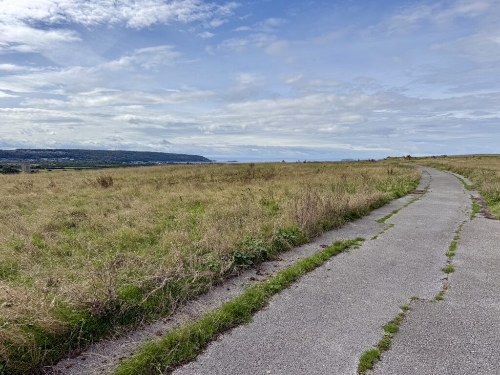
Following the old military track across Middle Hope (Credit: ThisIsSouthWest)
From St Thomas’s Head we turned back inland, following the concrete, former military track as it climbed gently towards Middle Hope.
This is where the older landscape becomes more apparent. Low banks and old field boundaries survive across the grassland. The OS map draws attention to the field systems and they are easy to overlook until you know what you are looking at.
We initially wondered whether they were Bronze Age. There is certainly prehistoric archaeology around Sand Point and Middle Hope, but the field boundaries themselves can’t currently be dated that confidently. The National Trust archaeological record describes them as potentially Iron Age, Roman or medieval, with earthwork banks extending across both the north and south facing slopes of Middle Hope. Some may subsequently have been worked by the community at nearby Woodspring Priory.
It’s fascinating. This isn’t a landscape belonging to one period. People have occupied, farmed and reused it for centuries, with military activity eventually being imposed on top of much older boundaries.
Woodspring Priory
Woodspring Priory from Middle Hope (Credit: ThisIsSouthWest)
From Middle Hope you are also close to one of the most interesting historic buildings in this part of North Somerset.
Woodspring Priory, or Worspring as it was known in the Middle Ages, was founded around 1210 for Augustinian canons of the Victorine order. Its founder, William de Courtenay, had a remarkable family connection with one of the defining events of medieval English history. His grandfather was Reginald FitzUrse, one of the four knights who murdered Thomas Becket in Canterbury Cathedral in 1170. The foundation of the priory may have been an act of penitence, and St Thomas the Martyr became one of its patron saints.
Woodspring was never a particularly large or wealthy religious house. The Landmark Trust believes there were probably fewer than ten members of the community at any one time. Nevertheless, it enjoyed a burst of prosperity during the fifteenth and early sixteenth centuries when the church, infirmary and great barn were developed. Building work was still taking place surprisingly close to the Dissolution, when the priory was suppressed in 1536.
Its subsequent history is just as interesting. Rather than abandoning the church, later owners converted part of it into a house. Floors were inserted, windows altered and chimneys pushed through the former nave roof. The priory continued as a farmhouse for centuries, which is one reason so much of its story remains visible today.
The National Trust bought the Woodspring estate in 1968 as part of its Enterprise Neptune campaign to protect the coastline from Sand Point to St Thomas’s Head. The Landmark Trust took over the priory buildings the following year and carried out a long programme of restoration. Woodspring Priory can now actually be stayed in as a Landmark Trust property, while the surviving great barn remains in National Trust ownership.
We had hoped to get closer to the priory from the path at Middle Hope, and whilst the military track runs close to it we encountered private farm signs. We didn’t continue. There may be other public routes that can be used as part of a longer walk, so that just gives us another reason to return.
Across Middle Hope to the trig point
Bagot goats grazing near the Sand Point trig point (Credit: ThisIsSouthWest)
Back at the old wall and gate, we could have taken the more direct path towards the car park. By this point, however, we were enjoying ourselves too much to take the shortest route home.
We continued across Middle Hope instead, passing through the old field boundaries and gradually returning towards the high ground at Sand Point.
It is a lovely final section because the landscape you crossed earlier now makes more sense. What initially appeared to be grassy banks and walls has become evidence of a much older landscape, while behind you St Thomas’s Head has gone from an anonymous fenced off corner of the coast to somewhere with a surprisingly complicated story.
Eventually the trig point came back into view.
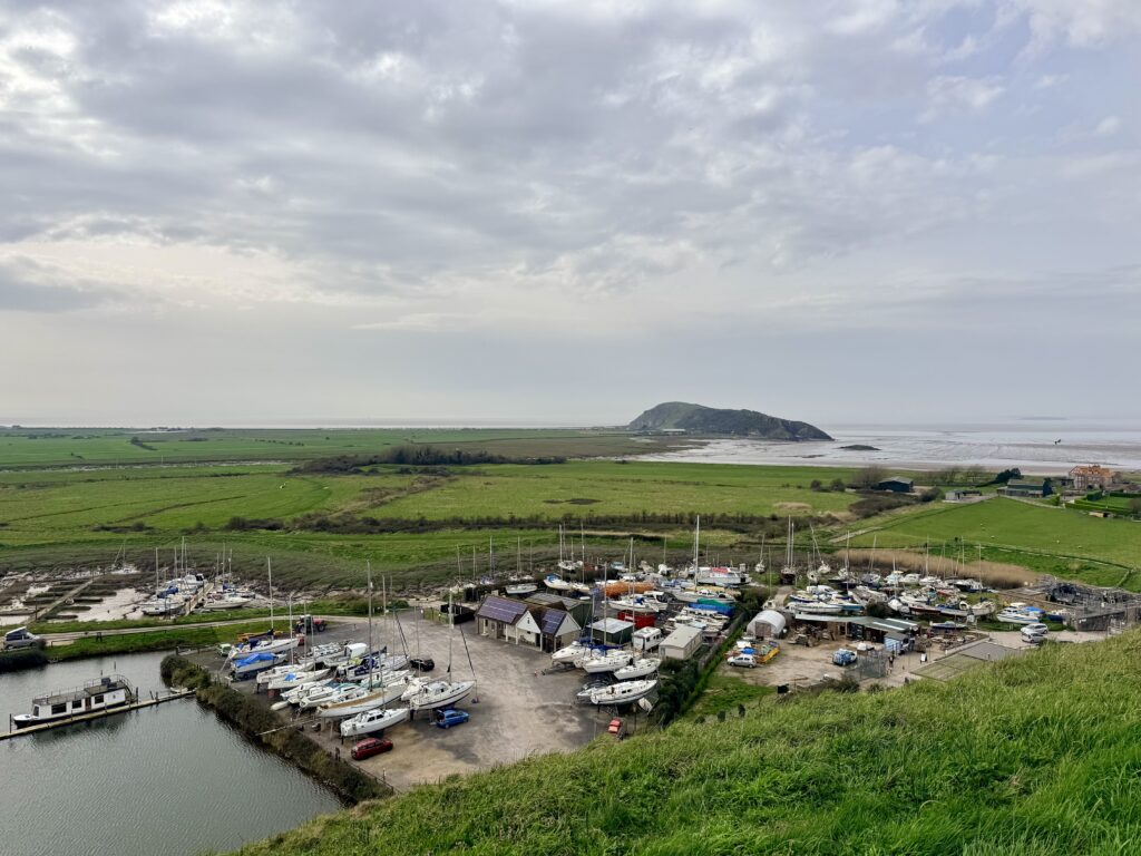
Back to Sand Point car park
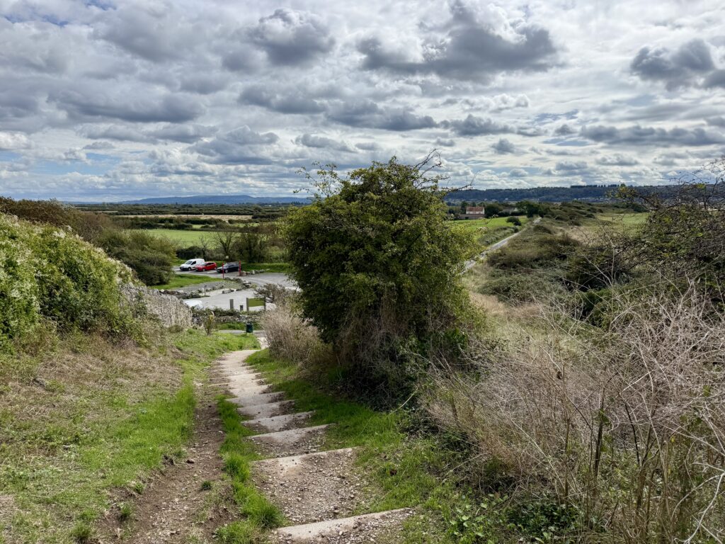
View of Sand Point car park and Beach Road (Credit: ThisIsSouthWest)
Returning to the trig point also gives you another chance to enjoy the view. We stopped again before following the steps back down towards the National Trust car park.
Our five-mile walk took around two and a half hours, but that included plenty of stopping, looking at maps, investigating paths and simply enjoying the views. For most visitors, we’d allow around two and a half to three hours, more if you want time to explore St Thomas’s Head and stop at the viewpoints along the way. You could certainly cover the ground more quickly. We wouldn’t.
Nor would we change the clockwise direction. Starting with the climb to the trig point gives the walk an immediate reward, Sand Point and its little coves follow naturally, and St Thomas’s Head provides a completely unexpected historical finale before the quieter return across Middle Hope.
Sand Point or Brean Down?
Middle Hope Beach (Credit: ThisIsSouthWest)
Do both.
Brean Down is the more immediately dramatic landmark. Its huge limestone ridge dominates the coast south of Weston and the walk combines extraordinary views with the fort at its western end.
Sand Point is subtler.
From a distance it looks like a fairly modest headland. Once you’re on it, the landscape keeps revealing something else: panoramic views, limestone cliffs, quiet coves, ancient earthworks, wildlife, Middle Hope and the strange remains of the former military site at St Thomas’s Head. That’s why we enjoyed it so much.
Our detailed Brean Down walk guide covers the steps, fort, parking, route and viewpoints if you’d like to explore the other side of Weston-super-Mare too. There is also the Brean Down Way which links Weston-Super-Mare to Brean and Burnham for both walkers and cyclists.
Make a walking weekend of Weston-super-Mare
One thing this walk reinforced for us is just how good Weston-super-Mare and the surrounding area can be as a base for a walking break.
In a series of walks, we have now covered the coastline from St Thomas’s Head south through Sand Bay and Weston-super-Mare, onwards towards Brean Down and eventually Burnham-on-Sea.
Each section feels different.
You could explore Sand Point one day, walk the Brean Down Way another and spend another day around Brean Down itself. Continue south and our Burnham-on-Sea visitor guide covers the coast, Low Lighthouse, Esplanade and places to explore around Bridgwater Bay.
Rather than choosing between them, we’d make a long weekend of it.
Weston-super-Mare probably makes the most practical base if you want restaurants, shops, public transport and plenty of accommodation, while the smaller villages around Sand Bay and Brean provide quieter alternatives.
Sand Point tide times and weather
Looking back from Sand Point towards Middle Hope (Credit: ThisIsSouthWest)
Sand Point tide times
You don’t need to plan this walk around the tide. The route across Sand Point and Middle Hope remains on land throughout, although the coastline looks very different between high and low water.
There isn’t a separate tide station for Sand Point, so the table below shows tide times for nearby Weston-super-Mare. Sand Point is only a few miles away, so these provide a useful indication of the expected high and low tides, although the exact times and heights at Sand Point may vary slightly.
At low tide, extensive areas of sand and mud are exposed across Sand Bay and the Bristol Channel, as they were during our walk. Around high tide, the small coves on the northern side of Sand Point look completely different as the water comes much further in.
The Bristol Channel has one of the largest tidal ranges in the world, so the tide can move quickly. If you leave the main walking route to explore the shoreline, take particular care and don’t rely on the tide table as a guarantee of conditions at a particular cove.
Weather at Sand Point
It is worth checking the weather before setting out. Much of Sand Point and Middle Hope is open grassland with very little shelter, and once you are out on the headland you are exposed to wind and changing weather coming in across the Bristol Channel. We suggest checking the Met Office forecast for Sand Bay or BBC Weather for Weston-super-Mare before leaving.
On a warm, settled day we found it an easy and very enjoyable walk, but conditions could feel quite different in strong winds or persistent rain. We’d take an extra layer even when the weather looks reasonable and carry a lightweight waterproof if there is any chance of rain. Walking shoes are a better all-round choice than the walking sandals we wore, particularly after wet weather.
It is worth looking at the wind forecast as well as the temperature and chance of rain. The exposed sections around Sand Point, Middle Hope and St Thomas’s Head offer little protection when it is windy.
Visibility matters too. Some of the best parts of this walk are the long views across the Bristol Channel towards Wales, the Severn crossings and along the North Somerset coast, so a clear day adds considerably to the experience.
Is Sand Point worth visiting?
One of the quiet coves along Middle Hope (Credit: ThisIsSouthWest)
Absolutely.
Sand Point was one of those walks where curiosity paid off.
We expected a pleasant couple of hours on a modest headland. Instead, we found some of the best views we’ve seen around Weston-super-Mare, peaceful stretches of coastline, hidden pebble coves, excellent dog walking and an extraordinary amount of history.
The almost 360 degree view from the high ground alone makes the climb worthwhile.
But what really makes Sand Point memorable is the variety.
One moment you’re looking across Sand Bay towards Weston-super-Mare. The next you’re following a quiet path beside the Bristol Channel that feels strangely reminiscent of the Isles of Scilly. Then an old military fence appears and you’re suddenly walking through the remains of a former MOD establishment at St Thomas’s Head.
Allow around three hours, take a drink, wear sensible footwear and don’t rush.
Sand Point is a real hidden treasure on the North Somerset coast.
Sand Point FAQs
How long is the Sand Point walk?
Our circular walk around Sand Point, Middle Hope and St Thomas’s Head is around five miles. We completed it in about two and a half hours with plenty of stops, but we’d allow around two and a half to three hours so you have time to enjoy the viewpoints and explore the former military site.
Where do you park for Sand Point?
The National Trust Sand Point car park is at the end of Beach Road near Sand Bay, postcode BS22 9UD. The final section of Beach Road is narrow and single track with passing places. The National Trust asks visitors not to park on the road or in the passing places, so if the car park is full it is better to return towards Sand Bay.
Is parking free at Sand Point?
Parking at the National Trust Sand Point car park cost £5 for the day when we visited and was free for National Trust members. Payment was available through JustPark. Charges can change, so check the National Trust’s latest information before travelling.
Is Sand Point free to visit?
Yes. There is no admission charge to walk around Sand Point and Middle Hope. You may need to pay for parking if you use the National Trust car park and are not a National Trust member.
Do you need to check Sand Point tide times before walking?
No. The main walking route around Sand Point and Middle Hope is not tide dependent and remains on land throughout. It is still useful to know the tide times because Sand Bay and the small coves around the headland look very different at high and low tide. Weston-super-Mare is the nearest useful tide reference and timings at Sand Point should be similar, although not identical.
Can you swim at Sand Point?
There are small pebble coves around Sand Point and Middle Hope, but we’d be cautious about swimming. The Bristol Channel has a very large tidal range and strong tidal flows, while these coves are remote and have no lifeguards or conventional beach facilities. Sand Bay is a more practical option if spending time beside the water is your main reason for visiting.
Are dogs allowed at Sand Point and Middle Hope?
Yes. Sand Point and Middle Hope are popular for dog walking, but livestock graze the headland and there are also ground nesting birds. Dogs should therefore be kept under close control and you should follow any National Trust signs in place during your visit.
Are there toilets at Sand Point?
There are no toilets at the National Trust Sand Point car park. The nearest public facilities are around Sand Bay, so it is worth stopping there before beginning the walk, particularly if you intend to complete the longer route through Middle Hope and St Thomas’s Head.
Is the Sand Point walk difficult?
We’d describe our five-mile route as moderate rather than difficult. There are steps, some climbing and several rocky or uneven sections around Sand Point. Much of Middle Hope is easier grassland, but sensible walking shoes are recommended and boots may be preferable after prolonged rain or during winter.
Can you take a pushchair around Sand Point?
We wouldn’t recommend taking a pushchair around the full Sand Point walk. The routes onto the higher ground involve steps and some of the paths towards Sand Point are narrow, rocky and uneven. The complete route would also be unsuitable for most wheelchairs.
What is the difference between Sand Point and Middle Hope?
Sand Point forms the western end of the headland overlooking the Bristol Channel, while Middle Hope stretches eastwards towards St Thomas’s Head. Together they form the wider National Trust landscape commonly referred to as Sand Point and Middle Hope.
What can you see from Sand Point?
On a clear day there are wide views over Sand Bay and Weston-super-Mare, towards Steep Holm and Flat Holm, across the Bristol Channel to South Wales and Cardiff, and north towards Clevedon and the Severn crossings. The trig point area provides some of the best views on the walk.
What is at St Thomas’s Head?
St Thomas’s Head contains the remains of a former military weapons testing establishment. The site was used for defence research for many years and was finally decommissioned in 2009. Today you can still see concrete roads, hard standings, the slipway and other traces of its military past.
Is Sand Point worth visiting?
We think so. Sand Point combines excellent Bristol Channel views, quiet coastal paths, wildlife, hidden coves, ancient field systems and the unusual military remains at St Thomas’s Head. It is also much quieter in character than nearby Weston-super-Mare and Brean Down.
Over to you … have you recently travelled to South West England? What worked for you? What advice would you give to others? Please leave your comments below or join in the discussion in our Facebook Group.
New to South West England or returning after a while? Start with our ‘Travel Basics’ – quick guides packed with tips to help you plan your trip.
Looking for Halloween events in South West England in 2026?
There is a huge choice of Halloween events across Devon, Cornwall, Somerset, Dorset and Bristol, from pumpkin trails and family days out to ghost trains, historic houses after dark and genuinely frightening scare attractions.
There are now simply too many Halloween events, spread across too many days, for us to cover properly in our regularly updated What’s On in South West England calendar. Halloween week also largely coincides with the October school half term across the South West, so we thought a dedicated guide would be useful.
We will keep adding events as we hear about them, from major attractions to small community events. Organisers can submit events to us for free. This creates an individual event page and, where we can, we will also include it in this Halloween guide, our main What’s On guide, or both.
We think Halloween events can also be a great organised alternative to traditional trick-or-treating, particularly for families with younger children who might otherwise need to be accompanied from house to house on a cold October evening. Plenty of gentler family activities are available, while older children and adults can choose from ghost tours, after-dark experiences and some altogether scarier attractions.
We have brought together confirmed events across the region, from heritage railways and castles to National Trust properties and town centre celebrations, while also keeping an eye out for free and more unusual local events.
Halloween falls on Saturday 31 October 2026, which means there will be plenty to do during the October half-term holiday. Popular evening events, scare attractions and special train services can sell out, so it is worth booking ahead where tickets are required.
Halloween Events 2026 at a Glance
Planning Halloween in South West England? Here are the key dates, ideas and quick links to help you find an event.
🎃 Halloween: Saturday 31 October 2026
📅 Main event period: Early October to Sunday 1 November 2026
👨👩👧👦 Good for families: Crealy Spook-Fest, Halloweden, The BIG Sheep, Wookey Hole, Ascarium at SEA LIFE Weymouth and Corfe Castle
👻 For bigger scares: FEAR at Avon Valley, Bodmin Jail, Scare Asylum, Horror in the Caves and Kents Cavern Ghost Walks
🚂 Something different: Ghost trains, the Lynton & Lynmouth Cliff Railway after dark, illuminated gardens, castles, caves and historic houses
🆓 Free events: Spooky Newquay, Southbourne Pumpkin Fest and selected town centre and community Halloween activities
Before you go: ThisIsSouthWest is an independent travel guide and is not connected with or endorsed by any of the events, attractions or organisations listed on this page. We make every effort to keep this guide accurate and up to date, but dates, opening times, activities, age restrictions, prices and ticket availability can change. Check organisers’ official websites for the latest information before booking or travelling.
Disclosure:Some of the outbound links on this page are affiliate links to sites that we use and would genuinely recommend. Using them doesn’t cost you extra, but it does help support this free guide. We also link to other sites we think you’ll find helpful.
That makes 2026 a particularly good year for a Halloween weekend away, with Halloween falling right at the end of the October half-term week.
There will, of course, be plenty of non-Halloween events across South West England during half term too, but many of the biggest Halloween attractions run throughout the week from 24 October to 1 November.
Halloween Events in Devon 2026
Halloween events take place across Devon throughout October, from theme parks, farms and visitor attractions to events organised by towns and local community groups. Some of the best choices are smaller local events, often free to attend, alongside the bigger ticketed attractions and heritage railways.
Families have plenty of less scary choices, while evening events and darker experiences suit those hunting for something a little more frightening. For events taking place over the coming weekend, see our separate guide to what’s on in Devon.
Crealy’s Spook-Fest is one of Devon’s biggest Halloween events, combining the theme park’s rides and attractions with Halloween entertainment.
In 2026, the park offers live scare mazes, Halloween shows and character appearances, and some rides with a Halloween twist. Every child visiting during Spook-Fest also receives a pumpkin.
Enough is going on to make this a full day out, not just a Halloween trail, with activities for younger children and bigger scares for older visitors.
The BIG Sheep near Bideford celebrates Halloween throughout October half term with its family-friendly Monster Glow Party.
Activities include Halloween games, fancy dress competitions and monster discos, alongside pumpkins to pick, carve and take home for an additional charge.
The park’s usual rides, indoor play areas and live animal shows are also running, making this more of a full family day out than a standalone Halloween trail.
24 to 25 October and 27 October to 1 November 2026
Devon Railway Centre at Bickleigh is running its Halloween Special across most of October half term.
Children can explore the attraction while following a pumpkin trail in search of Halloween treasure, and receive a Halloween gift (for children aged three and over).
The centre’s trains and railway attractions make this a particularly good option for younger children.
Babbacombe Model Village in Torquay takes on a different appearance after dark for Frightlights: A Halloween Adventure.
The illuminated miniature scenes are joined by a new 2026 Behind the Screams: Halloween Unleashed trail.
It is a good option for families looking for an evening Halloween event in Torbay. If you are spending longer in the area, our Torquay visitor guide covers Babbacombe, the harbour, beaches, and other attractions, while our wider guide to things to do in Torbay also includes Paignton and Brixham.
Kents Cavern in Torquay has a varied Halloween programme, ranging from family-friendly activities to after-dark experiences for older visitors.
From 17 October to 1 November, families can follow a Trick or Treat Trail through the prehistoric caves, complete Halloween challenges, and collect a treat at the end.
For something darker, Go Darker cave tours explore folklore, ancient rites and stories of witches, while evening Ghost Walks run on selected dates and are suitable for ages 12 and over.
Halloween silent discos are also planned underground on 30 and 31 October.
Greenway, Agatha Christie’s former holiday home near Brixham, takes on an autumn theme for October half term with a family trail through the garden.
Follow the pumpkins to discover poisonous plants, unusual wildlife and other seasonal surprises, with Halloween games along the route. The trail is included with normal admission to Greenway.
A Spooky Circus Skills day is also planned for 29 October, with performances and a drop-in workshop in the South Walled Garden.
31 October 2026 The Lynton & Lynmouth Cliff Railway takes on a spooky new look for Halloween, with candlelight, eerie smoke, haunting sounds, live actors and zombie drivers. The experience runs from 6 pm to 9 pm and is designed for all ages, with no booking required.
Devon’s events are spread across the county, but useful clusters are around Torbay and South Devon. If you are combining an event with a short break, search for accommodation in South Devon.
Halloween Events in Cornwall 2026
Cornwall has one of the biggest Halloween programmes in South West England in 2026.
Events range from the family-friendly Halloweden and town-centre celebrations in Newquay to Bodmin Jail, historic houses, and dedicated scare attractions.
Few places are more appropriate for Halloween than Bodmin Jail.
The historic prison offers an extensive October programme, including Go Darker guided tours, the Haunted Gallery, Ghost Walks, ghost-hunting experiences, and special Halloween events.
Some activities suit general visitors, while the later paranormal events are aimed much more firmly at adults. Check the age restrictions carefully before booking.
Healeys Cornish Cyder Farm near Truro combines pumpkin picking with a suitably spooky journey through the farm during October.
The Halloween experience begins with a haunted vintage tractor ride through the orchard, then visitors head to the pumpkin patch to choose their own pumpkin.
The return journey leads to pumpkin carving at the Rattler Bar, with equipment provided and, importantly, someone else cleaning up afterwards.
Adults can swap their pumpkin for a pint of Rattler or Rattler Zero. Booking is recommended.
Pendennis Castle in Falmouth provides one of the best settings for a historical Halloween event.
English Heritage’s Great Pumpkin Party brings Halloween games, interactive storytelling and a themed trail to the Tudor fortress during October half term.
Trerice also has a special Halloween evening experience on 31 October.
As darkness falls, the house’s history and memories become part of an atmospheric after-hours event with low lighting, eerie encounters and occasional jump scares.
The National Trust recommends the experience for ages 11 and over, and booking is required.
Carnglaze Caverns near Liskeard hosts an underground Halloween party deep inside its former slate mine on Halloween night.
The Monster Mash combines live music from Land of the Giants with a fancy dress competition, DJ, Halloween lighting and an underground party atmosphere.
This is one of Cornwall’s more unusual adult Halloween events, with the cavern setting providing a suitably atmospheric location for the night.
The Cornish Fun Farm and Maize Maze near Saltash combines autumn pumpkin picking with a much darker Halloween experience.
Pumpkin picking takes place on selected October dates, while Halloween itself brings the Maze of Horrors on 31 October, complete with live scare actors and performers.
You can easily combine several Cornwall events around Newquay and central Cornwall if you are making a weekend of it.
Halloween Events in Somerset 2026
Somerset’s caves, railways, and historic properties offer excellent settings for Halloween in 2026.
Wookey Hole runs one of the region’s longest Halloween programmes, while heritage railways and National Trust properties offer gentler alternatives.
Wookey Hole describes itself as the Home of Halloween, and its 2026 programme runs for almost a month.
The caves feature projections telling the story of the Witch of Wookey Hole, while elsewhere there is a pumpkin trail, Monster’s Ball Circus Show, Monster Golf and opportunities to meet the Witch.
It is aimed primarily at families, and most Halloween activities are included with a visit.
Heritage railways feature prominently among South West Halloween events, and the West Somerset Railway has seasonal activities throughout October half term.
Visitors can join Brunel on a secret quest by purchasing a Halloween trail sheet.
Check the railway timetable before travelling as operating days and services vary.
The Somerset & Dorset Railway Heritage Trust at Midsomer Norton is also getting into the Halloween spirit over the Halloween weekend.
Saturday features scarier services running into twilight, while Sunday is a gentler experience with the return of the Haunted DMU.
Halloween Events in Dorset 2026
Dorset has an unusually varied choice of Halloween events in 2026.
You can ride a ghost train, explore a ruined castle, follow an illuminated forest trail or choose from several family attractions during October half term.
SEA LIFE Weymouth becomes Ascarium for October, adding a family-friendly Halloween trail to the aquarium.
Children can help Serafina the Sea Witch protect her ocean home by completing magical challenges and activities as they explore the aquarium, with a reward for completing the trail.
The Halloween activities are included with normal SEA LIFE admission, making this an easy option for families looking for something less frightening during October half term.
10–11, 17–18 & 24–31 October 2026 Pick your own pumpkins at Bincombe Bumps near Weymouth, with outdoor play areas, a haunted house, a bouncy castle, axe throwing, trick-or-treating, and seasonal food and drink. The pumpkin patch is free to enter and opens from 10 am to 4 pm, with dogs on leads welcome.
Few places in Dorset suit Halloween better than the ruins of Corfe Castle.
The National Trust’s October half-term programme includes a family quest exploring folklore, mystery, and superstition, plus the return of the teddy bear zip wire and the castle’s seasonal pumpkin display.
24–31 October 2026 Explore Abbotsbury Subtropical Gardens after dark during October half term, when the gardens are illuminated to create an atmospheric evening experience among the exotic plants, trees and winding pathways. The event runs for eight nights from 24 to 31 October.
Corfe Castle also hosts storytelling during the second half of the week, with suitably gruesome tales inspired by history and the castle’s atmospheric surroundings.
31 October 2026 Southbourne’s free Halloween street party returns with a Pumpkin Trail, a trader pumpkin-carving competition, fancy dress, and family entertainment. The event runs from 10 am to 4 pm, with more Halloween activities to be announced closer to the date.
Swanage Railway is also running Steam & Screams on Halloween itself, adding another option for railway enthusiasts looking for something unusual on 31 October.
Moors Valley Country Park and Forest is running an illuminated Halloween experience throughout the half-term.
The family-friendly after-dark trail transforms the woodland with illuminated installations, giant skeletons, creepy characters and immersive Halloween scenes.
Sessions run into the evening, and booking is required.
Weymouth’s Victorian Nothe Fort hardly needs help becoming atmospheric at Halloween.
Halloween activities take place during half term, with the fort’s tunnels, passageways and military history providing an excellent setting.
The fort also has a separate, scarier Nothe of the Living Dead event on 30 and 31 October.
Corfe Castle and Swanage Railway work particularly well as part of a short break in Purbeck, particularly if you are attending one of the evening trains.
31 October 2026 A family-friendly indoor Halloween event in Poole, designed especially for children aged 2 to 10. Spook Fest features an interactive Trick or Treat Street, Halloween trail, bouncy castles, giant games, crafts, photo opportunities and a spooky disco party. The day includes three 90-minute sessions, with costumes encouraged and prizes for the best dressed.
Halloween Events in Bristol 2026
Looking for Halloween events in Bristol in 2026? There are strong options for adults and older teenagers, from FEAR at Avon Valley to horror films screened underground in Redcliffe Caves.
Family-friendly alternatives also include FEARless at Avon Valley.
FEAR is one of the biggest dedicated scare events in South West England.
For 2026, it runs on 9, 10, 16, 17, 18, 22, 23, 24, 25, 28, 29, 30 and 31 October.
Avon Valley transforms after dark with five scare attractions, live performers, fire and laser shows, thrill rides, and street entertainment designed for visitors who actively want to be frightened.
This is very different from the family Halloween trails elsewhere in this guide. The event is 16+; a responsible adult must accompany anyone under 18.
Clifton Observatory adds a Halloween twist to a visit during October half term, with a family trail running through to 1 November.
The trail takes visitors through the historic Camera Obscura and down into the atmospheric Giant’s Cave, with Halloween-themed questions to answer along the way.
It’s a good option for families who want to combine a seasonal activity with views across the Avon Gorge and a visit to one of Bristol’s more unusual attractions.
Families who like the idea of Avon Valley but not the full FEAR experience can look instead at FEARless.
Created for 11 to 16-year-olds and their families, it uses four scare attractions in a toned-down format, alongside street performers, a fire show, and fairground rides.
Bristol’s Halloween film programme also includes The Big Scream from Forbidden Worlds Film Festival.
The festival focuses on repertory fantasy, action, science fiction, and horror cinema. It provides another option for adults looking for a Halloween event in Bristol rather than a family attraction.
29 October 2026 Bristol Aquarium becomes a haunted ghost ship for an adults-only Halloween evening, with roaming actors, darkened corridors, eerie sounds and sharks swimming through the shadows. R.I.P Tide runs from 6 pm to 9 pm, with last entry at 8 pm, and is strictly for over 18s. The event regularly sells out, so we recommend booking in advance.
Explore Bristol’s darker side on a walking tour that delves into the city’s ghost stories, haunted buildings, strange history, and film and television locations.
The long-running tour normally departs from Bristol Cathedral on College Green. Booking is recommended, particularly around Halloween.
Best Family Halloween Events in South West England 2026
Halloween 2026 offers plenty for families.
For a full day out, Crealy Spook-Fest, Wookey Hole and Halloweden at the Eden Project are among the largest events. All three combine Halloween activities with established visitor attractions, so there is plenty to do beyond the seasonal programme.
Other good family choices include The BIG Sheep in North Devon, Kents Cavern in Torquay, Ascarium at SEA LIFE Weymouth and Halloween Haunt at The Blue Pool in Dorset.
For something different, we particularly like the idea of Swanage Railway’s Halloween Ghost Trains. The event is deliberately fun rather than frightening, and the stop at Corfe Castle station adds much more than simply decorating a train for Halloween. Corfe is a particularly atmospheric village, and we have visited it several times.
Some great places to eat are close to the station, particularly around The Square and East and West Street. We particularly enjoyed lunch at the Greyhound Inn overlooking the castle ruins, although we would recommend booking at busy times.
Families with younger children might also consider Devon Railway Centre, Abbotsbury Swannery, Farmer Palmer’s or one of the pumpkin events.
For a free option, Southbourne Pumpkin Fest in Dorset brings Halloween into the town centre with a pumpkin trail, fancy dress and family entertainment on 31 October.
For more ideas beyond Halloween, our guide to the best things to do in South West England covers attractions, historic places, walks, and days out across the region.
If children plan to dress up, remember that many of these are outdoor events, and late October can be cold and wet. A costume that works over warm clothes is generally more practical than elaborate fancy dress.
Halloween Events for Adults in South West England
Plenty of Halloween events for adults offer something more intense than a pumpkin trail.
At the scarier end of the scale is FEAR at Avon Valley Scream Park, one of the region’s major dedicated scare attractions.
Bodmin Jail is another obvious choice. Unlike a purpose-built scare attraction, much of its atmosphere comes from the building and its history.
Bodmin itself is a little underrated, but worth allowing an hour or two to explore. We visited last summer while walking the Camel Trail from Bodmin towards Padstow and stayed at a local campsite. Away from the jail, you could visit the Bodmin Keep military museum, explore the town centre and St Petroc’s Church, or, weather permitting, combine your visit with a walk or cycle along the Camel Trail.
Cornwall also has Scare Asylum and The Monster Mash at Carnglaze Caverns, an underground Halloween party held inside a former slate mine. In Devon, Kents Cavern runs evening Ghost Walks for older visitors, while Bristol offers the unusual experience of watching horror films underground during Horror in the Caves.
Always check age restrictions before booking. Some Halloween events use live actors, darkness, confined spaces, loud noises and deliberate jump scares.
Halloween Ghost Trains, Castles and Unusual Events
Corfe Castle, Dorset (Credit: ThisIsSouthWest)
Some of the most interesting Halloween events in South West England take place in unusual locations.
Heritage railway fans have several choices in 2026, including Swanage Railway, Devon Railway Centre, East Somerset Railway and seasonal activities on the West Somerset Railway.
For castles, Corfe Castle and Pendennis Castle in Falmouth both offer October half-term programmes. We particularly recommend Pendennis as part of any visit to Falmouth. Its position high above the coast offers superb views across the Carrick Roads and towards the mouth of the Fal, which is likely why Henry VIII chose the site for a fortress protecting this important anchorage.
The ruins of Corfe are particularly atmospheric in autumn, while Pendennis adds Halloween activities to one of Cornwall’s great coastal fortresses.
Historic houses, including Trerice, Trelissick and Lytes Cary Manor, offer another option, often drawing on folklore, history and storytelling rather than conventional Halloween scares.
Caves offer some of the most unusual settings. Kents Cavern in Torquay offers Ghost Walks, darker guided tours, and underground Halloween silent discos, while Carnglaze Caverns in Cornwall hosts The Monster Mash inside its former slate mine. Bristol’s Horror in the Caves takes a different approach, screening horror films beneath the city in Redcliffe Caves.
Do Halloween Events Need to Be Booked in Advance?
It depends on the event. Many free events organised by towns, community groups and even some local attractions simply require you to turn up and join in, while we recommend booking ahead for anything with a fixed entry time.
Ghost trains, scare attractions, film screenings, after-dark experiences and special tours have limited capacity and can sell out, particularly on Friday 30 and Saturday 31 October.
Daytime trails at larger attractions may offer more flexibility, although buying tickets online in advance can sometimes be cheaper than paying at the gate.
Always check the organiser’s latest information before setting out. Dates, times, ticket availability and individual activities can change.
Planning an October Half Term Break
Halloween falling on a Saturday makes 2026 a particularly good year to turn an event into an autumn weekend away.
Clusters of events around Torbay and South Devon, Newquay and central Cornwall, the Mendips, Purbeck and Bristol make it possible to combine a Halloween event with a couple of days exploring the surrounding area.
If you are travelling specifically for an evening event, staying locally also avoids a long drive home after dark.
If you are planning an October half term break around one of the events above, search for places to stay across South West England.
If you are visiting the region for the first time, our South West England travel guide brings together practical planning information for Devon, Cornwall, Somerset and Dorset.
For more ideas throughout October, see our What’s On in South West England guide, which covers festivals, shows, markets, family events and other things happening across the region.
What Comes After Halloween?
Halloween is only the start of a busy run of autumn and winter events across the South West.
Just a few days later, the Ottery St Mary Tar Barrels 2026 take place in East Devon on 5 November, combining huge crowds, fire, a traditional bonfire and the famous burning barrels carried through the town.
Christmas events then begin appearing across the region. Our Exeter Christmas Market 2026 guide covers the market on Cathedral Green from 13 November, while the Bay of Lights Torquay 2026 brings more than five weeks of illuminations and festive events to the English Riviera from 28 November.
Planning Halloween in South West England? Here are answers to some of the most useful questions about Halloween events in 2026.
What are the best Halloween events in South West England in 2026?
Some of the biggest Halloween events in South West England in 2026 include Crealy Spook-Fest in Devon, Halloweden at the Eden Project, Wookey Hole’s Home of Halloween, FEAR at Avon Valley and Halloween at Bodmin Jail. Other options range from ghost trains and castles after dark to cave experiences, pumpkin trails and family Halloween events.
Where are the best Halloween events in Devon in 2026?
Devon’s Halloween events include Crealy Spook-Fest, Pennywell Farm Pumpkin Nights, Halloween at Kents Cavern, The BIG Sheep’s Halloween Half Term, Pumpkins at Watermouth Castle, Devon Railway Centre’s Halloween Special and Frightlights at Babbacombe Model Village.
What Halloween events are taking place in Cornwall in 2026?
Cornwall’s Halloween programme includes Halloweden at the Eden Project, Halloween at Bodmin Jail, Spooky Newquay, the Newquay Zombie Crawl, Halloween at Healeys Cornish Cyder Farm, Pendennis Castle, Trerice, Trelissick, Scare Asylum and The Monster Mash at Carnglaze Caverns.
Where can families find Halloween events in South West England?
Families have plenty of choices across the region. Crealy, Wookey Hole and Halloweden offer full days out, while The BIG Sheep, Kents Cavern, Ascarium at SEA LIFE Weymouth, The Blue Pool, Devon Railway Centre and Swanage Railway’s Halloween Ghost Trains provide more family-friendly options.
Are there Halloween events for adults in South West England?
Yes. FEAR at Avon Valley is one of the region’s biggest dedicated scare attractions, while Bodmin Jail and Scare Asylum offer darker Halloween experiences. Kents Cavern has evening Ghost Walks, Bristol’s Horror in the Caves screens horror films underground, and Carnglaze Caverns hosts The Monster Mash on Halloween night.
Do Halloween events need to be booked in advance?
Many do. It is particularly sensible to book ghost trains, scare attractions, after-dark experiences, film screenings and special tours in advance because popular dates can sell out around October half term and Halloween weekend.
Are Halloween events only held on 31 October?
No. Many Halloween events in South West England run throughout October half term, while some begin much earlier in October. In 2026, Halloween falls on a Saturday, with many attractions running seasonal events during the weekends leading up to it and into Sunday 1 November.
What day is Halloween in 2026?
Halloween falls on Saturday 31 October 2026. This makes the final weekend of October particularly convenient for Halloween days out, but it is also likely to be one of the busiest periods, so advance booking is advisable for popular ticketed events.
Over to you … have you recently travelled to South West England? What worked for you? What advice would you give to others? Please leave your comments below or join in the discussion in our Facebook Group.
New to South West England or returning after a while? Start with our ‘Travel Basics’ – quick guides packed with tips to help you plan your trip.
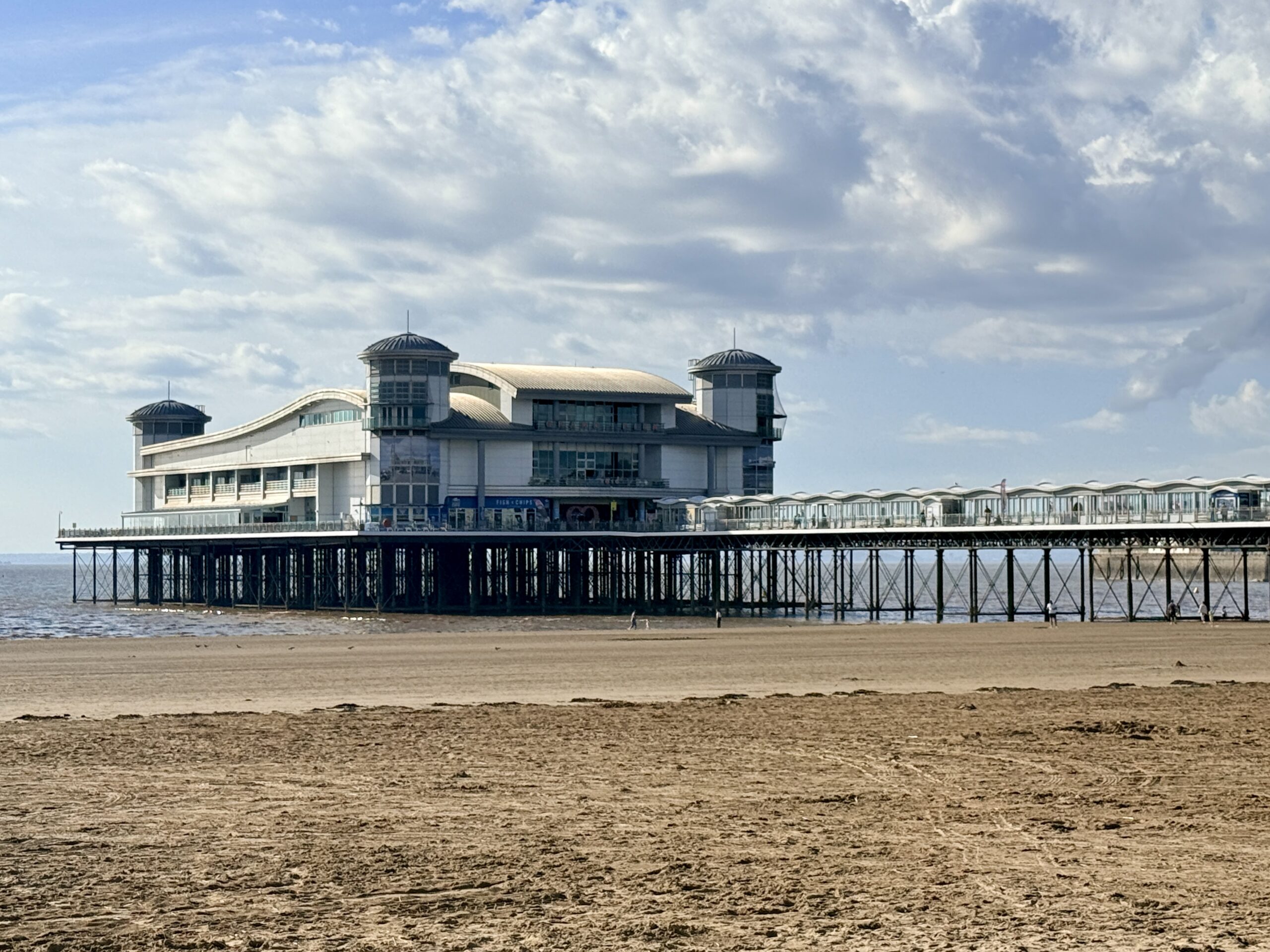
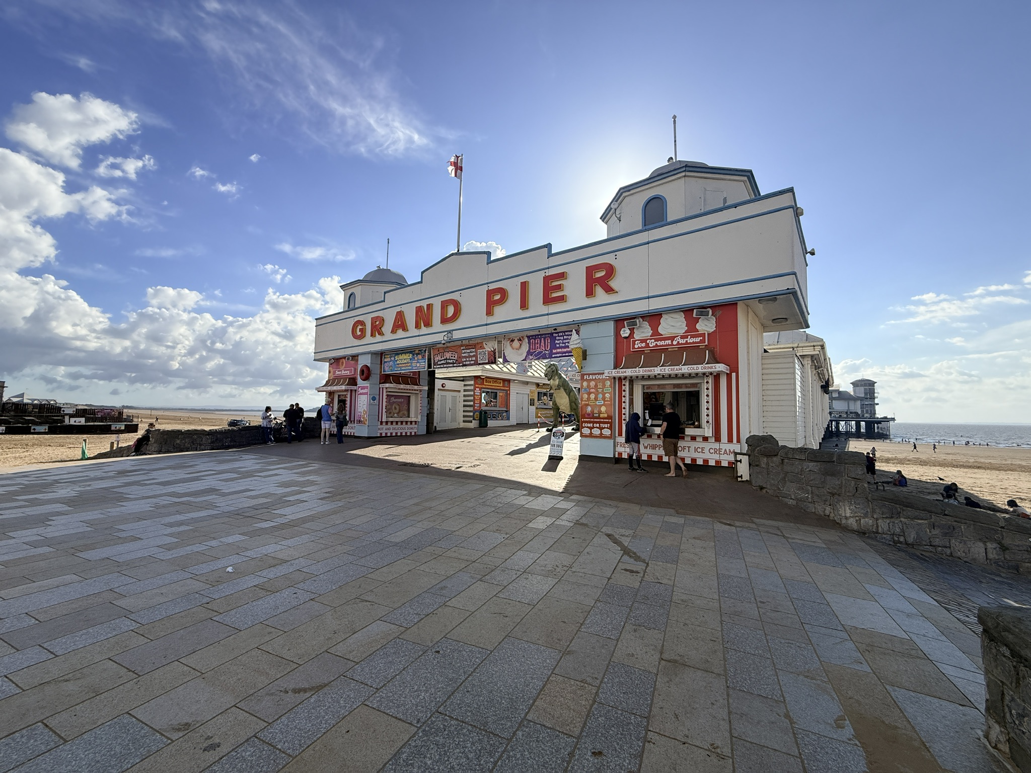
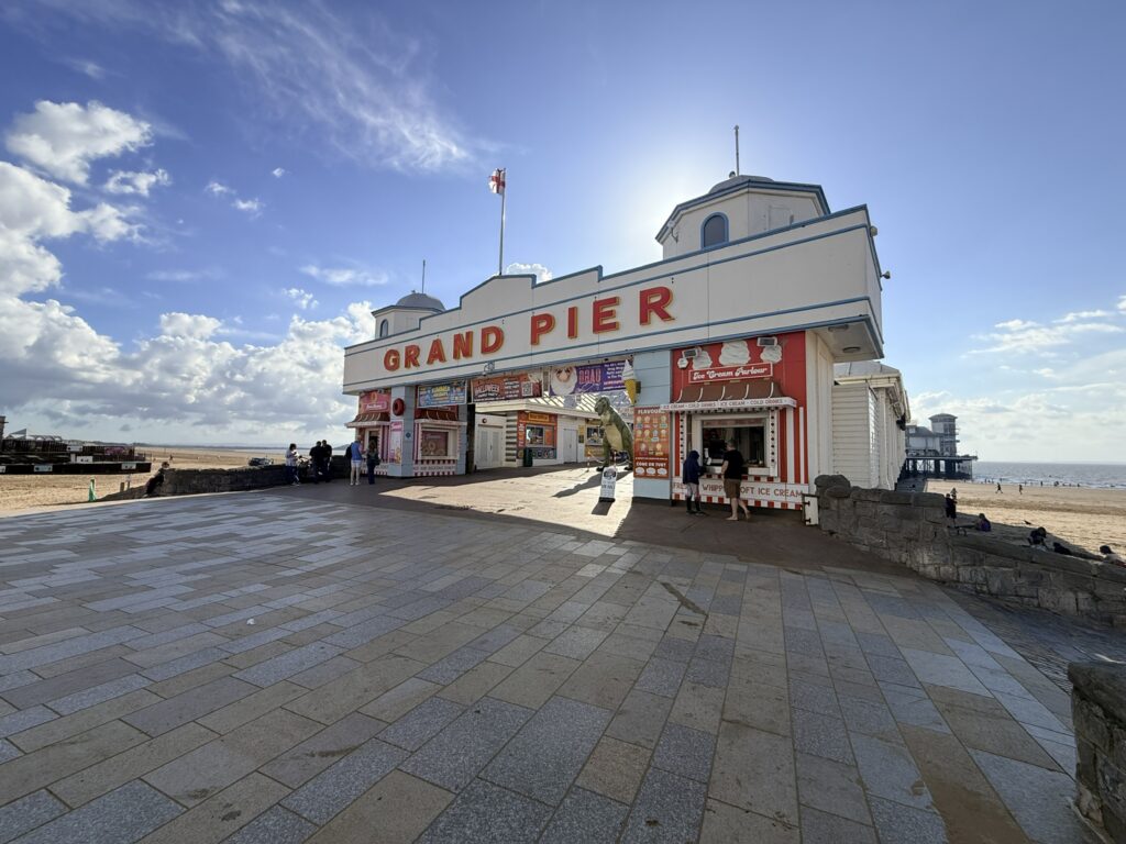
Weston-super-Mare Beach and the Grand Pier. (Credit: ThisIsSouthWest)
Weston-super-Mare beaches are surprisingly varied. There is the broad sweep of sand beside the Grand Pier, a restored marine lake for swimming, quieter shores at Uphill and Sand Bay and, a little further away, the enormous beaches running past Brean and Berrow towards Burnham-on-Sea.
We’ve explored much of this coastline ourselves, and where you go really depends on the sort of day you have in mind. Weston is hard to beat for a classic seaside day, Marine Lake gives swimmers somewhere to take the plunge when the Bristol Channel is a long way out, while Sand Bay offers a quieter setting for walking and dogs. Brean and Berrow bring seemingly endless sand, dunes and plenty of room to spread out.
There is also a wilder option. Beyond Sand Bay, Sand Point and Middle Hope feel a world away from Weston’s promenade and amusements, with rocky shores, open headland and far-reaching views across the Bristol Channel.
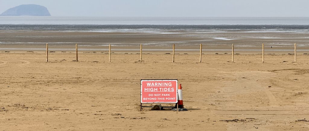
Before heading onto any of these beaches, however, it is important to understand the local tides. The Bristol Channel has an exceptionally large tidal range. At low water, the sea can be a considerable distance from shore, exposing soft sand and dangerous mud. Warning signs are there for good reason: never follow the water out across the mudflats.
Planning more than a beach day? Our complete guide to Weston-super-Mare covers the Grand Pier, Marine Lake, museums, walks, places to eat and practical information for visiting the town.
Weston-super-Mare Beaches at a Glance
From Weston’s main seafront to Sand Bay, Brean and Berrow, each beach suits a slightly different kind of day. Here’s the quick comparison.
Best for: Promenade, cafés, town and Low Lighthouse
Dogs: Restrictions vary by section
Swimming: Main beach not recommended for bathing
Important:
The Bristol Channel has a very large tidal range. At low tide, extensive areas of soft sand and mud are exposed. Check the tide before swimming or paddling and never walk out across the mudflats trying to reach the water.
Disclosure:Some of the outbound links on this page are affiliate links to sites that we use and would genuinely recommend. Using them doesn’t cost you extra, but it does help support this free guide. We also link to other sites we believe may be helpful to you. We also participate in the Amazon Associates Programme. As an Amazon Associate, we earn from qualifying purchases.
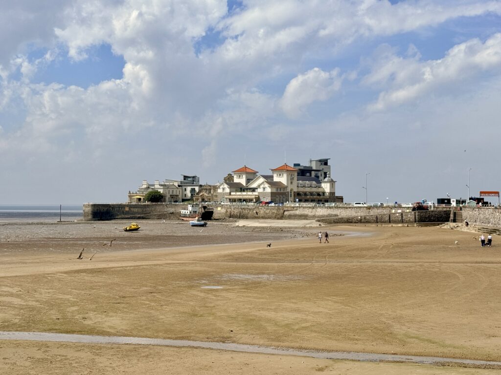
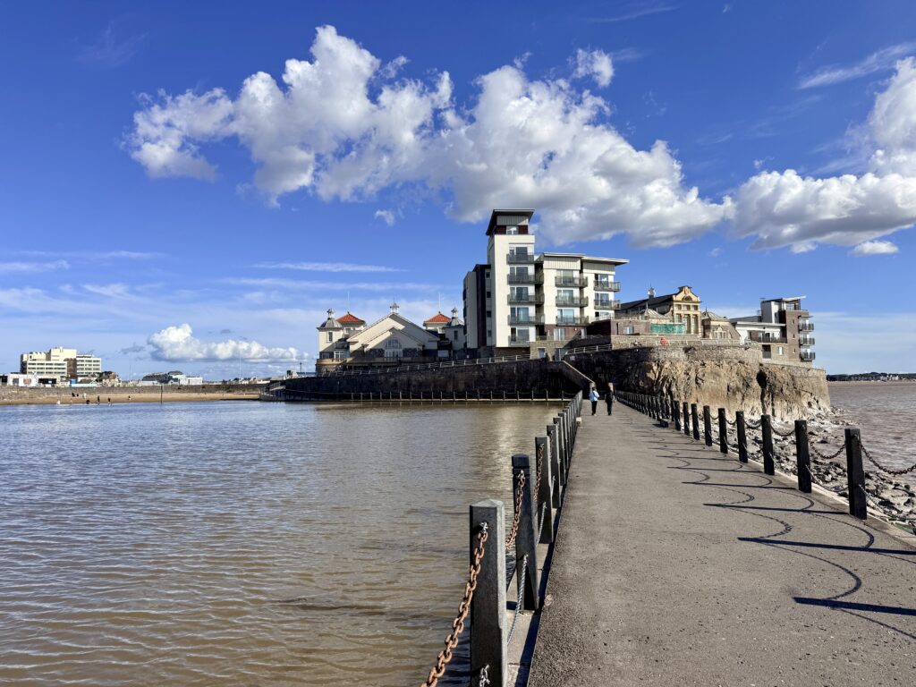
Weston-super-Mare Beach and Knightstone Island at low tide. (Credit: ThisIsSouthWest)
These beaches are worth visiting year-round, although the experience changes noticeably with the seasons.
Spring is particularly good for walking, with longer days, fewer visitors than midsummer and plenty of activity along the coast. Summer brings the busiest beach days, warmer weather, seasonal facilities and RNLI lifeguard cover at selected locations.
Autumn is often excellent for long walks around Sand Bay, Brean, Berrow and Sand Point, and seasonal dog restrictions begin to ease. Winter is much quieter and can be wonderfully atmospheric on a clear day, although strong winds, wet weather and short daylight hours deserve more careful planning.
Bus timetables, cafés, beach parking and other facilities can change between summer and winter, so it is always worth checking before a longer journey.
Weston-super-Mare Tide Times
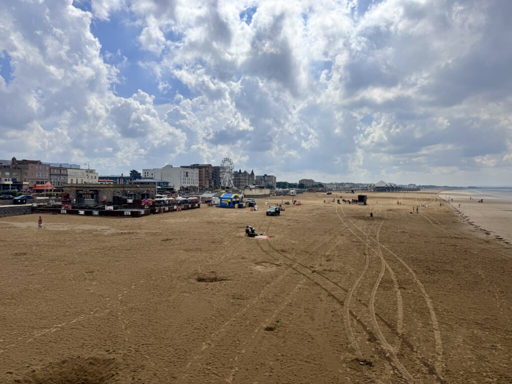
Low tide at Weston-super-Mare Beach. (Credit: ThisIsSouthWest)
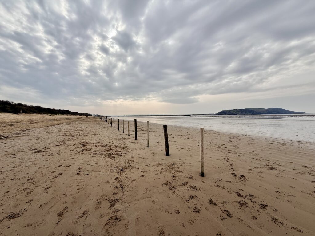
Weston-super-Mare has one of the world’s largest tidal ranges. The funnel shape of the Bristol Channel concentrates the incoming tide as it narrows towards the Severn Estuary, creating a dramatic difference between high and low water. As a result, Weston-super-Mare tides can completely transform the beach: at low tide, the sea retreats far across Weston Bay, while at high tide it comes much closer to the promenade.
If you’re planning to swim, paddle or spend time on the beach, check the latest Weston-super-Mare tide times before setting out. Never walk out across the exposed mud to reach the water at low tide, and remember that the incoming tide can move quickly.
Beach Safety
This stretch of coast requires a little more thought about the tide than many beach destinations.
As the water recedes, large areas of Weston Bay and the coast towards Burnham become exposed. Ground that appears firm can quickly turn into soft, deep mud. We know from experience how deceptive it can be: on a careful winter walk along this coast, one of us still managed to get a boot firmly stuck!
It was more inconvenient than serious, but a useful reminder not to underestimate the conditions. The mud can be considerably deeper further out, while the incoming tide brings another risk. Stay on the firm upper beach, follow local warning signs and never walk across the mudflats in an attempt to reach the water.
Somerset Council warns visitors at Brean and Berrow not to walk out to the sea at low tide, and similar warnings are displayed at Weston and Burnham. Around Brean Down, there is also a risk of the incoming tide cutting off the small coves beneath the headland.
The RNLI provides seasonal lifeguard cover at Brean Beach and Burnham-on-Sea Beach, usually during the main summer period. Patrol dates and times can change each year, so check the current RNLI information before travelling and never assume a lifeguard will be present. At Brean, swim between the red and yellow flags when lifeguards are on duty. Burnham’s main beach is permanently red-flagged and should not be treated as a swimming beach.
The RNLI also recommends learning its Float to Live technique. If you get into difficulty in the water, float on your back until you can control your breathing. In a coastal emergency, dial 999 or 112 and ask for the Coastguard.
1. Weston-super-Mare Beach
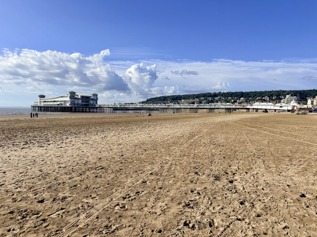
Weston-super-Mare beach and Grand Pier. (Credit: ThisIsSouthWest)
Go here for: Families, the Grand Pier, easy facilities and a full seaside day.
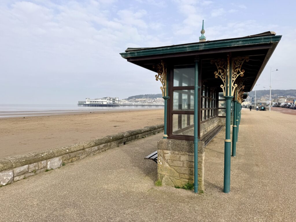
Weston’s main beach is where sand, promenade and resort meet. The Grand Pier dominates the central seafront, with cafés, restaurants, fish and chips, amusement arcades and shops all within a few minutes’ walk.
The upper shore provides plenty of room for sandcastles and games, and the traditional donkey rides remain a familiar summer sight. Unlike several places further along the coast, you don’t need a car once you arrive.
If you want to combine a few hours on the sand with the pier and other attractions, this is the obvious place to start. Our Weston-super-Mare visitor guide has much more on what to see, where to eat and how to spend a full day or weekend in town.
Getting there
Weston-super-Mare railway station is within walking distance of the seafront, making this the easiest beach in the guide to reach without a car. The town also has a bus interchange serving local and regional routes.
Drivers have a good choice of paid seafront car parks, with additional beach parking available when conditions permit.
Accessibility
North Somerset Council provides a free beach-friendly wheelchair for visitors who may find it difficult to use a conventional wheelchair on the sand. You can book it in advance for two-hour sessions, subject to availability. Check the council’s beach wheelchair information for current booking arrangements.
Beach huts
There are nine council beach huts on the promenade at Royal Sands. These are rented annually rather than as day-hire beach huts. See North Somerset Council’s beach hut information for current availability and details.
BBQs
BBQs are normally permitted on Weston Beach, but they must be raised off the ground, kept away from buildings and other fire hazards, and completely extinguished afterwards. All equipment, charcoal and rubbish must be removed from the beach, and BBQs are not permitted near the dunes. Check North Somerset Council’s beach safety information before your visit.
Dogs
Dog rules depend on which part of the seafront you visit.
North Somerset Council’s dog rules allow dogs on the beach year-round between the Grand Pier and Knightstone Island and from Royal Sands south towards Uphill. On the central section between the Grand Pier and Royal Sands, dogs are excluded from 1 May to 30 September between 9 am and 7 pm.
Dogs should be kept on a lead on the promenade.
Swimming and safety
Weston looks remarkably different depending on the tide. Around high water, the water within the Bristol Channel reaches much closer to the promenade. Several hours later, the sea may appear to have almost disappeared.
Don’t cross the exposed mud in pursuit of the water. Signs on the beach warn of soft sand and sinking mud at low tide.
Weston Main’s latest annual Environment Agency bathing-water classification is Poor, with official advice against bathing. Water quality can vary, however, and North Somerset Council provides current bathing-water quality information during the bathing season. If getting into the water is an important part of your visit, Marine Lake may be the better option.
Our view: Come here when you want a day at the seaside rather than simply somewhere to lay out a towel. For peace and open coastline, Sand Bay, Berrow or Middle Hope feel very different.
2. Marine Lake
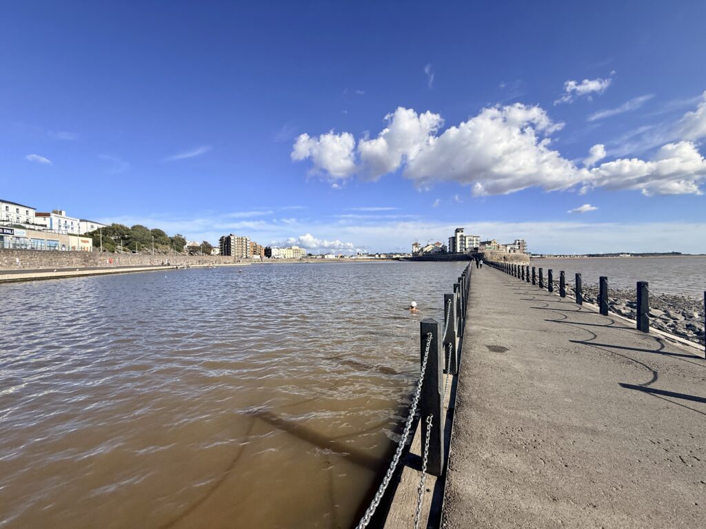
Marine Lake and Knightstone Island, Weston-super-Mare. (Credit: ThisIsSouthWest)
Go here for: Outdoor swimming, paddling, and water access when the main tide is out.
At the northern end of Weston’s seafront, Marine Lake solves one of the resort’s most obvious problems: what do you do when the sea is a mile away?
A causeway encloses the lake and retains seawater as the Bristol Channel recedes. Higher tides periodically overtop the structure and replenish it.
After improvement works, Marine Lake reopened in May 2026 and is open for outdoor swimming and non-powered watersports year-round.
Getting there
Marine Lake is walkable from central Weston and the railway station, so there is little reason to make a separate car journey if you are already visiting the town.
For drivers, use the seafront parking around Knightstone and Marine Parade rather than looking for a dedicated lake car park.
Dogs
Dogs, other than assistance dogs, are not permitted on the lake beach, lower apron or in the water. A public right of way crosses the causeway.
Swimming and safety
Having permanent water doesn’t make Marine Lake a supervised swimming pool. There is no lifeguard service, depths vary, and swimmers need to judge conditions for themselves.
Most of the edge is less than a metre deep, although depths change and the area close to the causeway is deeper. Follow the safety notices displayed around the lake.
Our view: For anyone asking “where can I swim in Weston when the tide is out?”, Marine Lake is the best answer.
3. Uphill Sands
Uphill Sands at the southern end of Weston Bay. (Credit: ThisIsSouthWest)
Go here for: A less developed end of Weston Bay, dogs and coastal walking.
Follow the seafront south and Weston gradually changes character. By the time you reach Uphill, the Grand Pier and amusement arcades feel some distance away.
The sand remains broad and open, but the backdrop is greener, and the mouth of the River Axe lies just beyond. Uphill Local Nature Reserve, the village and the hill above give you plenty to explore if you don’t want to spend the whole day beside the water.
This is also where the coast joins the Brean Down Way, an approximately eight-mile walking and cycling route from Weston through Uphill and across the Levels towards Brean Down.
Getting there
Uphill can be reached on foot from Weston along the seafront, or by local bus. First Bus route 20 links Weston with Uphill before continuing towards Brean, Berrow and Burnham-on-Sea.
Services vary through the year, so check the current timetable rather than relying on a fixed frequency.
If driving, North Somerset Council operates a large paid beach car park at Uphill Sands on Links Road, although access and availability can be affected by the tide.
Windsports
The stretch of beach between Royal Sands and Uphill includes Weston’s designated WindZone for activities including kite buggies, land sailing and mountain boarding. Access is regulated, with membership and insurance requirements applying to users. Check North Somerset Council’s WindZone information before bringing specialist equipment.
Dogs
The southern section between Royal Sands and Uphill is open to dogs year-round.
Swimming and safety
Swimming follows the same tidal patterns found elsewhere in Weston Bay. When the water is out, don’t cross the mud trying to reach it.
Our view: Uphill is a useful middle ground. You’re still close to Weston, but the setting is noticeably less developed, and it is easy to combine the shore with a proper walk. Uphill Local Nature Reserve is well worth exploring too. Make the short but fairly steep climb to Uphill Beacon for excellent views across Weston Bay, over the Levels and towards Brean Down.
4. Sand Bay
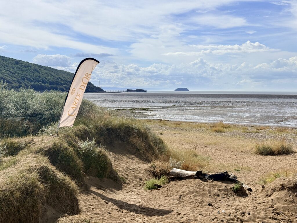
Sand Bay, near Weston-super-Mare. (Credit: ThisIsSouthWest)
Go here for: Dog walking, coastal scenery, wildlife and getting away from the resort.
Only a couple of miles north of central Weston, Sand Bay feels surprisingly separate from the town.
Instead of a pier and busy promenade, there is a long shore edged by dunes, saltmarsh and open countryside. Sand Point rises at its northern end, while Worlebury Hill separates the bay from Weston.
Getting there
First Bus route 1 links Weston-super-Mare with Sand Bay via Birnbeck Pier and Kewstoke, making this one of the easiest quieter beaches to visit without driving.
There are also two North Somerset Council car parks near the shore, at Beach Road and Sand Road by the bus terminus.
At the time of our most recent visit, the signs showed £1.10 for one hour, £2.10 for two hours and £3.10 for the day. Check the current tariff when you arrive.
Dogs
Sand Bay is a good option for dog owners because dogs are allowed on the beach year-round.
Dogs are not allowed on the dunes, however, so follow the local signs.
Walking and swimming
The England Coast Path and North Somerset Tidal Trail pass through the area, making Sand Bay as useful for walking as it is for a beach visit. From here you can continue north towards Sand Point and Middle Hope.
We wouldn’t come specifically for swimming. The water retreats a considerable distance and the coast shares the tidal characteristics of the wider Bristol Channel.
Marine Lake is easier if getting into the water is your main aim, while Brean offers a designated bathing water further south.
Our view: Sand Bay is our pick for a relaxed beach walk near Weston, especially with a dog.
5. Sand Point, Middle Hope and Middle Hope Beach
Middle Hope Beach. One of the quiet coves along Middle Hope (Credit: ThisIsSouthWest)
Go here for: Wild coastal scenery, headland walks and a complete change from Weston seafront.
Continue beyond Sand Bay and the landscape changes again.
Sand Point and Middle Hope form a prominent headland extending into the Bristol Channel. This isn’t a conventional sandy beach destination. The attraction here is the combination of rocky shore, grassland, cliffs and expansive views.
The headland is cared for by the National Trust and forms part of a Site of Special Scientific Interest. Our first-hand Sand Point and Middle Hope circular walk includes the complete route, map, parking information and the history of the headland.
Getting there
No bus drops you directly at the headland. The practical public transport option is to use the Weston to Sand Bay or Kewstoke service and continue on foot.
Drivers can use the National Trust car park at Sand Point. At the time of writing, parking costs £5 for non-members and is free for National Trust members. If the car park is full, do not park along Beach Road or in the passing places because these are needed for emergency access.
If walking from Sand Bay, allow enough time for the return journey and remember that daylight disappears quickly during winter.
Dogs
Dogs can accompany you, but this is countryside as well as coastline. Livestock may be grazing, and there are cliffs, steep slopes and important wildlife habitats. The National Trust asks visitors to keep dogs on leads at all times.
Swimming and safety
We wouldn’t suggest Sand Point or Middle Hope for swimming. Come for the landscape, rocky shoreline and walking rather than a conventional day on the sand.
The paths are rougher than the promenade and sandy beaches elsewhere in this guide. There are uneven sections, steep slopes and exposed cliff edges, so suitable footwear matters throughout the year.
Our view: Go here if you searched for Weston-super-Mare beaches but actually want somewhere wild and scenic.
6. Brean Beach
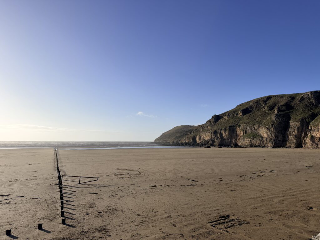
Brean Sands at low tide with Brean Down rising above the Bristol Channel. (Credit: ThisIsSouthWest)
Go here for: Miles of sand, families, dogs, summer lifeguards and Brean Down.
South of Weston, Brean opens out into one of Somerset’s great expanses of sand.
Brean Down rises dramatically at its northern end, while the shore continues south towards Berrow. The scale is immediately obvious when you arrive.
Brean village and the surrounding holiday parks provide cafés, entertainment and places to stay, so this is not an isolated stretch of coastline despite its size.
Getting there
First Bus route 20 runs from Weston-super-Mare through Brean, with stops including Brean Village Hall and Brean Leisure Park, before continuing to Berrow and Burnham.
That makes a car-free day at Brean quite practical, particularly if you combine the bus with a walk.
You can also reach the area on foot or by bicycle using the Brean Down Way from Weston.
Drivers can park on designated parts of Brean Beach when access is open. Opening depends on tides and conditions, seasonal charges apply, and a 15mph speed limit is enforced. A National Trust car park at the northern end of the beach, at the foot of Brean Down, is also convenient for combining the beach with a walk over Brean Down. It can fill quickly on busy summer weekends, so it’s sensible to arrive earlier in the day.
Never drive onto the mudflats.
Accessibility
Vehicle access onto designated parts of Brean Beach can reduce the distance between the car and the sand when the beach entrance is open, although the sandy surface itself may be difficult for conventional wheelchairs. At nearby Brean Down, the National Trust has an accessible route and all-terrain mobility scooters available to hire in advance. See the National Trust’s accessibility information for Brean Down for current details.
Beach activities
Brean is also used for horse riding, power kiting, land yachting and kite buggies, although restrictions apply. Some activities are limited to members of recognised clubs and organised meetings, while jet skis are not permitted at Brean or Berrow. Check Somerset Council’s beach and water safety information before bringing specialist equipment.
Dogs
Dogs are welcome year-round, provided they are kept under proper control or on a lead.
If you continue onto Brean Down, the National Trust asks owners to use leads because of livestock, wildlife and cliff edges.
The sea is generally much easier to reach around high tide. Once the tide goes out, extensive mudflats are exposed, and you should never attempt to walk out across them to reach the distant water.
RNLI lifeguards patrol during the main summer season. In 2026, cover ran daily from 4 July until 6 September between 10 am and 6 pm.
The RNLI also warns about deep shifting mud and the speed of the incoming tide. Around Brean Down, small coves can become cut off.
Walk up Brean Down
At the northern end of the beach, Brean Down rises to around 97 metres above the Bristol Channel.
Our Brean Down walk guide covers the steps, alternative routes, fort, parking and viewpoints in detail.
Our view: Brean is the strongest all-rounder south of Weston if you want a large sandy beach, room for the dog, family facilities and seasonal lifeguard cover.
7. Berrow Beach
Berrow Beach looking towards Burnham-on-Sea and the Low Lighthouse. (Credit: ThisIsSouthWest)
Go here for: Dunes, long walks, dogs and a less developed stretch of sand.
There isn’t an obvious point where Brean suddenly becomes Berrow. The sand simply carries on southwards, but the surroundings gradually become more natural.
Behind the shore lies Berrow Dunes Local Nature Reserve, a substantial dune system that gives this section of coast a very different backdrop from Weston.
Getting there
Route 20 also serves Berrow between Brean and Burnham-on-Sea, giving the village a direct bus connection with Weston.
If driving, vehicles can use designated parts of Berrow Beach while access is open. Parking is also available near Berrow Dunes when the beach gates are closed.
Accessibility
Vehicle access onto designated parts of Berrow Beach can reduce the distance between the car and the shore when the beach entrance is open, but the sandy surface and pedestrian access may still be difficult for wheelchair users. Somerset Council identifies disabled beach access points at nearby Burnham-on-Sea for visitors unable to use the pedestrian access at Berrow or Brean. See Somerset Council’s beach and water safety information for current access information.
Dogs
Dogs are allowed on Berrow Beach year-round, provided they remain under control or on a lead.
With miles of sand and fewer resort attractions, it is one of the easiest places in the area for a long walk with a dog.
Swimming and safety
Like neighbouring Brean, Berrow is a designated bathing water with a current “Good” Environment Agency classification.
Plan around the tide. Once the water has gone out, dangerous mud is exposed beyond the firmer upper shore.
At low tide, the remains of the SS Nornen, a Norwegian sailing ship wrecked at Berrow in 1897, can sometimes be seen protruding from the sand. It is one of the beach’s more unusual sights, but don’t attempt to walk out across the mudflats to reach it.
If you want to stay close by, look at accommodation in Brean, Berrow or Burnham rather than limiting your search to Weston.
Our view: Berrow gives you much of Brean’s scale with a stronger sense of dunes and open coast.
8. Burnham-on-Sea Beach
Burnham-on-Sea Pier and beach. (Credit: ThisIsSouthWest)
Go here for: A smaller seaside town, the Esplanade, cafés and the Low Lighthouse.
Burnham sits at the southern end of this long run of coastline. Its broad Esplanade, shops, cafés and sandy shore give it more in common with Weston than neighbouring Berrow.
One of its most recognisable sights is the Low Lighthouse, the wooden structure standing on legs on the beach north of the town centre.
Our Burnham-on-Sea visitor guide covers the lighthouse, pier, walks, parking and other things to see around town.
Getting there
Route 20 runs directly between Weston-super-Mare and Burnham-on-Sea via Uphill, Brean and Berrow. Current timetables show services throughout the day, although the frequency varies by day and season.
Burnham also has town and seafront parking within walking distance of the beach.
Accessibility
Burnham’s wide, level Esplanade makes it one of the easier places along this stretch of coast to enjoy sea views without going onto the sand. Parking is available along the Esplanade, and nearby, and Somerset Council identifies disabled access points to the beach. Its Accessible Coast information also includes accessible routes and mobility equipment around Burnham-on-Sea.
Dogs
Rules change by beach section and time of year. Dogs are prohibited year-round between the jetty and pavilion, with seasonal restrictions on adjoining areas.
Further north, beyond Maddocks Slade towards Berrow, dogs are welcome year-round if kept under control or on a lead.
Swimming and safety
Burnham-on-Sea’s main beach is not a place we recommend for swimming. Permanent advice against bathing is in place at Burnham Jetty, which is no longer designated as a bathing water. Somerset Council says the nearby rivers can affect water quality and recommends further up the coast at Berrow and Brean for swimming and paddling instead.
The RNLI describes Burnham’s main beach as permanently red-flagged. Other hazards include strong lateral currents around the jetty and areas of deep, shifting mud as the tide falls.
RNLI lifeguards provide seasonal cover at Burnham, but that should not be taken to mean the beach is suitable for bathing. Their role also includes warning visitors about conditions and helping people who get into difficulty.
Burnham has guesthouses, small hotels, holiday parks and self-catering accommodation, and staying here puts Berrow and Brean within easy reach.
Our view: Burnham is better considered as a seaside town and coastal walking destination than a swimming beach. Come for the promenade, Low Lighthouse and town, and head to Berrow or Brean if getting into the sea is important to your plans.
Which Beach Near Weston-super-Mare Should You Choose?
Brean Sands seen from Brean Down, one of the best viewpoints on the Somerset coast. (Credit: ThisIsSouthWest)
If you want the classic Weston experience, stay on Weston-super-Mare Beach, where the pier, promenade, food and attractions are all close at hand. Marine Lake is the practical answer when swimming matters but the main tide is out.
For somewhere calmer without travelling far, Uphill and Sand Bay both make good alternatives. Sand Bay is especially appealing with a dog, while Uphill connects easily with the nature reserve and Brean Down Way.
Head to Sand Point and Middle Hope for walking and wild coastal scenery rather than a conventional beach day.
South of Weston, Brean has the broadest appeal for families and acres of sand. It is also the starting point for our walk over Brean Down to the fort. Berrow is less developed and particularly attractive for dunes, dogs and longer walks.
Finally, Burnham-on-Sea provides another proper seaside town to explore. Our Burnham-on-Sea guide is useful if you plan to make a day of it, but its central beach shouldn’t be chosen for bathing.
A surprisingly large part of this coastline can be explored without a car, with Weston-super-Mare making a good base for public transport.
Weston-super-Mare railway station has direct services from Bristol Temple Meads, with connections from further afield. From Bristol, the X1 bus also provides a direct link to Weston-super-Mare.
Arriving by air is possible too. The A3 Weston Airport Flyer runs directly between Bristol Airport and Weston-super-Mare, calling at Cleeve, Congresbury and Worle on the way.
Once in Weston, the main beach and Marine Lake are within walking distance of the railway station and town centre. Route 1 heads north to Sand Bay, while route 20 travels south through Uphill, Brean and Berrow to Burnham-on-Sea.
Bus routes and timetables can change, so check the latest services with First Bus before travelling.
For walkers and cyclists, the Brean Down Way provides another car-free option between Weston and Brean.
For easy year-round access, consider Sand Bay, Brean or Berrow. All three allow dogs year-round, although owners remain responsible for keeping them under control.
Weston also has year-round dog-friendly sections, but seasonal restrictions apply to the central shore. Marine Lake doesn’t permit dogs other than assistance dogs.
If heading onto Sand Point, Middle Hope, or Brean Down, remember these are wildlife and grazing areas, as well as places to walk. Follow signs and use a lead around livestock or wherever requested.
Where Is Best for Swimming?
Marine Lake on Weston-super-Mare seafront. (Credit: ThisIsSouthWest)
Marine Lake is the easiest answer if you simply want to know that there will be water when you arrive. Its retained seawater avoids the problem of Weston’s enormous tidal movement, although there is no lifeguard.
For open-sea swimming, Brean and Berrow are designated bathing waters currently classified as Good by the Environment Agency. The tide still governs access, and RNLI lifeguards are on duty at Brean during the main summer season.
Weston’s main beach is best used for sand, the promenade, and traditional seaside activities rather than swimming. Weston Main’s latest annual Environment Agency bathing-water classification is Poor, with official advice against bathing. Water quality can vary, however, and North Somerset Council provides current bathing-water quality information during the bathing season.
Marine Lake is the more dependable option for entering the water, although it is unsupervised.
Do not plan to bathe at Burnham Jetty, where permanent advice against swimming is in place.
Can You Walk from Weston-super-Mare to Brean?
View towards Brean Down from Uphill Church on the Brean Down Way. (Credit: ThisIsSouthWest)
Yes. The Brean Down Way links Weston-super-Mare with Brean Down via Uphill and the River Axe.
The route is around eight miles and is largely flat, although reaching the top of Brean Down involves a substantial climb. You can walk or cycle it, and our guide covers the route, surfaces, facilities, and transport options.
Don’t assume you can simply follow the water’s edge all the way. Tides, mud and the River Axe make the recognised route the sensible option.
Once you reach Brean, you can continue with our separate Brean Down walk to climb the headland and visit the fort.
Staying Near the Beaches
Premier Inn, one of Weston-super-Mare’s seafront hotels. (Credit: ThisIsSouthWest)
Where you stay can make quite a difference if you are planning a few days on this part of the Somerset coast.
Weston-super-Mare has the widest range of hotels, guesthouses and apartments and is the easiest base without a car.
Brean and Berrow suit visitors who want long sandy beaches, holiday parks and self-catering accommodation close at hand.
Burnham-on-Sea is a smaller base with its own shops and restaurants, plus quick access north to Berrow and Brean.
Royal Sands looking towards Brean Down. (Credit: ThisIsSouthWest)
Check the tide, weather, bus timetable and any current beach notices before setting off. Conditions on this coast can look completely different within a few hours.
If you’re swimming at an RNLI lifeguarded beach, stay between the red and yellow flags and follow the lifeguards’ instructions. If someone is in difficulty at sea, alert a lifeguard or call 999 or 112 and ask for the Coastguard rather than entering the water yourself.
Supporting the RNLI helps fund lifeboat crews, lifeguards and water-safety work around the UK coast. You can also find the RNLI’s latest beach safety advice and learn its potentially lifesaving Float to Live technique before heading to the coast.
Frequently Asked Questions About Weston-super-Mare Beaches
Quick answers to some of the most common questions about beaches in and around Weston-super-Mare.
What is the nicest beach near Weston-super-Mare?
It depends on what you want from the day. Sand Bay is our choice for a quieter beach close to Weston, especially for walking and dogs. Brean has an enormous sandy beach with family facilities nearby, while Weston-super-Mare Beach is best if you want the Grand Pier, promenade, cafés and other seaside attractions.
What is the closest beach to Weston-super-Mare?
Weston-super-Mare Beach is immediately beside the town centre and promenade. Marine Lake is at the northern end of the seafront, while Uphill Sands lies towards the southern end of Weston Bay. Sand Bay is only a few miles from central Weston.
Does Weston-super-Mare have a sandy beach?
Yes. Weston-super-Mare has a broad sandy beach stretching along the seafront. The Bristol Channel has a very large tidal range, however, so at low tide the water can be a considerable distance from the promenade. Never walk out across exposed mud trying to reach the sea.
Which is better, Weston-super-Mare or Burnham-on-Sea?
Weston-super-Mare is the larger resort, with the Grand Pier, Marine Lake, more attractions and a wider choice of places to eat and stay. Burnham-on-Sea is smaller and quieter, with its Esplanade and distinctive Low Lighthouse. For sea swimming, Brean or Berrow are better options than central Burnham.
Which Weston-super-Mare beaches are dog friendly?
Sand Bay, Brean and Berrow allow dogs throughout the year, subject to owners keeping them under control. Weston Beach also has year-round dog-friendly sections, although seasonal restrictions apply to the central section. Dogs, other than assistance dogs, are not permitted at Marine Lake.
Are dogs allowed on Weston-super-Mare Beach?
Yes, but the rules depend on the section and time of year. Dogs on Weston-super-Mare Beach are allowed year-round between the Grand Pier and Knightstone Island and from Royal Sands south towards Uphill. On the central section between the Grand Pier and Royal Sands, dogs are not allowed from 1 May to 30 September between 9 am and 7 pm. Dogs should also be kept on a lead on the promenade.
Which beaches near Weston-super-Mare are best for swimming?
Marine Lake is useful when Weston’s main tide is out because it retains seawater, although there is no lifeguard. For open-sea swimming, Brean and Berrow are designated bathing waters currently classified as Good by the Environment Agency. Always check the tide and local conditions before entering the water. Burnham’s main beach should not be treated as a swimming beach.
Can you park on Brean Beach?
Yes. Vehicles can park on designated parts of Brean Beach when access is open. Opening depends on tides and conditions, seasonal charges apply and there is a 15mph speed limit. Never drive onto the mudflats. There is also a National Trust car park at the foot of Brean Down.
Which beaches near Weston-super-Mare are wheelchair accessible?
Accessibility varies between beaches. North Somerset Council provides a free beach-friendly wheelchair for Weston Beach, which can be booked in advance. Brean and Berrow allow vehicle access onto designated areas of the beach when conditions permit, although sand can still be difficult for conventional wheelchairs. Burnham-on-Sea has a wide, level Esplanade and disabled beach access points, while the National Trust provides accessible options and all-terrain mobility equipment at nearby Brean Down.
Can you visit Weston-super-Mare beaches without a car?
Yes. Weston Beach and Marine Lake are within walking distance of Weston-super-Mare railway station. First Bus route 1 serves Sand Bay, while route 20 links Weston with Uphill, Brean, Berrow and Burnham-on-Sea. Services can change, so check the latest timetable before travelling.
What is the best time of year to visit Weston-super-Mare beaches?
The beaches can be visited throughout the year. Spring and summer are best for traditional beach days and seasonal facilities, while autumn and winter are often quieter for walking and dog-friendly visits. Lifeguard cover, bus services, parking arrangements and some facilities can vary with the season.
Over to you … have you recently travelled to South West England? What worked for you? What advice would you give to others? Please leave your comments below or join in the discussion in our Facebook Group.
New to South West England or returning after a while? Start with our ‘Travel Basics’ – quick guides packed with tips to help you plan your trip.
Sutton Bingham Reservoir near Yeovil. (Credit: ThisIsSouthWest)
Sutton Bingham Reservoir is a peaceful place to walk, picnic and enjoy the countryside just a few miles south of Yeovil in Somerset. There is free parking, a children’s play area, toilets, picnic tables and a short Meadow Trail beside the water, while fishing, sailing and paddlesports also take place on the reservoir.
We first noticed Sutton Bingham Reservoir on a map and, despite living relatively nearby, had never visited. So, on a hot weekday afternoon in August, we went to explore.
What we found was a surprisingly attractive and well-maintained place that was remarkably quiet. We walked the Meadow Trail, spent some time beside the water and discovered somewhere we would happily return to simply for a picnic, to read, or even to sit at one of the shaded tables and get some work done.
Sutton Bingham Reservoir at a Glance
Important sat nav information
For general visits, enter Sutton Bingham Picnic Area, BA22 9QP. Do not simply search for “Sutton Bingham Reservoir”, as your sat nav may direct you to the separate Fishing Lodge on the opposite side of the water, which is not open to general visitors.
Location: Around 15 minutes south of Yeovil, near the Somerset and Dorset border.
Best for: Picnics, reservoir views, a short countryside walk and quiet time beside the water.
Parking: Free parking at Sutton Bingham Picnic Area.
Walking: The signed Meadow Trail is approximately 2 km return. Allow at least one hour.
Accessibility: The picnic area and separate Meadow Viewing Area have accessible paths. The full Meadow Trail crosses uneven grass and is not suitable for most wheelchairs or pushchairs.
Facilities: Public toilets, picnic tables, benches, children’s play area, water refill point, bike racks and an accessible viewing area.
Food and drink: There is nowhere to buy refreshments, so bring drinks and preferably a picnic.
Dogs: Dogs are not permitted.
Water access: Swimming and unauthorised launching of boats, kayaks or paddleboards are prohibited.
Good to know: The reservoir has separate areas for fishing, sailing and paddlesports. Some paths and sections of shoreline are restricted to permit holders or club members.
Disclosure:Some of the outbound links on this page are affiliate links to sites that we use and would genuinely recommend. Using them doesn’t cost you extra, but it does help support this free guide. We also provide links to other sites that we believe may be helpful to you.
This is one part of the visit where our experience may save you some frustration.
Our sat nav initially took us to the wrong part of the reservoir, near the fishing lodge and education facilities rather than the main picnic area.
A very friendly Wessex Water warden pointed us in the right direction.
If approaching from the A30, we found it better to use the A37 Dorchester Road first, then turnonto Darvole Road for the picnic area.
Alternative sat nav routes can take you along some very picturesque Somerset lanes, but they can also be extremely narrow.
Parking when you arrive is both plentiful and free of charge.
For the picnic area, the visitor information displayed during our visit gave:
Sutton Bingham Picnic Area BA22 9QP
The general reservoir has other entrances and facilities, so using the correct destination rather than simply entering “Sutton Bingham Reservoir” into your sat nav is worthwhile.
Sutton Bingham Picnic Area
Picnic tables overlooking Sutton Bingham Reservoir through mature trees on a sunny day.
The picnic area was one of the nicest surprises of our visit.
There is plenty of space, with picnic tables and benches overlooking the reservoir and attractive countryside. On the hot afternoon when we visited, there were only a handful of cars in the car park and the whole place felt remarkably peaceful.
There is a good children’s play area rather than simply a token piece of play equipment. It includes wooden climbing and balancing structures, ropes and a large basket swing, spread across a grassy area.
The public toilets were clean when we visited, and perhaps unsurprisingly, given that this is a Wessex Water Reservoir, there is a handy water refill point, which we used.
There is nowhere at the picnic area to buy food or drinks, so we would recommend bringing at least something to drink and, better still, a picnic. This is somewhere that lends itself to lingering rather than rushing through.
There was a little distant road noise during our visit, but otherwise it felt rural and secluded, with birdsong providing much of the background noise.
Even if you don’t intend to walk, we think the picnic area is worth visiting simply to sit and enjoy the surroundings.
Walking at Sutton Bingham Reservoir
The accessible path and Meadow Trail at Sutton Bingham Meadows. (Credit: ThisIsSouthWest)
The main public walk from the picnic area is the Sutton Bingham Meadow Trail.
This follows the western side of the reservoir through a mixture of open meadow, grassy paths, gravel and small shaded sections.
One of the best things about the walk is how close you remain to the water for much of the route. There are frequent reservoir views rather than the frustrating experience of walking around a lake while barely being able to see it.
On our visit in August 2026, following a prolonged spell of hot, dry weather, the reservoir was noticeably low. This exposed substantial stretches of shoreline that resembled small beaches in places.
They looked tempting on a hot afternoon, but visitors should stay out of the water. Swimming is prohibited, and access to the reservoir is controlled.
We actually found the unusually low water level fascinating rather than disappointing. It gave us a different view of the reservoir and certainly didn’t detract from our visit.
The signed Meadow Trail is approximately 2 km for the return walk, with the outward section ending after around 1 km at the road.
Wessex Water suggests allowing around 45 minutes. We would allow at least an hour so that you have time to stop and enjoy the views.
The route is extremely easy to follow, and we didn’t encounter any significant hills or difficult sections.
However, don’t confuse an easy walk with an entirely accessible one. Parts cross grass and meadow, and the ground is uneven in places. It was completely dry during our summer visit, but we would expect some sections to become muddy during wet winter weather.
For that reason, we wouldn’t recommend the full Meadow Trail for wheelchairs or most pushchairs.
There is, however, a separate signed Meadow Viewing Area, reached by an accessible path, with a bench and views across the meadows and reservoir.
No. There isn’t a straightforward public circular walk around Sutton Bingham Reservoir.
This is important because looking at the reservoir on a map might give the impression that you could simply walk around its shoreline.
The public Meadow Trail naturally ends at a gate beside the road after approximately 1 km. A Wessex Water sign warns that the road beyond has no pavement and recommends returning to the picnic area.
We followed that advice and retraced our route, making the walk approximately 2 km in total.
It is possible to continue by road towards the Dorset village of Halstock, where there is a small village shop. However, local people also cautioned us against walking this way because the lane has no pavement and carries a 40 mph speed limit.
We therefore wouldn’t recommend incorporating Halstock into a walk from the reservoir.
Elsewhere around Sutton Bingham, sections of shoreline are private or restricted to anglers and other authorised users. This is a working reservoir rather than a country park with unrestricted access.
Wildlife at Sutton Bingham Reservoir
Squirrel on the Meadow Trail. (Credit: ThisIsSouthWest)
The reservoir and surrounding meadows are valuable wildlife habitats.
Wessex Water says the site supports more than 200 species of wildflowers and grasses, around 1,000 species of invertebrates and at least 88 species of birds.
Interpretation boards beside the trail explain how some of the grassland is managed as traditional hay meadow. Wildflowers support butterflies, bees and other insects, while the reservoir attracts resident and visiting waterbirds.
Sutton Bingham is also known for overwintering wildfowl and migrant birds, including occasional ospreys.
We’re certainly not expert birdwatchers, so we’ll leave identifying Sutton Bingham’s more interesting birds to those who are. During our own walk, we saw rabbits and squirrels and heard plenty of birdsong.
The relative tranquillity of the site is part of its appeal if you simply want to slow down and enjoy the countryside.
Visitors are also asked to help prevent the spread of invasive non-native species by cleaning footwear and equipment. Information boards around the reservoir highlight species including New Zealand pygmyweed, Himalayan balsam, giant hogweed and Japanese knotweed.
Fishing is an important recreational use of Sutton Bingham. Wessex Water manages both bank and boat fishing, with trout and coarse fishing available at different times of year. In 2026, the trout season ended in June, after which the reservoir reopened to coarse fishing for the remainder of the year.
The Fishing Lodge and some areas of shoreline are reserved for anglers and are not accessible to general visitors. We encountered signs stating “Fishing permit holders only. No public access.” A visible path or stretch of shoreline should not therefore be assumed to form part of the public walking route.
Check current seasons, permits, access arrangements and conditions with Wessex Water before travelling.
Kayaking, Canoeing and Paddleboarding
Kayaking at Sutton Bingham Reservoir. (Credit: ThisIsSouthWest)
You can kayak, canoe and paddleboard at Sutton Bingham Reservoir, but you cannot simply arrive with your own craft and launch independently.
Signs around the reservoir state that unauthorised launching of boats or other craft is prohibited and that boats may only be used through approved clubs.
Sutton Bingham Paddlesports Club operates at the reservoir and offers kayaking, canoeing and stand-up paddleboarding. The club was founded in 2001 as Sutton Bingham Canoe Club and welcomes both beginners and more experienced paddlers. It is affiliated with Paddle UK.
When we visited, the club was closed, but the information board showed a range of kayaks, open canoes, and paddleboards available, along with equipment such as paddles and buoyancy aids.
Current membership, sessions and equipment arrangements are available from Sutton Bingham Paddlesports Club. In 2026, adult membership was £35 and junior membership £12, although these prices can change.
Sailing at Sutton Bingham Reservoir
Sailing is another well-established activity at Sutton Bingham. Sutton Bingham Sailing Club was founded in the early 1970s and has operated from the reservoir for more than fifty years.
The club is an accredited RYA Training Centre and supports recreational sailing, organised racing, youth activities and recognised sailing courses. Its programme caters for different levels of experience, including people learning to sail and established members looking to develop their skills or take part in club racing.
Races are normally held on Sundays, with additional Thursday evening sailing during the summer months. Activities and access are organised through the club rather than forming part of the reservoir’s general visitor facilities.
No. Swimming is not permitted at Sutton Bingham Reservoir.
Wessex Water signs around the site warn of the hazards associated with reservoirs, including deep, cold water, sudden drops, mud, currents, and underwater structures.
During our visit in August 2026, there was also a blue-green algae warning, advising people and animals to stay out of the water.
Are Dogs Allowed at Sutton Bingham Reservoir?
Dogs are not permitted. (Credit: ThisIsSouthWest)
No. Dogs are not permitted at Sutton Bingham Reservoir.
We saw very few walkers during our weekday visit, despite the excellent weather. The restriction on dogs may be one reason the Meadow Trail is quieter than many comparable countryside walks, although that is only our impression.
The no dogs rule is one of several restrictions visitors should know about.
Wessex Water signage also states that there should be no swimming, fires, barbecues, cycling or unauthorised launching of boats.
There are quite a few rules and signs around Sutton Bingham, so you’re never likely to forget that this is a working reservoir rather than a conventional country park.
We didn’t find that detracted from the experience. Its primary purpose is water supply, and restrictions around the water and wildlife are understandable.
A Little Sutton Bingham History
Low water at Sutton Bingham Reservoir. (Credit: ThisIsSouthWest)
Sutton Bingham Reservoir was completed in 1955 to provide a water supply for Yeovil and South Somerset. The reservoir covers around 142 acres and holds approximately 2,600 million litres when full.
Its creation changed the landscape considerably. The valley was flooded, and the remains of Sutton Mill now lie beneath the reservoir.
One much older landmark survived.
Close to the reservoir stands All Saints Church, Sutton Bingham, which dates from the medieval period and contains important historic wall paintings.
We didn’t visit the church on this occasion, largely because we hadn’t appreciated its significance until researching Sutton Bingham afterwards. In hindsight, we wish we had.
If you are visiting the reservoir and have time, it is therefore worth investigating the church as an addition to your visit.
We found plenty of spaces on our weekday afternoon visit, and parking was straightforward. Wessex Water also lists parking at its fishing lodge, but this serves a different part of the site.
From the picnic area car park, it is only a short distance to the toilets, play area, picnic tables, reservoir viewing area, and the start of the Meadow Trail.
The main picnic area appeared reasonably accessible during our visit, with surfaced areas connecting the principal facilities.
There is also a specifically designated accessible path leading to the Meadow Viewing Area, with a bench overlooking the meadows and water.
Wessex Water also lists accessible fishing facilities, including a wheelchair-accessible lodge, toilets and boats. These are associated with fishing access and are separate from the facilities available to general visitors at the picnic area.
The full Meadow Trail is different. Because it crosses grass and uneven terrain, we wouldn’t consider the entire 2 km walk suitable for wheelchairs, and some pushchairs may also struggle.
Visitors with specific accessibility requirements should check the latest information with Wessex Water before travelling.
How Long Should You Spend at Sutton Bingham Reservoir?
Sutton Bingham play area. (Credit: ThisIsSouthWest)
Allow at least an hour if you want to walk the Meadow Trail and enjoy the reservoir views without rushing.
But we’d recommend staying longer.
Bring a picnic, and Sutton Bingham could easily fill a relaxed couple of hours. Families can combine the walk with a visit to the playground, while couples might simply enjoy a picnic and a stroll beside the water.
It is also somewhere we would happily visit alone. There are shaded tables, peaceful surroundings and attractive views. We’d quite happily bring a laptop or notebook and spend an afternoon writing here.
There is no café, so bring your own food and drinks. The water refill point is useful, particularly during warmer weather.
Is Sutton Bingham Reservoir Worth Visiting?
Meadow Trail beside the reservoir. (Credit: ThisIsSouthWest)
Yes, particularly if you’re looking for a peaceful, free place near Yeovil for a picnic and a short walk.
Sutton Bingham isn’t a major visitor attraction, and we don’t think it needs to be presented as one. Its appeal is simpler than that.
There is attractive countryside, plenty of water to look at, a pleasant and easy-to-follow Meadow Trail, good picnic facilities, a surprisingly substantial children’s play area and enough wildlife to make you slow down and look around.
The reservoir was very quiet during our late afternoon weekday visit. There were only a few cars and very few other walkers, despite visiting on a beautiful summer day.
We initially went because we’d spotted Sutton Bingham on a map and wondered what was there. We left thinking it was somewhere we’d happily return to, perhaps with a picnic and a book, or simply to sit beside the water for a couple of hours.
For somewhere only around a 15-minute drive from Yeovil, we think Sutton Bingham is easily overlooked.
Sutton Bingham Reservoir FAQs
What is the postcode for Sutton Bingham Reservoir?
For a general visit, use Sutton Bingham Picnic Area, BA22 9QP. Do not simply enter “Sutton Bingham Reservoir”, as your sat nav may direct you to the separate Fishing Lodge, which is not open to general visitors.
Is parking free at Sutton Bingham Reservoir?
Yes. Parking is free at Sutton Bingham Picnic Area. The Fishing Lodge has separate parking for anglers and should not be used as the destination for a general visit.
What are Sutton Bingham Reservoir’s opening times?
The picnic area opens at 8am throughout the year. Closing times range from 3.30pm in December to 8pm in June and July, with intermediate seasonal closing times during other months. Check the
latest Wessex Water information
before travelling.
Can you walk around Sutton Bingham Reservoir?
No. There is no public circular walk around the reservoir. The signed Meadow Trail is approximately 2 km return and follows the western shoreline before visitors retrace their route to the picnic area.
Can you swim in Sutton Bingham Reservoir?
No. Swimming is prohibited because of hazards including deep, cold water, sudden drops, mud, currents and submerged structures.
Can you paddleboard or kayak at Sutton Bingham Reservoir?
Kayaking, canoeing and paddleboarding are available through Sutton Bingham Paddlesports Club. Visitors cannot independently launch their own craft without authorisation.
How much does fishing at Sutton Bingham Reservoir cost?
Permit prices depend on the season, type of fishing and ticket selected. Check current prices, permitted methods and access arrangements directly with
Wessex Water.
Are dogs allowed at Sutton Bingham Reservoir?
No. Dogs are not permitted at Sutton Bingham Reservoir, including on the Meadow Trail.
Over to you … have you recently travelled to South West England? What worked for you? What advice would you give to others? Please leave your comments below or join in the discussion in our Facebook Group.
New to South West England or returning after a while? Start with our ‘Travel Basics’ – quick guides packed with tips to help you plan your trip.
Looking for things to do in Minehead, Somerset? This guide covers what to see, where to stay and how to plan your visit.
Minehead is one of the main seaside towns on the Somerset coast, located between the Bristol Channel and the edge of Exmoor National Park. It combines a traditional seafront, a long beach, and a harbour with direct access to some of the best walking and countryside in South West England.
The town is at the western end of the Somerset coast, where the coastline begins to rise towards the cliffs and wooded valleys of Exmoor. To the west, the South West Coast Path begins its long journey to Dorset, while inland routes lead quickly into open moorland, wooded combes and quiet villages.
Minehead has grown from a small medieval port into a popular seaside destination, with a mix of historic streets, modern attractions and family-focused resorts. It is larger and busier than nearby Watchet, with more facilities, a wider choice of places to stay and a lively atmosphere in summer.
For many visitors, Minehead works well as both a base and a destination in its own right, offering beach walks, heritage railways, coastal views and easy access to Exmoor, Dunster and the wider Somerset coast.
Minehead Harbour (Credit: ThisIsSouthWest)
Minehead at a glance
Minehead is a traditional seaside town on the Somerset coast, known for its long beach, promenade, harbour and position on the edge of Exmoor National Park.
It has a livelier, more developed feel than smaller harbour towns nearby, with family attractions, coastal walks and access to the countryside.
Best for: beach walks, family days out, coastal scenery, Butlin’s Minehead, the West Somerset Railway, the South West Coast Path and Exmoor.
A good choice for a classic Somerset coast day out, family holiday or base for exploring West Somerset.
Disclosure:Some of the outbound links on this page are affiliate links to sites that we use and would genuinely recommend. Using them doesn’t cost you extra, but it does help support this free guide. We also provide links to other sites that we believe may be helpful to you.
Minehead offers a wider range of seaside facilities than smaller harbour towns nearby, including a long promenade, shops, cafés, accommodation and family attractions. Minehead is better suited to visitors looking for a livelier base with easy access to the beach, Butlin’s, the West Somerset Railway, the nearby villages of Dunster and Porlock and Exmoor.
One of its main advantages is location. It is both by the coast and Exmoor, making it easy to combine time on the beach with walks inland through woodland, hills and open moorland.
Minehead is also the starting point of the South West Coast Path, one of the UK’s best-known long-distance walking routes. Even short sections offer interesting views along the Bristol Channel.
For families, the town has plenty to offer, including the beach, seafront attractions and the well-known Butlin’s Minehead resort. For walkers, photographers and those exploring the region, it provides easy access to Dunster, Porlock, Exmoor and the wider Somerset coast.
Best things to do in Minehead, Somerset at a glance
Best walk: South West Coast Path from Minehead towards Porlock
Best view: North Hill overlooking Minehead town centre and the Bristol Channel
Best family attraction: Butlin’s Minehead and the seafront
Best beach: Minehead Beach for long walks and easy access
Best green space: Blenheim Gardens, close to Minehead town centre and seafront
Best heritage trip: West Somerset Railway from Minehead station
Best nearby historic attraction: Dunster Castle and Dunster village
Best short stop: Harbour and promenade area
Best for a longer visit: Combine Minehead with Dunster, Exmoor and the West Somerset Railway
Where is Minehead?
Minehead is on the north Somerset coast at the western end of Bridgwater Bay.
It lies at the edge of Exmoor National Park and marks the official start of the South West Coast Path. The town is well placed for exploring West Somerset, with nearby places including Dunster, Porlock and Watchet all within a short drive.
Distances by car from nearby towns:
• Dunster – around 5 minutes (3 miles / 5 km) • Porlock – around 20 minutes (14 miles / 23 km) • Watchet – around 20 minutes (9 miles / 14 km) • Bridgwater – around 45 minutes (24 miles / 39 km) • Taunton – around 1 hour (28 miles / 45 km)
Minehead is also the western terminus of the West Somerset Railway, with heritage steam and diesel trains running (seasonally, usually April to October) to Bishops Lydeard near Taunton via key stops including Dunster, Blue Anchor, Watchet, Washford and Williton.
Map of Minehead, Somerset
The History of Minehead
Minehead has a long history as both a coastal settlement and a working port, shaped by its position on the Bristol Channel and at the edge of Exmoor.
There is evidence of Bronze Age activity on North Hill above the town, and it is likely that early communities used the sheltered bay to land small boats and trade along the coast. By the medieval period, Minehead had developed into a recognised port, with a small harbour recorded by the late fourteenth century.
The early settlement was divided into three distinct areas. Quay Town grew around the harbour, where fishing and trade took place. Higher Town developed around St Michael’s Church on the slopes above, while Lower or Middle Town formed the commercial centre that visitors see today.
During the late medieval and early modern period, Minehead became a busy trading port. Ships regularly crossed the Bristol Channel to South Wales, Ireland and Bristol, carrying goods such as wool, cloth and agricultural produce, while coal and other materials were imported. By the eighteenth century, dozens of vessels were operating from the harbour, and fishing, particularly herring, was an important local industry.
However, the harbour was always vulnerable to silting and shifting coastal conditions. Rebuilding and improvements were carried out over several centuries, including the construction of a new harbour wall in the seventeenth century. Despite this, trade gradually declined as larger ports became more dominant. By the nineteenth and early twentieth centuries, Minehead’s role as a commercial port was already fading.
A major turning point came in 1791, when a devastating fire destroyed much of the Lower Town. Large areas were rebuilt in the late eighteenth and early nineteenth centuries, creating the layout and character that still define the town centre today.
The Arrival of the Railway and Growth of Tourism
Minehead’s transformation into a seaside resort gathered pace in the nineteenth century, driven by the rise of sea bathing and the growing popularity of coastal holidays.
The arrival of the railway in 1874 was particularly important. It connected Minehead directly with Taunton and the wider rail network, making it far easier for visitors to reach the coast. As a result, hotels, boarding houses and seafront facilities expanded rapidly, and the town became a fashionable destination for visitors from the Midlands and beyond.
During the Victorian and Edwardian periods, further development took place, including the creation of the promenade, the construction of larger houses on North Hill, and the expansion of the town centre. Tourism became the main driver of the local economy, replacing the earlier focus on trade and fishing.
The railway continued to play a key role well into the twentieth century, bringing day-trippers and holidaymakers to Minehead. However, like many branch lines, it declined after the Second World War and was eventually closed in 1971. It has since been restored as the West Somerset Railway, now the longest heritage railway in England and a major attraction in its own right.
Twentieth Century Changes and Butlin’s Minehead
The twentieth century saw Minehead fully established as a seaside holiday destination.
One of the most significant developments was the opening of Butlin’s Minehead in 1962. The holiday camp brought large numbers of visitors to the town and remains one of its biggest attractions today, increasing the population significantly during peak holiday periods.
At the same time, traditional industries continued to decline. Commercial shipping had largely disappeared, and fishing had been reduced to a much smaller scale. The harbour, once central to the town’s economy, became quieter and more focused on leisure use.
Tourism, however, continued to grow. The seafront, beach, and promenade became the main focus for visitors, while attractions such as the West Somerset Railway and nearby Dunster Castle helped broaden the area’s appeal.
The South West Coast Path and Modern Minehead
The South West Coast Path start sculpture in Minehead, marking the beginning of the 630 mile trail (Credit: ThisIsSouthWest)
Minehead is now a special place in the South West as the starting point of the South West Coast Path, the longest national trail in England. A marker near the harbour marks the beginning of the 630-mile route, which runs along the coasts of Somerset, Devon, Cornwall and Dorset.
From here, the path climbs onto North Hill and continues west into Exmoor, linking Minehead directly with some of the most dramatic coastal scenery in South West England.
Despite its growth and popularity, Minehead still retains clear links to its past. The harbour, older streets and historic buildings reflect its origins as a working port, while the surrounding landscape remains largely unchanged.
Things to Do in Minehead, Somerset
Minehead RNLI Lifeboat Station (Credit: ThisIsSouthWest)
The seafront is the natural starting point. Minehead Beach runs for around a mile, with a flat promenade ideal for walking. At low tide, wide sands and rock pools are exposed, with views across the Bristol Channel towards Wales.
The promenade also forms part of the Minehead Maritime Mile Trail, a signposted route linking the harbour, seafront and key historic points, with panels highlighting the town’s Victorian and Edwardian past. The route is marked by scallop shells, which will look strangely familiar if you have walked the Camino de Santiago in northern Spain.
At the western end, Minehead marks the official start of the South West Coast Path. A sculpture marks the beginning of the 630-mile route.
North Hill rises directly above Minehead, offering some of the best viewpoints in the area. From here, there are views across the Bristol Channel, often extending into Wales. The hillside forms part of Exmoor National Park and is known for Exmoor ponies, with routes such as Culver Cliff Walk providing quick access from the seafront.
At the base of North Hill, just beyond the harbour, the Culvercliffe play area provides a good stop for families, with wooden play equipment for older children, picnic benches and a grassy area for games. A pebbly beach sits alongside, with access to footpaths climbing up onto North Hill.
The harbour offers a quieter contrast, with small boats resting on the mud at low tide and a more traditional feel. Seasonal boat trips and charter services operate from here, including coastal cruises and wildlife trips along the Exmoor and North Devon coastline. Teddie Boy Charters runs regular cruises from Minehead harbour, with options ranging from short coastal trips to longer excursions, subject to weather and sea conditions.
Just along the harbour, the Minehead RNLI lifeboat station is another point of interest, where the Atlantic class inshore lifeboat is housed and often visible when the doors are open, with a small shop on site supporting the work of the crew.
For more active options, the seafront is also home to Channel Adventure CIC, which offers paddleboarding, kayaking and bike hire from its base on Warren Road. Bikes can be hired for rides along the seafront, to Dunster Beach or onto Exmoor, with children’s bikes and trailers also available.
Other local cycle hire options include Exmoor Adventures mountain bike hire, which specialises in Exmoor trails and off-road riding, and Pompy’s Cycles bike hire in Minehead.
Minehead Heritage, Gardens and Family Attractions
Blenheim Gardens, a peaceful green space in Minehead close to the seafront. (Credit: ThisIsSouthWest)
Minehead combines a traditional seaside setting with a range of historic attractions.
One of the town’s main attractions is the West Somerset Railway, which runs for around 20 miles between Minehead and Bishops Lydeard. Steam and heritage diesel trains depart from Minehead station and pass through stations including Dunster, Blue Anchor, Watchet, Washford and Williton. It is one of the longest heritage railways in the UK and a straightforward way to explore the countryside without having to drive. Journeys can easily be combined with a walk, such as the Watchet to Minehead or Minehead Walk (Watchet coastal routes), or with the First Bus 28 service, which runs between the towns and is useful for one-way trips.
Just a few minutes from Minehead, the historic village of Dunster and Dunster Castle and Watermill are standout historic attractions in the area. The castle has evolved from a Norman stronghold into a country house, with gardens and a working watermill, while the village itself retains a well-preserved medieval layout.
Back in town, Blenheim Gardens provides a quieter setting close to Minehead town centre and the seafront. This Edwardian park includes mature trees, seasonal planting, a putting green and a bandstand that hosts summer events. It is an easy stop if you want a break from the beach.
For local history, Minehead Museum on The Avenue offers a small but worthwhile introduction to the town’s past, including maritime history, local traditions and the development of Minehead as a seaside resort. Entry is free, making it an easy addition to a visit, particularly on a quieter day or as part of a walk through Minehead town centre. The displays are compact but informative and help provide context for the harbour, seafront and surrounding area.
Minehead is also closely associated with Butlin’s Minehead, one of the town’s biggest visitor attractions. While the resort is primarily for guests staying on site, day passes are sometimes available, particularly outside peak periods or for specific events. These typically give access to facilities such as the pool complex, entertainment venues and restaurants, but availability and pricing vary, so it is best to check in advance.
Day Trips from Minehead, Somerset
Dunster Castle (Credit: ThisIsSouthWest)
Minehead works particularly well as a base for exploring West Somerset and Exmoor.
To the west, the road and coast path lead towards Porlock and Porlock Weir, where the coastline becomes more rugged as Exmoor meets the sea. This stretch includes some of the most scenic sections of the South West Coast Path.
Inland, Exmoor National Park offers a very different landscape, with wooded valleys, rivers and open moorland. One of the best-known spots is Tarr Steps, an ancient clapper bridge set within a wooded valley along the River Barle.
To the east, Watchet provides a smaller harbour town with a marina, independent shops and an arts centre. It offers a quieter contrast to Minehead and is easily reached by car or on the West Somerset Railway.
Further inland, Taunton offers a wider range of shops, restaurants and transport connections, making it a practical stop when travelling to or from the area. It is easily accessed by First Bus service 28, which runs regularly between Minehead and Taunton via Watchet and Williton.
20 Things to Do in Minehead and the Surrounding Area
Butlin’s Minehead (Credit: ThisIsSouthWest)
Here are some of the best things to do in Minehead and nearby.
Walk along Minehead Beach A long, accessible stretch of coastline ideal for walking and taking in wide views across the Bristol Channel.
Stroll the promenade The seafront promenade runs along the beach with cafés, shops and classic seaside attractions.
Visit Minehead Harbour A quieter part of town with a more traditional feel and views across the water.
Start the South West Coast Path Minehead marks the beginning of this famous long-distance walking route.
Walk up North Hill One of the best viewpoints in the area, overlooking the town centre and coastline.
Ride the West Somerset Railway Steam trains run from Minehead through West Somerset countryside.
Visit Dunster Castle A short drive away, with gardens and views over the surrounding landscape.
Explore Dunster village Historic streets, shops and the well-known Yarn Market.
Visit Butlin’s Minehead A large resort offering entertainment, pools and family activities.
Walk to Porlock along the coast A scenic section of coast path with cliffs and wooded valleys.
Visit Exmoor National Park Open moorland, wildlife and walking routes begin just beyond Minehead.
Go fossil hunting Sections of the Somerset coast nearby contain Jurassic rocks.
Visit Blue Anchor Bay A quieter beach a short distance east of Minehead.
Take a coastal drive The A39 towards Porlock offers some of the best coastal driving views.
Explore Blenheim Gardens A public park in Minehead with open space and seasonal events.
Visit local cafés and pubs Plenty of choice along the seafront and in Minehead town centre.
Watch the sunset The west-facing coast provides excellent evening views.
Try sea fishing Popular along the beach and harbour.
Visit Watchet A smaller harbour town nearby with museums and an arts centre.
Walk inland into Exmoor Routes from Minehead quickly lead into woodland and open countryside.
Minehead Town Centre: Shops, Markets & Things to Do
The Avenue, Minehead’s main shopping street, lined with independent shops, cafés and historic buildings (Credit: ThisIsSouthWest)
Minehead has a wider range of shops and services than most towns along the Somerset coast, making it a practical base for longer stays.
Around the main shopping streets and seafront, visitors will find a mix of national chains, independent shops, cafés and everyday services. The Avenue and The Parade form the main shopping area, with bakeries, takeaways, pubs and small local retailers alongside familiar high street names.
For self-catering stays, caravanning or camping, Minehead is well served by supermarkets. There are larger stores on the edge of town, including Tesco, Morrisons and Lidl, all within a short drive of the centre, along with smaller convenience stores closer to the seafront.
The town is also a good place to pick up outdoor gear and supplies before heading into Exmoor. You will find outdoor and walking shops, including Trespass and Minehead Sports, offering clothing, footwear, and essentials.
The town centre itself is easy to explore on foot, with most shops and facilities within walking distance of the seafront, railway station and harbour.
What’s On in Minehead, Somerset: Festivals and Seasonal Highlights
Looking for what’s on in Minehead? The town hosts a varied calendar of events throughout the year, from heritage railway weekends and agricultural shows to live music and seaside festivals across West Somerset.
Spring sees the return of the main visitor season, with the West Somerset Railway resuming regular services and hosting themed steam weekends, visiting locomotives and heritage events throughout the year. Around the May bank holidays, Minehead becomes noticeably busier as cafés, attractions and seasonal businesses reopen for the summer season.
Summer is the busiest period. Butlin’s Minehead hosts a packed programme of live music weekends, tribute events and themed breaks, attracting visitors from across the UK. Blenheim Gardens regularly hosts bandstand concerts and community events during the warmer months, while the seafront often features smaller family activities and seasonal entertainment.
One of the town’s newer highlights is the Minehead Bay Festival, a free, community-led event held on the seafront, featuring live music, street performances, workshops, food stalls, and family entertainment.
Nearby, Dunster Show, usually held in August, remains one of the best-known traditional agricultural shows in Somerset, combining livestock competitions, rural crafts, food stalls, and countryside displays close to Exmoor.
The West Somerset Railway also runs popular summer services and special events, including steam galas, dining trains and seasonal experiences which attract railway enthusiasts and families alike.
Autumn and winter are generally quieter, although Christmas markets, seasonal railway events and selected Butlin’s shows help keep the town active outside the main holiday season.
Event dates and formats can change from year to year, so it is always sensible to check current listings before planning your visit. For the latest updates and a wider selection of events across Devon, Cornwall, Somerset and Dorset, see our regularly updated guide to What’s on in South West England.
How to Get to Minehead and Travel Around
By Car
Minehead is most easily reached by car via the A39, which runs along the Somerset coast.
From the M5, leave at Junction 25 (Taunton) and follow the A358 towards Minehead. At Williton, join the A39 and continue west for the final stretch into Minehead. This is the most direct and commonly used route.
An alternative is to leave the M5 at Junction 24 (Bridgwater) and follow the A39 through Cannington and along the coast via Kilve and Watchet, which is slightly slower but more scenic.
Free Parking in Minehead and Nearby Car Parks
There are limited options for free parking in Minehead, especially near the beach and town centre, where most car parks are pay-and-display. However, some residential streets on the edge of town offer unrestricted parking, though spaces can be limited in peak season, and it is important to park responsibly and check signage carefully.
Main car parks in Minehead include:
Warren Road Upper Car Park, Minehead – TA24 5SJ
Summerland Car Park, Minehead – TA24 5BL
Station Car Park, Minehead – TA24 5BJ
Quay West Car Park, Minehead – TA24 5UN
North Road Car Park, Minehead – TA24 5QW
Clanville Car Park, Minehead – TA24 5PW
Alexandra Road Car Park, Minehead – TA24 5QE
If you are staying for the whole day, it may be worth considering alternatives. Parking in nearby locations such as Blue Anchor (TA24 6JS) or Dunster Beach (TA24 6TH) can sometimes be cheaper or easier, particularly outside peak times. Visitors using the West Somerset Railway can currently park for free at Dunster Station (TA24 6JP), which has a small station car park for railway passengers. Non-passengers may also be able to park for a small charge (£1 at the time of writing), although arrangements can vary during special events and busy periods. (west-somerset-railway.co.uk)
From Blue Anchor, you can walk into Minehead along the coast or use the First Bus 28 service, which runs regularly between Minehead, Watchet and Taunton. This can be a cost-effective option if you are planning to leave the car for the day.
For walkers starting the South West Coast Path, another option is to park outside Minehead altogether and travel in by bus or the West Somerset Railway, avoiding town centre parking charges.
Starting the South West Coast Path
Start of the South West Coast Path, Minehead, Somerset (Credit: ThisIsSouthWest)
For those starting the South West Coast Path, Taunton is the main gateway. It is easily reached by National Rail, long-distance coach services, and the motorway network, and often offers a wider and more affordable choice of accommodation than Minehead for a first-night stop.
By Bus or By Train
From Taunton, the First Bus 28 service runs regularly throughout the day to Minehead, taking around an hour. Buses are generally well suited to walkers, with space for luggage and, on most services, USB charging points.
For a more scenic arrival, it is also possible to take a bus from Taunton to Bishops Lydeard and then join the West Somerset Railway, travelling by heritage steam or diesel train through the Somerset countryside to Minehead.
Minehead itself is the terminus of the West Somerset Railway, with services running to Bishops Lydeard via stations including Watchet, Washford and Williton.
Exmoor Coastal Explorer Service 300
Once in Minehead, public transport remains useful. The seasonal Exmoor Coastal Explorer provides links west along the coast to Porlock and Lynmouth, making it possible to explore sections of the South West Coast Path without needing a car.
Where to Eat & Drink in Minehead
Blenheim Garden Café, Minehead
Minehead offers a wide choice of places to eat, from cafés and takeaways to pubs and restaurants, with options to suit every budget.
Along the seafront, there are plenty of casual stops for coffee, snacks and traditional fish and chips, many with views across the beach and Bristol Channel. Popular choices include The Old Ship Aground near the harbour for food with a view, and seafront cafés such as the Harbour Cafe, where you can sit outside on warmer days.
In the town centre and around The Avenue, there is a good mix of pubs, restaurants and independent cafés. Places such as The Hairy Dog offer a more contemporary setting, while traditional pubs provide straightforward meals and a relaxed atmosphere. For something quieter, Blenheim Gardens Café is a reliable option away from the busier seafront.
For those staying longer, nearby Dunster and the surrounding countryside add further choice, with well-regarded pubs and hotel dining in more rural settings.
There is a wide range overall, so it is worth browsing options in advance. TripAdvisor provides a useful starting point, and we always recommend checking recent reviews and booking ahead where possible, especially during busy periods.
Where to Stay in Minehead: Best Hotels, B&Bs and Places to Stay
Minehead has one of the widest ranges of accommodation on the Somerset coast, making it a good base for both short breaks and longer stays.
Options include hotels, guesthouses, self-catering cottages, holiday parks and the large Minehead Butlin’s resort. Along the seafront, places such as the Northfield Hotel, The Beach Hotel and The Old Ship Aground are popular for their location close to the promenade, while guesthouses and smaller hotels around the town centre offer good value.
For something with more character, nearby Dunster has several highly rated options, including our favourite, The Luttrrel Arms (complete with secret garden), The Yarn Market Hotel in the centre of the village and Dunster Castle Hotel, both within walking distance of shops, pubs and the castle. Watchet, Porlock and Blue Anchor also offer quieter alternatives, particularly for those looking to stay closer to Exmoor or away from the busier seafront.
The seafront remains the most convenient place to stay in Minehead, especially for easy access to the beach, harbour and South West Coast Path, while the edges of town and surrounding villages tend to be quieter.
There are a number of options, so it is worth comparing them carefully. We recommend checking recent reviews on sites such as TripAdvisor and Booking.com before booking. Platforms like Booking.com and Trip.com are often a good place to start, as they frequently offer flexible options such as pay-at-property and free cancellation, which can be useful if plans change.
As parking in Minehead can be relatively expensive, it is worth checking whether your accommodation includes free or discounted parking, particularly if you are staying near the seafront.
Booking ahead is strongly recommended during summer and school holidays, when availability in Minehead and Dunster can become limited.
Weather in Minehead, Somerset: When to Visit
Minehead has a mild coastal climate, with relatively moderate temperatures throughout the year.
Summers are usually warm without extremes, while winters tend to be milder than in inland areas. Coastal winds and changing conditions are common, particularly along the seafront and higher ground.
For forecasts, check the Met Office or BBC Weather before visiting. Tide times are also important along this stretch of coast, particularly for beach walks and harbour access, and can be checked in advance using EasyTide. Local webcams along the seafront and harbour can also be useful for checking current conditions before heading out.
Practical Information for Visiting Minehead, Somerset
🛍️ Shops & Supermarkets – A mix of high street chains, independents and supermarkets including Tesco, Morrisons and Lidl
🏥 Nearest Hospital – Minehead Community Hospital, Luttrell Way, TA24 6DF, with a local urgent treatment centre; larger hospital facilities at Musgrove Park Hospital, Taunton
🚔 Nearest Police Station – Minehead Police Station, Seahorse Centre, Stephenson Road, TA24 5EB
💊 Pharmacies – Several located in the town centre
✈️ Nearest Airport – Bristol Airport, around 51 miles away by road
🚆 Railway Station – Minehead Station on the West Somerset Railway heritage line; nearest National Rail station at Taunton
🚌 Bus Services – First Bus 28/28A connects Minehead with Taunton via Watchet, Williton and Bishops Lydeard; seasonal Exmoor Explorer/Coaster service links Minehead with Porlock and Lynmouth
🅿️ Car Parks – Multiple sites across town including seafront, harbour and town centre locations
⛽ Petrol & EV Charging – Available in and around Minehead, including supermarket and public charging options
💵 Banks & ATMs – Available around The Avenue and town centre
📮 Post Office – Avenue Post Office, 22 The Avenue, TA24 5AZ
🚻 Public Toilets – Found along the seafront, harbour and within town
🚶 Tourist Information – The former Minehead Information Centre has closed; visitor information is available online via Minehead Bay and local tourism resources
Other Helpful Links
Booking.com – for most accommodation needs. Look out for options that include free cancellation.
Easy Tide – Free UK tidal prediction service, providing tidal data and tide times for the current day and 6 days into the future.
Traveline SW – Comprehensive public transport information from A to B by bus, coach, train, ferry in South West England and Great Britain.
TripAdvisor – for reviews of… pretty much everything. Our go-to before booking anything.
Vrbo – Great for self-catering and vacation holiday home rentals.
Minehead, Somerset FAQs
Where is Minehead?
Minehead is on the north Somerset coast at the edge of Exmoor National Park, at the western end of Bridgwater Bay. It is around 28 miles from Taunton and marks the start of the South West Coast Path.
What to see in Minehead
Walk along Minehead Beach and promenade, visit the harbour, explore Blenheim Gardens and head up to North Hill for views across the Bristol Channel towards Wales.
What to do in Minehead
Walk the South West Coast Path, ride the West Somerset Railway, visit Dunster Castle, explore Exmoor National Park, take a boat trip from the harbour or try watersports along the seafront.
Where to stay in Minehead
Choose from seafront hotels, guesthouses and self-catering accommodation, or stay in nearby Dunster or Porlock for a quieter base. Butlin’s Minehead offers a large resort-style option for families.
Is Minehead good for families?
Yes. The town has a long, level promenade, family attractions, play areas and easy access to the beach, making it a popular choice for family holidays.
Is Minehead good for walking?
Yes. Minehead is the official start of the South West Coast Path and provides direct access to Exmoor, with routes ranging from short coastal walks to longer inland hikes.
Can you swim at Minehead beach?
Swimming is possible, but the tidal range is very large and the sea goes out a long way at low tide. Check tide times before visiting and be aware that conditions change quickly.
When is the best time to visit Minehead?
Late spring to early autumn is best for beach days and outdoor activities. Summer is livelier, while autumn and winter offer quieter visits with good walking conditions.
How do I get to Minehead without a car?
Travel to Taunton by train or coach, then take the First Bus 28 service to Minehead. You can also travel via the West Somerset Railway from Bishops Lydeard for a more scenic route.
Where can I park in Minehead?
There are several car parks in the town centre, seafront and harbour areas. Free parking is limited, but nearby options such as Blue Anchor can be useful for longer stays.
Are there boat trips from Minehead?
Yes. Seasonal boat trips and coastal cruises operate from Minehead harbour, with options depending on weather and sea conditions.
Can you visit Butlin’s Minehead for the day?
Day passes are sometimes available, particularly outside peak periods or for specific events. These may include access to pools and entertainment, but availability varies so it is best to check in advance.
Is Minehead worth visiting?
Yes. Minehead offers a traditional seaside setting with a long promenade, access to Exmoor and a wide range of things to do, making it suitable for both day trips and longer stays.
What should I know about tides in Minehead?
The tidal range is one of the largest in the UK, and the sea can retreat a long distance at low tide. Always check tide times before walking on the beach or planning coastal activities.
Is Minehead Worth Visiting?
Yes. Minehead offers one of the most complete seaside experiences on the Somerset coast.
On a recent visit, it felt easy to explore, with good parking, a long, accessible promenade and plenty of places to stop along the seafront. The beach provides space for walking, while the harbour offers a quieter contrast.
We like the atmosphere here. It is busier in summer, with a classic seaside feel, but much quieter in winter, which suits those looking for a more relaxed visit. It works particularly well for families, with plenty to do, and for walkers, with Exmoor, Watchet, Dunster and Porlock all within easy reach.
What sets Minehead apart is its position. Within a short distance, you can move from a busy seafront to open countryside on Exmoor or explore nearby villages and coastal routes.
The main drawback is the tidal range. The sea goes out a long way, so paddling and swimming are not always possible, but there is more than enough to do, from coastal walks and gardens to heritage railways and day trips.
For visitors planning a trip to West Somerset, Minehead works well as both a destination and a base, offering access to the coast, countryside, and some of the region’s best landscapes.
Over to you … have you recently travelled to South West England? What worked for you? What advice would you give to others? Please leave your comments below or join in the discussion in our Facebook Group.
New to South West England or returning after a while? Start with our ‘Travel Basics’ – quick guides packed with tips to help you plan your trip.
Blue Anchor towards Dunster and Minehead (Credit: ThisIsSouthWest)
The Watchet to Minehead walk follows approximately 8 miles of the West Somerset Coast Path, passing Blue Anchor and Dunster Beach before reaching Minehead seafront. Walkers can continue to Minehead Harbour and the official start of the South West Coast Path.
I completed the walk in about three and a half hours without rushing. The first section climbs out of Watchet and crosses higher ground above the coast before descending into Blue Anchor. From there, the route becomes much flatter, following a mixture of beachside tracks, the Steam Coast Trail and surfaced paths towards Dunster Beach and Minehead.
This is a varied linear walk rather than a simple beachside stroll. The route includes woodland, fields, cliffside paths, shingle and stretches beside the West Somerset Railway. There are wide views across the Bristol Channel, with South Wales visible in clear weather, while Dunster Castle and the hills of Exmoor gradually appear ahead.
I drove to Watchet and parked at the Harbour Road car park, close to the marina, the town centre, and the West Somerset Railway station. After completing the walk, I returned from Minehead on the First Bus number 28, boarding outside the main entrance to Butlin’s.
The combination of parking, buses and West Somerset Railway stations makes this a particularly flexible section of the King Charles III England Coast Path. It can be completed as the full Watchet to Minehead route or divided into shorter walks between Watchet, Blue Anchor, Dunster Beach, and Minehead.
Watchet to Minehead walk at a glance
Start: Watchet Harbour, Somerset
Finish: Minehead seafront and railway station. Continue to Minehead Harbour for the official South West Coast Path marker.
Distance: Approximately 8 miles (13 km) to Minehead seafront, with additional distance if you continue to Minehead Harbour.
Time: Allow 3.5 to 5 hours
Difficulty: Moderate, with a climb after leaving Watchet followed by much flatter walking
Terrain: Roads, woodland and field paths, cliffside sections, shingle, beachside tracks and surfaced shared paths
Route: Watchet Harbour, Daws Castle, Blue Anchor, Steam Coast Trail, Dunster Beach and Minehead
Maps: OS Explorer OL9, Exmoor, or OS Landranger 181, Minehead & Brendon Hills
Parking: Harbour Road long-stay car park in Watchet
Return transport: First Bus services 28 and 28A connect Minehead and Watchet. Seasonal West Somerset Railway services provide another option on operating days
Facilities: Toilets, cafés and shops in Watchet, with additional facilities at Blue Anchor, Dunster Beach and Minehead
Dogs: Dogs are welcome, but leads are advisable near cliff edges, livestock and other path users. Check seasonal beach restrictions
Accessibility: The complete route is not suitable for wheelchairs or pushchairs. Short, surfaced sections at Blue Anchor, Dunster Beach and Minehead may be accessible independently, but they do not form a continuous accessible route.
Important: Check tide times and current path conditions before setting out. A short section immediately west of Blue Anchor may be affected by high tides or bad weather.
Disclosure:Some of the outbound links on this page are affiliate links to sites that we use and would genuinely recommend. Using them doesn’t cost you extra, but it does help support this free guide. We also provide links to other sites that we believe may be helpful to you.
The route map below shows the complete Watchet to Minehead walk via Daws Castle, Blue Anchor, and Dunster Beach.
Although the coast and railway provide useful reference points, I recommend carrying a proper map or using a downloaded digital map. I use the OS Maps app to plan my walks and check nearby paths and points of interest. The route is covered in detail by OS Explorer OL9: Exmoor, while OS Landranger 181: Minehead & Brendon Hills provides a useful wider overview.
Mobile reception can be patchy along parts of the coast, so download any digital mapping before leaving Watchet and carry enough battery power for the day.
What is the West Somerset Coast Path?
The West Somerset Coast Path runs for approximately 25 miles (40 km) between Steart and Minehead. It now forms part of the longer 58-mile King Charles III England Coast Path section between Brean Down and Minehead, where it joins the South West Coast Path.
Between Watchet and Minehead, the route passes through Blue Anchor and Dunster before reaching the broad sweep of Minehead Bay. It shadows the West Somerset Railway for much of the second half of the walk, creating several possible starting points and return options.
This guide follows the route from east to west, beginning beside Watchet Harbour and finishing in Minehead.
Stage 1: Watchet Harbour and the start of the walk
Watchet Harbour towards Minehead (Credit: ThisIsSouthWest)
The walk begins at Watchet, a historic harbour town on the Bristol Channel with long links to maritime trade, iron ore exports and the West Somerset Railway. The marina, harbour walls and surrounding streets provide an easy starting point, with cafés, independent shops, a bus stop and a railway station all within a short distance. For a complete guide to the town, see our page, “Things to do in Watchet, Somerset: A Complete Visitor Guide.”
A short walk around Watchet Harbour gives a clear sense of the town’s connection to the sea. Fishing boats and yachts sit within the marina, while the harbour walls look out across the Bristol Channel towards South Wales. Around the quayside are reminders of the town’s maritime and literary past, including the statue of the Ancient Mariner and the memorial to Yankee Jack, a local sailor and sea shanty singer.
East Quay
Next to the marina, East Quay adds a more contemporary element to the waterfront. Its galleries, studios and café overlook the basin and have become a focal point for visitors, sitting comfortably alongside what is now largely a leisure marina rather than a working port.
West Somerset Railway
Watchet Station is also a popular stop on the West Somerset Railway, which operates for around 20 miles through the Somerset countryside and coast. The line reached the town in the nineteenth century and later extended to Minehead, opening up the coast to trade and tourism. Steam trains still arrive beside the harbour during the season, adding to the atmosphere around the station.
Beyond the harbour, the coastline is known for its geology and fossils. The cliffs contain layers from the Triassic and Jurassic periods, and ammonites and other finds are regularly uncovered after rough weather. This stretch of coast provides an early glimpse of the landscapes that continue west towards Blue Anchor and Dunster Beach, setting the scene for the walk ahead.
Stage 2: Watchet to Blue Anchor
View from Daws Castle back towards Watchet (Credit: ThisIsSouthWest)
Leaving Watchet, keep the harbour to your right and climb steadily up Cleeve Hill along the B3191, which is closed to through motor traffic at Cleeve Hill because of continuing cliff instability. Pedestrian arrangements and coast-path conditions can change, so follow current signs and diversions. The climb towards Daws Castle is moderate, and the lack of traffic makes this an unexpectedly peaceful section. Daws Castle itself is the earthwork remains of an Iron Age hillfort, later reused in the Saxon period as a defensive site guarding the Bristol Channel.
At Daws Castle, the King Charles III England Coast Path leaves the road to the right, crossing open ground before entering woodland. From here to Blue Anchor, the route weaves in and out of trees, with a mix of shaded paths and more open stretches. A short descent leads into a small valley, with a track to the left leading to Warren Bay Holiday Village, while a track to the right drops down to the rocky beach typical of this part of the coast.
Another steady climb takes you to the highest point of the route, around 270ft (83 m), before the path begins to descend through woodland and then fields. It is on this descent that the views really begin to open up, with your first sight of Dunster Castle, Dunster Beach and, in the distance, Minehead, your destination for the day. A short stretch along the road then leads down to the beach at Blue Anchor.
The coast path between Watchet and Blue Anchor is narrow in places and unsuitable for pushchairs. It also passes close to unstable cliff edges, so children should be carefully supervised, and dogs, even the best-behaved, should be kept on leads. After wet weather, the path can be muddy, so decent footwear is recommended.
Blue Anchor, Somerset: Coastal Walk and Fossil Hunting
Blue Anchor promenade and beach (Credit: ThisIsSouthWest)
Blue Anchor is one of the key geological locations along this stretch of coast. The cliffs here clearly reveal distinct layers formed over millions of years, with red Triassic rocks showing beneath darker Jurassic deposits. These exposed strata provide a visible record of changing environments, from arid desert conditions in the Triassic period to the warmer, shallow seas of the Jurassic.
The shoreline around Blue Anchor and towards Watchet is particularly well known for fossil hunting. After storms or high tides, it is not uncommon to find fragments of ammonites, bivalves and other marine fossils washed out from the cliffs and scattered across the foreshore.
Blue Anchor is not a traditional sandy seaside beach. The beaches along this stretch of the Somerset coast are a mix of shingle, rock, mud, and intertidal sand, so the experience is very different from that of a classic sandy beach.
The Bristol Channel has one of the highest tidal ranges in the world, and at low tide the sea can retreat a considerable distance, exposing wide areas of mudflats. As a result, conditions may be unsuitable for paddling or swimming, particularly at low tide or after heavy rain. Water quality can also vary, particularly after periods of heavy rain, so it is worth checking current conditions before planning a swim.
That said, Blue Anchor does offer a range of useful facilities. There is free parking near the beach, public toilets, a pub, the Smugglers Inn, and a café, Driftwood Café, which is a popular stop for walkers. Blue Anchor is also home to several holiday parks, including Hoburne Blue Anchor and Beeches Holiday Park, which provide accommodation and on-site amenities.
Transport links are also good for walkers. Blue Anchor railway station is on the West Somerset Railway line, while a short walk inland to Carhampton gives access to the First Bus 28 service between Watchet and Minehead.
In all but the best weather, Blue Anchor can feel exposed. However, for those staying locally, the surrounding area has plenty to offer. The nearby countryside offers excellent walking and wildlife watching, with Exmoor just a short drive away, along with a wider choice of activities in Watchet, Dunster, Minehead and the surrounding villages.
Fossil rich shores along the West Somerset coast
While the official UNESCO Jurassic Coast lies further south, the Somerset coastline around Blue Anchor, Kilve and Lilstock shares similar geology and contains some of the most important fossil beds on the West Somerset coast.
At Blue Anchor, the cliffs expose layers rich in evidence of ancient marine life. Fossils found here include ammonites, fish remains, shark material and fragments from the late Triassic Bone Bed. Early Jurassic ammonites such as Psiloceras are particularly significant.
Further west, near Kilve and Lilstock, broad intertidal rock platforms are revealed at low tide. These expose layered mudstone and limestone, where fossils continue to appear through natural erosion.
Storms and tides regularly uncover new material while gradually wearing back the cliffs, so conditions and visible features can change from one visit to the next, making this a particularly interesting stretch of the West Somerset Coast Path to explore.
Stage 3: Blue Anchor to Dunster Beach
Steam Coast Trail near Blue Anchor towards Dunster Beach (Credit: ThisIsSouthWest)
At the western end of the sea wall at Blue Anchor, you need to descend the steps onto the beach, as the King Charles III England Coast Path follows the shoreline for a short distance, passing close to private land. At high tide, and particularly in poor weather, this section can become difficult or even impassable, so it is important to check tide times before setting out. We recommend using a reliable tide table service such as EasyTide, provided by the UK Hydrographic Office.
If conditions allow, it is possible to continue along the beach towards Dunster Beach. However, the mix of rocks and shingle can make this slow and hard going. A better option for most walkers is to follow the path at the top of the beach, which begins as loose shingle, becomes a firmer track and then joins a paved multi-use route, part of the Steam Coast Trail.
This is a pleasant and straightforward stretch of around 2 to 2.5 miles (3 to 4 km), with the West Somerset Railway running alongside for much of the way. Views of Dunster Castle, with Exmoor behind, add interest as you approach your destination.
What is the Steam Coast Trail?
The Steam Coast Trail is a developing walking and cycling route along the West Somerset coast, designed to link coastal communities between Minehead and Williton. On this walk, the most useful section is between Blue Anchor and Dunster Beach, where it provides an easier alternative to the rougher shoreline.
This stretch runs close to both the coast and the West Somerset Railway, which is where the trail gets its name. In places, you can walk with the beach on one side and the heritage railway line nearby, making it one of the most distinctive parts of the Watchet to Minehead route.
Between Blue Anchor and Dunster Beach, the path begins as a rougher beachside track before becoming firmer and, in places, surfaced. It is generally easier underfoot than walking directly along the shingle, although conditions can still vary after bad weather.
Dunster Beach, Somerset: Coastal Walk and Beach guide
Dunster Beach and Dunster Beach Holiday Chalets (Credit: ThisIsSouthWest)
Dunster Beach opens out into a wide, exposed stretch of the Somerset coast, with views over the channel towards Wales.
Here, the shoreline is a mix of shingle, mud and intertidal sand rather than a continuous sandy beach. The very large tidal range in the Bristol Channel means the sea retreats a long way at low tide, exposing wide expanses of shoreline that are very different from a typical seaside beach. That said, it remains a good place to pause, walk and take in the scenery, with a quieter, more open feel than many nearby coastal spots.
The shoreline is backed by a large shingle ridge, with dunes and wetland areas forming in the more sheltered ground behind. The pebbles are mainly derived from Devonian sandstone eroded from the Exmoor coast, many marked with distinctive white quartz veins. Over thousands of years, these have been carried eastwards by longshore drift and tidal movement following the end of the last Ice Age. The ridge continues to shift under the influence of tides and storms, with wooden groynes helping to trap pebbles and slow erosion, while marram grass stabilises the dunes.
Compared with the cliffs further east, the landscape here is lower and more open, with wide areas of sand visible at low tide and a constantly changing shoreline of shingle, sand and mud. Behind the beach, dunes, rough grassland and wetland areas support a wide range of plant and animal life. In summer, wildflowers such as Viper’s Bugloss, Carline Thistle and Evening Primrose bring colour to the dunes, while the shoreline and wetter ground attract birds including curlew, oystercatchers, turnstones and little egrets.
Set just behind the beach is Dunster Beach Holidays, a long-established collection of chalets and open green spaces that gives this area a more settled, low-key feel. Some of the chalets are modern, while others are more traditional, but overall, it remains a relaxed place to stop. For walkers, it provides a useful break point, with the Kingfisher Café, benches, open greens and direct access to the coast all close to the path.
There is also beachside pay-and-display parking here, making it a practical access point for exploring this section of the coast.
Optional Detour – Walk to Dunster Village
Riverside Jubilee Walk map linking Dunster Beach to Dunster village (Credit: ThisIsSouthWest)
From Dunster Beach, you can turn inland along Sea Lane, which links the beach to the A39. On the right is Dunster railway station on the West Somerset Railway. Continuing along Sea Lane, look for signs for the Riverside Jubilee Walk, which leads inland to Dunster village.
The Riverside Jubilee Walk follows the banks of the River Avill, offering a quieter, more scenic route into the village. It is hard to imagine now, but medieval Dunster once had its own port here before the river silted up in the 17th century, leaving Minehead as the nearest harbour.
Dunster itself is one of Somerset’s best-preserved medieval villages, known for Dunster Castle, the Yarn Market, its historic high street and a good range of independent shops and cafés. The detour is approximately 1.5 miles each way, adding about 3 miles to the complete walk.
Stage 4: Dunster Beach to Minehead
Approaching Minehead past the golf course and dunes (Credit: ThisIsSouthWest)
From Dunster Beach to Minehead, the route follows the shoreline, with several Second World War pillboxes visible along the way. At the far end of Dunster Beach, the path bears slightly right, running between Minehead Golf Course on the left and the beach on the right.
Station Road leads inland towards Dunster railway station and Dunster village. This is an optional detour rather than part of the direct coastal route to Minehead. This can be useful in poor weather or during very high tides, as the coastal path here runs close to the beach.
The path passes between Minehead Golf Course and the beach. Follow the waymarkers, remain on the designated path and stay alert when crossing or walking near areas of play.
The route continues along the back of the beach, crossing low dunes, which makes this section unsuitable for pushchairs or cycles. It then drops down onto Warren Road, where the walk becomes easier along the seafront. Passing Butlin’s Minehead on your left, you continue into Minehead, finishing at Minehead Railway Station and the town centre, a natural endpoint for the walk.
Minehead: End of the Watchet to Minehead Walk
The beach in Minehead and North Hill (Credit: ThisIsSouthWest)
Minehead makes a natural endpoint for the walk and, in good weather, is an enjoyable place to spend some time. The town’s main draw is Butlin’s, which dominates this part of the seafront and remains one of the area’s biggest attractions, particularly for families.
Alongside it is Minehead Beach, a long stretch of sand and shingle. There is plenty of space for a walk, with broad sandy areas suitable for traditional seaside activities such as sandcastles and beach games, although some sections are pebbly; tides here are significant, with the sea retreating a long way at low tide, so the best time for swimming is usually around high tide.
It is well worth continuing your walk a little further to Minehead Harbour, where you will find the statue marking the official start of the South West Coast Path, a popular photo spot and a fitting place to pause at the end of the route. The harbour itself has a more traditional feel, with fishing boats and cafés back along the coastline you have just walked.
The town centre is centred on The Avenue, a broad, tree-lined street with a mix of independent shops, cafés, and places to eat. It is at its best in the sunshine, with a relaxed, seaside feel. Just a short walk away, Blenheim Gardens offers a quieter space to sit, with well-kept lawns, seasonal planting, and a café that makes a good stop before heading back.
Another highlight is the West Somerset Railway, which terminates in Minehead. The West Somerset Railway operates for around 20 miles between Minehead and Bishops Lydeard, making it a major attraction in its own right. If you time it right, you may see steam trains arriving and departing, and the turntable used to reverse engines for the return journey is particularly interesting to watch.
For the return journey, First Bus Somerset service 28 runs regularly. It can be caught outside Butlin’s main entrance or near Minehead Railway Station, making it straightforward to get back to your starting point without retracing your steps.
Minehead Railway Station and steam train (Credit: ThisIsSouthWest)
Parking for the Watchet to Minehead walk
I parked at Harbour Road car park in Watchet, which is a convenient starting point for the walk. It is close to the harbour, marina, town centre, public toilets and West Somerset Railway station.
Payment by contactless card was simple. There were plenty of spaces when I visited, though it was a weekday very early in the season, so it may be busier on summer weekends and school holidays.
Harbour Road is a long-stay pay-and-display car park with 24-hour access and no height restriction. Payment is available by card, cash or the PayByPhone app. Charges and arrangements can change, so check the tariff board when you arrive or consult the Somerset Council Harbour Road car park page.
The public toilets were clean and tidy during my visit. From the car park, it is only a short walk to the harbour and the beginning of the route.
Returning from Minehead to Watchet by bus
After reaching Minehead, I returned to Watchet on the First Bus number 28. I boarded outside the main entrance to Butlin’s, which is conveniently placed near the eastern end of Minehead seafront.
The journey twists and turns through West Somerset, and I always marvel at how comfortably the drivers negotiate some of the narrower stretches. The bus itself was comfortable, and the USB charging port was particularly welcome because my phone battery was running low after using it during the walk.
Services 28 and 28A connect Minehead with Watchet, Williton, Bishops Lydeard and Taunton. Timetables can change, so check the current service before starting the walk. It is sensible to identify your intended return bus in advance rather than waiting until you reach Minehead.
Can you return from Minehead to Watchet by train?
The West Somerset Railway links Minehead, Dunster, Blue Anchor and Watchet. Travelling back by heritage train can turn the walk into a particularly memorable day out.
However, this is a heritage railway rather than an everyday public transport service. Trains operate on selected dates, and the timetable varies through the season. Check the current West Somerset Railway timetable before relying on it for your return journey.
The number 28 bus is generally the more flexible option because it operates more frequently and does not depend on the heritage railway’s running calendar.
Tide conditions west of Blue Anchor
I followed the marked route rather than walking along the shoreline, apart from the brief stretch immediately after leaving Blue Anchor. The tide was a long way out on my walk, but warning signs made it clear that this section could be difficult or inaccessible at high tide or in bad weather.
Check tide times before leaving home. I use EasyTide, the free tidal prediction service provided by the UK Hydrographic Office. Do this before the walk because mobile reception can be unreliable along parts of the coast.
Even when the tide is out, shingle and loose stones can make shoreline walking slower and more tiring than expected. Follow local signs, avoid unstable cliffs and never attempt to continue if waves are reaching the available route.
Helpful Links for the West Somerset Coast Path
Booking.com – for most accommodation needs. Look out for options that include free cancellation.
Easy Tide – Free UK tidal prediction service, providing tidal data and tide times for the current day and 6 days into the future.
Traveline SW – Comprehensive public transport information from A to B by bus, coach, train, ferry in South West England and Great Britain.
TripAdvisor – for reviews of… pretty much everything. Our go-to before booking anything.
Vrbo – Great for self-catering and vacation holiday home rentals.
Watchet to Minehead walk FAQs
How long is the Watchet to Minehead walk?
The walk is approximately 8 miles (13 km) to Minehead seafront and the railway station. I completed it in about three and a half hours without rushing, but allowing up to five hours provides time for photographs, refreshments and stops at Blue Anchor or Dunster Beach. Continuing to Minehead Harbour and the South West Coast Path marker adds further distance.
What is the Watchet to Minehead walk route?
The route begins at Watchet Harbour and climbs past Daws Castle before crossing woodland and fields to Blue Anchor. It then follows a short beachside section and the Steam Coast Trail towards Dunster Beach before continuing along the coast to Minehead.
Is there a map of the Watchet to Minehead walk?
Yes. The interactive route map above shows the complete walk from Watchet to Minehead via Blue Anchor and Dunster Beach. The route is also covered by OS Explorer OL9, Exmoor, and OS Landranger 181, Minehead & Brendon Hills.
Where can I park for the Watchet to Minehead walk?
Harbour Road long-stay car park is close to Watchet Harbour and the start of the route. It has public toilets and accepts contactless cards, coins and PayByPhone. Check the current charges before travelling.
How difficult is the Watchet to Minehead walk?
The walk is moderately challenging. The principal climbs come between Watchet and Blue Anchor, where there are also some narrow, muddy or uneven paths. The route becomes considerably flatter between Blue Anchor and Minehead.
Can I walk from Watchet to Blue Anchor?
Yes. The Watchet to Blue Anchor walk follows the coast path past Daws Castle and across higher ground before descending to Blue Anchor. This is the hillier part of the complete route and includes narrow paths close to the cliffs.
Can I walk from Blue Anchor to Minehead?
Yes. Blue Anchor to Minehead is the flatter part of the route, passing Dunster Beach before reaching Minehead. It is a useful alternative for anyone who does not want to complete the hillier section from Watchet, although parts of the path remain rough or covered with shingle.
Can I return from Minehead to Watchet by bus?
Yes. First Bus services 28 and 28A connect Minehead and Watchet. I boarded the number 28 outside the main entrance to Butlin’s. Check the current timetable and identify a suitable return service before starting the walk.
Can I travel between Watchet and Minehead by train?
The West Somerset Railway operates heritage trains between Watchet, Blue Anchor, Dunster and Minehead on selected dates. It can provide an enjoyable return journey, but services are seasonal and do not operate like a regular National Rail service. Check the railway’s operating calendar before relying on it.
Does the route pass through Dunster village?
The main coastal route passes Dunster Beach rather than Dunster village. An optional inland detour connects the beach with the village, approximately 1.5 miles away. This adds around 3 miles to the walk. I did not include the detour during my Watchet to Minehead walk, although I have since walked between Dunster village and the beach.
Do I need to check the tide?
Yes. A short stretch immediately west of Blue Anchor can be affected by high tides and poor weather. Check EasyTide before beginning the walk and follow warning signs along the route.
Is the Watchet to Minehead walk suitable for dogs?
Dogs can accompany walkers, but they should be kept under close control around livestock, other path users and cliff edges. Seasonal restrictions may apply on some beaches.
Is the walk suitable for wheelchairs or pushchairs?
The complete Watchet to Minehead route is not suitable for wheelchairs or pushchairs because of its climbs, narrow paths, uneven ground, shingle and cliffside sections. Short, surfaced sections at Blue Anchor, Dunster Beach and Minehead may be accessible independently, but they do not form a continuous accessible route.
Is the Watchet to Minehead walk worth doing?
Yes. Despite the slightly grey day apparent in the photographs, I found the Watchet to Minehead walk varied, manageable and rewarding. This stretch of coast is particularly beautiful when the sun is out, but even on a cloudy day, its appeal lies in the changing landscape, from Watchet Harbour and the wooded paths above the cliffs to Blue Anchor, Dunster Beach and Minehead seafront.
The route links Watchet, Blue Anchor, Dunster Beach and Minehead, combining coastal paths, shingle beaches, open shoreline and historic settlements. You can complete the full walk in a day, shorten it using the bus or West Somerset Railway, or explore individual sections at your own pace.
The variety is its greatest strength. Along the way, you pass fossil-rich cliffs, woodland, fields, dunes, harbour scenery and long stretches of open coast, with occasional views towards South Wales in clear weather. The West Somerset Railway follows parts of the route, adding interest and providing another option for planning a one-way walk.
Over to you … have you recently travelled to South West England? What worked for you? What advice would you give to others? Please leave your comments below or join in the discussion in our Facebook Group.
New to South West England or returning after a while? Start with our ‘Travel Basics’ – quick guides packed with tips to help you plan your trip.
Winsham village centre, Somerset (Credit: ThisIsSouthWest)
Somerset Walks – Hike to Wayford Woods
If you are looking for a quieter walk in South Somerset, this circular route from Winsham to Wayford Woods offers a varied and rewarding loop through gently rolling countryside, woodland and quiet lanes, with views stretching into Dorset and a number of interesting features along the way.
Winsham, Somerset
Starting in the pretty village of Winsham, with its traditional pub, The Bell Inn and community-run shop, the route heads out along the Chalkway, skirting the edge of the Cricket St Thomas Estate, best known as the filming location for the classic BBC comedy To the Manor Born. From here, it climbs steadily towards higher ground near Windwhistle, where the landscape opens up with wide views across the Somerset countryside and south into Dorset.
The return leg brings a clear change in character, descending towards the attractive village of Wayford, home to the church of St Michael and All Angels and the nearby Wayford Manor, a striking Tudor manor house dating from the 16th century, before joining a section of the Liberty Trail. A highlight of the walk is the stretch past Wayford Woods, which, in spring, is particularly appealing with bluebells and wildflowers and offers a peaceful spot for a picnic. From here, a quieter, largely level section leads back towards Winsham.
This is a quiet walk that never feels busy, yet offers plenty of interest throughout. There is a good mix of terrain, from open tracks and farmland to woodland and quiet country lanes, making it ideal for a relaxed half-day walk. It is also suitable for dogs, though care is needed around livestock, and while it may be a longer route for younger children, the variety of scenery helps keep it interesting.
Facilities are limited along the route, with the pub and shop in Winsham providing the main stopping point. However, there are opportunities to adapt the walk, including optional diversions to Cricket St Thomas Hotel or the Windwhistle Inn. As with many walks in this area, studying an Ordnance Survey map reveals several possible variations, allowing you to tailor the route to suit your time and energy.
Small bridge and stream in Wayford Woods (Credit: ThisIsSouthWest)
Practicalities
Start: Winsham village centre (near the pub and village shop)
Difficulty: Moderate – a varied walk with a steady climb towards Windwhistle and a similar descent towards Wayford
Length: approx. 11–13 km (7–8 miles), 3 to 4 hours depending on pace and any diversions
Parking: Limited on-street parking in Winsham. Please park considerately. Alternative informal parking near Wayford Woods is possible, but access is via an uneven track
Public Transport: Winsham is served by South West Coaches bus 96 which links Winsham with Chard and Crewkerne. Nearest rail stations include Crewkerne and Axminster, both a short drive away
Nearest Towns: Chard, Crewkerne (also close to Axminster in Devon)
Facilities: Village shop and pub in Winsham. Additional options if you divert to Cricket St Thomas Hotel, Forde Abbey or Windwhistle Inn
Dog Friendly Walk: Yes, suitable for dogs throughout, but they should be kept on a lead around livestock
Maps: Ordnance Survey Explorer 129 (Yeovil & Sherborne) or Landranger 193 is recommended for this walk. The OS App is useful for following the network of paths and potential variations
Best for: varied countryside, quiet lanes, woodland, spring flowers, views towards Dorset, dog walking
Disclosure:Some of the outbound links on this page are affiliate links to sites that we use and would genuinely recommend. Using them doesn’t cost you extra, but it does help support this free guide. We also provide links to other sites where we believe their inclusion may be helpful to you.
Map: Winsham to Wayford Woods Circular Walk
Winsham Circular Walk Route Description
St Stephen’s Church, Winsham (Credit: ThisIsSouthWest)
The starting point is Winsham, a small, picturesque village of around 750 residents, surrounded by gently rolling farmland and the wider Axe Valley landscape.
At the centre of the village stands the parish church of St Stephen, parts of which date from the 13th and 14th centuries. Around it, a mix of stone cottages, farmhouses and quiet lanes gives Winsham a settled, traditional feel. The village is also on the Liberty Trail, which passes directly through Winsham, and this walk follows a short section of it.
Winsham is also within easy walking reach of Forde Abbey, a former Cistercian monastery with well-known gardens just a short distance away. Despite its rural setting, it remains a very much lived-in place, with a community-run shop and a welcoming pub, making it a practical and appealing starting point for walks exploring the quieter countryside around Cricket St Thomas and Wayford.
What is the Liberty Trail? Route, History and Maps
The Liberty Trail is a 28 mile (45 km) long-distance walking route linking Lyme Regis in Dorset to Ham Hill in Somerset. The route passes through a number of villages and historic landscapes, as well as nearby attractions including Forde Abbey and hillforts such as Lambert’s Castle and Coney’s Castle.
The trail is closely associated with the events of 1685, when the Duke of Monmouth, reputed illegitimate son of King Charles II, landed at Lyme Regis after a period in exile and attempted to overthrow his uncle, King James II.
Today, the Liberty Trail offers a very different experience. It provides a way of exploring quiet countryside, historic villages, churches and lanes that still retain a strong sense of the past. In places such as Winsham, it adds an extra historical thread to an already interesting walk.
The route can be completed as a longer walk over a few days or broken into shorter sections for day walks. It is covered by Ordnance Survey Explorer maps 116 (Lyme Regis & Bridport), 128 (Taunton & Blackdown Hills) and 129 (Yeovil & Sherborne), and GPX routes are widely available for those using GPS devices.
For walkers today, the Liberty Trail is both a practical waymarked route and a reminder that many of these peaceful paths once formed part of a much more dramatic chapter in West Country history.
1. Start from the centre of Winsham near the Bell Inn or Winsham Village Shop
With the church on your left and the Bell Inn on your right, head north through the village, passing Fore Street before turning right into Back Lane, then almost immediately left into Colham Lane. The route climbs gently with great views across the countryside before descending into a wooded valley, where a right turn across a cattle grid brings you onto the Chalkway.
2. Walk along the Chalkway (0.75 miles)
The Chalkway leads across open farmland for around half a mile, where you will often find livestock grazing, so dogs should be kept on a lead. This stretch forms part of the Cricket St Thomas Estate, well known as the setting for the BBC comedy To the Manor Born.
If you are interested, you can continue up Colham Lane instead of turning right onto the Chalkway, you will reach the estate lodge, recognisable to fans of the series as the home of Mrs Forbes Hamilton and her long suffering butler, Ned. This also offers a variation to the walk, taking you through the estate towards Cricket St Thomas Hotel.
Otherwise, continue along the Chalkway until you reach a left turn into Limekiln Lane.
3. Limekiln Lane to Purtington (3 miles)
You now face a short but fairly steep climb, the most noticeable ascent of the walk, as you gain the higher ground near Windwhistle. This is a quiet lane, used mainly by local farm traffic.
Partway up, you will pass a lane on your left which leads into the estate and towards the hotel. For now, continue straight on along Limekiln Lane. As you climb, the views begin to open out, with glimpses into the Cricket St Thomas Estate and across to Windwhistle on your left and across open farmland to the right.
The route then approaches Purtington, more a small hamlet than a village, comprising a handful of farms, homes and cottages set in a shallow valley. Like much of this area, it has long agricultural roots and a quiet, settled feel.
At Purtington, turn right onto Purtington Road, continuing towards a crossroads at Crewkerne Hill.
4. Crewkerne Hill to Wayford (5 miles)
St Michael and All Angels Church, Wayford, Somerset (Credit: ThisIsSouthWest)
From the crossroads at Crewkerne Hill, turn right. This section of road runs from the A30 towards Winsham and, while still quiet, is likely to be the busiest stretch of the walk, so take care.
To your left, the views open out across Somerset towards Crewkerne. In this wider landscape, you may also catch glimpses towards Coombe Farm, part of a long-established organic farming enterprise in the area. The farm supplies products, including yoghurt, to supermarkets.
Continue broadly south along Crewkerne Hill for around half a mile before taking a left turn onto Chard Road.
Take care to follow the route here as described, as continuing straight on will bring you back towards Winsham sooner than intended.
Chard Road then descends moderately towards a crossroads, with the village of Wayford off to your right. There is a bench here, well placed for a pause, with views down towards the railway line below and across the countryside towards Dorset in the distance.
A short detour to the left will take you to Wayford Cemetery, with its small chapel.
Wayford Village and Wayford Woods
The Lake at Wayford Woods, Somerset (Credit: ThisIsSouthWest)
For now, turn right into the village of Wayford, passing first the parish church of St Michael and All Angels and then Wayford Manor. The church, which dates largely from the 13th century, reflects the long history of this quiet hillside village overlooking the Axe Valley, with features such as lancet windows and a 14th century font. Look out for small details, including marks by the doorway traditionally said to have been made by returning Crusaders, and a historic scratch dial in the porch, once used to indicate service times before clocks were common.
Just beyond, Wayford Manor is a striking Tudor house dating from the 16th century, built in local hamstone and later extended. The manor has long associations with prominent West Country families and forms an important part of the village’s historic setting. The house is private, but its gardens open to visitors through the National Garden Scheme, with opening dates in 2026 on Sunday, 31st May. These openings provide a rare opportunity to explore the formal terraced gardens, redesigned by Harold Peto in the early 20th century, with features including yew hedges, topiary, spring-fed ponds and a wide range of seasonal planting.
There is a pleasant bench within the village where you can pause for a moment before continuing. The route then follows what becomes an unmetalled track, heading broadly west towards Wayford Woods.
You will first pass a small volunteer’s hut on your right before reaching a short flight of steps leading up towards a small ornamental lake. Beyond this, an informal car park marks the main entrance to the woods.
Wayford Woods
Wayford Woods is one of the highlights of this walk and well worth lingering in, or visiting in its own right. Managed by local volunteers, it is a community woodland where paths are maintained, habitats cared for and the area preserved as a quiet space for both wildlife and visitors.
The woods themselves make for a worthwhile diversion, with well-kept paths leading through a sheltered valley, across a small bridge and back again through a mix of woodland and open meadow. There is a small lake, a good chance of spotting wildlife, and several benches placed thoughtfully throughout, making it an ideal place for a short pause or picnic.
It remains a quiet corner, known mainly to locals, but popular with families, dog walkers and those who value peace, quiet and a close connection with nature. There are no formal facilities. Entry is free, but donations are encouraged to support the work of the volunteers.
If you do visit by car, please be respectful of residents in Wayford. It is a small village with one road in and out, and beyond the village the track is unmetalled and rough in places, so care is needed. A very slow approach is sensible, with an absolute maximum of 10 mph.
Although included here as part of a longer circular walk, Wayford Woods can also be reached more simply by following the Liberty Trail from Winsham and returning the same way. This makes a pleasant alternative of around 4 miles there and back, with the added benefit of easier parking in Winsham, along with the village pub and community-run shop.
6. From Wayford Woods to Winsham (7 miles)
Liberty Trail near Wayford, Somerset (Credit: ThisIsSouthWest)
From Wayford Woods, continue along the track heading west towards Winsham and your starting point. This is a private farm track serving nearby properties, with barriers in place to prevent unauthorised vehicles.
Following part of the Liberty Trail, the route passes through attractive countryside and farmland, where you are likely to see horses, ponies, livestock and a variety of wildlife and birdlife. Just to the south runs the Waterloo to Exeter railway line, and the occasional passing train adds a small point of interest to an otherwise quiet stretch.
The return to Winsham is generally straightforward to follow. The only point to note is near Broadenham Farm, where the track turns right into Ebben Lane. While this will take you back to Winsham, the Liberty Trail and the route described here continue straight ahead through a series of field gates before re-entering the village.
This final section may be less suitable for pushchairs, particularly after wet weather. In that case, the return via Ebben Lane provides a more straightforward alternative.
Practical Information
• Parking in Winsham is limited but usually manageable with on-street options – please park considerately • Some lanes are narrow with occasional traffic, particularly around Crewkerne Hill • Facilities available in Winsham (pub and community shop), otherwise none along the route • Dogs welcome but must be kept on a lead around livestock • Footpaths and tracks can be muddy or slippery after rain • Parts of the route use working farm tracks and quiet lanes • Mobile signal can be variable in places
Why Walk Here?
This is a varied and rewarding Somerset countryside walk, combining quiet lanes, open farmland and woodland with far-reaching views towards Dorset. The route links together a number of highlights, including the edge of the Cricket St Thomas Estate, the historic village of Wayford and a section of the Liberty Trail.
It never feels busy, yet offers plenty of interest, from open stretches along the Chalkway to the more sheltered and peaceful setting of Wayford Woods. Along the way, there are opportunities to pause, take in the views, or extend the walk with optional diversions.
Whether you are looking for a relaxed half-day walk, a dog-friendly route, or a way to explore a quieter corner of South Somerset, this walk provides a well-balanced mix of scenery, history and accessibility.
Other Helpful Links
Booking.com – for most accommodation needs. Look out for options that include free cancellation.
Easy Tide – Free UK tidal prediction service, providing tidal data and tide times for the current day and 6 days into the future.
Traveline SW – Comprehensive public transport information from A to B by bus, coach, train, ferry in South West England and Great Britain.
TripAdvisor – for reviews of… pretty much everything. Our go-to before booking anything.
Vrbo – Great for self-catering and vacation holiday home rentals.
Over to you … have you recently travelled to South West England? What worked for you? What advice would you give to others? Please leave your comments below or join in the discussion in our Facebook Group.
New to South West England or returning after a while? Start with our ‘Travel Basics’ – quick guides packed with tips to help you plan your trip.
The Grand Pier, Weston-super-Mare. (Credit: ThisIsSouthWest)
Weston-super-Mare, England, is one of Somerset’s best-known seaside resorts, located on the Bristol Channel between Worlebury Hill and Brean Down. This guide explores Weston-super-Mare beach, the Grand Pier, Marine Lake, coastal walks and family attractions that continue to make the town one of the West of England’s top seaside destinations.
Unlike smaller Somerset coastal towns such as Clevedon, Burnham-on-Sea and Watchet, Weston-super-Mare is a larger resort town, with a population of around 85,000. Here you will find a long promenade, traditional seaside attractions, independent shops, family entertainment and easy access to some of North Somerset’s finest coastal scenery.
Weston-super-Mare makes an excellent base for exploring the Somerset coast. It is also a destination in its own right, with attractions ranging from Weston Beach and the Grand Pier to Marine Lake, Weston Museum, and nearby Brean Down, plus accommodation options including holiday parks, seafront hotels, and traditional guesthouses.
If spending time by the sea is a priority, our guide to the beaches near Weston-super-Mare compares Weston Beach, Marine Lake, Sand Bay, Uphill, Brean and Berrow, including swimming, dogs, parking and tide considerations.
This complete visitor guide to Weston-super-Mare covers the best things to do, where to stay, how to get there and how to make the most of your visit.
Weston-super-Mare at a Glance
🌊 Best for: Traditional seaside days out, family attractions, promenade walks and easy coastal breaks from Bristol and the Midlands.
⭐ Known for: The Grand Pier, wide sandy seafront, Marine Lake, Birnbeck Pier and the huge tidal range of Weston Bay.
🎡 Top attractions: Weston Beach, the Grand Pier, Marine Lake and Knightstone Island, Weston Museum, the Helicopter Museum, Uphill and Weston Woods.
🆓 Best free things to do: Walk along the promenade, explore Marine Lake and Knightstone Island, visit Weston Museum, see Birnbeck Pier, wander through Prince Consort Gardens or follow the coast towards Uphill.
👨👩👧👦 Good for families: The seafront, Grand Pier, Rock Up Weston, Water Adventure Play Park and nearby Puxton Park.
🥾 Good for walking: Birnbeck Pier, Prince Consort Gardens, Weston Woods, Sand Bay, Uphill Nature Reserve and the Brean Down Way.
⏱️ Time to allow: One full day for the seafront, pier, Marine Lake and town centre, or a weekend if you also want to explore Uphill, Sand Bay and nearby attractions.
🚌 Getting around: The seafront and town centre are easy to explore on foot. Local buses are useful for some outlying areas, with seasonal services towards Sand Bay and Brean.
🛏️ Where to stay: Seafront hotels are convenient for the Grand Pier, Marine Lake and town centre. Holiday parks and caravan sites are mainly found around Sand Bay, Bleadon and Brean.
📍 Nearby highlights: Brean Down, Sand Bay, Uphill, Walborough Nature Reserve, Burnham-on-Sea, Clevedon and the wider Somerset coast.
💡 Our tip: If you have more than a day, explore beyond the main seafront. Uphill, Weston Woods, Sand Bay and Brean Down reveal a much quieter side of the area and are all easy to combine with a stay in Weston-super-Mare.
Knightstone Island and Marine Lake, Weston-super-Mare. (Credit: ThisIsSouthWest)
Disclosure:Some of the outbound links on this page are affiliate links to sites that we use and would genuinely recommend. Using them doesn’t cost you extra, but it does help support this free guide. We also link to other sites we believe may be helpful to you.
This map of Weston-super-Mare shows the location of key attractions, beaches, parking areas and places of interest across the town. Use it to plan your visit and discover the best things to do in Weston-super-Mare and the surrounding Somerset coast.
A Brief History of Weston-super-Mare, England
Weston-super-Mare beach and Grand Pier. (Credit: ThisIsSouthWest)
Weston-super-Mare’s story has always been linked to the Bristol Channel and its remarkable tides. At low tide, the sea retreats far across the bay, exposing vast expanses of sand and mudflats that remain one of the town’s most distinctive features today.
For centuries, Weston was a small fishing and farming village clustered around St John the Baptist Church. Everything changed in the late 18th and early 19th centuries, when sea bathing became fashionable, and the Victorians began arriving to enjoy the fresh air and supposed health benefits of the coast.
The arrival of the railway in the 1840s transformed Weston into one of Britain’s leading seaside resorts. Thousands of holidaymakers travelled from Bristol, the Midlands and South Wales, prompting the development of hotels, theatres, attractions and the town’s famous piers. Birnbeck Pier opened in 1867, followed by the Grand Pier in 1904; both became iconic landmarks.
Things to Do and Attractions in Weston-super-Mare, Somerset
The best things to do and attractions in Weston-super-Mare range from its wide sandy beach and Grand Pier to museums, indoor activities and coastal walks. The promenade remains the focus of the resort, while Marine Lake, Birnbeck Pier, Uphill and Weston Woods reveal quieter and more unusual sides of the town.
Along the seafront are several larger venues, including the Winter Gardens Pavilion, which hosts concerts, exhibitions and community events throughout the year. Nearby stands the Tropicana, the former Art Deco outdoor pool complex that later became a major events space and is currently closed while refurbishment plans are underway.
Beyond the promenade, you will also find museums, theatres and coastal walking routes, along with quieter areas such as Uphill, Weston Woods and Sand Bay. Together, they offer a combination of seaside activities, local history, and access to the wider North Somerset coastline.
Visit Weston-super-Mare Beach
Weston-super-Mare beach at low tide. (Credit: ThisIsSouthWest)
Weston-super-Mare beach stretches for nearly two miles along Weston Bay and remains one of the town’s biggest attractions. The central section beside the Grand Pier offers the classic Weston seaside experience, with a broad sandy shore, donkey rides in summer, and cafés, kiosks, toilets, and other facilities close to the promenade.
The enormous tidal range completely changes the character of the bay during the day. At low tide, the sea can retreat a considerable distance, exposing extensive areas of sand and mud. Weston Main’s latest annual bathing-water classification is Poor, with official advice against bathing, so we would choose Marine Lake if getting into the water is an important part of your visit.
Dogs are allowed on some parts of Weston Beach year-round, while seasonal restrictions apply to the central section. Check the signs when you arrive for the rules applying to the part of the beach you are using.
Want to explore beyond the main seafront? Our guide to Weston-super-Mare beaches compares Weston Beach with Marine Lake, Uphill, Sand Bay, Sand Point, Brean, Berrow and Burnham-on-Sea, including swimming, dog rules, parking, tides and getting there.
Walk the Weston-super-Mare Promenade
The Promenade, Weston-super-Mare (Credit: ThisIsSouthWest)
Weston-super-Mare’s promenade runs for more than two miles along the edge of Weston Bay and forms the social heart of the town. Wide, level, and easy to walk, it remains popular year-round with tourists and residents alike.
You can often park along the road beside the promenade at the southern end of Weston Beach (parking charges apply from March to the end of October). This is our favourite starting point for a walk along the seafront towards Birnbeck Pier and back, taking in many of the town’s best-known attractions along the way.
Along the central stretch, amusement arcades, fish and chip shops, cafés, and ice cream kiosks line the promenade, particularly around the Grand Pier and Marine Parade. Benches face the Bristol Channel, offering wide views across the bay towards Steep Holm and Flat Holm.
Several landscaped spaces sit just behind the seafront. Grove Park provides gardens, trees and a small lake, while nearby Marine Lake offers a sheltered tidal pool used for paddling, kayaking and open-water swimming. Public art installations, events and seasonal attractions also appear along the promenade throughout the year.
To the north, the promenade leads towards Knightstone Island and Birnbeck Pier, while to the south it gradually becomes quieter as it approaches Uphill and the mouth of the River Axe. This quieter southern section is particularly popular with walkers and cyclists following the coastal path.
Visit the Grand Pier, Weston-super-Mare
Inside the Grand Pier, Weston-super-Mare. (Credit: ThisIsSouthWest)
The Grand Pier is one of Weston-super-Mare’s best-known landmarks and one of the most popular things to do. Stretching around 360 metres into Weston Bay, the pier combines the traditional experience of walking above the sea with a large indoor entertainment complex that operates throughout much of the year.
The original Weston-super-Mare Pier opened in 1904, during the height of the town’s popularity as a Victorian and Edwardian seaside resort. Like many piers of the era, it was designed as a place where people could stroll above the water while enjoying amusements, refreshments and entertainment. Fire has played a dramatic role in its history. A blaze destroyed the pavilion in 1930, and a second major fire in 2008 devastated the structure again. The pier reopened in 2010 following a major reconstruction, with a modern pavilion designed to house most attractions indoors.
Today, the Grand Pier is one of Weston-super-Mare’s leading family attractions. Inside the pavilion are hundreds of arcade machines and games, alongside rides and activities, including dodgems, a ghost train, indoor go-karts, mini golf, laser maze challenges, and soft play areas for younger children. Several cafés, bars and restaurants are also found inside the building, making it a reliable destination whatever the weather.
The pier hosts events throughout the year, including live music, themed parties, seasonal activities and private functions. Admission to the pier currently costs around £2 per person, although most rides, games and attractions require additional payment. Opening times vary by season, but the attraction generally opens from around 11 am on weekdays and 10 am at weekends, with extended hours during school holidays and summer. Check the official website before travelling, as opening hours, admission prices, and attraction charges can change.
Swim in the Marine Lake and walk to Knightstone Island
Marine Lake and Knightstone Island, Weston-super-Mare. (Credit: ThisIsSouthWest)
Near the northern end of Weston’s seafront lies Marine Lake, a tidal swimming lagoon created so holidaymakers could bathe even when the sea had retreated far across Weston Bay. The lake was completed in 1929, when a retaining wall was built between the shore and Knightstone Island, enclosing part of the coastline to form a seawater pool. At high tide, the lake fills naturally from the Bristol Channel and retains water as the tide falls, allowing swimming for much longer periods of the day.
More than 200 metres long, the lake has become a well-known spot for open-water swimming, with calmer, enclosed water that suits training and group swims.
One of the most common questions is: “Is Weston-super-Mare Marine Lake open?” The answer is yes. After extensive maintenance and refurbishment, Marine Lake reopened on 22 May 2026. It provides a more sheltered alternative to swimming in the open bay, although there is no lifeguard service and visitors should follow the safety information displayed around the lake.
Just above the lake lies Knightstone Island, a small rocky outcrop connected to the mainland by a causeway. In the early nineteenth century, Dr Edward Long Fox, a physician associated with the nearby Worcester House spa, developed it as part of Weston’s growing sea-bathing and health culture.
Today, the island is largely residential but remains accessible on foot. Enjoy a walk out along the short causeway, where a seafront café and seating areas provide a pleasant place to pause and enjoy views across Weston Bay towards Birnbeck Pier and the Bristol Channel. During the Victorian era, the island also hosted entertainment buildings linked to Birnbeck Pier, forming part of the resort’s northern leisure area.
Discover Birnbeck Pier
Birnbeck Pier and Birnbeck Island, Weston-super-Mare. (Credit: ThisIsSouthWest)
Although currently closed, Birnbeck Pier remains one of Weston-super-Mare’s most iconic landmarks. Opened in 1867 and designed by the Victorian engineer Eugenius Birch, it is unique among British piers, linking the mainland to Birnbeck Island rather than extending directly into the sea.
During its heyday, passenger steamers from Cardiff, Newport and Ilfracombe docked at the island, allowing visitors to walk straight into the resort. Birnbeck Island itself was home to pavilions, refreshment rooms and other attractions, making it a lively part of Weston’s seafront.
As steamship services declined and maintenance costs increased, the pier fell into disrepair and eventually closed to the public in 1994. Years of exposure to the Bristol Channel’s harsh conditions further weakened the structure.
Today, Birnbeck Pier and Island remain closed because parts of the historic structure are unsafe to access. However, progress is finally being made. North Somerset Council acquired the site in 2023 and has since secured funding for restoration and stabilisation works.
Wildlife pond in Prince Consort Gardens. (Credit: ThisIsSouthWest)
Just above Birnbeck Pier, Prince Consort Gardens are an easy place to miss but well worth the short climb from the seafront. The gardens have wonderful views across Weston Bay and the Bristol Channel, with plenty of benches and quiet corners to sit for a while.
We particularly liked the contrast with the busy promenade. Despite being only a few minutes away, the gardens feel peaceful and surprisingly secluded, with mature planting and a wildlife pond.
There is some interesting local history too. The site was originally known as Flag Staff Hill and was used as a navigation point for passing ships. It became a public garden in the late 19th century, and information boards around the gardens tell more of its story.
Prince Consort Gardens are also a good starting point for a walk towards Weston Woods and Sand Bay. The seasonal bus between Weston-super-Mare and Sand Bay stops nearby, so you can continue on foot through the woods and catch the bus back from Sand Bay.
Weston Woods, Worlebury Hill and the Walk to Sand Bay
Sand Bay, near Weston-super-Mare. (Credit: ThisIsSouthWest)
One of our favourite ways to escape the bustle of Weston-super-Mare is to walk north from Birnbeck Pier through Weston Woods to Sand Bay. It offers an enjoyable change from the promenade and gives you a surprisingly varied walk that combines Victorian Weston, woodland, local history, and a much quieter stretch of coast.
From Birnbeck Pier, we walked through Prince Consort Gardens before following the old toll road north. This was once part of the route between Weston-super-Mare and Kewstoke, winding around the steep western side of Worlebury Hill. Take particular care on the initial roadside section.
We then turned right onto a path through Weston Woods, which runs roughly parallel with the road towards Sand Bay. The woods cover the slopes of Worlebury Hill and feel remarkably removed from the busy resort below, with woodland paths, limestone outcrops and occasional glimpses towards Weston Bay and the Bristol Channel.
Higher on Worlebury Hill are the remains of Worlebury Camp, an important Iron Age hillfort. Banks, ditches and other earthworks survive around the hilltop, while archaeological excavations have found evidence of the settlement that once occupied this commanding position above the coast. It is worth exploring separately if you have more time.
Continue north through the woods, and you eventually emerge near Sand Bay. We found it quite a contrast to central Weston-super-Mare. The beach feels much more spacious and less developed, with plenty of room to walk and generally a quieter atmosphere. There are car parks, toilets, and places for refreshments, so it still has enough facilities for an easy day out.
We stopped for an ice cream before catching the open-top double-decker bus back to Weston-super-Mare, which makes this a particularly good one-way walk rather than having to retrace your steps.
Sand Bay is also an excellent starting point for longer walks. Head north to Sand Point and Middle Hope, and to the south to Weston Woods and Worlebury Hill.
Old Town Quarry, Weston-super-Mare. (Credit: ThisIsSouthWest)
We discovered Old Town Quarry after spotting a small poster on the seafront describing it as one of Weston’s hidden spots. About a mile from the town centre, this former limestone quarry is now a community space combining local history, nature and working artists’ studios.
The quarry itself is impressive, although you can explore the main site in around 15 minutes. Interpretation boards explain how stone quarried here was used in Weston’s buildings and roads, while the small studios are perhaps the more unusual attraction. You may see and meet local artists at work.
We particularly liked Stone & Canvas. This is more than a basic visitor-attraction café; it’s more of a bistro, with an extensive breakfast and lunch menu, a licensed bar, and inviting outdoor seating. Our sandwiches, chips and soft drinks were excellent. We’d happily return just to eat here.
Free parking is available, with additional on-street parking nearby. If you’d like to make more of your visit, the quarry also features on the Nature & Heritage Walk, which links Grove Park with Birnbeck Pier and explores some of Weston’s history and green spaces along the way. We’d recommend the quarry, particularly for its local history, art and excellent café.
Visit Weston Museum
Weston Museum. A free visitor attraction for all the family. (Credit: ThisIsSouthWest)
If you’re looking for free things to do in Weston-super-Mare, Weston Museum is one of the town’s best free attractions. Situated in a Grade II-listed building on Burlington Street, the museum tells the story of Weston-super-Mare and the wider North Somerset area through a series of modern, engaging displays.
Exhibitions cover local geology, archaeology, maritime history, and Weston’s growth from a small coastal settlement into one of Britain’s best-known seaside resorts. Historic photographs, seaside memorabilia and objects from the North Somerset collection help bring the area’s past to life.
One highlight is Clara’s Cottage, a recreated Victorian working-class home furnished with original household items and period artefacts. The museum also hosts temporary exhibitions, talks and community events throughout the year.
Admission is free, although donations are welcome. Facilities include a café, gift shop and courtyard, making it a pleasant place to spend an hour or two away from the seafront.
Visit the Helicopter Museum, Weston Airport
Located at the old Weston Airport, a short distance from the town centre, The Helicopter Museum is one of the area’s more unusual things to do in Weston-super-Mare. It holds one of the world’s largest collections of helicopters and rotary-wing aircraft, with more than 80 machines displayed across several large hangars and outdoor areas.
The museum traces the development of helicopter aviation from early experimental designs to modern military, rescue and civilian aircraft. The collection includes a wide range of machines used in search and rescue, offshore transport, policing and military operations. Several rare aircraft are preserved here, including Cold War-era helicopters and prototypes that are no longer in active service.
Inside the hangars, information displays explain how helicopters work and how rotary-wing aviation developed during the twentieth century. You can view many of the aircraft up close, allowing you to see the helicopter’s size and complexity in detail.
The museum also hosts special events throughout the year, including open-cockpit days when you can sometimes sit inside selected aircraft. The site also hosts occasional talks, exhibitions, and aviation-themed events.
Opening hours are limited, and the museum is typically open on weekends and selected weekdays rather than every day. Admission charges apply, with tickets usually around £12 for adults and reduced prices for children and families, though prices can change. Check the museum’s website before travelling to confirm opening times and current admission costs.
Climb the Walls at Rock Up Weston
For those looking for indoor activities in Weston-super-Mare, Rock Up Weston offers an active alternative to the town’s traditional seaside attractions. Found at Dolphin Square on the seafront, the centre features a large indoor climbing arena with more than 20 themed climbing walls designed for a wide range of ages and abilities.
The colourful climbing challenges vary in difficulty and include speed climbs, obstacle-style walls and vertical challenges that test balance, coordination and confidence. Climbers use an automatic belay system, allowing them to climb safely without needing prior experience or specialist training.
One of the attraction’s highlights is the high ropes course, suspended above the climbing arena and featuring a variety of aerial obstacles. The venue also has a soft play area for younger children, making it suitable for families with children of different ages.
Rock Up suits both beginners and experienced climbers. Introductory safety briefings are provided before climbing sessions, and trained staff are available throughout the venue to offer guidance and supervision.
Among the best things to do for families in Weston-super-Mare, the attraction is particularly busy during school holidays and on rainy days, when outdoor activities are less appealing. Climbing sessions are available throughout the week, although booking is recommended during busy periods.
Admission charges vary depending on the activities selected and the session length. Family tickets and combination packages are often available. Check the venue’s website before travelling for the latest opening times, prices and booking information.
See a Show at The Playhouse Theatre
The Playhouse Theatre, Weston-super-Mare. (Credit: ThisIsSouthWest)
Close to the seafront on High Street, the Playhouse Theatre is Weston-super-Mare’s main performing arts venue and an important part of the town’s cultural life. The theatre stands in a building originally constructed in the nineteenth century, reflecting Weston’s long tradition of entertainment venues that developed alongside its rise as a seaside resort.
Over the years, the building has evolved into a modern theatre while retaining elements of its historic character. Today, the Playhouse provides a professional performance space serving Weston and the wider North Somerset area. The auditorium seats around 650 people, making it one of the largest theatres in the region outside Bristol.
The theatre hosts a wide and varied programme throughout the year. Touring theatre productions regularly visit Weston, alongside stand-up comedy shows, tribute concerts, dance performances and live music events. The venue is also known for its annual pantomime, which draws large local audiences each winter and has become a long-standing seasonal tradition.
Walk the Brean Down Way to Uphill and Walborough Nature Reserve
St Nicholas Church, Uphill (Credit: ThisIsSouthWest)
South of Weston-super-Mare, the landscape begins to change as the seafront gradually gives way to the quieter village of Uphill, at the mouth of the River Axe, where the estuary meets the Bristol Channel.
Above the village rises Uphill Hill, a limestone ridge that stands out sharply against the surrounding wetlands and grazing marsh. At the summit are the ruins of St Nicholas Church, a landmark visible for miles along the coast. Nearby stands Uphill Beacon, where you can climb the beacon’s steps to reach the top, where wide views open in all directions across Weston Bay, the Bristol Channel, the Axe estuary and south towards the limestone headland of Brean Down.
The hillside also contains several historic lime kilns, reminders of the area’s industrial past, when locals burnt limestone to produce quicklime for agriculture and construction. Today, the slopes are known for their limestone grassland and wildflowers, particularly during spring and early summer.
The Brean Down Way begins in Weston-super-Mare and follows the coastline south towards Brean. The route passes through Uphill, where walkers will find toilets, pubs, cafés and a beach car park, making it a convenient stopping point. From here, the path continues along the edge of the estuary and across open coastal landscapes before eventually reaching the dramatic limestone ridge of Brean Down.
Nearby lies Walborough Nature Reserve, managed by the Avon Wildlife Trust. The reserve protects areas of limestone grassland and salt marsh that support a wide variety of wildlife, including butterflies, orchids and coastal birds. Walking paths cross the reserve and provide excellent views across the River Axe estuary and out towards the Bristol Channel.
Take a Trip to Puxton Park
For families looking for things to do in Weston-super-Mare, Puxton Park is one of the area’s largest attractions. Found at Hewish, just a few minutes from Junction 21 of the M5, the park combines indoor and outdoor play areas with farm animals, rides and family activities across a large countryside site.
The attraction is designed as a full-day outing, with a wide variety of activities suitable for children of different ages. Kids can explore adventure playgrounds, climbing areas, zip lines, pedal karts, crazy golf, tractor-themed attractions and a miniature railway that runs around parts of the park.
Animal lovers can visit the farm and animal zones, which are home to a range of farm animals and smaller creatures. Regular feeding sessions, animal encounters and demonstrations take place throughout the day, allowing families to learn more about the animals and farming life.
One of the park’s biggest attractions is its extensive indoor soft play centre, making it a good choice during wet weather. Outdoor attractions include adventure play areas, a giant bouncing pillow, climbing challenges and seasonal activities that vary throughout the year.
Among the best family activities in Weston-super-Mare, Puxton Park is open most of the year and offers enough activities to keep families occupied all day. On-site facilities include cafés, a restaurant, a farm shop and picnic areas.
Admission charges apply, with tickets covering most attractions within the park. It is usually best to book online in advance, and we recommend checking the park’s website before travelling for current opening times, ticket prices and special events.
Weston-super-Mare Town Centre: Shops, Markets and Things to Do
The Sovereign Shopping Centre (Credit: ThisIsSouthWest)
Weston-super-Mare’s town centre is just inland from the seafront and offers a good mixture of shopping, cafés and everyday services. High Street, Regent Street and Orchard Street form the main shopping area, combining well-known high-street brands with independent shops, bakeries and local businesses.
The town centre is compact enough to explore on foot. The Italian Gardens provide an attractive link between the promenade and the shops, while Regent Street’s pedestrianised area is lined with cafés and smaller retailers. The Sovereign Centre adds a covered shopping area with additional stores and indoor walkways.
Markets and seasonal events take place throughout the year, particularly during the summer and Christmas periods. The town centre is a good place to browse, enjoy a coffee or pick up essentials, all within a short walk of the seafront and Grand Pier.
The Tourist Information Centre is on Waterloo Street, a short walk from the seafront.
There is also a substantial amount of out-of-town shopping in Weston-super-Mare. Retail parks and larger stores are clustered in several areas, including around Marchfields Way and the eastern side of the town. These include supermarkets, homeware, furniture, electrical and other larger retailers. If a rainy day of shopping appeals, there is considerably more here than you might expect from a seaside resort, although you will probably want to use a car or local bus to reach these areas from the town centre.
For an even larger shopping trip, Bristol city centre, Cribbs Causeway and Clarks Village are all within reach of Weston-super-Mare.
What’s On in Weston-super-Mare: Festivals and Seasonal Highlights
Weston-super-Mare hosts a busy programme of events throughout the year, with many taking place on the beach, promenade and seafront. From major sporting events and live music festivals to food fairs and community celebrations, there is often something happening beyond the traditional summer holiday season.
One of the town’s best-known events is the Weston Beach Race, one of Europe’s largest beach motocross competitions. The Weston-super-Mare Carnival is another highlight, bringing illuminated floats and thousands of spectators to the town each autumn as part of the wider Somerset Carnival circuit.
Music and entertainment also play a major role in the town’s events calendar. The Weston-super-Mare Sea Shanty and Folk Festival attracts performers from across the UK, while beach concerts, tribute weekends, food festivals and seasonal markets regularly take place throughout the year. The annual Fireworks at Sea display around the Grand Pier is another top attraction.
The Helicopter Museum hosts themed weekends, military history events, and aviation gatherings, while community festivals and family events take place in locations such as Grove Park and the Italian Gardens.
For local festivals, shows and family activities, explore what’s on in Somerset this weekend. Our regularly updated guide also covers upcoming events across Somerset and the wider South West.
Brean Sands seen from Brean Down, one of the best viewpoints on the Somerset coast. (Credit: ThisIsSouthWest)
Things to do Near Weston-super-Mare
Weston-super-Mare is also well placed for exploring some of Somerset’s best-known attractions.
Sand Bay: Just north of Weston-super-Mare, Sand Bay offers a quieter and more natural alternative to the main resort beach. Its broad shoreline, dunes and views across the Bristol Channel make it popular with walkers, dog owners and visitors seeking a peaceful coastal escape.
Brean Down: Just a few miles south of Weston-super-Mare, this dramatic limestone headland offers spectacular coastal walks, historic fortifications and panoramic views across the Bristol Channel. The climb is steep in places, but the views towards Weston Bay, Steep Holm and the Somerset Levels make it well worth the effort.
Burnham-on-Sea: Around 25 minutes south of Weston-super-Mare, Burnham-on-Sea offers a wide sandy beach, traditional promenade and welcoming town centre. Its best-known landmark is the distinctive Low Lighthouse, which stands on wooden legs near the shoreline.
Clevedon: Around 30 minutes north of Weston-super-Mare, Clevedon is known for its elegant Victorian pier, attractive seafront and coastal walks beside the Bristol Channel. Marine Lake, independent cafés and the historic buildings around Hill Road make it an enjoyable half-day trip.
Cheddar Gorge: Around 40 minutes from Weston-super-Mare, Cheddar Gorge is famous for its towering limestone cliffs, spectacular caves and dramatic walking routes. The village of Cheddar also offers cafés, independent shops and opportunities to sample locally made Cheddar cheese.
Wells: Around 45 minutes from Weston-super-Mare, Wells is England’s smallest cathedral city and makes an excellent day trip. Highlights include Wells Cathedral, the medieval Vicars’ Close, the Bishop’s Palace and the independent shops and cafés around the historic market square.
Glastonbury: Around 45 minutes from Weston-super-Mare, Glastonbury is known for its abbey ruins, independent shops and connections with Arthurian legend. A walk up Glastonbury Tor rewards visitors with extensive views across the Somerset Levels.
How to Get to Weston-super-Mare and Travel Around
Open-top bus at Sand Bay for the return journey to Weston-super-Mare. (Credit: ThisIsSouthWest)
Weston-super-Mare is one of the most accessible seaside towns in the South West. Just off the M5 and well served by rail and bus links, it is easy to reach from Bristol, Exeter, South Wales, the Midlands and much of southern England.
By air
The nearest airport is Bristol Airport, around 14 miles north-east of Weston-super-Mare. The A3 Weston Airport Flyer provides a direct link between the airport, Worle, Weston railway station and the town centre, with journey times of around 40 to 50 minutes. By car, the trip typically takes 30 to 40 minutes via the A38 and M5.
By train
Weston-super-Mare railway station is a walk of 10 to 15 minutes from the seafront. Regular services connect the town with Bristol Temple Meads in about 25 minutes, with onward links to London, Cardiff, Birmingham and the Midlands. Trains also run south towards Taunton, Exeter and Devon.
By bus
Frequent bus services connect Weston with surrounding towns and cities. The X1 and X1a connect Weston-super-Mare with Bristol via Worle, Congresbury, Cleeve and Backwell, with journey times of around 60 to 80 minutes. Other services serve Brean, Burnham-on-Sea, Bridgwater, Taunton and communities across North Somerset.
By coach
National Express operates services linking Weston-super-Mare with London, Birmingham and other major cities, usually stopping close to the town centre.
By car
Weston-super-Mare is just off Junction 21 of the M5. The journey takes around 35 minutes from Bristol and roughly two hours from Birmingham, depending on traffic.
Visiting without a car
Weston-super-Mare works particularly well as a car-free destination. The railway station, town centre and seafront are all within walking distance, while local buses provide seasonal access to Uphill, Sand Bay and Brean. It’s easy to explore the beach, promenade, piers and town centre entirely on foot.
Parking in Weston-super-Mare: A quick guide
Whether you are visiting for a day at the beach, shopping in the town centre or staying longer, Weston-super-Mare has several convenient parking options. Charges vary considerably depending on the location and season, with cheaper long-stay parking available away from the main seafront. During busy summer periods, it is sensible to arrive early or consider parking slightly inland.
Seafront and beach parking
Marine Parade: Promenade parking close to the Grand Pier and main beach. Peak-season charges are currently £3.50 for two hours, £7 for four hours and £12 for the day. Lower winter charges apply. Payment is available through pay and display machines or the MiPermit app.
Royal Sands and Uphill: Weston-super-Mare is unusual in allowing vehicles to park directly on the beach in designated areas. Parking is subject to tides, weather and ground conditions. At both Royal Sands and Uphill Sands, current peak-season charges are £7 for up to four hours and £14 for the day, with lower winter rates. Always check warning signs, tide times and current prices before leaving your vehicle.
Town centre parking
Carlton Street: A centrally located car park within walking distance of the town centre, Grand Pier and seafront. At the time of writing, the upper levels remain closed, so check current availability before travelling.
The Sovereign car park: A covered multistorey car park above the Sovereign shopping centre, with lift access and a short walk to the shops and seafront.
Grove and Melrose car parks: Convenient pay and display options close to Grove Park, the Blakehay Theatre, Marine Lake and the northern end of the seafront.
Long stay and lower cost parking
Locking Road car park: A council-operated long-stay car park with 325 spaces. Parking currently costs £6 for 24 hours, making it a useful option for a full day or longer visit. It is approximately a 10 to 15 minute walk from the seafront.
Weston-super-Mare railway station: APCOA-managed parking is available at the station and may be useful for rail passengers and visitors looking for parking away from the seafront.
Our tip: Parking charges, availability and beach access arrangements can change. Check current signs, parking information and tide conditions before leaving your vehicle.
Where to Eat in Weston-super-Mare
Revo Kitchen on Weston-super-Mare seafront. (Credit: ThisIsSouthWest)
There is no shortage of places to eat in Weston-super-Mare, with everything from cheap and cheerful seaside food to pubs, cafés, international restaurants and smarter places for an evening meal.
Around the seafront and town centre, you will find plenty of traditional favourites, including fish and chips, ice cream, cafés, takeaway food and pub meals. You’ll also find Italian, Indian, Chinese, Japanese, and other international restaurants, alongside familiar national chains. If you are looking for something particular, TripAdvisor and Google Maps are useful for checking current menus, opening times and recent reviews.
We tend to keep things fairly simple when we visit Weston. On our latest trip, we had fish and chips on the Grand Pier, sitting outside overlooking the beach, stopped for coffee at a café near Birnbeck Pier, and finished our walk to Sand Bay with an ice cream. Nothing fancy, but all part of a good day at the seaside.
The Grand Pier and seafront are particularly good if you want something quick without interrupting a day on the beach. Cafés, kiosks, fish-and-chip shops, ice cream outlets, and restaurants are within walking distance, with more options on the streets immediately behind the promenade.
Fish and chips by the beach in Weston-super-Mare. (Credit: ThisIsSouthWest)
Head into Weston-super-Mare town centre and the choice becomes wider, ranging from inexpensive cafés and takeaways to pubs and independent restaurants. Prices and styles vary considerably, so most budgets should have options.
If you are exploring beyond the main resort, Sand Bay also has places to stop for refreshments. It is much quieter than central Weston, and we enjoyed having an ice cream before catching the bus back into town after our walk through Weston Woods.
For a longer meal or somewhere for dinner, it is worth browsing the latest Weston-super-Mare restaurant reviews before choosing. Restaurants can change hands, menus, and opening hours, so we prefer not to recommend somewhere we haven’t personally tried based solely on an online rating.
Our tip: You don’t necessarily need to plan where to eat before visiting Weston-super-Mare. There are plenty of cafés, pubs, restaurants and traditional seaside food outlets around the centre and seafront. If somewhere catches your eye, check its most recent reviews and opening hours before heading in.
Where to Stay in Weston-super-Mare
The Royal Hotel, Weston-super-Mare. (Credit: ThisIsSouthWest)
Accommodation in Weston-super-Mare is varied and often more affordable than in many coastal resorts farther south. Options range from seafront hotels and independent guesthouses to holiday apartments, campsites and caravan parks.
Seafront Hotels in Weston-super-Mare
Premier Inn, one of Weston-super-Mare’s seafront hotels. (Credit: ThisIsSouthWest)
Most Weston-super-Mare seafront hotels are concentrated around Beach Road, Marine Parade, Knightstone Road and the streets immediately behind the promenade. Staying here gives you quick access to the beach, Grand Pier, Marine Lake, restaurants, and the town centre.
Near the northern end of the main seafront, the Royal Hotel has lawns extending towards the promenade, while the Royal Grosvenor Hotel is just behind the seafront on Knightstone Road. The Sandringham Hotel faces the beach near the Grand Pier, and The York Hotel is also well placed for the pier, promenade and town centre.
Many Victorian and Edwardian terraces along and behind the promenade have been converted into smaller hotels and bed-and-breakfast accommodation. Some offer views across Weston Bay, although these may be limited to particular rooms. Check the individual room description and recent guest reviews before booking.
Weston also has familiar chain accommodation away from the immediate seafront, including Travelodge Weston-super-Mare. This may suit visitors prioritising price, parking or straightforward road access over a sea view.
Weston-super-Mare Holiday Parks and Caravan Sites
Sand Bay Holiday Village, near Weston-super-Mare. (Credit: ThisIsSouthWest)
Holiday parks, campsites and caravan sites are mainly found outside central Weston-super-Mare, particularly around Sand Bay, Bleadon and Brean.
Sand Bay Holiday Village is close to Sand Bay Beach and provides half-board accommodation with evening entertainment. It is an adults-only resort, making it more suitable for couples, groups and solo travellers than families with children.
Country View Holiday Park is also near Sand Bay Beach and primarily caters for touring caravans, motorhomes and seasonal pitches. Its quieter setting may appeal to visitors who want coastal walks and countryside within easy reach of Weston.
South of the town, Riverside Holiday Village near Bleadon offers holiday caravans, camping, an indoor swimming pool and family facilities. Farther along the coast at Brean, Unity Beach is a larger family resort with caravans, lodges, entertainment and extensive leisure facilities.
These out-of-town parks can provide more space and easier beach access than central accommodation, although a car is useful at most locations. Book well ahead during school holidays and major events. Outside the main season, availability is generally better, and prices can be more competitive.
Weather in Weston-super-Mare: When to Visit
Weston-super-Mare weather is strongly influenced by its position on the Bristol Channel. Summers are generally mild to warm, while winters can be cool, wet and breezy. Spring and early autumn are often among the best times to visit Weston-super-Mare, with fewer crowds and pleasant conditions for walking along the beach, promenade and coastal paths.
Sea breezes can make the seafront feel cooler than inland areas, even on sunny days. Check the latest Weston-super-Mare weather forecast before travelling, particularly if you are planning a beach day or coastal walk.
Weston-super-Mare Tide Times
Weston-super-Mare has one of the largest tidal ranges in the world, so checking the tide times can make a considerable difference to your visit. At low tide, the sea retreats a long way across Weston Bay, while around high tide the water comes much closer to the promenade.
If you’re planning to swim, paddle or spend time on the beach, check the latest tide times before setting out. Avoid walking far across the exposed mud at low tide, as the incoming tide can move quickly.
Practical Information for Visiting Weston-super-Mare
🛍️ Shops & supermarkets – A mix of national chains and independent shops in the town centre, with larger supermarkets including Tesco, Sainsbury’s and Lidl in and around Weston-super-Mare.
🏥 Nearest hospital – Weston General Hospital, Grange Road, Uphill, Weston-super-Mare BS23 4TQ. Its Emergency Department is normally open daily from 8 am until 10 pm rather than 24 hours. Call 999 in a life-threatening emergency or use NHS 111 for other urgent medical advice.
🚔 Nearest police station – Weston-super-Mare Town Hall Police Station, Town Hall, Walliscote Grove Road, Weston-super-Mare BS23 1UJ. The public enquiry office is normally open Monday to Friday, excluding bank holidays.
💊 Pharmacies – Several are located in the town centre, including Boots and independent chemists.
✈️ Nearest airport – Bristol Airport, around 14 miles away, with a direct A3 Weston Airport Flyer bus to Weston-super-Mare.
🚆 Railway station – Weston-super-Mare railway station is on the Bristol to Taunton line, around 10 to 15 minutes’ walk from the seafront.
🚌 Bus services – Regular routes connect Weston-super-Mare with Bristol, Worle, Clevedon, Brean, Burnham-on-Sea and other nearby towns. The X1 and X1a to Bristol and the A3 Airport Flyer are particularly useful for visitors.
🅿️ Car parks – Multiple council and private car parks are available in the town and along the seafront, with additional beach parking in designated areas at Royal Sands and Uphill.
⛽ Petrol and EV charging – Petrol stations and EV charging points are available in and around the town.
💵 Banks and ATMs – Cash machines are available in the town centre and at supermarkets.
📮 Post Office – High Street Post Office, 119–123 High Street, Weston-super-Mare BS23 1HN.
🚻 Public toilets – Available along the seafront, near the beach and in the town centre.
🚶 Visitor information – Visitor Information Centre, 32 Waterloo Street, Weston-super-Mare BS23 1LN. Check current opening hours before visiting.
Other Helpful Links for Visiting Weston-super-Mare
Booking.com – for most accommodation needs. Look out for options that include free cancellation.
EasyTide – Free UK tidal prediction service, providing tidal data and tide times for the current day and 6 days into the future.
Traveline SW – Comprehensive public transport information from A to B by bus, coach, train, and ferry in South West England and Great Britain.
TripAdvisor – for reviews of… pretty much everything. Our go-to before booking anything.
Vrbo – Great for self-catering and holiday home rentals.
Weston-super-Mare FAQs
Where is Weston-super-Mare?
Weston-super-Mare is on the North Somerset coast, facing the Bristol Channel, around 18 miles south-west of Bristol. It sits in Weston Bay between Worlebury Hill to the north and Brean Down to the south.
What is Weston-super-Mare known for?
Weston-super-Mare is known for the Grand Pier, its long seafront and promenade, Marine Lake, Birnbeck Pier and its history as one of the Bristol Channel’s best-known Victorian seaside resorts.
Is Weston-super-Mare good for families?
Yes. The Grand Pier, promenade, donkey rides in summer, Marine Lake and family attractions around the seafront make Weston-super-Mare a popular destination with children, particularly during the warmer months and school holidays.
What happened to Birnbeck Pier?
Birnbeck Pier closed to the public in 1994 after years of deterioration. It remains one of Weston’s most important historic landmarks and is the subject of long-term restoration plans, although it is currently closed and unsafe to access.
Is the Grand Pier worth visiting?
For many visitors, yes. The Grand Pier combines arcades, rides, indoor attractions, cafés and event spaces, making it one of the main all-weather attractions on Weston’s seafront.
What is Marine Lake?
Marine Lake is a large tidal swimming lagoon near Knightstone Island that was created so visitors could bathe even when the tide had retreated far across Weston Bay. It remains one of the most distinctive features of the northern seafront.
Can you walk onto Knightstone Island?
Yes. Knightstone Island is connected to the mainland by a causeway and remains accessible on foot. It is now largely residential, but visitors can still walk out for views across Weston Bay.
How do I get to Weston-super-Mare from Bristol?
The quickest option is usually the train from Bristol Temple Meads to Weston-super-Mare, which typically takes around 25 minutes. The X1/X1a buses also run between Bristol and Weston-super-Mare, usually taking around 60 to 80 minutes depending on traffic. By car, the journey is about 35 minutes via the M5.
How do I get to Weston-super-Mare by train?
Weston-super-Mare has its own railway station on the Bristol to Taunton line. Regular services connect the town with Bristol Temple Meads in around 25 minutes, with onward connections to London, Cardiff, Birmingham and the South West.
Can I visit Weston-super-Mare without a car?
Yes. The railway station, town centre and seafront are all within easy walking distance of one another, while local buses provide access to places such as Uphill, Sand Bay and Brean.
Is there a bus from Bristol Airport to Weston-super-Mare?
Yes. The A3 Weston Airport Flyer provides a direct link between Bristol Airport and Weston-super-Mare, stopping at places including Worle, Weston railway station and the town centre.
Can you park on the beach at Weston-super-Mare?
Yes, in designated areas at Royal Sands and Uphill. Beach parking is subject to tides, weather and ground conditions, so check local signs and current access arrangements before leaving your vehicle.
What are the best nearby walks?
Popular options include the promenade itself, Weston Woods and Worlebury Hill, the coast path through Uphill, and the Brean Down Way heading south towards Brean Down.
Is Weston-super-Mare worth visiting?
Yes. Weston-super-Mare combines the Grand Pier, Marine Lake, a long promenade, museums, family attractions and coastal walks, while its rail and road links make it easy to reach from Bristol and the Midlands. It is also a useful base for exploring Uphill, Sand Bay, Brean Down and the wider Somerset coast.
When is the best time to visit Weston-super-Mare?
Late spring to early autumn is best for outdoor attractions, events and longer walks, although summer can be busy. Winter is much quieter and can be a good time for promenade walks, photography and exploring the coast.
Is Weston-super-Mare Worth Visiting
We think so. Weston-super-Mare still retains some of the elegance of its Victorian seaside heyday, but it has evolved around it too. Historic buildings, shelters and piers sit alongside modern attractions, cafés and a busy seafront, giving the town a character that feels distinctly its own.
For us, one of the highlights is simply walking along the promenade. There is always something to see, from the Grand Pier and the wide sweep of Weston Bay to Marine Lake, Knightstone Island and the remains of Birnbeck Pier. Look inland and there are reminders of the town’s Victorian and Edwardian past alongside newer developments and attractions. Continue towards Uphill or Weston Woods and the surroundings gradually become quieter and more natural.
Weston also benefits from an excellent location. Bristol and the Midlands are easily reached by road or rail, while Brean Down, the Mendip Hills and the wider Somerset coast provide plenty of possibilities for exploring further.
For anyone who enjoys British seaside towns, coastal walks and places where old and new sit side by side, Weston-super-Mare is well worth visiting. It may have changed considerably since the great days of the Victorian seaside resort, but much of that heritage remains, and the promenade is still a fine place to experience it.
Over to you … have you recently travelled to South West England? What worked for you? What advice would you give to others? Please leave your comments below or join in the discussion in our Facebook Group.
New to South West England or returning after a while? Start with our ‘Travel Basics’ – quick guides packed with tips to help you plan your trip.
Burnham-on-Sea Pier and beach. (Credit: ThisIsSouthWest)
Burnham-on-Sea is a traditional seaside town on the Somerset coast, known for its beach, Esplanade, compact pier and distinctive Low Lighthouse. Facing the Bristol Channel and Bridgwater Bay, it combines familiar seaside attractions with enormous tides, open coastal scenery and easy access to the Somerset Levels.
We visit Burnham regularly on local day trips and have particularly enjoyed winter beach walks with our dog. While researching this guide, we returned to explore the town and coastline in greater detail, alongside several visits to nearby Brean, Brean Down and the Brean Down Way.
If you are looking for things to do in Burnham-on-Sea, highlights include walking along the Esplanade, seeing the Low Lighthouse, exploring Apex Park and continuing north towards Berrow and Brean. The town centre also has independent shops, cafés, pubs and practical facilities within easy walking distance of the seafront.
This complete Burnham-on-Sea visitor guide covers the beach and main attractions, where to eat and stay, shops, parking, public transport and what visitors should know about swimming and the tide. The beach deserves particular caution at low water, when large expanses of mud are exposed, but that changing landscape is also a defining part of Burnham’s character. The station is approximately a mile and a half from the seafront, with local buses connecting the station and town.
Burnham-On-Sea Pier (Credit: ThisIsSouthWest)
Burnham-on-Sea at a Glance
Planning a visit to Burnham-on-Sea? These are the essential details, with links to more information throughout this guide.
📍 Location
Somerset coast, beside the Bristol Channel and close to Highbridge.
⭐ Best known for
Its Low Lighthouse, enormous tides, mudflats, coastal views and Esplanade.
Disclosure:Some of the outbound links on this page are affiliate links to sites that we use and would genuinely recommend. Using them doesn’t cost you extra, but it does help support this free guide. We also link to other sites we think may be helpful.
Burnham-on-Sea developed where the Somerset Levels meet Bridgwater Bay and the Bristol Channel. Rivers, tidal flooding, and centuries of drainage shaped the low-lying landscape around the town, creating the distinctive network of fields and rhynes seen today.
The coast has always presented challenges for shipping. Shifting sandbanks, mudflats and powerful tides made navigation difficult, particularly for vessels approaching the River Parrett and the historic port of Bridgwater.
Burnham’s first purpose-built lighthouse, now known as the Round Tower, was established in 1801. It was replaced in 1832 by the High and Low Lighthouses, which worked together as leading lights to guide vessels through the safe channel. The wooden Low Lighthouse, standing on nine legs on the foreshore, remains active and is now Burnham’s best-known landmark.
The arrival of the Somerset Central Railway in 1858 helped Burnham develop as a seaside destination. Trains continued beyond the station to a long jetty, where passengers could connect with steamers crossing the Bristol Channel. The town centre station closed to regular passengers in 1951, although excursion trains continued until 1962.
During the early twentieth century, Burnham’s seafront was redeveloped with a reinforced concrete sea wall, a broad Esplanade, and a pleasure pier. These features, together with the beach and lighthouses, shaped the traditional coastal town visitors see today.
The distinctive Low Lighthouse on Burnham-on-Sea beach at low tide. (Credit: ThisIsSouthWest)
Things to Do and Attractions in Burnham-on-Sea, Somerset
Many of the best things to do in Burnham-on-Sea are free and within walking distance of the town centre. The beach, Low Lighthouse, Esplanade and pier form the heart of a visit, while Apex Park, the Somerset Levels and nearby Brean Down provide opportunities for walking, cycling and wildlife watching.
In our experience, Burnham is best enjoyed as a coastal town rather than a conventional swimming destination. It is also a good place to visit outside the main summer season, particularly for walkers, dog owners and wildlife enthusiasts. Allow time to explore the seafront, but also look beyond it towards the quieter landscapes around Berrow, Brean and Bridgwater Bay. Wrap up warmly, though, as the wind coming off the Bristol Channel can make it feel surprisingly chilly.
Burnham-on-Sea Beach
Burnham-on-Sea beach and pier. (Credit: ThisIsSouthWest)
Burnham’s beach changes dramatically with the tide. At high water, the sea reaches close to the wall, and there are wide views across the Bristol Channel. At low tide, it retreats a remarkable distance, exposing a vast expanse of sand and mud across the bay.
The landscape’s scale can be striking, with enormous skies and an open, almost wild shoreline. Distances are deceptive, however, and visitors should never attempt to cross the mudflats to reach the distant water.
Much of the exposed foreshore is estuarine mud mixed with sand rather than firm, dry beach. It can cling to boots, paws and clothing, while the ground closer to the River Parrett becomes softer and more unpredictable, with channels and areas of deeper mud.
We know the beach reasonably well, but it can still catch us out. During a winter walk close to the sea wall, I managed to get a boot firmly stuck and ended up with a cold, muddy foot. It was a useful reminder that apparently firm ground can be deceptive and that the warning signs are there for good reason.
Somerset Council advises visitors not to walk out towards the sea at low tide because of the risk of sinking mud. Burnham Jetty is no longer a designated bathing water and permanent advice against bathing applies, while the RNLI describes Burnham’s main beach as permanently red-flagged. Strong lateral currents around the jetty and areas of deep, shifting mud present further hazards. Burnham’s main beach is therefore not somewhere we recommend for swimming.
If swimming or a more conventional day on the sand is your priority, our guide to beaches near Weston-super-Mare compares Burnham with nearby Berrow, Brean, Weston Beach and Marine Lake.
Burnham-on-Sea Esplanade runs beside the beach and forms the centre of the town’s seafront. The level promenade is well suited to a relaxed walk, with open views across the Bristol Channel and easy access to the pier, beach and town centre.
Along the central section are traditional amusement arcades, fish and chip shops, cafés, a bandstand and small green spaces. Public toilets, beachside showers and nearby parking make this one of the most convenient parts of Burnham for families and day visitors.
Ramps at intervals provide access between the Esplanade and the beach. One unusual feature is National Cycle Network Route 33, also known locally as the Stop Line Way, which heads north along the beach through Berrow towards Brean. This section is tide-dependent and becomes impassable around high tide, so cyclists and walkers should check the tide times and follow local signs before setting out.
We enjoy walking along the Esplanade, particularly outside the busiest summer months, when there is more space to appreciate the coastline. Its substantial concrete sea wall reflects Burnham’s exposure to high tides, storm surges and flooding. Although the defences are functional rather than decorative, they provide an accessible route along the seafront and help protect the low-lying town and surrounding Somerset Levels.
Burnham-on-Sea Pier
Pier Pavilion amusements on the Burnham-on-Sea seafront promenade. (Credit: ThisIsSouthWest)
Burnham-on-Sea Pier is commonly described as Britain’s shortest pier. Rather than extending far across the beach, it consists mainly of an Edwardian pavilion standing on concrete piles beside the Esplanade.
The pavilion formed part of the redevelopment of Burnham’s seafront, which began in 1911 with the construction of a reinforced concrete sea wall and broad promenade. Built between 1911 and 1914, it was the first concrete seaside pier of its kind in Europe. Plans to extend it were never completed, leaving only the shoreward pavilion and giving Burnham its unusual claim to fame.
The building retains distinctive Edwardian features, and its design has been compared with the style of Isambard Kingdom Brunel’s railway stations at Bristol Temple Meads and Bath Spa. Today, the pavilion contains amusement machines, refreshments and small shops. It is modest compared with the Grand Pier at nearby Weston-super-Mare, but remains a familiar focal point on Burnham’s seafront.
This was not Burnham’s first pier-like structure. A separate 278-metre jetty was constructed further south in 1857 to serve commercial traffic and passenger steamers crossing the Bristol Channel. The first passenger service mentioned on the Esplanade heritage panel ran between Barry and Cardiff on the Iron Duke in 1858, allowing travellers to connect with the railway at Burnham. The arrival of the Severn Tunnel later reduced the need for these cross-channel connections.
Part of the old jetty survives near the South Esplanade. It now plays an important role in launching Burnham’s rescue boats and should not be confused with the shorter pleasure pier and pavilion in the centre of the seafront.
A serious fire damaged around half of the pavilion on 5 August 2021. The pier reopened three days later, initially with part of the building cordoned off. Opening hours for its amusements and refreshments can vary, so check locally before making a special journey.
Burnham-on-Sea’s wooden Low Lighthouse is one of Somerset’s most distinctive coastal landmarks. Built in 1832, it stands on nine wooden legs and remains an active navigation light, although visitors cannot go inside.
The lighthouse is especially popular with photographers. At low tide, wet sand and shallow pools can create striking reflections, while early morning and evening light often silhouette the structure against the open horizon. We particularly enjoy the sense of space here, with views stretching across Bridgwater Bay and the Bristol Channel.
Take care if walking towards the lighthouse. The apparently firm surface can give way to softer mud, and the tide changes quickly. Check the tide times, follow local warning signs and avoid crossing exposed mud to reach the water.
Burnham-on-Sea Rescue Services: BARB and the RNLI
Burnham-on-Sea has an unusual maritime rescue presence, reflecting the realities of its coastline. Wide mudflats, shifting channels and one of the highest tidal ranges in the world mean that no single rescue craft can deal with every situation. As a result, the town is served by both the Burnham Area Rescue Boat and an RNLI lifeboat station, working alongside HM Coastguard.
The Burnham Area Rescue Boat, known as BARB, is an independent local charity established in 1992. Its most distinctive rescue craft are hovercraft, which can travel across mud, sand and shallow water where boats and ordinary vehicles would struggle.
The need for a hovercraft becomes understandable when the tide goes out. Vast areas of mud are exposed, and walkers, dogs and vehicles can become stuck or be cut off by the returning water. BARB’s hovercraft can launch directly from the beach and reach casualties across these difficult surfaces.
The BARB station stands on the seafront near the Esplanade. It is an operational rescue base rather than a conventional visitor attraction, although the hovercraft can sometimes be seen during training, open days and community events.
Burnham’s historic jetty at high tide. (Credit: ThisIsSouthWest)
Burnham-on-Sea’s lifeboat history began in 1836, when a lifeboat was provided following a local shipping disaster. The RNLI took responsibility for the station in 1866, but it closed in 1930 after motor lifeboats were stationed at Minehead and Weston-super-Mare.
The RNLI returned to Burnham in December 2003, with the present station officially opening in May 2004. Its volunteer crew operates two inshore lifeboats suited to rescues in Bridgwater Bay and along the Somerset coast.
The lifeboats are launched from the surviving section of Burnham’s old railway and steamer jetty near the South Esplanade. They frequently work alongside BARB’s hovercraft and HM Coastguard, with each service bringing different capabilities to the shallow water, mudflats and fast-moving tides around Burnham.
Birdwatching Around Burnham-on-Sea
Reedbeds near Brean Down Sluice along the Brean Down Way. (Credit: ThisIsSouthWest)
Burnham-on-Sea sits beside Bridgwater Bay, where extensive mudflats, salt marsh and tidal channels provide feeding and resting areas for large numbers of birds. At low tide, visitors may see oystercatchers, curlews, redshanks, shelducks and gulls feeding across the exposed shore.
Autumn and winter are particularly rewarding, when migratory waders and wildfowl arrive around the estuary. The sheer scale of the mudflats means birds can be some distance away, so binoculars are useful. The Esplanade and beach provide accessible viewpoints, but visitors should remain close to the sea wall rather than walking onto the mud.
Stert Island and the mouth of the River Parrett are important wildlife areas south of Burnham. On the opposite side of the estuary, WWT Steart Marshes is about a 35-minute drive away and has walking trails, hides, and viewing points overlooking salt marsh, freshwater wetlands, and grassland.
Further north, the dunes and shoreline around Berrow and Brean support additional coastal wildlife. Brean Down provides higher viewpoints across Bridgwater Bay and is particularly enjoyable when combined with a walk along the coast.
Burnham to the right, Weston to the left. The view from Brean Down (Credit: ThisIsSouthWest)
Brean Down rises above the coast around six miles north of Burnham-on-Sea and provides one of the best viewpoints in this part of Somerset. Managed by the National Trust, the limestone headland extends into the Bristol Channel and reaches almost 100 metres at its highest point.
We have visited Brean Down several times while exploring this coastline. The climb from the beach is steep, but the summit rewards the effort with views towards Burnham, Weston-super-Mare, the Somerset Levels, South Wales and the islands of Steep Holm and Flat Holm. At the seaward end are the remains of Brean Down Fort, built during the nineteenth century and used again during the Second World War.
Our separate guide to Brean Down covers the walking routes, parking, facilities, history and what to expect from the climb.
You can also reach Brean from Burnham via National Cycle Network Route 33, known locally as the Stop Line Way. This section follows the beach through Berrow and is impassable around high tide, so check the tide times before setting out. From Brean, the route connects with the Brean Down Way, which continues towards Weston-super-Mare via the River Axe and Uphill. Our guide explains the route, surfaces, distances and public transport options for returning after a one-way walk or ride.
Cycle Around Burnham-on-Sea
The Bicycle Shack bike hire and repair shop in Burnham-on-Sea. (Credit: ThisIsSouthWest)
Brean Bike Hire. (Credit: ThisIsSouthWest)
You can hire bikes nearby, especially during the main season. Brean Bike Hire operates near Diamond Farm in Brean and offers bikes for adults and children, with delivery available to Burnham-on-Sea and other locations across Somerset. The same business operates Bicycle Shack in Burnham, which specialises in new and used bikes, spare parts, repairs and servicing.
Brean Hire Centre at Unity offers pedal bikes and electric bikes, as well as mobility scooters and other mobility equipment. Further inland, Wedmore Bike Hire provides hybrid and electric bikes for exploring the Somerset Levels and Mendip area. Opening times and availability can vary outside the main season, so check directly and reserve bikes in advance where possible.
The flat landscape around Burnham, Highbridge and the Somerset Levels is well suited to relaxed cycling. Shorter rides can combine the Esplanade, Apex Park and Highbridge, while quieter lanes across the Levels provide options for longer days away from the busy seafront.
Apex Park, Burnham-on-Sea
Apex Leisure and Wildlife Park covers approximately 42 acres between Burnham-on-Sea and Highbridge. It was created on former clay workings, whose flooded pits now form the lakes at the park’s heart.
A circuit of the main lake takes around 30 minutes and provides an easy change of scenery from the seafront. The park also has a woodland walk, a large children’s play area, a skate park, an outdoor gym, a dog agility area, and a fishing lake, alongside open grass suitable for picnics and informal games.
The lakes, reed beds and surrounding grassland attract ducks, swans, moorhens and other wildlife. This makes Apex Park a good option for families, dog walkers and anyone seeking a quieter walk away from the beach.
Free parking, picnic tables and public toilets are available beside the Marine Drive entrance. Seasonal catering may also be available, although visitors should not rely on it outside the main summer period.
Things to Do Near Burnham-on-Sea
Weston-super-Mare Beach and the Grand Pier. (Credit: ThisIsSouthWest)
Burnham is a useful base for exploring the wider Somerset coast. Nearby Berrow and Brean have long sandy beaches that are generally better suited to swimming and paddling than Burnham’s main beach. Brean Down offers one of the best coastal walks and viewpoints in the area, while the Brean Down Way provides a walking and cycling route towards Weston-super-Mare.
Other things to do near Burnham-on-Sea include visiting the attractions, shops and seafront covered in our complete Weston-super-Mare visitor guide, watching wildlife at WWT Steart Marshes and exploring the villages, wetlands and quiet lanes of the Somerset Levels. Our guide to beaches near Weston-super-Mare compares Burnham, Berrow, Brean and other nearby places for a day beside the sea.
Burnham-on-Sea Town Centre and Shops
Burnham-on-Sea town centre begins just behind the Esplanade, with the High Street only a few minutes’ walk from the beach and pier. It is a practical, compact centre rather than a major shopping destination, but it has a useful mixture of independent businesses and familiar national retailers.
The High Street and surrounding streets contain cafés, bakeries, charity shops, gift shops, pharmacies and everyday services. Independent shops remain an important part of the town centre, with businesses selling books, crafts, clothing, homeware and traditional seaside goods.
Tesco and Aldi provide convenient food shopping within Burnham, while Asda and Lidl are available in nearby Highbridge. A large B&M on Pier Street, close to the Esplanade, also sells groceries, homeware, pet supplies, toys and seasonal goods. Together, these shops make the area practical for visitors staying in self-catering accommodation, caravans or holiday parks.
The town centre is close enough to combine with the beach and Esplanade without moving the car. We would allow time for a relaxed look around rather than visiting solely to shop, perhaps stopping for coffee, lunch, or fish and chips before returning to the seafront.
Several council car parks are located around Pier Street, including spaces behind B&M, but these are generally pay-and-display rather than free visitor parking. Always check the current charges and restrictions when you arrive.
What’s On in Burnham-on-Sea: Events and Seasonal Highlights
Burnham-on-Sea Carnival (Credit: ThisIsSouthWest)
Burnham-on-Sea hosts a varied programme of community events throughout the year. Spring and summer bring food festivals, classic vehicles and free outdoor music, while autumn is dominated by one of Somerset’s spectacular illuminated carnivals.
Regular highlights include eat:Burnham-on-Sea, which fills the town centre with local food and drink producers, and the Burnham Classic Vehicle Show, when vintage and classic vehicles are displayed around the High Street. Manor Gardens also hosts free concerts and family events during the warmer months.
The largest event is the Highbridge and Burnham-on-Sea Carnival, part of the Somerset carnival circuit. Illuminated carts, performers and marching groups travel through the town after dark, attracting large crowds. A seafront fireworks display is normally held around the same weekend. In 2026, the fireworks are scheduled for 6 November, followed by the carnival on 9 November.
Christmas lights, seasonal markets and community entertainment provide further reasons to visit during November and December. Dates, routes and parking arrangements can change, so always check the organiser’s latest information before travelling.
For more confirmed festivals, shows and seasonal activities, see our regularly updated guide to what’s on in South West England.
How to Get to Burnham-on-Sea by Car, Train and Bus
Burnham-on-Sea is close to the M5 and can be visited without a car, although having a car is handy if you want to explore Brean, the Somerset Levels and other places nearby.
Getting to Burnham-on-Sea by Car
Burnham-on-Sea is around three miles from Junction 22 of the M5. This makes it easily accessible from Bristol, South Wales, Birmingham and the Midlands, although journey times can vary considerably during summer weekends and holiday periods.
Several council car parks are available near the Esplanade and town centre. Charges and restrictions vary, so check the signs when you arrive.
Getting to Burnham-on-Sea by Train
Burnham-on-Sea does not have its own town centre railway station. The nearest is Highbridge and Burnham, approximately one and a half miles from the seafront.
Great Western Railway services connect the station with Bristol Temple Meads, Weston-super-Mare, Bridgwater and Taunton. Some trains continue to or originate from destinations including Cardiff and Exeter, although passengers may need to change depending on the service.
The walk from the station to Burnham town centre takes roughly 30 minutes. Local buses and taxis provide alternatives for passengers with luggage or limited mobility.
Getting to Burnham-on-Sea by Bus
The number 20 bus links Burnham-on-Sea with Berrow, Brean, Weston General Hospital and Weston-super-Mare. This is particularly useful for visitors walking one way along the coast or exploring Brean without a car. Service levels can vary between summer and winter.
The 21A provides connections towards Bridgwater and Taunton, while other local services link Burnham with Highbridge and surrounding communities. Check current timetables before travelling, particularly on Sundays and public holidays.
Burnham itself is compact and largely flat. The beach, pier, Esplanade and town centre are all within easy walking distance of one another, so most visitors will not need transport once they arrive.
Where to Eat and Drink in Burnham-on-Sea
Bay View Café on the Burnham-on-Sea seafront with views across the Bristol Channel. (Credit: ThisIsSouthWest)
Burnham-on-Sea has a good choice of cafés, pubs, restaurants and takeaways, with many concentrated around the High Street, Pier Street and Esplanade. Traditional seaside food is easy to find, including fish and chips, cooked breakfasts, cream teas and ice cream.
For a meal in the town centre, La Vela Ristorante serves Italian food on Abingdon Street, while The Railway offers familiar pub meals close to the High Street. The Rosewood, on Love Lane, is a family-friendly pub with an outdoor play area.
Closer to the sea, Bay View Café is conveniently positioned on the Esplanade for breakfasts, drinks and light meals with views across the Bristol Channel. Star Fish Bar is one of several options for takeaway fish and chips, while Chatterbox Café and The Galley Café serve breakfast and café-style dishes in the town.
We recommend checking recent reviews, menus and opening times before choosing where to eat. Some independent cafés and seafront businesses reduce their hours outside the main holiday season, while restaurants may require booking on busy summer evenings.
Browse current Burnham-on-Sea restaurant listings on TripAdvisor.
Where to Stay in Burnham-on-Sea
Burnham-on-Sea offers hotels, pubs with rooms, holiday parks, caravan sites, and self-catering accommodation. Staying near the Esplanade is convenient for the beach and town centre, while the holiday parks around Burnham, Berrow and Brean generally offer more facilities for families.
The Victoria Hotel is a traditional pub with a small number of rooms on Victoria Street, a short walk from the promenade. It can suit visitors looking for straightforward accommodation close to the centre of town.
Dunstan House Inn combines a pub and restaurant with six bedrooms. Some rooms welcome dogs, making it worth considering for visitors planning coastal walks with their pet.
Holiday Parks and Caravan Sites
Holiday parks form a significant part of Burnham’s accommodation offer. Compare prices and reviews for Haven Burnham-on-Sea Holiday Village, a large park offering caravans and lodges, plus swimming pools, entertainment, and family activities. It normally opens between March and November.
Several more holiday parks and caravan sites are located north of the town around Berrow and Brean. Golden Sands Holiday Park is one option for visitors who want to stay close to Brean Beach and use the area as a base for family attractions and coastal walks.
Self Catering Accommodation
Apartments, cottages and privately rented caravans provide more flexibility for longer stays. These can be particularly well suited to families, dog owners and visitors using Burnham as a base for exploring Brean Down, the Somerset Levels and Bridgwater Bay.
Location matters when comparing properties. Accommodation near the Esplanade is convenient for the beach and town centre, while places farther north may provide easier access to Berrow, Brean and their more suitable swimming beaches.
Compare Burnham-on-Sea Accommodation
Prices and availability change considerably between summer holidays and quieter periods. Compare recent reviews, location, parking arrangements and cancellation terms before booking.
The River Brue at low tide in Burnham-on-Sea. (Credit: ThisIsSouthWest)
Burnham-on-Sea is exposed to winds from the Bristol Channel, which can make the seafront feel considerably colder than the forecast suggests.
Summer brings the warmest weather and the widest choice of seasonal facilities. We also enjoy Burnham during spring, autumn and winter, when the beach is quieter and particularly appealing for walkers, dog owners and wildlife enthusiasts.
The tide also makes a considerable difference to the beach, so check the current Burnham-on-Sea tide times below.
Burnham-on-Sea Tide Times
Practical Information for Visiting Burnham-on-Sea, Somerset
🛍️ Shops & Supermarkets – A mix of national chains and independents in the town centre, with larger supermarkets including Tesco, Asda and Lidl on the edge of town
🏥 Nearest Hospital – Bridgwater Community Hospital, Bower Lane, Bridgwater TA6 4GU; the nearest major hospital with full A&E is Musgrove Park Hospital, Taunton
🚔 Nearest Police Station – Burnham-on-Sea Police Station, Love Lane
💊 Pharmacies – Several located in the town centre including Boots and independent chemists
✈️ Nearest Airport – Bristol Airport, around 20 miles away
🚆 Railway Station – Highbridge & Burnham Station on the Bristol–Exeter line
🚌 Bus Services – Regular routes connect Burnham with Weston-super-Mare, Bridgwater, Taunton and surrounding villages
🅿️ Car Parks – Multiple council and private car parks in town and along the seafront
⛽ Petrol & EV Charging – Petrol stations and charging points available in and around the town
💵 Banks & ATMs – Cash machines available in the town centre and at supermarkets
📮 Post Office – Located on the High Street in the town centre
🚻 Public Toilets – Available along the Esplanade and in the town centre
🚶 Tourist Information – South Esplanade, Burnham-on-Sea TA8 1BU
Other Helpful Links
Booking.com – for most accommodation needs. Look out for options that include free cancellation.
Easy Tide – Free UK tidal prediction service, providing tidal data and tide times for the current day and 6 days into the future.
Traveline SW – Comprehensive public transport information from A to B by bus, coach, train, and ferry in South West England and Great Britain.
TripAdvisor – for reviews of… pretty much everything. Our go-to before booking anything.
Vrbo – Great for self-catering and vacation holiday home rentals.
Is Burnham-on-Sea Worth Visiting
Yes. Burnham-on-Sea is worth visiting, although it is not a typical sandy seaside resort.
The very large tides, wide mudflats and changing shoreline mean it is less suited to swimming and paddling than some other beaches. At low tide, the coast can feel exposed, particularly in unsettled weather.
However, this is also what gives Burnham-on-Sea its character. The coastline feels open and spacious, with constantly changing views influenced by the tide and the light across Bridgwater Bay.
Burnham-on-Sea can be busy in summer because of its large holiday parks, but in our view it suits walking, birdwatching and quieter coastal visits better than traditional beach holidays. It also works well as a base, with holiday parks in Burnham, Berrow and Brean, and good access from South Wales, the Midlands and London.
For visitors who enjoy wide landscapes and a less conventional seaside setting, Burnham-on-Sea offers something a little different on the Somerset coast.
Burnham-on-Sea FAQs
Answers to frequently asked questions about Burnham-on-Sea beach, swimming, things to do, transport and visiting the town.
What are the best things to do in Burnham-on-Sea?
The best things to do in Burnham-on-Sea include walking along the Esplanade, seeing the Low Lighthouse, visiting the pier, exploring Apex Park and watching wildlife around Bridgwater Bay. Brean Down, Berrow Beach and the Somerset Levels are also within easy reach.
What is Burnham-on-Sea beach like?
Burnham-on-Sea beach has a sandy upper section, but the sea retreats a remarkable distance at low tide and exposes extensive sand and mudflats. It is best suited to walking, coastal views and photography rather than swimming.
Can you swim at Burnham-on-Sea?
We do not recommend swimming from Burnham-on-Sea’s main beach. The RNLI describes the beach as permanently red-flagged because of strong lateral currents and areas of deep, shifting mud, while permanent advice against bathing applies at Burnham Jetty. Somerset Council recommends nearby Brean and Berrow for swimming and paddling instead.
Is it safe to walk on Burnham-on-Sea beach at low tide?
Stay on the firm upper beach and never cross the exposed mudflats to reach the distant sea. Deep mud and tidal channels can be difficult to recognise, even where the surface appears firm. Check the tide times and follow all local warning signs.
What free things can you do in Burnham-on-Sea?
Many of Burnham’s main attractions are free. You can walk along the Esplanade, see the Low Lighthouse, explore the beach safely, visit Apex Park and watch birds around Bridgwater Bay. Walking or cycling towards Berrow and Brean is another inexpensive way to explore the coast.
What is there to do in Burnham-on-Sea town centre?
Burnham-on-Sea town centre has independent shops, cafés, pubs, bakeries and everyday services. The High Street is only a few minutes’ walk from the beach and pier, making it easy to combine shopping or lunch with a walk along the seafront.
Is Burnham-on-Sea worth visiting?
Yes, particularly if you enjoy coastal walking, big skies, wildlife and traditional seaside towns. Burnham is less suitable for a conventional swimming holiday, but its Low Lighthouse, enormous tides, Esplanade and surrounding landscapes give it a distinctive character.
What is Burnham-on-Sea known for?
Burnham-on-Sea is best known for its wooden Low Lighthouse, extensive mudflats, large tidal range, Esplanade and unusually short pier. It is also home to BARB’s rescue hovercraft and an RNLI lifeboat station.
Are dogs allowed on Burnham-on-Sea beach?
Dogs are banned throughout the year between the jetty and pavilion. They are also prohibited from May to September between the jetty and yacht club and between the pavilion and Maddocks Slade. North of Maddocks Slade, dogs are allowed throughout the year but must be kept under control or on a lead. Always check the signs when you arrive.
What is the Burnham-on-Sea Low Lighthouse?
The Low Lighthouse is the distinctive wooden lighthouse standing on nine legs on Burnham’s foreshore. Built in 1832, it remains an active navigation light and is one of the most photographed landmarks on the Somerset coast.
How do I get to Burnham-on-Sea by train?
The nearest railway station is Highbridge and Burnham, approximately one and a half miles from the seafront. Trains connect it with Bristol, Weston-super-Mare, Bridgwater and Taunton, with some services continuing farther afield. From the station, continue by bus, taxi or on foot.
Can I visit Burnham-on-Sea without a car?
Yes. Travel by train to Highbridge and Burnham and continue into town by bus, taxi or on foot. The number 20 bus also connects Burnham with Berrow, Brean and Weston-super-Mare. The beach, pier, Esplanade and town centre are close enough to explore on foot.
What are the best things to do near Burnham-on-Sea?
Nearby places include Brean Down, Berrow and Brean beaches, Weston-super-Mare and the Somerset Levels. You can also walk or cycle the Brean Down Way or visit WWT Steart Marshes.
Where is Apex Park and is it worth visiting?
Apex Park lies between Burnham-on-Sea and Highbridge. Its lakes, walking paths, children’s play area, outdoor gym and wildlife habitats make it a good choice for families, walkers, dog owners and anyone seeking a quieter alternative to the seafront.
When is the best time to visit Burnham-on-Sea?
Summer offers the warmest weather and the widest choice of seasonal facilities. Spring and early autumn are particularly good for walking and cycling, while winter is quieter and atmospheric. The Bristol Channel wind can make the seafront feel chilly at any time of year.
Where can I check Burnham-on-Sea tide times and weather?
Check the tide and weather panel in this guide before visiting the beach. Burnham has a very large tidal range, so conditions and the appearance of the beach change considerably throughout the day. Tide predictions do not replace local warning signs or safety advice.
Where is Burnham-on-Sea?
Burnham-on-Sea is on the Somerset coast beside the Bristol Channel. It lies close to Highbridge, the mouth of the River Parrett and the River Brue, approximately three miles from Junction 22 of the M5.
What are the best things to do in Burnham-on-Sea?
The best things to do in Burnham-on-Sea include walking along the Esplanade, seeing the Low Lighthouse, visiting the pier, exploring Apex Park and watching wildlife around Bridgwater Bay. Brean Down, Berrow Beach and the Somerset Levels are also within easy reach.
What is Burnham-on-Sea beach like?
Burnham-on-Sea beach has a sandy upper section, but the sea retreats a remarkable distance at low tide and exposes extensive sand and mudflats. It is best suited to walking, coastal views and photography rather than swimming.
Can you swim at Burnham-on-Sea?
We do not recommend swimming from Burnham-on-Sea’s main beach. The RNLI describes it as permanently red flagged because of water quality, strong lateral currents and areas of deep, shifting mud. Somerset Council recommends nearby Brean and Berrow for swimming and paddling instead.
Is it safe to walk on Burnham-on-Sea beach at low tide?
Stay on the firm upper beach and never cross the exposed mudflats to reach the distant sea. Deep mud and tidal channels can be difficult to recognise, even where the surface appears firm. Check the tide times and follow all local warning signs.
What free things can you do in Burnham-on-Sea?
Many of Burnham’s main attractions are free. You can walk along the Esplanade, see the Low Lighthouse, explore the beach safely, visit Apex Park and watch birds around Bridgwater Bay. Walking or cycling towards Berrow and Brean is another inexpensive way to explore the coast.
What is there to do in Burnham-on-Sea town centre?
Burnham-on-Sea town centre has independent shops, cafés, pubs, bakeries and everyday services. The High Street is only a few minutes’ walk from the beach and pier, making it easy to combine shopping or lunch with a walk along the seafront.
Is Burnham-on-Sea worth visiting?
Yes, particularly if you enjoy coastal walking, big skies, wildlife and traditional seaside towns. Burnham is less suitable for a conventional swimming holiday, but its Low Lighthouse, enormous tides, Esplanade and surrounding landscapes give it a distinctive character.
What is Burnham-on-Sea known for?
Burnham-on-Sea is best known for its wooden Low Lighthouse, extensive mudflats, large tidal range, Esplanade and unusually short pier. It is also home to BARB’s rescue hovercraft and an RNLI lifeboat station.
Are dogs allowed on Burnham-on-Sea beach?
Dogs are banned throughout the year between the jetty and pavilion. They are also prohibited from May to September between the jetty and yacht club and between the pavilion and Maddocks Slade. North of Maddocks Slade, dogs are allowed throughout the year but must be kept under control or on a lead. Always check the signs when you arrive.
What is the Burnham-on-Sea Low Lighthouse?
The Low Lighthouse is the distinctive wooden lighthouse standing on nine legs on Burnham’s foreshore. Built in 1832, it remains an active navigation light and is one of the most photographed landmarks on the Somerset coast.
How do I get to Burnham-on-Sea by train?
The nearest railway station is Highbridge & Burnham, approximately one and a half miles from the seafront. Trains connect it with Bristol, Weston-super-Mare, Bridgwater and Taunton, with some services continuing farther afield. From the station, continue by bus, taxi or on foot.
Can I visit Burnham-on-Sea without a car?
Yes. Travel by train to Highbridge & Burnham and continue into town by bus, taxi or on foot. The number 20 bus also connects Burnham with Berrow, Brean and Weston-super-Mare. The beach, pier, Esplanade and town centre are close enough to explore on foot.
What are the best things to do near Burnham-on-Sea?
Nearby places include Brean Down, Berrow and Brean beaches, Weston-super-Mare and the Somerset Levels. You can also walk or cycle the Brean Down Way or visit the wetlands at WWT Steart Marshes.
Where is Apex Park and is it worth visiting?
Apex Park lies between Burnham-on-Sea and Highbridge. Its lakes, walking paths, children’s play area, outdoor gym and wildlife habitats make it a good choice for families, walkers, dog owners and anyone seeking a quieter alternative to the seafront.
When is the best time to visit Burnham-on-Sea?
Summer offers the warmest weather and the widest choice of seasonal facilities. Spring and early autumn are particularly good for walking and cycling, while winter is quieter and atmospheric. The Bristol Channel wind can make the seafront feel chilly at any time of year.
Where can I check Burnham-on-Sea tide times and weather?
Check the tide and weather panel in this guide before visiting the beach. Burnham has a very large tidal range, so conditions and the appearance of the beach change considerably throughout the day. Tide predictions do not replace local warning signs or safety advice.
Where is Burnham-on-Sea?
Burnham-on-Sea is on the Somerset coast beside the Bristol Channel. It lies close to Highbridge, the mouth of the River Parrett and the River Brue, approximately three miles from Junction 22 of the M5.
Over to you … have you recently travelled to South West England? What worked for you? What advice would you give to others? Please leave your comments below or join in the discussion in our Facebook Group.
New to South West England or returning after a while? Start with our ‘Travel Basics’ – quick guides packed with tips to help you plan your trip.
Brean Sands with the Somerset Levels and Brent Knoll rising in the distance. (Credit: ThisIsSouthWest)
Brean Sands is one of Somerset’s most distinctive stretches of coast. Wide, open and exposed, it runs three miles south towards Burnham on Sea, with Brean Down jutting into the Bristol Channel at the northern end. For walkers, that limestone headland is the real highlight.
Brean is firmly associated with caravan parks and traditional seaside holidays, and rightly so. Static caravans, arcades, bingo halls and fish and chip shops line the narrow strip behind the beach. In summer, it is busy with returning families and has an unpretentious, no frills feel.
If you are looking for boutiques or a varied high street, you will not find them here. Outside peak season the village can feel limited and slightly cut off, reached by a single road across the Levels. With marshland to one side and the Bristol Channel to the other, poor weather can make it feel bleak at any time of year.
At low tide, the beach is vast, with firm sand ideal for long walks and wide views towards Wales. It is less suited to paddling. The tidal range is huge, and the water, when in, is often brown from strong currents and estuary mud.
During the peak summer season, parts of Brean Beach are lifeguarded by the RNLI. If you plan to swim, do so between the red and yellow flags. No flags means no lifeguards on duty.
Brean is one of several very different beaches around Weston Bay. See our guide to the best beaches near Weston-super-Mare for comparisons with Weston Beach, Uphill, Sand Bay and Berrow.
Those same open conditions also make it popular among kitesurfers and other wind-powered sports enthusiasts. On breezy days, it is common to see kites above the shoreline and boards moving quickly across the shallows. The combination of wide-open sand, strong tidal flow, and reliable wind suits experienced riders, though it is not a calm, sheltered swimming beach in the traditional sense.
Brean Down changes the mood entirely. Within minutes of climbing from the National Trust car park, the holiday parks fall away. You are on open grassland with sea on both sides and views from the Somerset Levels to Steep Holm, Flat Holm and the Welsh coast.
The contrast is sharp: a family resort below, a narrow limestone ridge shaped by geology and history above. With its fort, trig point and sweeping views, Brean Down is the real reason to visit.
This guide focuses on walking from the National Trust car park at Brean Down, following a gentle anticlockwise route that takes in the old military road, the summit, and the long stair descent. We have also written a wider article describing the Brean Down Way, the 8-mile walk and cycle path that runs from Weston-super-Mare to Brean Down.
Disclosure:Some of the outbound links on this page are affiliate links to sites that we use and would genuinely recommend. Using them doesn’t cost you extra, but it does help support this free guide. We also provide links to other sites that we believe may be helpful to you.
Where is Brean Sands?
Getting to Brean Down from the M5
Brean is straightforward to reach by car.
Leave the M5 at Junction 22, signposted for Burnham-on-Sea. Follow the A38 briefly, then pick up signs for Burnham and Brean. After passing through Burnham-on-Sea, follow the coast road north towards Brean. It is also possible to cut across from the A370 near Eastertown (if approaching from Weston-Super-Mare or the B3140 from Brent Knoll), but both roads are windy and in places single-track.
Brown tourist signs direct you to Brean Down and the National Trust car park at the base of the headland. In summer, the roads through Brean village can be busy, so allow extra time and arrive early if possible.
The National Trust car park is directly at the foot of the Down, making it the most convenient place to start the walk. As of February 2026, parking costs £6 per day for non-members. In summer and on sunny weekends, it often fills by late morning. Arriving early is sensible in peak season.
Facilities are basic, National Trust Cafe, kiosk and toilets (seasonal), with information boards explaining the history and layout of the Down. Further on, you will also find the independently owned Brean Down Cafe (seasonal).
Just beyond the National Trust car park, on the right-hand side, there is a slightly cheaper alternative car park which operates year-round. This can be useful if the main car park is full or if you prefer not to pay the National Trust all-day rate.
Public transport options are limited compared to those in larger resorts, so most visitors arrive by car. There are seasonal bus services linking Brean with Weston-super-Mare and Burnham-on-Sea, with Weston offering the nearest railway station on the main line between Bristol and the South West. Services are generally more frequent in summer and much reduced in winter, so it is worth checking current timetables in advance.
It is possible to walk from Weston-super-Mare along the coast path and Brean Cross sluice to Brean Down. This forms part of the Brean Down Way, which you can read about in more detail here: https://thisissouthwest.com/brean-down-way-walk/
Although this makes for a fairly long outing. As our article explains, it can be made more manageable by combining the walk with a bus journey back, or by cycling the route, both of which make for a great day out.
A brief history of Brean Down
Brean Down Fort on the headland above the Bristol Channel, with Steep Holm beyond. (Credit: ThisIsSouthWest)
Brean Down has been important for thousands of years. Archaeological evidence shows that it was occupied in the Iron Age, when communities built defensive earthworks across the narrowest part of the ridge. The shape of the headland made it an obvious stronghold. It is long, narrow and elevated, with steep slopes dropping to the sea and wide views in every direction. Anyone based here could see movement along the coast and across the Bristol Channel.
Traces of banks and ditches from the Iron Age are still visible in places, particularly along the spine of the Down. Finds over the years have included pottery and evidence of settlement. Its position would have offered both security and status, set apart from the flat lands of the Somerset Levels behind.
There is also evidence of Roman activity. Brean Down appears to have been used as a religious site during the Romano British period. Excavations in the twentieth century uncovered the remains of what is thought to have been a small temple or shrine. The location, prominent and surrounded by sea, would have carried symbolic as well as strategic value. Although little survives above ground today, the idea that this headland once held a place of worship adds another layer to its story.
The old military road to Brean Down Fort (Credit: ThisIsSouthWest)
The most visible remains, however, date from the nineteenth century. In the 1860s, Britain feared invasion from Napoleon III’s France. As part of a national defence programme, a series of coastal forts were constructed to guard vulnerable ports and estuaries. Brean Down Fort was built to help defend the approaches to the River Severn and the major ports of Bristol and Cardiff. Together with forts on Steep Holm and Flat Holm, it formed a defensive triangle across the channel.
The fort was substantial for its time. Thick stone walls enclosed gun emplacements designed to house heavy artillery capable of firing across the water. Underground magazines and stores were built into the rock. From here, the guns could command shipping moving up and down the estuary.
In reality, the feared invasion never came, and the fort did not see action in the nineteenth century. It was eventually disarmed, but it was used again during both world wars. In the First World War, it served as a coastal defence site once more. In the Second World War, it was adapted again, this time for more modern military needs. The site was used for experimental weapons testing, including rocket trials, due to its exposed position and clear firing range across the channel.
After 1945, the fort was finally decommissioned. Like many coastal defences, it became redundant as military technology changed. For a period, it fell into disrepair before being taken into care.
Today, the fort buildings remain at the seaward end of the Down. The concrete gun emplacements, vaulted rooms and thick defensive walls are open to explore. Standing in the empty chambers, it is easy to imagine the wind outside and the tension that once accompanied their use. The views that made the site strategically important are the same views visitors enjoy now.
The headland itself was acquired by the National Trust in the twentieth century and has since been protected from development. That protection has ensured that Brean Down retains its open character. Grazing animals help maintain the grassland habitat, keeping scrub at bay and preserving the clear lines of the ridge.
What makes Brean Down distinctive is its natural landscape, expansive views, and history. An Iron Age stronghold, a possible Roman religious site, a Victorian fort and a twentieth-century military outpost all occupy the same narrow strip of limestone. Walk along the ridge today, and you are moving through thousands of years of coastal defence, belief and strategy, set against the constant presence of the Bristol Channel below.
Walking Brean Down from the National Trust car park
The walk described here is a gentle anticlockwise circuit starting from the National Trust car park. It combines the old military road, the highest point of the Down and a return via the long staircase.
Stage 1: The gentle climb along the old military road
Weston-super-Mare is seen across the Bristol Channel from the old military road on Brean Down. (Credit: ThisIsSouthWest)
From the car park, instead of heading straight up the steps, bear right, then left off the farm track, and follow the broad track that curves around the south-eastern side of the headland. This is the old military road, built to allow access to the fort at the end.
The gradient here is steady and relatively gentle, and the old military road to the fort may be suitable for some pushchairs. It is a good option if you prefer a gradual climb rather than a short, steep ascent.
As you gain height, look back over Brean Sands. The scale of the beach becomes clearer. On a clear day, you can see Burnham-on-Sea to the south.
Ahead, the path continues to rise gradually along the flank of the Down. The grassland is open, often grazed by sheep or cattle. The sea begins to appear on your right as the path curves around towards the western side.
The views open up quickly. To the west, across the Bristol Channel, the outline of the Welsh coast becomes visible on a clear day. To the north, you can see Weston-super-Mare stretching along the bay, with its seafront and the distinctive outline of its pier reaching out into the water.
Stage 2: Towards the fort and the end of the Down
Brean Down Fort overlooking the Bristol Channel, with Steep Holm, Flat Holm and the South Wales coast visible on a clear day. (Credit: ThisIsSouthWest)
Continuing along the military road, you approach the narrower spine of the headland. The path is clear and well used. Wind can be strong here, even on days that are calm inland.
Eventually, you reach the fort complex at the far end of the headland. Take time to explore. Information boards explain the site’s history and its role in coastal defence. The gun emplacements face out across the Channel, and it is easy to see why this was considered a strategic location. The estuary narrows further north, and vessels heading towards Bristol would once have passed within range.
From this point, you also have good views of the islands in the channel. To the north west lies Steep Holm. Further east, closer to the Somerset coast, is Flat Holm.
Steep Holm is rugged and rises sharply from the water, as its name suggests. It has its own Victorian fortifications and a small resident warden presence in season.
Flat Holm is lower and flatter, and also has historic military structures. Both islands add interest to the horizon and help you judge visibility on the day.
Beyond and between these islands, the outline of the Welsh coast becomes visible in good conditions. You are looking towards South Wales, with the hills forming a dark band on the horizon across the Bristol Channel. On very clear days, the coastline is distinct rather than a faint shape, giving a strong sense of how relatively narrow this stretch of water is despite its powerful tides.
Stage 3: The highest point and trig point
The OS trig point at the highest point of Brean Down, looking east towards the Somerset Levels. (Credit: ThisIsSouthWest)
After exploring the fort, begin your return along the top of the ridge rather than retracing the military road exactly. The path along the crest leads you towards the highest point of Brean Down.
This section crosses open ground rather than a formed track. The surface is uneven in places, with short grass, exposed stone and occasional dips. It is straightforward to walk in dry conditions, but not suitable for pushchairs, wheelchairs, or anyone needing a smooth, level path. In wet weather, it can be slippery underfoot, and there is little shelter from the wind along the ridge.
The highest point is around 97 metres (318 feet) above sea level. Nearby stands a trig pillar, marking the summit. From here, the views are at their widest.
To the north, you look towards Weston-super-Mare and the start of the Mendip Hills. To the east, the flat farmland with the Somerset levels beyond, to the south, you see the full sweep of Brean Sands. To the west, the Bristol Channel dominates, with Steep Holm and Flat Holm clearly visible in good weather.
This is a good place to pause. On clear days, you can also make out more distant features along the Welsh coast.
Visiting Steep Holm and Flat Holm
Both islands can be visited on organised boat trips (usually seasonal and tide dependent). For the most up to date sailing dates and booking, see the operators below:
Bay Island Voyages (Steep Holm trips from Weston-super-Mare and Cardiff, plus some Flat Holm sailings)
Cardiff Cruises (Flat Holm trips from the Cardiff Bay area on selected dates)
Stage 4: The stair descent
The stepped path down from Brean Down to the National Trust car park. (Credit: ThisIsSouthWest)
To complete the anticlockwise circuit, continue along the ridge path until you reach the staircase that drops steeply back towards the car park. Alternatively, you can continue on, eventually returning via the old military road, the same way in which you came up.
The steps make for the most direct descent. It is noticeably steeper than the military road ascent. We counted over 200 steps on this section.
Take care here, especially in wet conditions. The steps can be uneven and slippery. The handrail helps, but sensible footwear makes a difference.
As you descend, the beach comes back into view and the holiday parks reappear beyond the dunes. The contrast between the exposed ridge and the busy strip below is clear.
At the bottom of the stairs, you rejoin the lower path and return easily to the National Trust car park.
How long does the walk take?
At a relaxed pace, allowing time to explore the fort and stop at the trig point, allow around 1.5 to 3 hours for the full anticlockwise circuit.
The total distance is roughly 3 miles, depending on the exact line you take along the ridge. The highest point is around 97 metres (314 feet) above sea level, so there is a steady climb on the way out and a matching descent on the return. The ascent via the old military road is gradual and manageable for most walkers, while the return via the staircase is steeper, with more than 200 steps down to the base.
The distance is not great, but wind and exposure can slow progress. In strong winds, it can feel more demanding than the map suggests, particularly along the open crest where there is little shelter.
When is the best time to walk Brean Down?
Brean Down is open all year. In summer, it can be busy, particularly at weekends and during school holidays. Early morning or late afternoon are usually quieter.
Autumn and winter can offer excellent views. The air is often sharper, and the beach below is much less crowded. Just be prepared for the wind and bring an extra layer. These quieter months are also the most rewarding for bird watching. The upper Bristol Channel and Severn Estuary support internationally important numbers of Redshank, Whimbrel, Shelduck, Dunlin and Teal, either on passage or over winter. They join many other waterbirds that live here year-round or visit seasonally, feeding along the mudflats and tide line.
Spring brings wildflowers to the grassland and grazing to the fields inland. The ridge itself can also reward patient watchers, with gulls riding the wind and the occasional bird of prey using the updraft along the cliffs.
Final thoughts
Brean Sands has a mixed reputation because of its holiday park setting. But the setting itself is striking. The combination of a vast tidal beach and a narrow limestone ridge makes it different from many other parts of the Somerset coast. Add in the scale of the Bristol Channel and the backdrop of the Levels, and it has a sense of space that is hard to ignore.
Brean Down is also one of those landmarks many people recognise without ever properly exploring. The headland is clearly visible from the M5 near Bristol as you descend towards the Somerset Levels, a long ridge rising from otherwise flat land. It is just as distinctive from Weston-super-Mare, where it forms the southern edge of the bay. Thousands of people see it in passing each year, but far fewer take the time to walk it.
For keen walkers, it can make a full day out from Weston-super-Mare along the Brean Down Way or Burnham-on-Sea along the King Charles III England Coast Path. It links well with other local landmarks, too. We combined it with a walk on Brent Knoll, the distinctive hill near the M5 between Weston and Burnham-on-Sea, which offers a different perspective over the Levels.
It is a relatively short walk, but it feels more substantial because of the sea, the history and the scale of the tides. Bring binoculars, and you may also spot waders along the mudflats or birds of prey riding the wind along the ridge. For anyone interested in coastal walking in Somerset, Brean Down should be on the list.
Other Helpful Links
Booking.com – for most accommodation needs. Look out for options that include free cancellation.
Easy Tide – Free UK tidal prediction service, providing tidal data and tide times for the current day and 6 days into the future.
Traveline SW – Comprehensive public transport information from A to B by bus, coach, train, ferry in South West England and Great Britain.
TripAdvisor – for reviews of… pretty much everything. Our go-to before booking anything.
Vrbo – Great for self-catering and vacation holiday home rentals.
Over to you … have you recently travelled to South West England? What worked for you? What advice would you give to others? Please leave your comments below or join in the discussion in our Facebook Group.
New to South West England or returning after a while? Start with our ‘Travel Basics’ – quick guides packed with tips to help you plan your trip.