I set out on foot from Meadfoot Beach in Torquay to discover the best beaches in Torbay and followed the South West Coast Path around Torbay to Brixham, exploring every major beach and several quieter coves along the way. Rather than simply compiling a list, this guide invites you to come with me as I discover the coastline one beach at a time, sharing the places that impressed me, the hidden corners I almost missed and the practical details that will help you plan your own visit.
From sheltered family beaches and traditional seaside resorts to secluded coves backed by red sandstone and limestone cliffs, Torbay beaches offer one of the most varied stretches of coastline in South West England. Along the way, I visited many of the best Torquay and Paignton beaches, as well as the quieter coves towards Brixham, combining first-hand observations with practical visitor information to help you discover the best beaches in Torbay, whether you are looking for swimming, walking, watersports, or simply somewhere to relax by the sea.
Can you walk from Torquay to Brixham?
Yes. Following the South West Coast Path from Torquay to Brixham via Paignton covers around 10 miles (16 km) and passes more than twenty of Torbay’s beaches and coves. Much of the route between Torquay Harbour and Goodrington Sands is relatively level, although the total ascent and descent is around 650 ft (200 m). The walk is best described as moderate due to its length rather than its difficulty. Allow a full day to complete the route, with the Brixham-to-Torquay ferry providing a memorable, scenic return journey across Tor Bay.
Torbay Beaches at a Glance
Torbay beaches range from busy family resorts to secluded coves reached only on foot. This guide follows the South West Coast Path from Meadfoot Beach in Torquay to Brixham, passing the main Torquay beaches, Paignton beaches and quieter beaches around Beacon Cove, Broadsands, Elberry Cove and Churston Cove.
Best for families: Goodrington Sands, Paignton Beach, Preston Sands and Broadsands Beach.
Best for dogs: Elberry Cove, Churston Cove, Fairy Cove, Beacon Cove and Peaked Tor Cove are dog friendly all year.
Best hidden beaches: Elberry Cove, Fairy Cove, Churston Cove, Peaked Tor Cove and Hollicombe Beach.
Best for swimming: Goodrington Sands, Broadsands Beach and Elberry Cove, depending on conditions.
Best for rock pooling: Hollicombe Beach, Fairy Cove and Saltern Cove at low tide.
Best for walking: The South West Coast Path between Broadsands Beach, Elberry Cove and Churston Cove.
Best for steam train views: Goodrington Sands, the South West Coast Path above the railway and Broadsands Beach.
Best for couples: Beacon Cove, Corbyn Head and Elberry Cove.
Best for views: Churston Point, Corbyn Head, Beacon Cove and Broadsands Beach.
Good to know: Many of the larger resort beaches have summer dog restrictions, while several smaller coves have no facilities and are best visited on foot. Always check tides, water quality and local safety information before swimming.
Disclosure: Some of the outbound links on this page are affiliate links to sites that we use and would genuinely recommend. Using them doesn’t cost you extra, but it does help support this free guide. We also provide links to other sites that we believe may be helpful to you.
- Torbay Beaches at a Glance
- Meadfoot Beach to Peaked Tor Cove
- Peaked Tor Cove to Beacon Cove
- Beacon Cove to Torre Abbey Sands
- Torre Abbey Sands to Corbyn Beach
- Corbyn Head to Livermead Sands and Institute Beach
- Livermead Sands to Hollicombe Beach
- Hollicombe Beach to Preston Sands
- Preston Sands to Paignton Beach
- Fairy Cove – Paignton's Hidden Beach
- Paignton Harbour to Goodrington Sands
- Goodrington Sands to Broadsands Beach
- Broadsands Beach to Elberry Cove
- Elberry Cove to Churston Cove
- Churston Cove to Brixham Harbour
- Brixham to Torquay Ferry
- Walking This Section of the South West Coast Path
- Torbay Beaches FAQs
- Plan Your Visit to Torbay Beaches
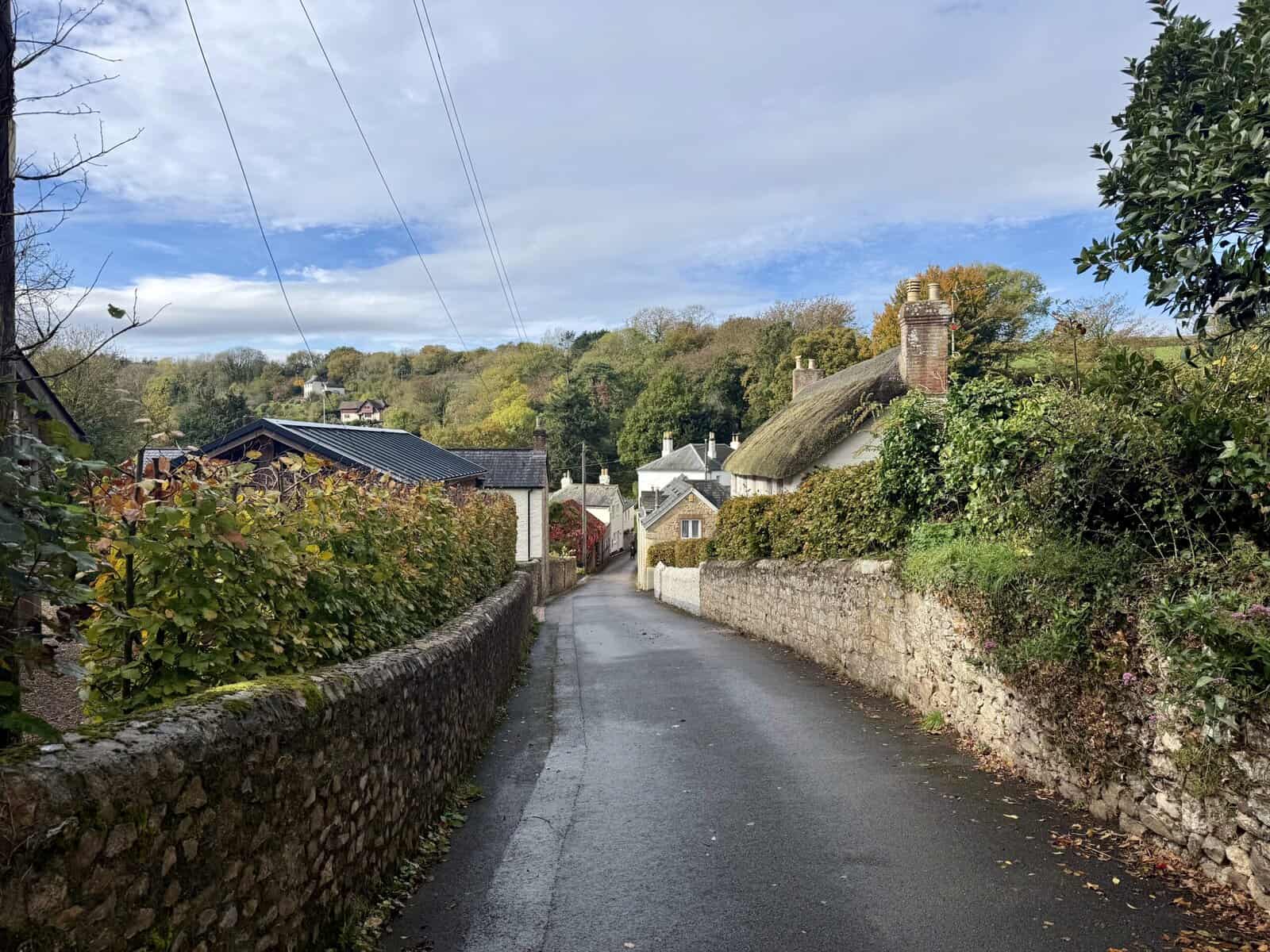
Meadfoot Beach to Peaked Tor Cove
Our walk around Torbay’s beaches began at Meadfoot Beach on a blisteringly hot day in early June, with temperatures climbing into the high twenties. It made for a long but memorable day exploring the English Riviera on foot. Although I travelled by car from our base on the Devon-Somerset border, the train is often our preferred option, with reasonably priced off-peak fares to Torquay via Axminster.
Parking was straightforward, with free spaces available on Ilsham Road near Ilsham Green, additional roadside parking near Meadfoot Beach if you arrive early enough, and a pay-and-display car park at Kilmorie Beach.
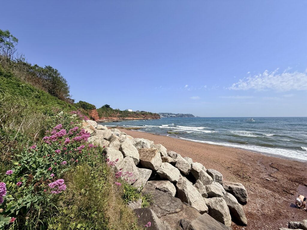
Meadfoot Beach itself is one of Torquay’s most attractive and varied beaches, combining sand, shingle and pebbles. The western end is backed by colourful beach huts and the popular café, while the quieter eastern section is rockier and known for fishing, diving and rock pooling. At high tide, much of the beach disappears beneath the sea, making low tide the best time to visit.
Leaving the beach, the South West Coast Path climbs steadily towards Daddyhole Plain, passing the Osborne Hotel and Headland Hotel, both enjoying superb views across Tor Bay. Looking back, Meadfoot Beach stretches below while the National Coastwatch Institution lookout stands prominently above the cliffs, complete with a welcome water bowl for passing dogs when volunteers are on duty.
The path then descends gently towards Peaked Tor Cove, passing the London Bridge viewing point (London Bridge is a sea stack with an archway), offering impressive views across the coastline. I did not make the steep descent to the cove itself, but the secluded beach is reached via a challenging path with around 150 steps and is known as a peaceful spot popular with walkers and dog owners year-round. There are no facilities at the cove itself, with the nearest parking around Beacon Quay and limited public transport serving nearby Torquay.
Meadfoot Beach Information
Access: The beach can be reached from Kilmorie Car Park via a walk of around 250 metres, or by steep steps from Meadfoot long stay car park. There are 18 steps from the promenade to the beach, while level access to the promenade is available from the road via a slope.
Facilities: Year round toilets, including accessible facilities, a café, beach showers, annual and visitor chalet hire, deckchair hire and a boat launching area for small craft are available.
Parking: The nearest parking is at Meadfoot Beach, Meadfoot Road and Kilmorie car parks, together with limited roadside parking nearby.
Dogs: Dogs are permitted all year on the rocky eastern half of the beach but are prohibited on the main sandy western section between 1 May and 30 September.
Peaked Tor Cove Information
Access: The cove is reached via a steep path with around 115 steps from the South West Coast Path. The route is approximately 150 metres from the coast path and is not suitable for wheelchairs.
Facilities: There are no toilets, cafés or other visitor facilities at Peaked Tor Cove.
Parking: There is no dedicated parking nearby. The cove is best accessed on foot from the South West Coast Path or via Daddyhole Road in Torquay.
Dogs: Dogs are permitted all year round.
Peaked Tor Cove to Beacon Cove
From Peaked Tor Cove, the South West Coast Path continues north past the rather grand-looking Imperial Hotel before descending towards Beacon Cove and Torquay Harbour. The walk is relatively short but packed with history, with superb views across the bay before the path reaches the small cove tucked beneath Beacon Hill.
Unlike Peaked Tor Cove, I made the short walk down to Beacon Cove itself. Access is through a seasonal gate from the Beacon Quay car park, followed by a winding path down to the shoreline. The final approach involves large stone revetments rather than a ramp, so care is needed.
Beacon Cove is far more than just another beach. Once known as the Ladies Bathing Cove, it was a favourite place of Agatha Christie, who almost drowned here as a child while trying to rescue her nephew. Information boards around the cove tell its fascinating story, from Victorian bathing machines and the former lifeboat station to the Marine Spa, Coral Island leisure attraction and, more recently, Living Coasts, all remembered fondly by generations of visitors.
The cove also lies within the English Riviera UNESCO Global Geopark, with interpretation boards explaining the ancient geology beneath your feet and the rich marine life in the seagrass meadows of Tor Bay, which are home to seahorses, cuttlefish, and many other species.
Just beyond the beach, Beacon Quay provides another unexpected piece of history. Memorials mark the D-Day embarkation ramps used by American forces in June 1944 as thousands of troops and vehicles departed Torquay for Normandy. It is an easy place to pause and reflect before continuing into the bustling harbour and seafront.
Beacon Cove Beach Information
Access: Reached via a seasonal gate from Beacon Quay Car Park followed by a winding path of around 100 metres. The final approach to the beach is via stone steps forming part of the sea defences rather than a ramp. The promenade above is suitable for wheelchair users but there is no step free access onto the beach.
Facilities: The nearest public toilets are at Beacon Quay. There are no facilities on the beach itself.
Parking: The closest parking is the Beacon Quay pay and display car park a short walk from the beach entrance.
Dogs: Dogs are permitted all year round.
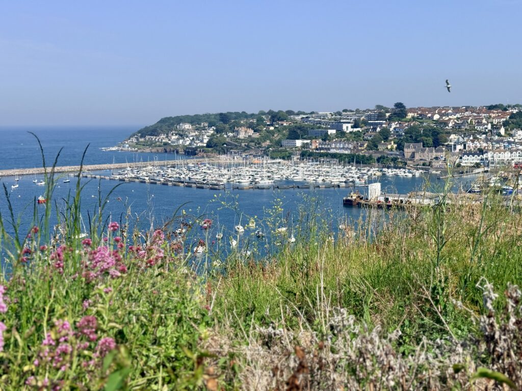
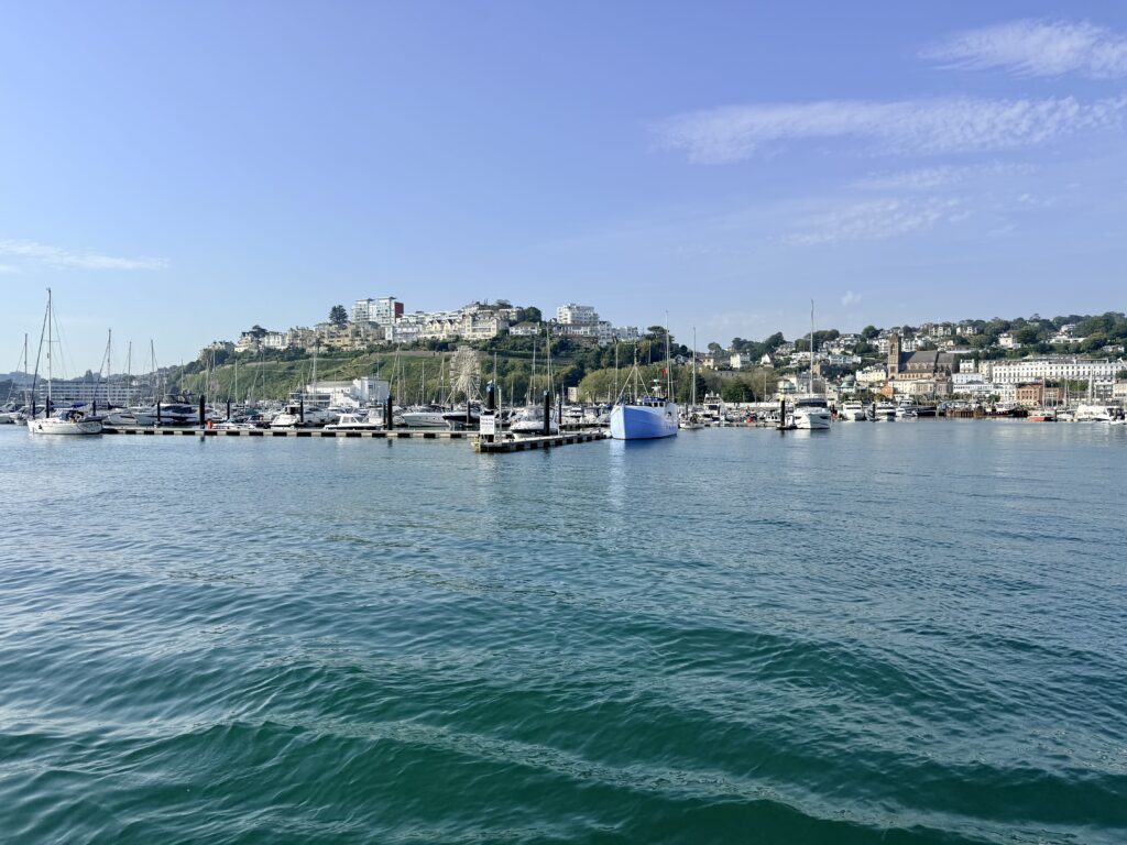
Beacon Cove to Torre Abbey Sands
Leaving Beacon Cove, the walk follows the waterfront through Torquay Harbour, one of the liveliest parts of Torbay. Ferries depart regularly for Paignton and Brixham, while sightseeing boats and wildlife cruises head out across Tor Bay and along the South Devon coast towards Dartmouth.
There is no shortage of things to do along the harbour front. Gift shops, independent businesses, cafés, restaurants and ice cream kiosks line the promenade, creating a lively holiday atmosphere on a warm summer’s day. Torquay’s town centre has sometimes been criticised for looking tired, but during our visit, it was bustling and bright with visitors enjoying the sunshine.
Along the way, look out for the elegant Torquay Marina lifting bridge, the historic Princess Gardens, the English Riviera Wheel and the Princess Theatre overlooking the bay. Nearby, the Grade II-listed Pavilion, opened in 1912 as a concert hall and entertainment venue, remains one of the town’s best-known landmarks; it is currently closed while plans for its future continue.
The Rock Walk is another highlight, particularly after dark when colourful lighting transforms the cliffside gardens and seafront into an attractive evening promenade.
Continuing east, the recognisable Black Ball pedestrian bridge spans the busy road and marks the start of Torre Abbey Sands. It also provides the easiest route to nearby Torre Abbey and its historic gardens, one of Torquay’s best-known landmarks.
Torre Abbey Sands Beach Information
Access: Straightforward via steps ramps and oversized revetments from Torbay Road with level access along the promenade making it suitable for wheelchair users.
Facilities: Year round toilets including accessible facilities cafés restaurants deckchair hire and a designated windsurfing area are available nearby.
Parking: Pay and display parking is available along Torbay Road and at the Abbey Park and Shedden Hill car parks.
Dogs: Dogs are banned from the main beach between 1 May and 30 September although a dedicated dog exercise area is provided on Torre Abbey Meadows.
Torre Abbey Sands to Corbyn Beach
From Torre Abbey Sands, the walk continues along Torquay seafront and promenade, with Torre Abbey Gardens to the right and the sea to the left. This is one of the easiest sections of the route, following the curve of the bay towards Corbyn Beach.
The path passes Torquay railway station, the most convenient station for Torquay town centre and seafront, before continuing past the Grand Hotel, another prominent seafront hotel with superb views across Tor Bay.
Corbyn Beach is smaller and often quieter than Torre Abbey Sands, which is generally regarded as Torquay’s main beach. Tucked beneath Corbyn Head, it still has useful facilities, including a café, and makes a calmer stopping point along the seafront walk.
Just beyond the beach, Corbyn Head provides excellent views across Tor Bay, with seats, public toilets and a poignant war memorial commemorating local Home Guard service members who died here during a Second World War training accident. Agatha Christie fans may also recognise the headland, said to be the inspiration for Baldy’s Head in Postern of Fate.
Corbyn Beach Information
Access: Good access from the road to the promenade with a slipway providing wheelchair access to the beach. There are also eight steps from the promenade onto the sand. Please note that access to the public toilets is via a fairly steep slope.
Facilities: Seasonal toilets including accessible facilities are available from April to October. The beach also has a café beach hut hire deckchair hire and beach showers.
Parking: There is no parking immediately beside the beach. The nearest car parks are Abbey Park and Torre Valley while Torquay railway station is just a short walk away.
Dogs: Dogs are prohibited from the beach between 1 May and 30 September.
Corbyn Head to Livermead Sands and Institute Beach
After a brief pause at Corbyn Head to enjoy the views across Tor Bay, I continued east along the South West Coast Path. This section is one of the easiest of the walk, following a wide level pavement alongside Torbay Road with uninterrupted sea views.
The next beach is Livermead Sands, a small sandy beach that has a habit of almost disappearing beneath the sea at high tide. At low water, however, it provides another pleasant place to stop, particularly for families and those looking for a quieter alternative to Torquay’s larger beaches.
Overlooking the beach is the Livermead Cliff Hotel, another of the grand seafront hotels that occupy commanding positions above Tor Bay and enjoy panoramic coastal views.
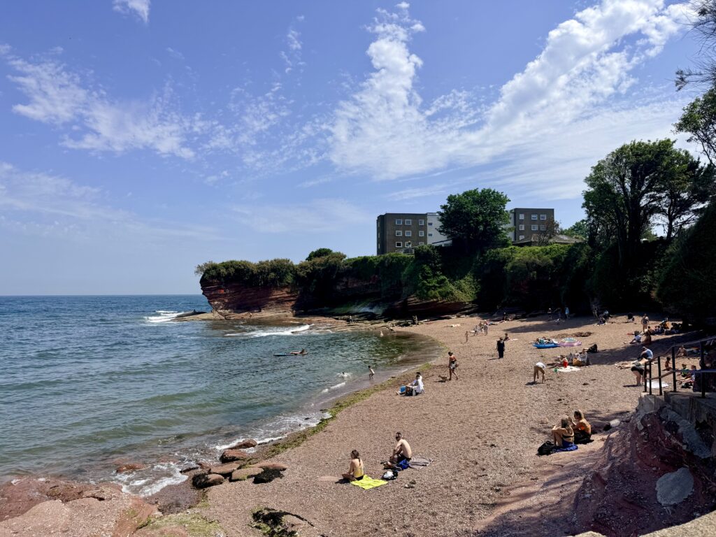
Just beyond lies Institute Beach, a small and often overlooked cove tucked beneath the red sandstone cliffs below the hotel. On this occasion, I admired it from above rather than making the descent. Still, its sheltered setting and secluded atmosphere make it feel a world away from the busy promenade only a few metres away.
Made up of red sand, shingle and rocky outcrops, Institute Beach is particularly attractive at low tide when rock pools are exposed along the shoreline. Dogs are welcome all year, making it a popular spot for local walkers, while its secluded location rewards those prepared to venture away from Torquay’s better-known beaches.
Livermead Sands Beach Information
Access: The beach is reached via 24 steps from Torbay Road and is not suitable for wheelchairs.
Facilities: There are no toilets or cafés on the beach itself. The nearest public toilets are at Corbyn Head. A designated water skiing area operates offshore.
Parking: There is no parking immediately beside the beach. The nearest parking is some distance away although Torquay railway station is within walking distance.
Dogs: Dogs are permitted all year round.
Livermead Sands to Hollicombe Beach
Beyond Livermead Sands and the Livermead Cliff Hotel, the South West Coast Path leaves the seafront and heads inland around the headland, climbing steadily alongside Torbay Road and the railway line that links Torquay with Paignton. This is probably the least inspiring section of the walk, with the road and railway replacing the coastal scenery for a short distance.
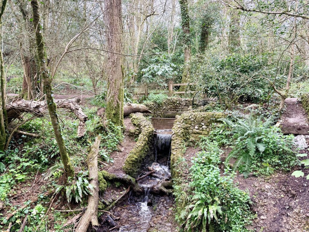
After crossing the railway by footbridge, the path descends once more towards the coast, where a pleasant surprise awaits. To the left lies Hollicombe Park, a peaceful green space of mature trees and open lawns that feels far removed from the busy main road.
Passing through a tunnel beneath the railway line brings you to Hollicombe Beach, one of Torbay’s hidden beaches. Sheltered beneath towering red sandstone cliffs, the beach is known for its distinctive red sand and quiet atmosphere, making it feel much more secluded than many of the bay’s larger beaches.
At low tide, extensive rock pools are revealed at either end of the beach, making it an excellent place for rock pooling and crabbing, while the calm waters and sheltered position make it popular with swimmers and families. Backing directly onto the beach, Hollicombe Park provides an ideal spot for a picnic before continuing what is now quite a short walk towards Preston Sands and Paignton.
Hollicombe Beach Information
Access: From Torbay Road and the South West Coast Path walk through Hollicombe Park and under the railway bridge before following a steep path down to the beach. The route from the nearest parking is approximately 170 metres. Wheelchair access is possible via a slipway although the return climb to the road is steep.
Facilities: There are no toilets or other visitor facilities at Hollicombe Beach.
Parking: Limited roadside parking is available nearby or the beach can be reached on foot from the South West Coast Path.
Dogs: Dogs are prohibited from the beach between 1 May and 30 September.
Hollicombe Beach to Preston Sands
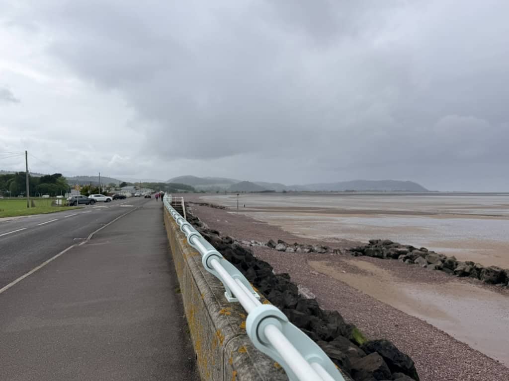
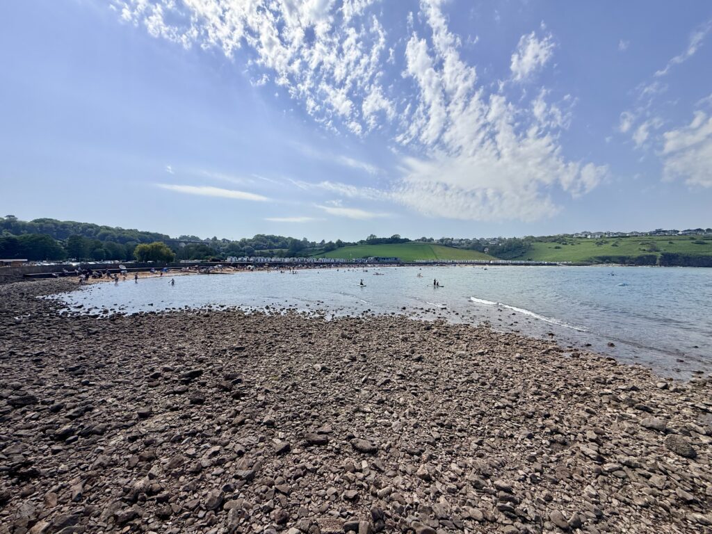
Returning to Hollicombe Park, the South West Coast Path continues south west across a larger open area on top of the headland before descending once again to the coast. Within a few minutes, the route reaches Preston Sands, one of Paignton’s two main beaches and a popular destination for families visiting the English Riviera.
Although often slightly quieter than neighbouring Paignton Beach, Preston Sands can still become extremely busy during the summer holidays. Backing the beach is Preston Green, a large open space that provides plenty of room for picnics, games and relaxation away from the sand. During our visit, much of the green was inaccessible due to coastal defence works, a reminder of the growing need to protect Torbay’s coastline from erosion and rising sea levels.
Preston Sands is a wide, gently sloping beach of distinctive red sand with attractive views across Tor Bay towards Torquay and Brixham. A colourful line of beach huts, cafés and seafront facilities creates a traditional seaside atmosphere, while the calm waters make it a popular spot for swimming and paddleboarding.
At low tide, the beach extends significantly and joins with neighbouring Paignton Sands, creating a vast stretch of sand ideal for walking. Rock pools are also exposed beneath the cliffs at the northern end of the beach, making it a good place for exploring marine life before continuing the walk towards Paignton Harbour.
Preston Sands Beach Information
Access: The beach is flat and easily accessible from the promenade making it suitable for wheelchair users and visitors with limited mobility. Accessible parking spaces are available nearby.
Facilities: Year round toilets including accessible facilities are available at Preston North while additional seasonal toilets are available at Preston Redcliffe from April to October. The beach also has cafés and restaurants deckchair hire and beach hut sites.
Parking: The closest parking is at Colin Road Car Park just a short walk from the beach.
Dogs: Dogs are prohibited from the beach between 1 May and 30 September although a designated dog exercise area is available on Preston Green behind the beach.
Preston Sands to Paignton Beach
At low tide, it is possible to walk directly from Preston Sands to Paignton Beach across the sand, although care should be taken to avoid being cut off by the incoming tide. If there is any doubt, the safer option is to follow Marine Drive just inland, where the walk is level and only takes a few minutes. Along the way, I spotted what must surely be one of the closest Travelodge hotels to a beach anywhere in the country.
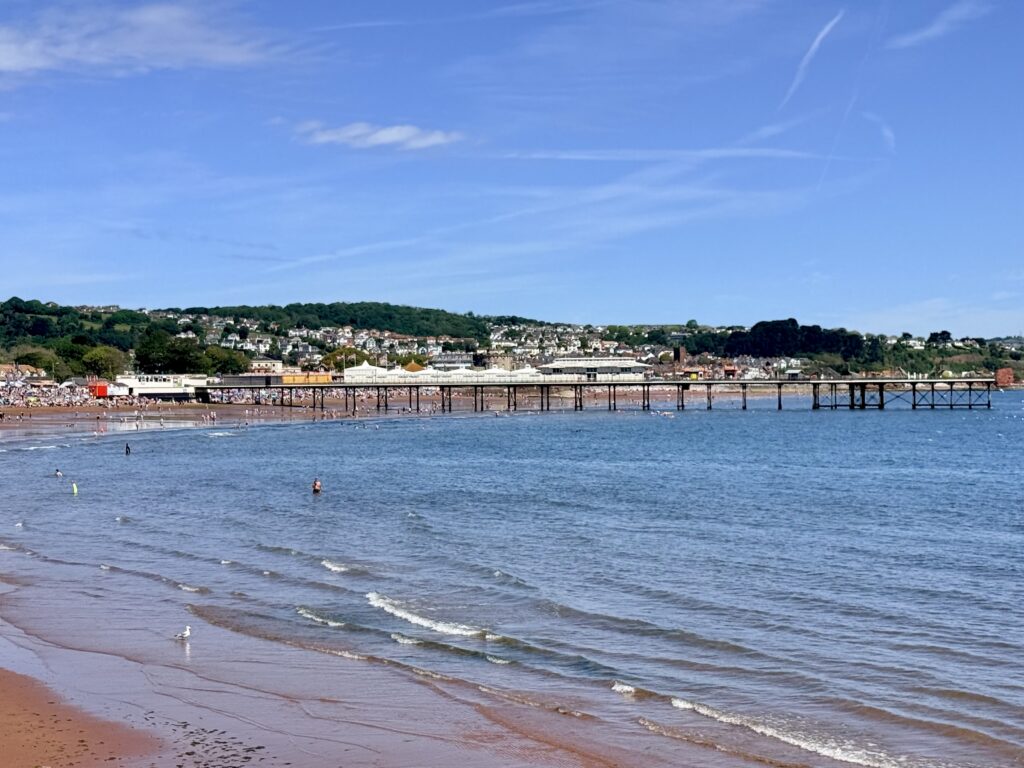
The route soon reaches Paignton Green, a large open space overlooking the broad sands of Paignton Beach, with Paignton Pier stretching out into Tor Bay ahead. For me, arriving here felt like coming home, having been born in Paignton many years ago. The familiar sights of the promenade, beach and pier brought back countless childhood memories.
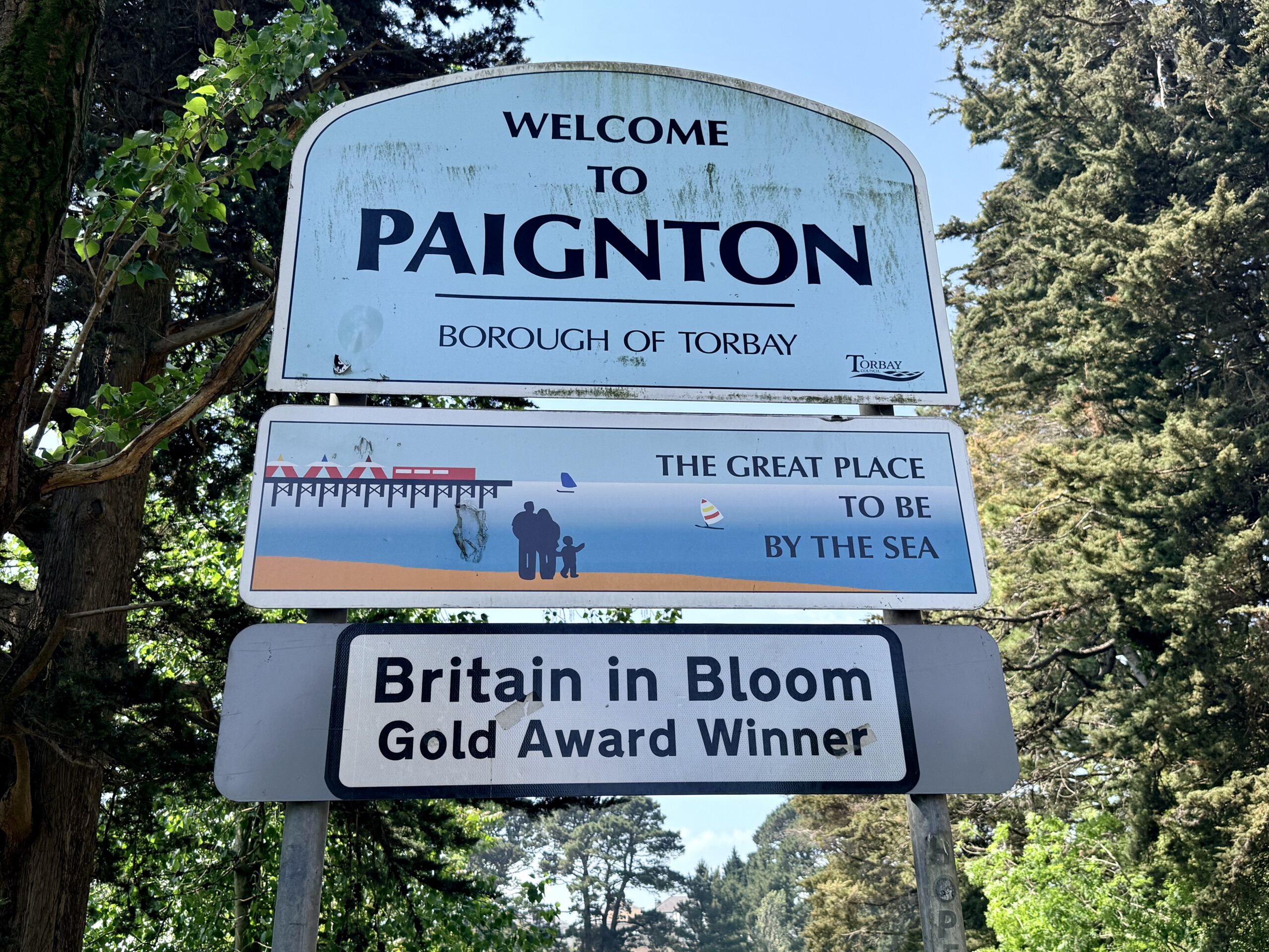
Paignton
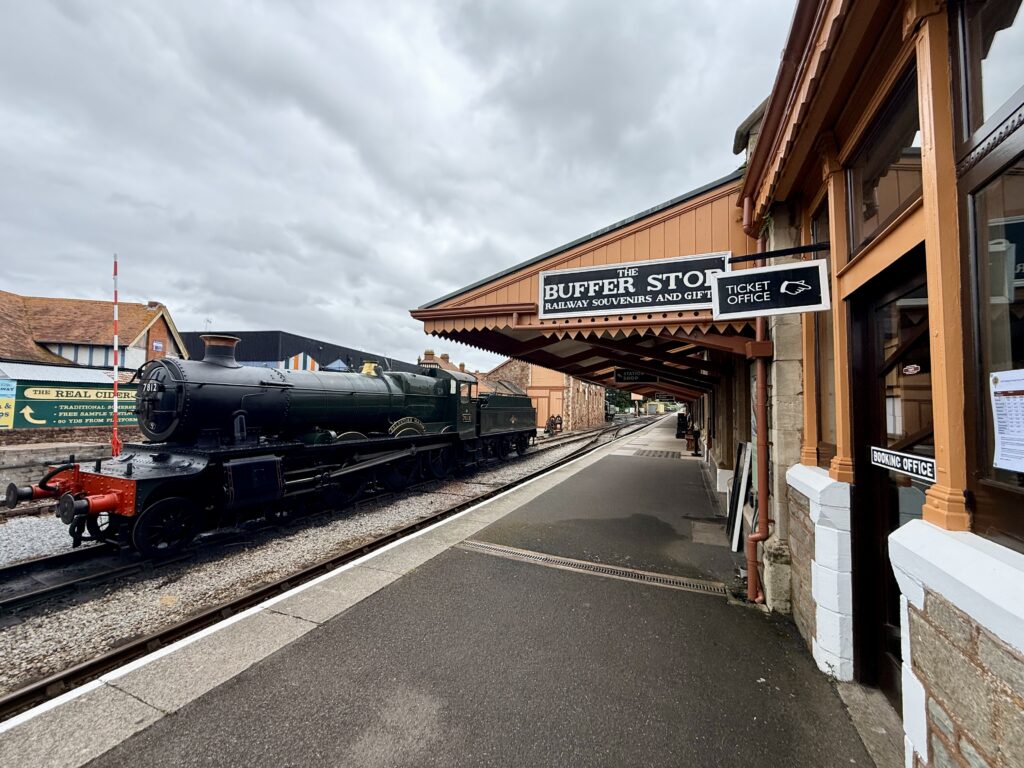
Paignton remains a traditional seaside resort with plenty to see and do. Although slightly smaller than neighbouring Torquay, it has retained its own distinct character, centred around the beach, harbour and pier. The town is also home to the mainline railway station and the Dartmouth Steam Railway, whose heritage trains I would soon be walking alongside as the route continues towards Goodrington.
Like many British seaside towns, Paignton has changed over the years, and some parts would undoubtedly benefit from investment and restoration. Even so, on a busy summer’s day, it remains full of life, with cafés, bars, amusement arcades and independent shops lining Torbay Road and the seafront.
One of the great advantages of exploring Torbay on foot is the excellent public transport. Frequent buses run throughout the day between Torquay, Paignton and Brixham, making it easy to walk only part of the route if preferred. It is also possible to return to Torquay by train or by ferry across the bay for a more memorable journey home.
For me, the highlights of Paignton include the free-to-enter Paignton Pier, the bustling harbour and nearby Victoria Park. A short bus ride or drive inland brings you to Paignton Zoo, one of Devon’s leading visitor attractions. At roughly the halfway point of today’s walk, Paignton makes an ideal place to stop for lunch, an ice cream or simply a well-earned rest before continuing along the coast towards Goodrington Sands.
Paignton Beach Information
Access: Access is excellent with level promenades stretching along the seafront and harbour. Two ramps located north and south of Paignton Pier provide easier access from the promenade onto the beach for wheelchair users and visitors with limited mobility.
Facilities: Year round toilets including accessible facilities are available at Central and Festival Apollo with additional public toilets at Paignton Harbour. The beach is well served by cafés and restaurants deckchair and pedalo hire a designated windsurfing area Paignton Pier a promenade crazy golf a children’s play park and seasonal donkey rides on Paignton Green.
Parking: Parking is available a short walk from the beach with Victoria Car Park the nearest public car park.
Dogs: Dogs are prohibited from the beach between 1 May and 30 September although a designated dog exercise area is available on Paignton Green behind the beach.
Fairy Cove – Paignton’s Hidden Beach
Before leaving Paignton behind, it is worth making the short walk to Fairy Cove, one of Torbay’s best secret beaches and a place that many visitors never discover.
Tucked beneath the red sandstone cliffs between Paignton Harbour and Goodrington Sands, the tiny cove feels surprisingly secluded despite being only a few minutes from the busy seafront. The easiest route is to follow the harbour wall around the far side of Paignton Harbour, where the beach suddenly appears below the headland. It can also be reached via steep steps from Cliff Road through the small memorial garden above.
The beach is a mixture of red sand, shingle, and rocks, with extensive rock pools exposed at low tide, ideal for exploring with children. Sea glass can often be found among the pebbles, while the sheltered position and views across Tor Bay towards Torquay make it a peaceful place to pause before continuing the walk.
Dogs are welcome year-round, making Fairy Cove popular with local dog walkers outside the busier nearby beaches. There are no facilities on the beach itself, but the cafés, pubs and restaurants around Paignton Harbour are only a short walk away.
Fairy Cove Beach Information
Access: Fairy Cove can be reached from Roundham Car Park by walking through the small public garden and descending around 50 steps to the beach. Alternatively from Paignton Harbour walk towards the sea bear right and descend approximately 19 steps to the cove. The beach is not suitable for wheelchairs.
Facilities: There are no facilities on the beach itself. The nearest public toilets are at Paignton Harbour with cafés pubs and restaurants just a short walk away.
Parking: The nearest parking is at Roundham Pay and Display Car Park.
Dogs: Dogs are permitted all year round.
Paignton Harbour to Goodrington Sands
Shortly after leaving Paignton Harbour, the South West Coast Path turns left onto Roundham Head, following Cliff Road before entering the attractive Roundham Gardens. This is the official route and offers superb views across Tor Bay from the clifftops.
On this occasion, however, the combination of the heat and the growing realisation of just how far I had already walked meant I missed the turning and carried straight on towards Goodrington. It proved no great hardship, as I still passed Roundham Gardens before making the short descent onto the beach.
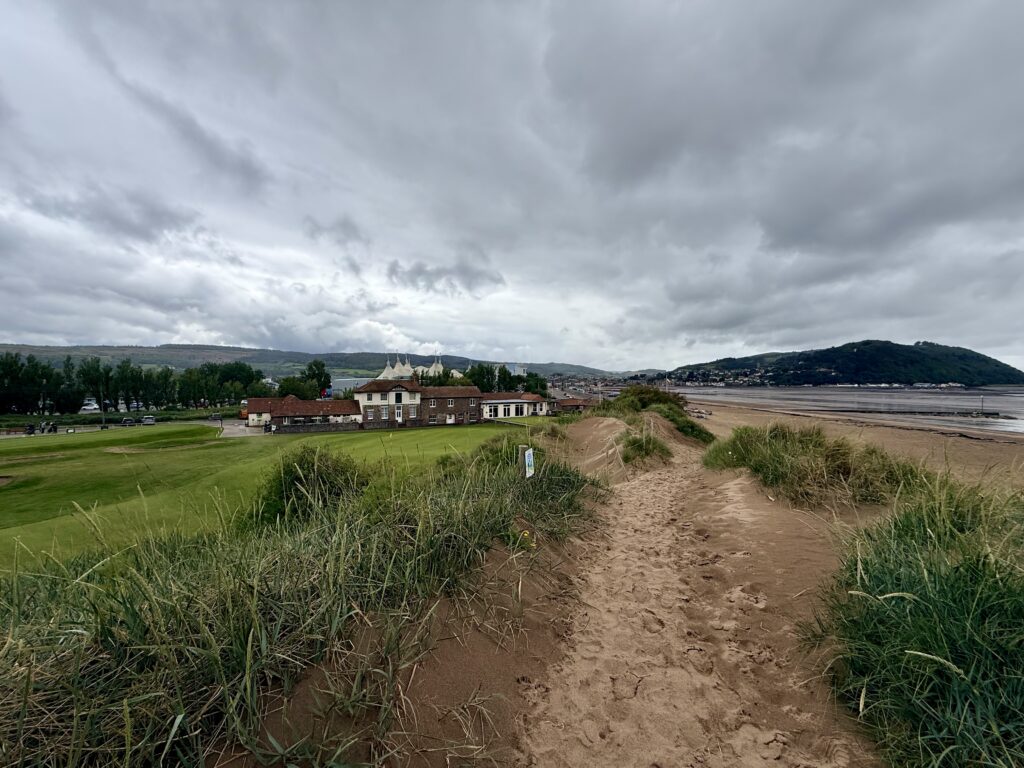
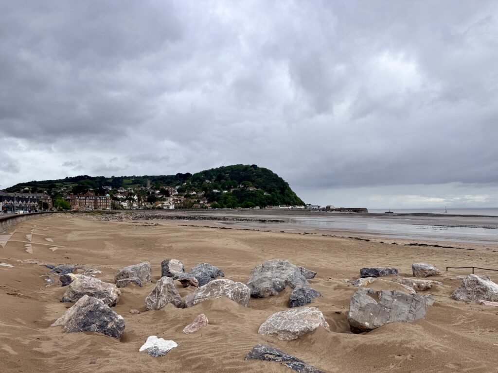
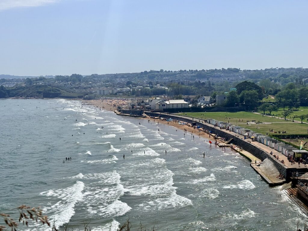
Few beaches in Torbay are as popular as Goodrington Sands. On a sunny day, it is packed with families enjoying the wide expanse of red sand and the safe, gently shelving waters that make it ideal for swimming and paddling. The beach is divided into North Sands and South Sands, with excellent facilities spread across the seafront.
Among the biggest attractions is Splashdown Quaywest, the UK’s largest outdoor waterpark, while nearby Young’s Park offers boating lakes, crazy golf and family activities. A Premier Inn overlooks part of the beach, and cafés, kiosks and ice cream outlets ensure nobody goes hungry.
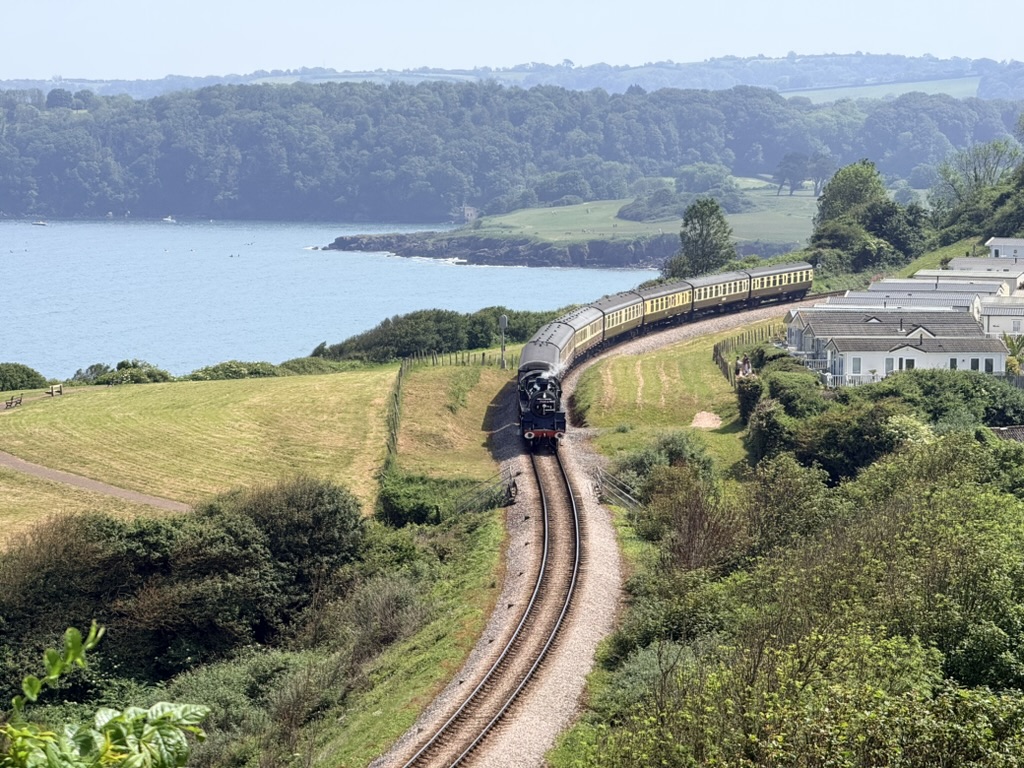
For us, however, the real highlight was the Dartmouth Steam Railway, whose heritage trains run immediately behind the beach throughout the season. Watching a steam locomotive emerge alongside the sand before heading towards Kingswear is one of the iconic sights in Torbay and a favourite location for photographers.
One small feature also stood out: the public drinking water refill tap. After many miles in the summer heat, it was a welcome sight and something we wish more beaches, towns and villages would provide, as is common across much of continental Europe.
Goodrington Sands Beach Information
Access: Access to both North Sands and South Sands is straightforward from Young’s Park and Quaywest Car Parks with level paths leading to the promenade and ramps or a small number of steps down to the beach. South Sands can also be reached from Cliff Park Road Car Park via the railway bridge and promenade. The beach is generally suitable for wheelchair users with accessible ramps and beach matting provided during the main season weather permitting.
Facilities: Year round public toilets including accessible facilities are available at the central beach with additional seasonal toilets at North Sands and South Sands. The beach also offers cafés and restaurants annual and visitor beach hut hire deckchair hire beach showers pedalo and windsurf hire together with excellent family attractions nearby.
Parking: The nearest parking is at Quaywest Car Park and Young’s Park Car Park both within a short walk of the beach. Cliff Park Road Car Park provides an alternative for South Sands.
Dogs: Dogs are prohibited from South Sands between 1 May and 30 September while North Sands welcomes dogs all year round. Dogs on the promenade must be kept on a lead at all times.
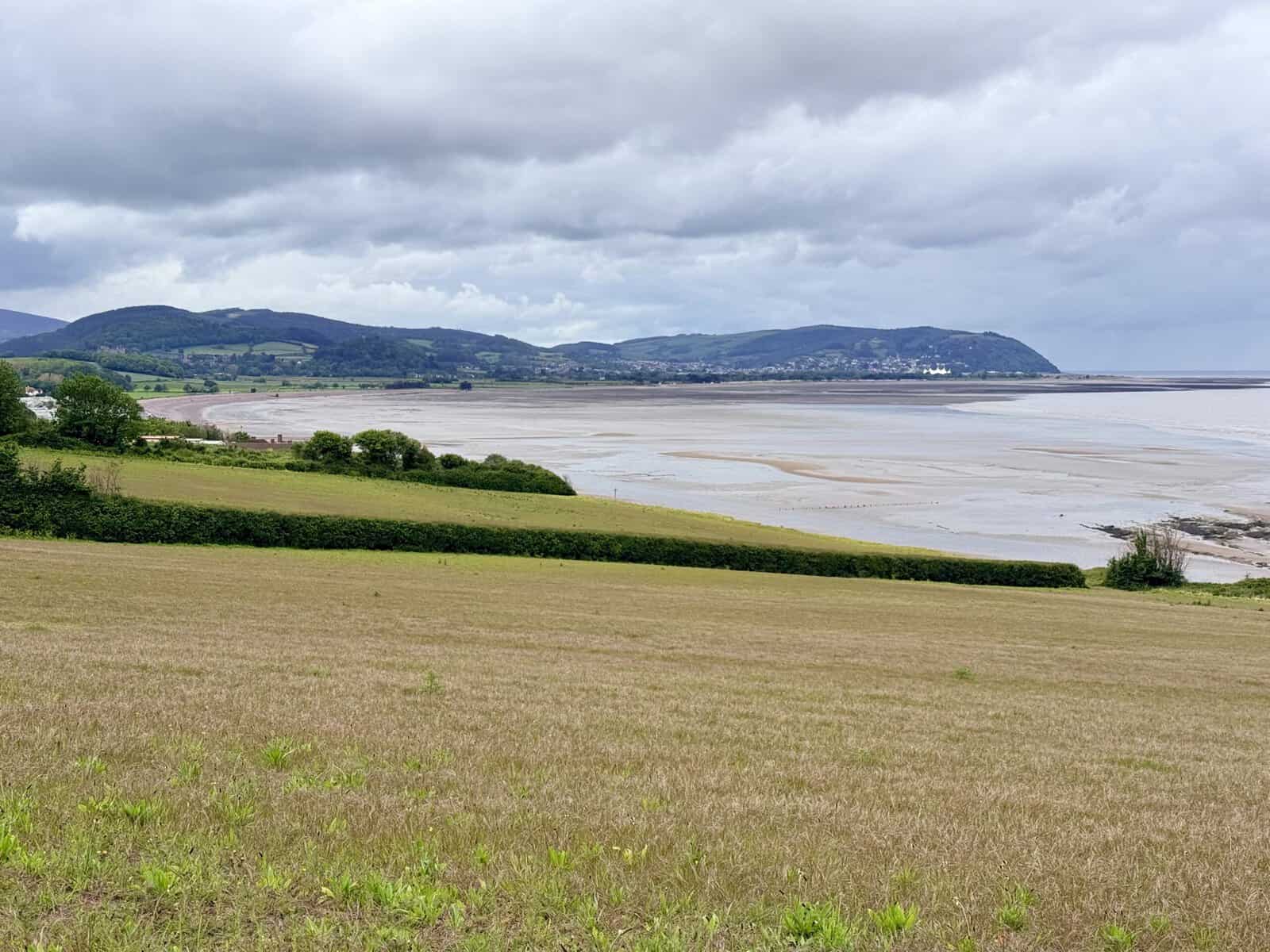
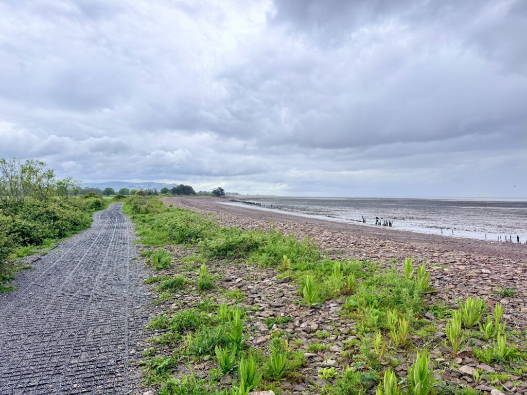
Goodrington Sands to Broadsands Beach
Leaving Goodrington Sands behind also marks the end of the largely flat section of the walk that has followed the Torbay coastline from Torquay Harbour. The South West Coast Path soon crosses the Dartmouth Steam Railway via a footbridge, a favourite spot for photographers hoping to capture one of the heritage trains as it climbs away from Goodrington Station.
Beyond the bridge, the path begins a steady climb inland while still offering glimpses of both the sea and the railway below. After around half a mile, signposts point towards Oyster Cove and Saltern Cove, two secluded beaches tucked away beneath the red sandstone cliffs. By this stage, with time running short and the last ferry from Brixham to Torquay firmly in mind, I reluctantly stayed on the main coast path rather than making the detour.
Oyster Cove is a quiet sandy and shingle beach known for its rock pools and peaceful atmosphere, while neighbouring Saltern Cove, a Site of Special Scientific Interest and Local Nature Reserve, is renowned for its ancient geology, marine life and crystal clear waters. At low tide, it is a superb place for rock pooling, crabbing and snorkelling, while nearby Armchair Cove offers another, off-the-beaten-path corner of the coastline for those prepared to explore.
Continuing along the South West Coast Path, the climb becomes noticeably steeper before the route suddenly drops towards Broadsands Beach, passing beneath the impressive limestone viaduct carrying the Dartmouth Steam Railway high overhead. It is one of the most dramatic moments of the entire walk and also marks the point where the railway leaves the coastline behind.
From here, the line climbs inland to Churston Ferrers before descending through mature woodland and eventually emerging alongside the River Dart for its spectacular final approach into Kingswear, opposite Dartmouth. It is one of England’s finest heritage railways and, although not inexpensive, forms part of what is surely one of Devon’s best days out when combined with the Round Robin excursion of steam train, ferry, river cruise and bus linking Paignton, Kingswear, Dartmouth and Totnes.
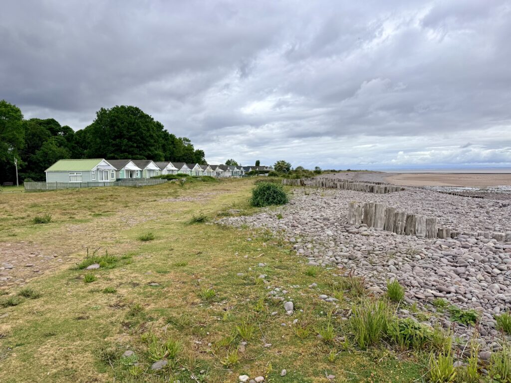
Back at Broadsands Beach, the atmosphere is once again very different. A broad sweep of gently shelving red sand backed by grassy parkland makes it one of Torbay’s most popular family beaches. The calm waters are ideal for swimming, paddleboarding and kayaking, while beach huts, cafés, toilets and deckchair hire provide everything needed for a day by the sea.
For railway enthusiasts and photographers, Broadsands offers some of the best viewpoints anywhere on the English Riviera, with steam trains crossing Brunel’s impressive limestone viaducts just behind the beach.
Broadsands Beach Information
Access: The beach is located directly in front of Broadsands Car Park and can be reached via either a slipway or steps. The promenade is level and easily accessible although access onto the sand itself is mainly via steps with handrails.
Facilities: Year round toilets including accessible facilities are available. The beach also offers cafés and restaurants annual and visitor beach hut hire deckchair hire boat hire beach showers and a designated windsurfing area.
Parking: Broadsands Car Park is immediately adjacent to the beach providing easy access with only a short walk required.
Dogs: Dogs are prohibited from the beach between 1 May and 30 September. A designated dog exercise area is available on the grass behind the beach where dogs must be kept on leads.
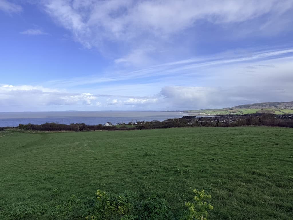
Broadsands Beach to Elberry Cove
The short walk from Broadsands Beach to Elberry Cove is one of my favourite sections of the entire Torbay route. It takes little more than fifteen minutes but quickly leaves behind the crowds and bustle of Broadsands.
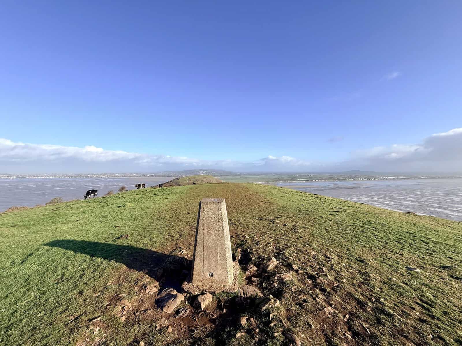
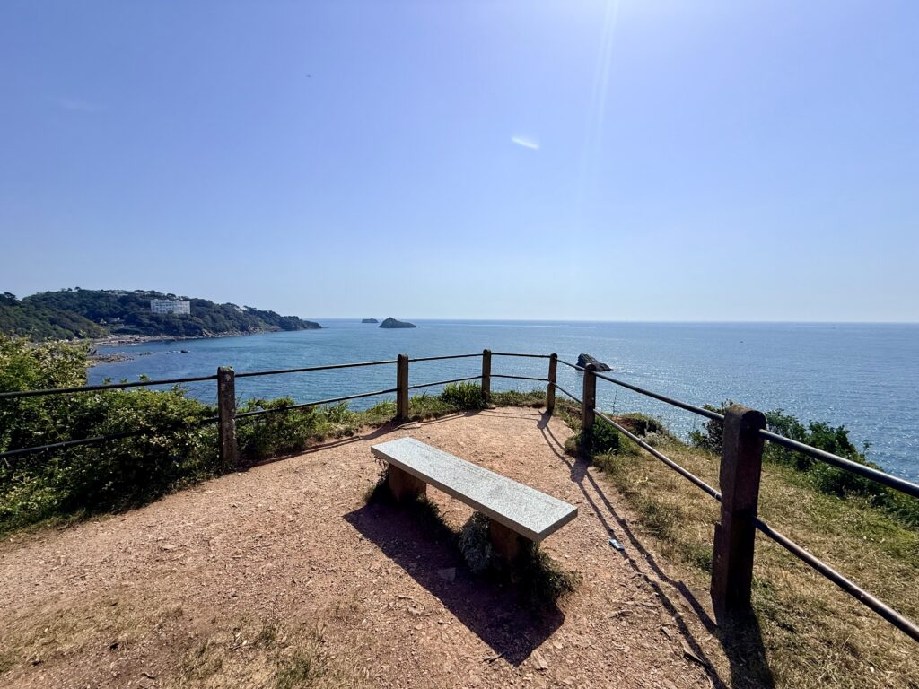
The South West Coast Path climbs gently around Churston Point, passing through open grassland with plenty of benches to stop and enjoy the views. Looking back across Tor Bay, you can see Paignton, Torquay and, in the distance, Meadfoot Beach and Thatcher Rock, where today’s walk began. The grassy headland also makes an ideal picnic spot and, if you’re anything like me, is far preferable to trying to keep sand out of your sandwiches.
With the sea breeze, open views and relatively few people, it feels a peaceful corner of the coast path that many visitors never discover.
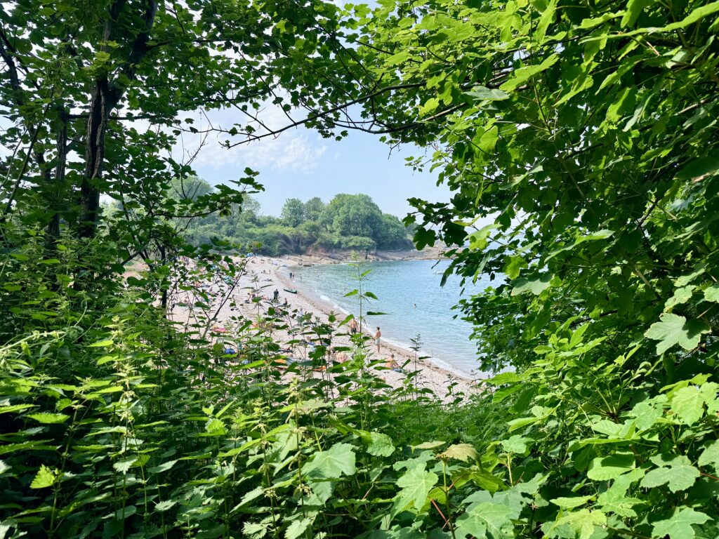
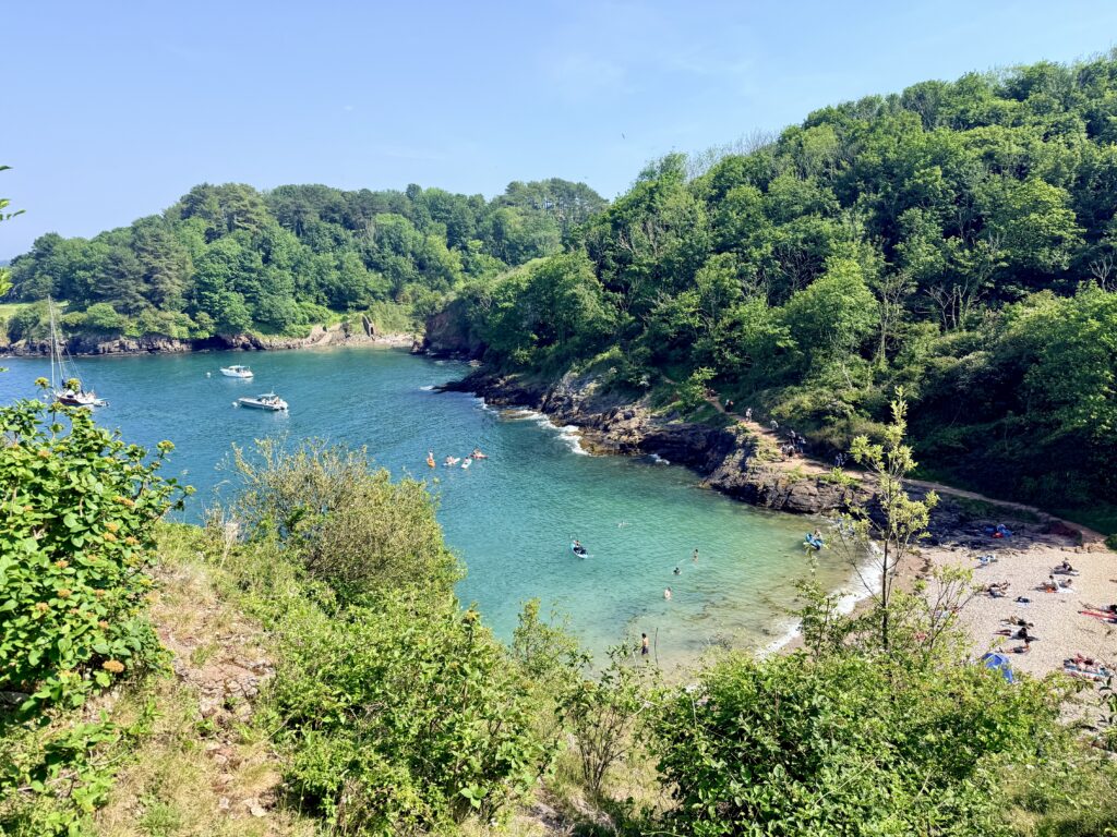
The path then descends to Elberry Cove, which is perhaps my favourite beach in Torbay. Best reached on foot from Broadsands or Brixham, it remains popular with walkers, and dogs are welcome year-round.
The beach itself is a mixture of shingle and crystal-clear blue-green water, backed by woodland that almost reaches the shoreline. The sheltered waters support eelgrass beds, an important habitat for native seahorses, while rock pools and marine life make it a fascinating place to swim, snorkel and explore.
At the eastern end of the cove stand the remains of Lord Churston’s Bath House, built in the eighteenth century for private sea bathing. The cove also has links to Agatha Christie, who is said to have enjoyed swimming here and is believed to have drawn inspiration for The ABC Murders from it.
For us, Elberry Cove was a place to stop for a while, enjoy the scenery and appreciate just how different this quieter stretch of coastline feels compared with the busy beaches further around the bay.
Elberry Cove Beach Information
Access: From Broadsands Car Park bear right past the beach chalets and continue across the large grassy area keeping the sea on your left. Pass through the metal kissing gate and follow the South West Coast Path before descending approximately 30 steps to the cove. The walk from the car park is around 400 metres.
Facilities: There are no toilets or other visitor facilities at Elberry Cove. A designated water skiing lane operates offshore.
Parking: The nearest parking is at Broadsands Car Park followed by a pleasant walk along the South West Coast Path.
Dogs: Dogs are permitted all year round.
Elberry Cove to Churston Cove
Leaving Elberry Cove behind, the South West Coast Path becomes more demanding once again. The route climbs quite steeply through woodland as it begins one of the final stretches of today’s walk towards Churston Cove.
Although the distance is a little more than a mile, it somehow feels much longer. The path winds through mature woodland with Churston Golf Club never far away on the right, while the cliffs to the left rise to around 150 feet above the sea below. There are occasional side paths leading towards viewpoints, but I would always recommend keeping well away from cliff edges, which can be unstable. Children should be kept close, and dogs should be kept on a lead through this section.
For most of the way, the route is easy to follow, although at the far end of the golf course, there is a junction where the path appears to continue straight ahead or left. The left fork is the correct route, leading through more woodland before the trees suddenly open to reveal a steep flight of steps descending into Churston Cove.
The effort is well rewarded. Churston Cove is another of Torbay’s hidden beaches, surrounded by woodland and high cliffs, giving it a wonderfully secluded feel. The beach is a mixture of sand and shingle, while the clear waters make it popular with swimmers, paddleboarders and snorkellers. Seals are occasionally spotted offshore, adding to the sense of this being one of Torbay’s quieter and more natural corners.
There are no cafés or facilities here, only the sound of the sea and the surrounding woodland. We love it. After the busier beaches of Torquay and Paignton, Churston Cove feels wonderfully remote and is one of those places that really does reward the effort needed to reach it.
Churston Cove Beach Information
Access: From Fishcombe Road Car Park walk downhill past Brixham Battery and Brixham Holiday Park before following the path uphill into the woods to join the South West Coast Path. Continue with the sea on your right before descending to the cove via a very uneven track and approximately 67 steps. The route is steep and unsuitable for wheelchairs or visitors with limited mobility.
Facilities: There are no toilets cafés or other visitor facilities at Churston Cove.
Parking: The nearest parking is at Fishcombe Road Car Park followed by a walk along the South West Coast Path.
Dogs: Dogs are permitted all year round.
Churston Cove to Brixham Harbour
Mindful of the time and increasingly in need of suitable refreshment and hoping to catch the 5 pm ferry back to Torquay rather than a much longer bus ride around the bay, I reluctantly left Churston Cove behind. I began the final climb through the woods.
The path rises steadily before emerging into open countryside, with Brixham Holiday Park on the right and The Cove luxury apartments on the left. Almost immediately, I found myself distracted by the Brixham Battery Museum. Unfortunately, it had already closed for the day, which was a shame, as it is one of the best-preserved World War II coastal defence sites in Britain. The restored gun emplacements, tunnels and exhibits make it well worth visiting, and with free admission, it has now earned a place on my list for a future trip.
That distraction, however, came at a cost.
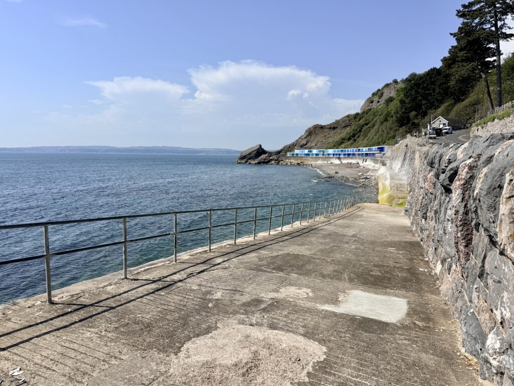
Once again, I managed to miss a turning and, instead of descending through Battery Gardens to Fishcombe Cove, continued uphill. Fishcombe is another of Torbay’s hidden coves, a sheltered shingle beach backed by woodland and red sandstone cliffs, popular with swimmers, paddleboarders and snorkellers. A seasonal café and peaceful setting make it sound like an ideal place to spend an afternoon, and I slightly regretted missing what would almost certainly have been one of the highlights of the day.
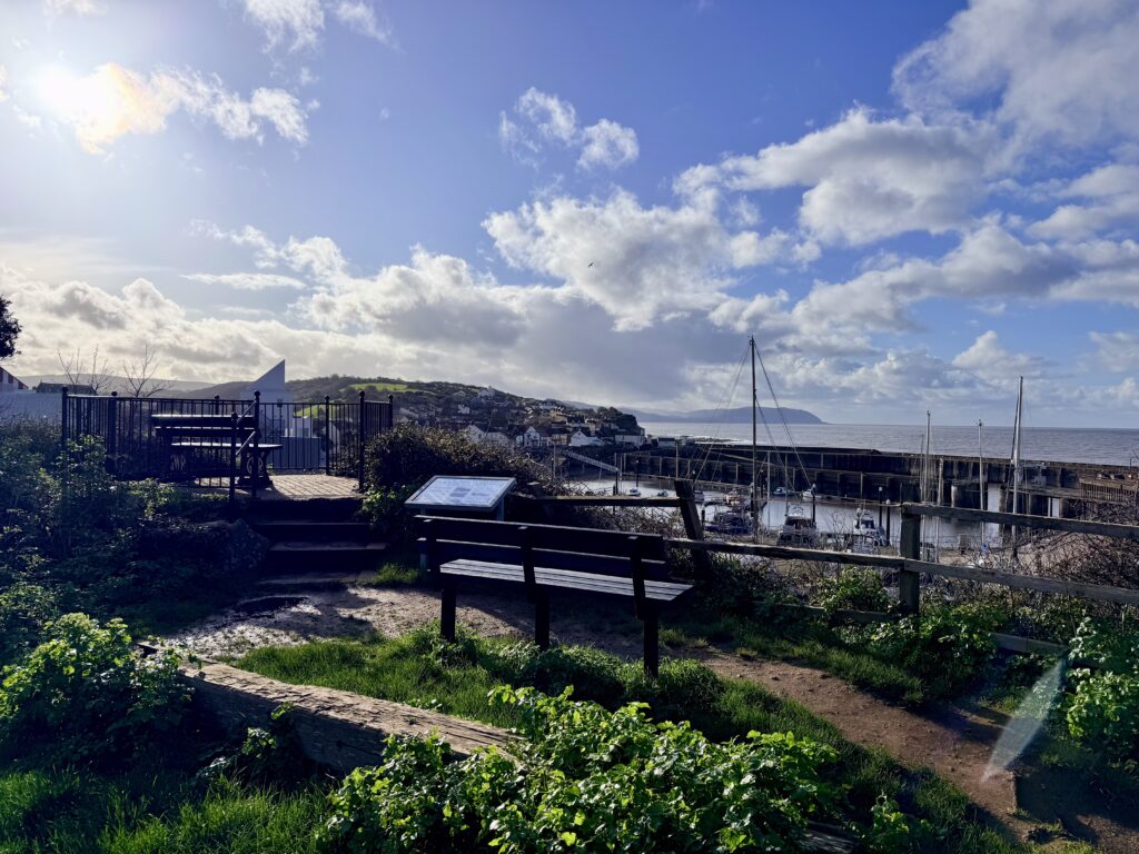
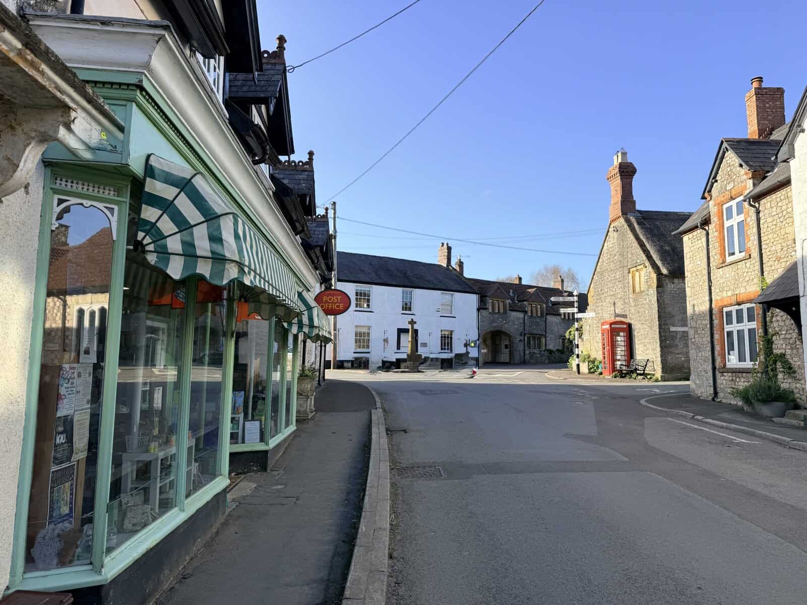
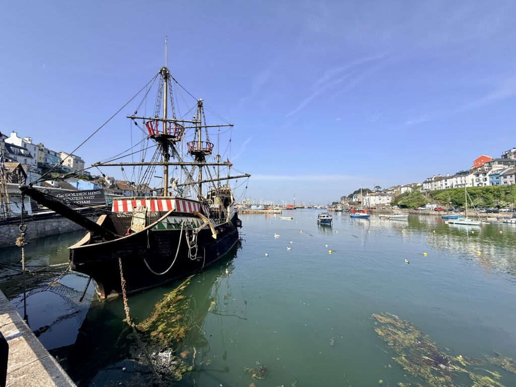
Instead, I carried on along North Furzeham Road, passing Fishcombe Road Car Park before eventually discovering the wonderfully named Overgang, a narrow historic lane squeezed between rows of cottages and clearly designed long before anyone imagined motor cars. It drops steeply into Brixham Harbour and provides a characterful entrance into one of Devon’s most attractive fishing towns.
I have always liked Brixham. It somehow manages to combine a busy working fishing port with a traditional seaside destination and an independent shopping town. Colourful cottages climb the hillsides above the harbour, fishing boats unload their catches, and cafés spill onto the quayside. Although I know the town reasonably well, there simply was not enough time to explore properly, giving me the perfect excuse to return soon to write a dedicated guide to Brixham.
The town may not be famous for its beaches, but Breakwater Beach deserves special mention. Just a short walk from the harbour, its remarkably clear water has made it one of the country’s best locations for scuba diving and snorkelling, while its sheltered position, beach café and easy access make it popular with families throughout the summer.
Before long, it was time for one final treat. After admiring the replica of Sir Francis Drake’s Golden Hind and resisting the temptation of fresh seafood being served around the harbour, I bought a cold drink and a ticket for the Brixham to Torquay ferry back to where I started.
I arrived just in time.
Fishcombe Cove Beach Information
Access: From Fishcombe Road Car Park walk down the hill and turn right just past Brixham Battery before following the very steep path down to the cove. There are approximately 12 steps onto the beach. Alternatively the cove can be reached from Brixham via Oxen Cove and Freshwater Car Park using the South West Coast Path and steps. The walk is around 170 metres from Fishcombe Road Car Park and 250 metres from Freshwater Car Park. The route is steep and not suitable for wheelchairs.
Facilities: Seasonal public toilets are available from April to October together with a beach café.
Parking: The nearest parking is at Fishcombe Road Car Park followed by a short walk to the beach.
Dogs: Dogs are permitted all year round.
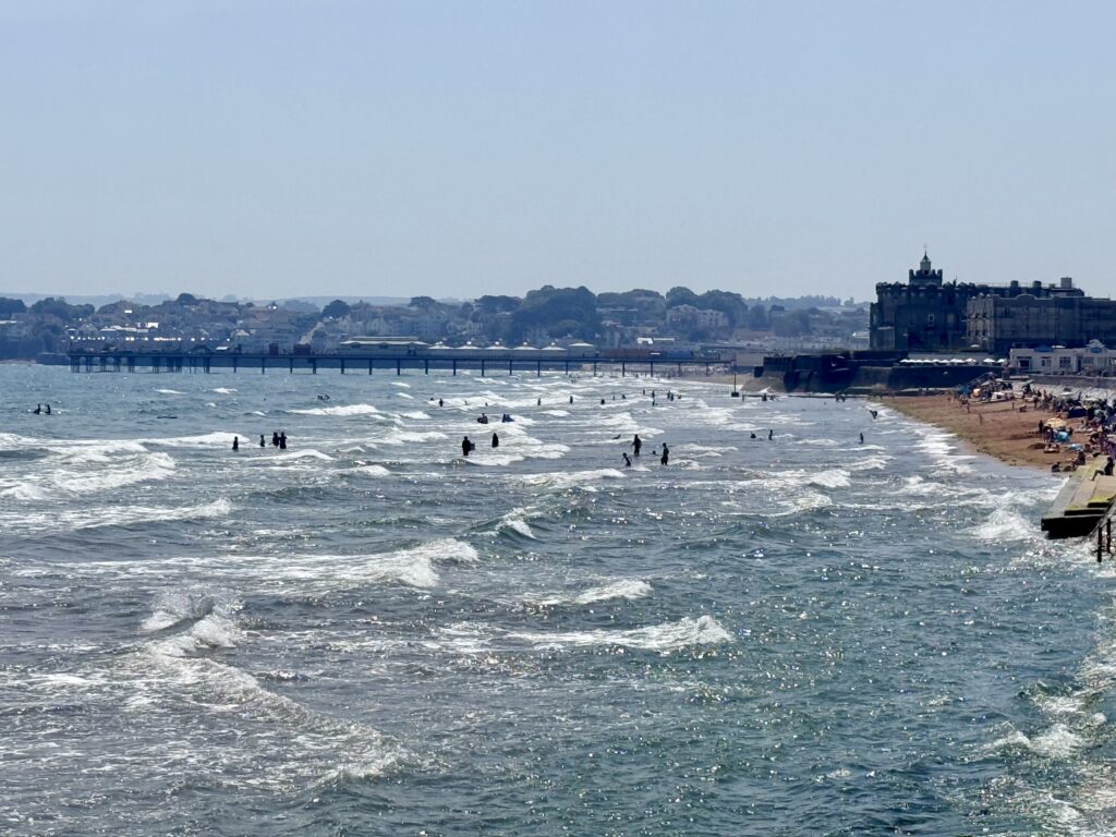
Brixham to Torquay Ferry
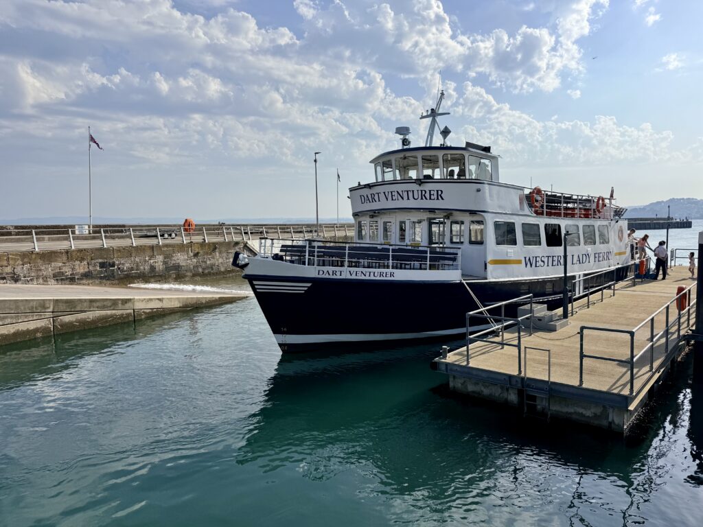
By now, the wind had strengthened considerably, and conditions out on Tor Bay were becoming lively. Fortunately, I have always enjoyed ferries and rough crossings, although walking around the boat proved almost impossible as it pitched its way across the bay. The planned refreshments remained firmly behind the counter, but nobody seemed to mind. The views back towards Brixham and Berry Head were magnificent, and, remarkably, I was treated to sightings of both seals and dolphins during the half-hour crossing.
The ferry delivered me back to Torquay Harbour, almost exactly where the walk had begun several hours earlier. Tired but satisfied, I took the direct route back to the car via Parkhill Road and Meadfoot Sea Road, passing the Osborne Hotel where guests were enjoying pre-dinner drinks on the terrace and then Meadfoot Beach itself, now almost completely covered by the incoming tide.
The car was still there.
It had been a long day, covering much of Torbay’s coastline on foot, discovering famous beaches and out-of-the-way coves, busy promenades and quiet woodland paths, steam railways and historic harbours. There are still sections left to explore, notably between Babbacombe and Meadfoot and onwards from Brixham to Berry Head (or maybe even Kingswear), but I came away convinced that there is no better way to experience the English Riviera than on foot. It is a journey that simply cannot be appreciated from a car, a bus or even a bicycle, and one that left me already planning my next visit.
Walking This Section of the South West Coast Path
For long-distance walkers following the South West Coast Path from Minehead to Poole, this section is normally walked in the opposite direction to the route described here, travelling from Brixham through Paignton to Torquay.
It can be tempting to save time by taking the ferry across Tor Bay from Brixham to Torquay, but in our view, that would mean missing one of the most rewarding sections of the entire coastline. Yes, parts of the route pass through busy seaside resorts, but they also reveal hidden coves, quiet parks and unexpected places that many visitors never discover.
Eastbound walkers encounter the steepest climbs between Brixham, Churston and Broadsands before the route becomes much easier beyond Goodrington Sands. From there, a largely level promenade continues through Paignton and much of Torquay, offering a welcome break after some of the tougher sections elsewhere in Devon.
Practical facilities are another advantage of staying on the path. There are regular cafés, public toilets, water refill points, beach showers and shops, making it easy to stock up on supplies or freshen up before continuing. For walkers carrying camping gear, these can make a real difference on a warm day.
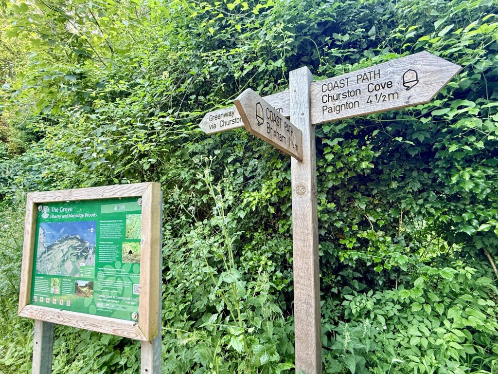
If time allows, it is also worth making short detours to places such as Fairy Cove, Hollicombe Park, Elberry Cove and Churston Cove. They lie only a few minutes from the South West Coast Path yet offer peaceful surroundings and some of the finest coastal scenery on the English Riviera, proving that even on a popular stretch of coast, there are still plenty of quiet corners waiting to be discovered.
This guide was researched by walking almost the entire Torbay coastline from Meadfoot Beach in Torquay to Brixham in a single day, visiting the major beaches and many of the quieter coves along the way. It is based on first-hand observations, local knowledge, and official visitor information.
Torbay Beaches FAQs
Does Torquay have nice beaches?
Yes. The main Torquay beaches include Meadfoot Beach, Torre Abbey Sands, Corbyn Beach, Livermead Sands and Beacon Cove. Torre Abbey Sands is best for easy access and facilities, while Meadfoot Beach and Beacon Cove offer more character, coastal scenery and history.
What are the top five beaches in Torbay?
Our top five Torbay beaches are Goodrington Sands for families, Elberry Cove for a hidden beach, Broadsands Beach for space and views, Meadfoot Beach for scenery and swimming, and Fairy Cove for a quiet cove close to Paignton Harbour.
Which is nicer, Paignton or Torquay?
Torquay is better for harbour views, restaurants, the marina, Torre Abbey Sands and Meadfoot Beach. Paignton is better for a traditional family seaside day, with Paignton Beach, Goodrington Sands, the pier, harbour, railway station and Dartmouth Steam Railway nearby.
Is Torquay good for children?
Yes. Torquay is good for children, especially around Torre Abbey Sands, the seafront, harbour, Princess Gardens and nearby attractions. For a more traditional family beach day, Goodrington Sands and Paignton Beach are also excellent choices.
Which Torbay beaches are best for families?
Goodrington Sands, Paignton Beach, Preston Sands and Broadsands Beach are among the best Torbay beaches for families, with good facilities, nearby cafés, toilets and easy access.
Which Torbay beaches are dog friendly?
Several smaller Torbay beaches are dog friendly all year, including Elberry Cove, Churston Cove, Fairy Cove, Beacon Cove and Peaked Tor Cove. Some larger beaches have summer dog restrictions, so always check local signs before visiting.
Which Torquay beaches are dog friendly?
Beacon Cove, Peaked Tor Cove and Livermead Sands are dog friendly all year. Meadfoot Beach allows dogs all year on the rocky eastern section, but dogs are restricted on the main sandy section during summer.
What are the best hidden beaches in Torbay?
Elberry Cove, Fairy Cove, Churston Cove, Peaked Tor Cove and Hollicombe Beach are among the best hidden beaches in Torbay. Most require a short walk and some have steep or stepped access.
Which are the best sandy beaches near Torquay?
Torre Abbey Sands is the main sandy beach in Torquay, while nearby Preston Sands, Paignton Beach, Goodrington Sands and Broadsands Beach offer larger sandy beaches within easy reach around Tor Bay.
Can you walk from Torquay to Brixham?
Yes. Following the South West Coast Path from Torquay to Brixham via Paignton covers around 10 miles (16 km) and passes more than twenty of Torbay’s beaches and coves. Allow a full day if you want time to stop, take photographs and return by ferry.
Are Torbay beaches good for swimming?
Many Torbay beaches are sheltered and suitable for swimming in calm conditions. Goodrington Sands, Broadsands Beach and Elberry Cove are popular choices, but swimmers should always check tides, weather, water quality and local safety information before entering the sea.
Where are the best steam train views near Torbay beaches?
Goodrington Sands and the South West Coast Path above the railway offer some of the best steam train views, especially around the footbridge and the descent towards Broadsands Beach, where the Dartmouth Steam Railway crosses the viaduct.
Plan Your Visit to Torbay Beaches
These trusted resources can help you plan and book your trip, from transport and accommodation to weather and local information.
- Booking.com – for most accommodation needs. Look out for options that include free cancellation.
- Easy Tide – Free UK tidal prediction service, providing tidal data and tide times for the current day and 6 days into the future.
- Expedia – good for flights and packages.
- Get Your Guide – find and book things to see. Includes unusual things to do.
- Hostelworld – Hostel-focused booking platform that fosters backpack connections.
- MetOffice – Weather forecasts from the UK’s official meteorological office.
- National Express – UK-based coach operator providing long-distance bus services
- Omio – Book travel tickets by comparing trains, buses and planes in one search.
- Rental Cars– to search out and book hire cars.
- Rome2Rio – Great for comparing local transport options (and for locating bus stops).
- Ticketmaster – What’s On – Major Events – Venues – Bookings
- Trainline.com – our go-to online platform for booking train and bus tickets, offering route planning, price comparisons, seat reservations, and ticket sales.
- Traffic England – for live traffic updates on major roads.
- Traveline SW – Comprehensive public transport information from A to B by bus, coach, train, ferry in South West England and Great Britain.
- TripAdvisor – for reviews of… pretty much everything. Our go-to before booking anything.
- Vrbo – Great for self-catering and vacation holiday home rentals.
Over to you … have you recently travelled to South West England? What worked for you? What advice would you give to others? Please leave your comments below or join in the discussion in our Facebook Group.
Welcome to ThisIsSouthWest.com
Start Here!