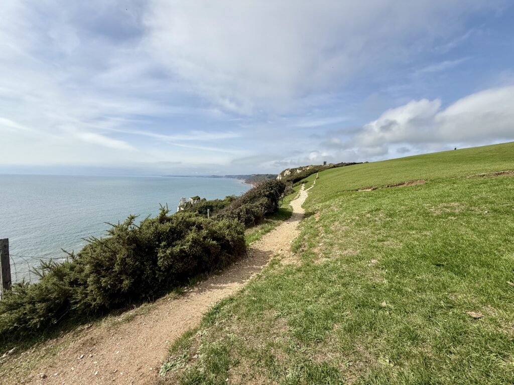
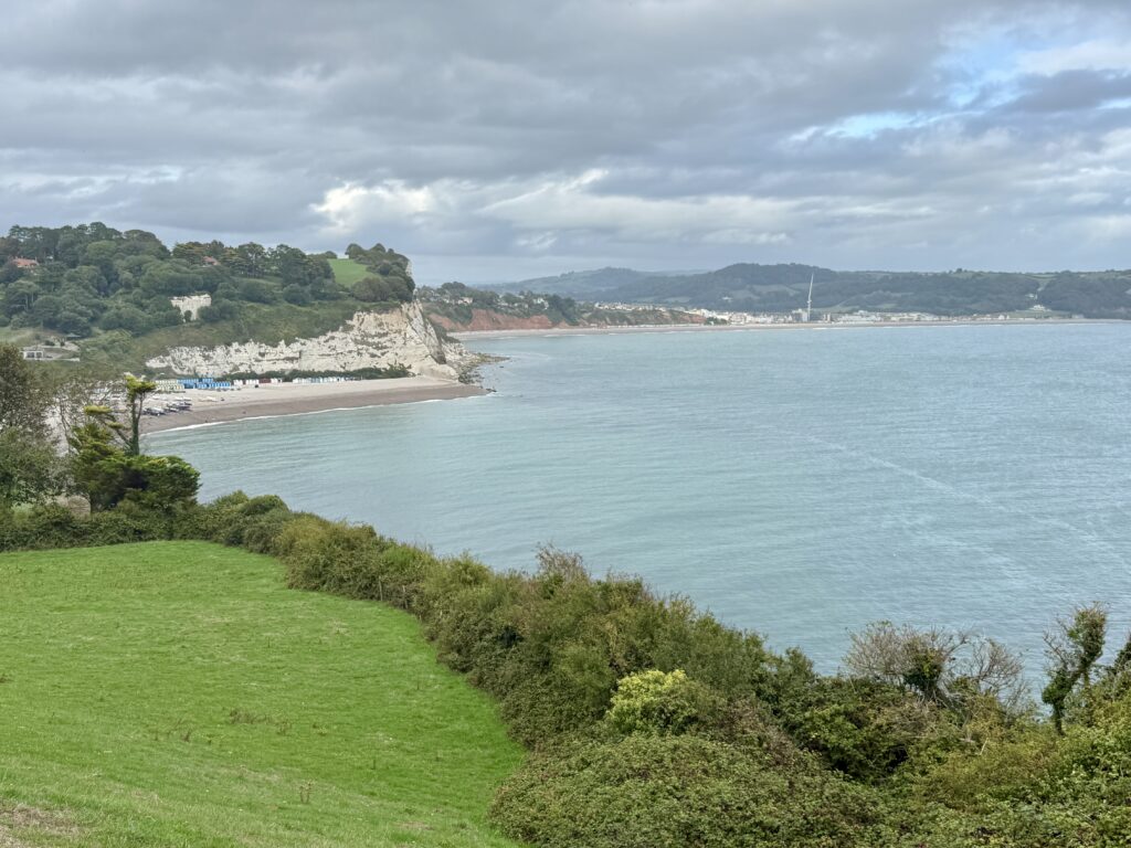
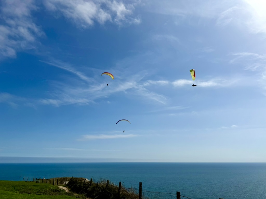
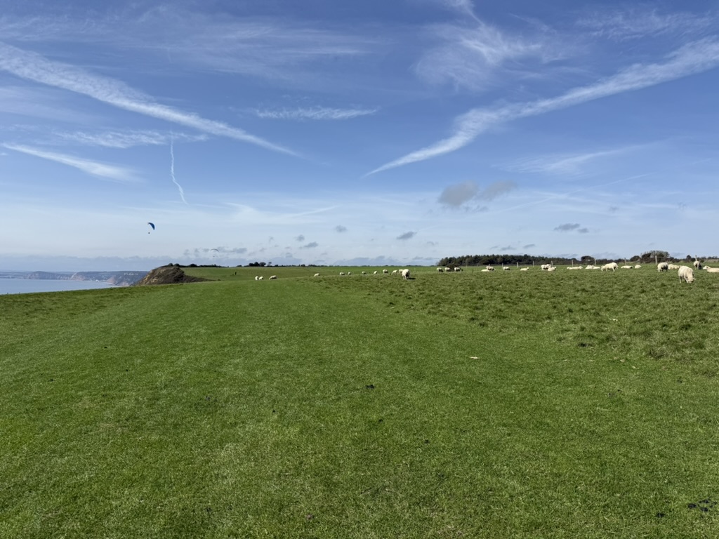
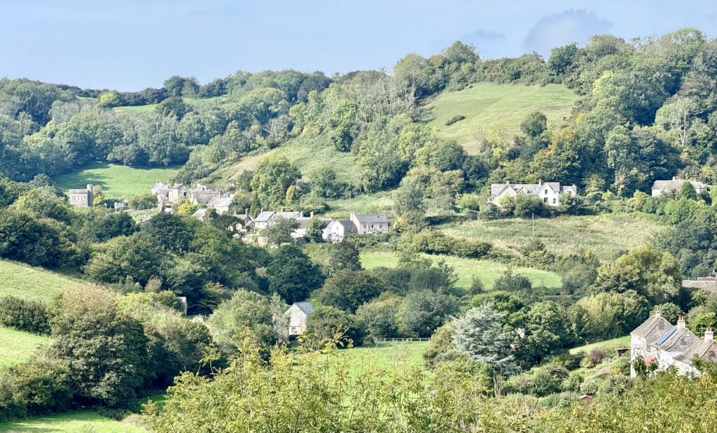
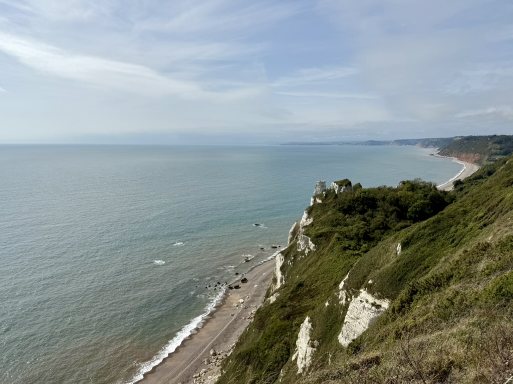
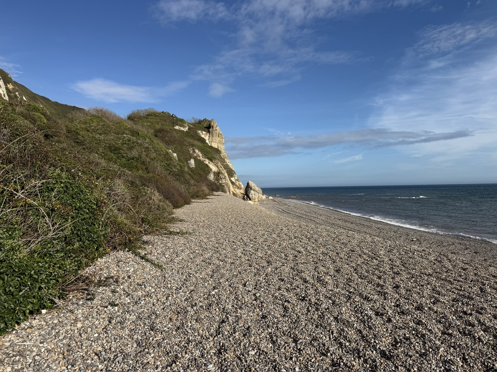
The clifftop coast path between Branscombe and Beer. (Credit: ThisIsSouthWest)
The Beer to Branscombe walk links two of East Devon’s most attractive villages across the open clifftops of Beer Head. Along the way, you’ll find far-reaching views across Lyme Bay, ancient earthworks, a lost Napoleonic gun battery, and the extraordinary landscape of Hooken Undercliff.
We have walked between Beer and Branscombe many times, in summer and winter and in both directions. For us, it would be difficult to visit or stay in either village without exploring the other.
The two villages have quite different characters. Beer is the larger, with a sheltered beach, fishing boats, shops and plenty of places to eat and drink. Branscombe is quieter and more scattered, stretching inland through a peaceful National Trust valley.
The walk between them is moderate, not easy. There is a steady climb out of Beer and a much steeper descent into Branscombe, but the route is straightforward enough, suitable for most, and the views make the effort worthwhile.
🥾 Beer to Branscombe Walk at a Glance
This moderate Beer to Branscombe coastal walk links two of East Devon’s loveliest villages by way of Beer Head, open clifftops and the steep path down East Cliff. The same route can also be followed as a Branscombe to Beer walk.
📍 Starting point
Beer Beach, although the walk can also begin at Branscombe Beach.
🚗 Parking in Beer
Clapps Lane car park, Beer, EX12 3EN. For a shorter walk that avoids Common Hill, use Cliff Top Long Stay Car Park, also known as Beer Head Car Park, EX12 3AQ.
🅿️ Parking in Branscombe
Branscombe Village Hall, EX12 3DB, where parking is by donation. Paid ANPR parking is also available beside Branscombe Beach.
↔️ Distance
Just over 4 miles for our return route between Beer and Branscombe.
⏱️ Walking time
About two hours without stops. Allow at least three hours, or longer if you plan to explore Branscombe.
⛰️ Total ascent
Approximately 800 feet.
🥾 Difficulty
Moderate. Common Hill is the longest climb, while East Cliff above Branscombe is shorter but considerably steeper.
🌿 Terrain
Village roads, field paths, wide clifftop tracks, gates and a steep coastal path. Some sections can become muddy and slippery in winter.
🐕 Dog friendly
Yes, although dogs should be kept on leads around livestock and under close control near cliff edges.
👨👩👧 Suitable for children
Suitable for active children, but the climb back up East Cliff can be challenging.
♿ Accessibility
The full route is not suitable for wheelchairs or pushchairs because of steep gradients, steps and uneven ground.
☕ Refreshments and toilets
Available in Beer and Branscombe, although some cafés and attractions open seasonally.
🚌 Return by bus
The Axe Valley 899 connects Beer and Branscombe. Check the current timetable before setting out.
⚠️ Hooken Undercliff route update:
the lower coast path beyond Hooken Beach was closed because of subsidence during our latest visit. Hooken Beach and the undercliff remain accessible as a worthwhile detour, but walkers continuing to Branscombe should follow the signed upper clifftop route.
Disclosure: Some links on this page are affiliate links. If you follow one and make a booking or purchase, we may receive a small commission at no extra cost to you. This helps support our independent guides. We also link to non-affiliate websites that we believe will be helpful. As an Amazon Associate, we earn from qualifying purchases.
Beer to Branscombe Walk Route Map
Our Beer to Branscombe walk route map shows the outward coastal path across Beer Head and East Cliff, then our return to Beer via the bridleway near the Lookout Tower and Common Hill.
Starting the Walk in Beer
Beer Beach, the starting point for the walk to Branscombe. (Credit: ThisIsSouthWest)
For convenience, we begin the walk at Beer Beach. It is easy to find and places the start close to public toilets, cafés, pubs and village shops.
Beer has several car parks, but we usually use Clapps Lane car park, EX12 3EN. This is the main long-stay car park and is only a few minutes’ walk from the beach.
Occasionally, on-street spaces may be available on Long Hill or The Causeway, although parking is certainly not guaranteed and restrictions may apply. Our complete guide to things to do in Beer has more information about parking, places to eat and other attractions in the village.
Public toilets are situated just above the beach. A water tap is also at the bottom of Sea Hill, on the right-hand side. We believe this provides drinking water, although it would be sensible to check the signage before filling a bottle.
From Beer Beach, walk uphill along Sea Hill towards the Anchor Inn. Turn left beside the pub and continue up Common Hill.
This is the longest climb of the walk. Common Hill is fairly steep, but the gradient eases as you leave the village and approach Beer Head.
Little Lane and Beer Memorial Avenue
Before reaching Beer Head Holiday Park, turn left from Common Hill into Little Lane. Look out for the coast-path signs.
If you miss the turning, continuing up Common Hill and Common Lane will still bring you towards the clifftop, so it is difficult to go too far wrong.
A large car park soon appears on the right. This is Cliff Top Long Stay Car Park (pay and display), also known locally as Beer Head Car Park, EX12 3AQ.
You can begin the Beer to Branscombe walk here if you want a slightly shorter route and would prefer to avoid the steep climb up Common Hill. Starting here means missing the walk through Beer and the initial views as you leave the village, but it puts you closer to the coast path.
Before continuing around Beer Head Holiday Park, take a few moments to visit Beer Memorial Avenue beside the car park.
The avenue consists of 30 small-leaved lime trees planted in November 2019 to honour people from Beer who served during the First World War. Plaques remember local residents who were killed, while two of the trees recognise more than 200 men and women who served and returned.
An information board recounts several personal stories, including those of Beer men who lost their lives at the Battle of Jutland. This moving, relatively little-known place is tucked away just beyond the village.
Climbing Towards Beer Head
Beer Beach and Seaton. (Credit: ThisIsSouthWest)
Return to the path and continue around the lower edge of Beer Head Holiday Park. Depending on opening times, Beer Head Bistro, with its fabulous views, may offer a chance to stop for refreshments.
The path continues gently uphill towards Beer Head. Compared with Common Hill, this section feels a little easier.
Before reaching the headland, you will pass a bench with an excellent view back across Beer Beach and along the coast towards Seaton. It is perfectly placed for a rest after the climb and is one of our favourite viewpoints on this side of Beer Head.
The white cliffs enclosing Beer Beach show why the village is so sheltered. Fishing boats are drawn up on the shingle below, while Seaton Bay opens out beyond the headland.
Beer Head
Paragliders above Beer Head on a clear day. (Credit: ThisIsSouthWest)
Beer Head is a broad, open headland rising above the white chalk cliffs of the Jurassic Coast.
The views are the main reason to make the climb. On a clear day, you can look east along the coast towards Portland and west across Lyme Bay towards Torbay and Berry Head. Closer at hand, there are wonderful views over Beer, Seaton Bay and the changing colours of the East Devon coastline.
Paragliders are sometimes seen above the headland when the weather and wind direction are suitable.
The path is generally wide, with much of the cliff edge fenced because of grazing livestock. Those who are nervous around heights can easily remain well back from the edge.
Beer Head is exposed, however, with little shelter in poor weather. The cliffs are also unstable, so walkers should stay on the established paths and keep children and dogs under close supervision.
Farming and Wildlife on Beer Head
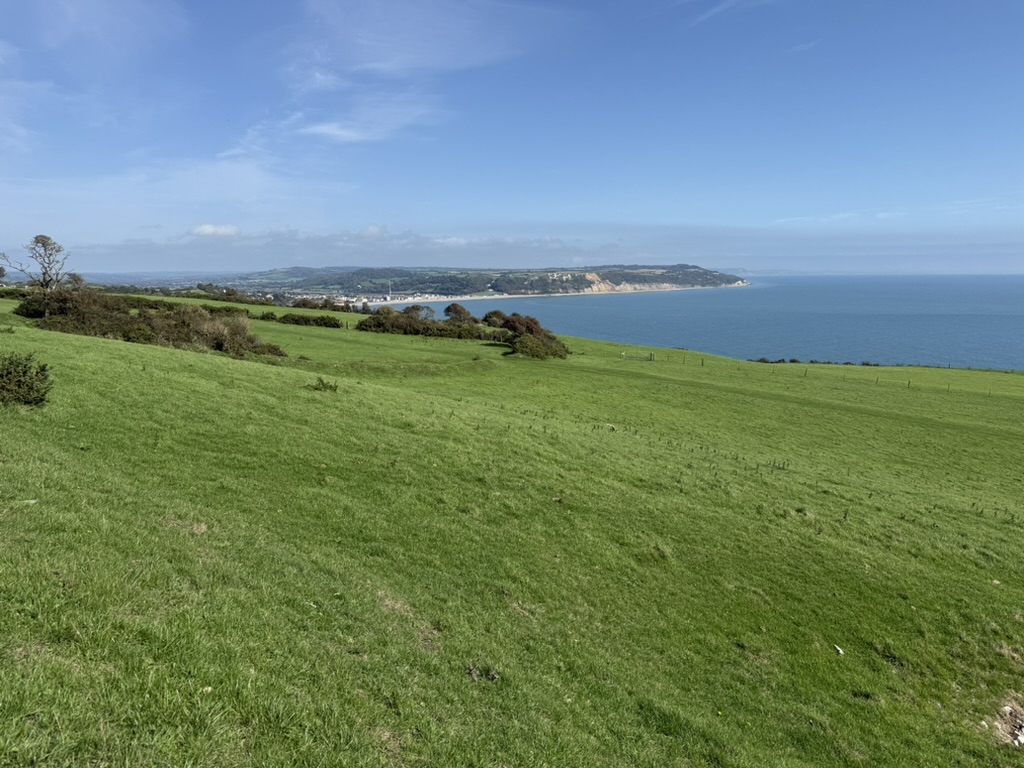
Open clifftop fields between Beer Head and Branscombe. (Credit: ThisIsSouthWest)
Beer Head remains a working farm, and its agricultural story stretches back more than 4,500 years.
Information boards explain how people have grown crops and kept animals here since at least the Neolithic period. The most visible field boundaries date from later centuries, but the wider landscape contains traces of far older activity.
The chalk grassland around the cliffs is particularly valuable. Thin soils and wind exposure create conditions in which specialist wildflowers can survive. The information boards identify rare plants found in the area, including Nottingham catchfly and purple broomrape.
Sheep and cattle often graze the fields beside the route. Dogs are welcomed, but should be kept on leads where livestock are present.
Ancient Archaeology and the Lost Gun Battery
Coastal views towards Seaton from Beer Head. (Credit: ThisIsSouthWest)
Subtle marks in the fields around Beer Head reveal a long history of occupation. The local map identifies areas of ancient and Roman archaeology, while worked flint found on the headland provides evidence of much earlier activity.
A ten-gun coastal battery once stood close to Beer Head.
The battery was installed during a period of concern about attacks and invasion during the Napoleonic era. It appears to have been a fairly simple position, with guns placed on the cliff and a hut to shelter the men rather than a substantial stone fort.
The guns were regularly exercised but apparently never fired in action. Local accounts say that a section of the cliff collapsed during the night, taking the guns and their shelter into the sea. The Beer Head map marks the former position, but walkers see little or nothing recognisable today.
The map also marks the site of a steam-powered winding wheel from the 1920s which we think was associated with stone working and features connected with later coastguard and wartime activity.
The Junction for Hooken Beach
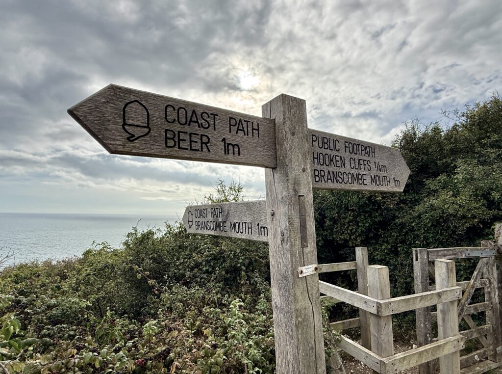
Coast path choices between Beer, Branscombe and Hooken Cliffs. (Credit: ThisIsSouthWest)
Continuing west, you reach the walk’s most important junction.
The path to the left descends towards Hooken Undercliff and Hooken Beach. Continuing straight ahead (signposted Hooken Cliffs and Branscombe Mouth) keeps you on the upper clifftop route towards the lookout and Branscombe.
At the time of our latest visit, the South West Coast Path through the lower undercliff towards Branscombe was closed following landslips and subsidence during the winter of 2025/26. The upper route provides a clear and straightforward alternative for the main Beer to Branscombe walk.
However, Hooken Undercliff and Hooken Beach remain well worth exploring as a separate detour.
Hooken Undercliff
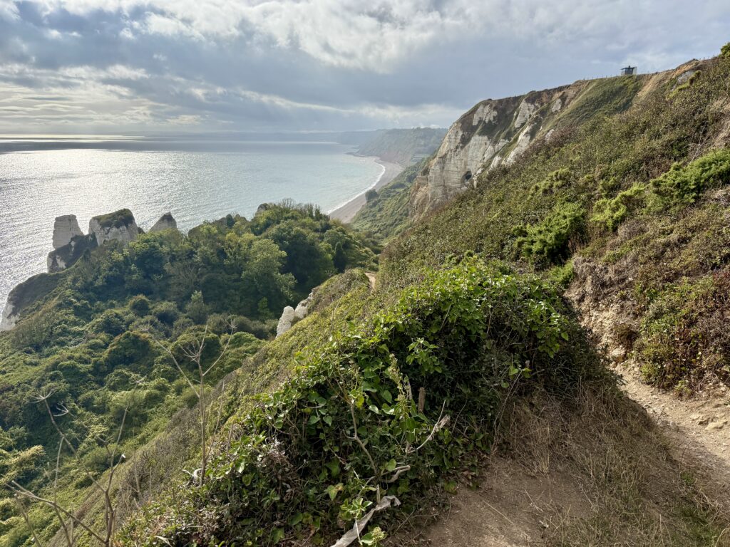
The steep path through Hooken Undercliff to Hooken Beach. (Credit: ThisIsSouthWest)
Hooken Undercliff is one of the most remarkable parts of the East Devon coast.
A huge cliff collapse in 1790 created the landscape, when about ten acres of chalk slipped towards the sea. Great blocks and pinnacles of chalk were left standing while the fallen ground between them gradually became covered with trees, shrubs and coastal plants.
The result is quite unlike the open fields above. The path descends into a sheltered and almost hidden landscape, with pale cliffs and chalk pinnacles rising through the vegetation.
It is beautiful, slightly mysterious and much more dramatic than the word “landslip” might suggest. The sheltered conditions also provide valuable wildlife habitat, helping explain its designation as a Site of Special Scientific Interest.
One of the most striking formations is the Pinnacle, a tower-like section of chalk left standing when the surrounding cliff moved.
The path down is steep, stepped and uneven. It is considerably harder on the way back up, but we think the landscape is worth the extra effort if time and conditions allow.
Hooken Beach
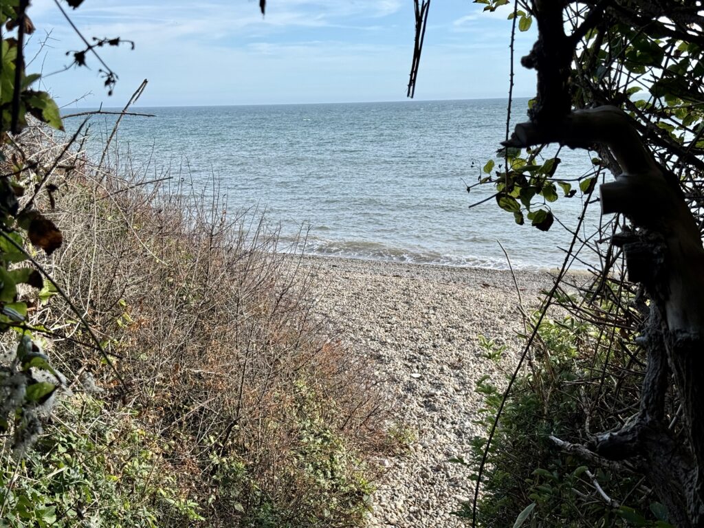
A secluded glimpse of Hooken Beach. (Credit: ThisIsSouthWest)
At the bottom lies Hooken Beach, a wonderfully quiet stretch of shingle beneath the white cliffs.
It feels far removed from the busier beaches at Beer and Branscombe. There are no cafés, toilets or other facilities, and it is quite possible to have much of the beach to yourself.
Access to Hooken Beach remains possible, but visitors should watch the tide and allow enough time for the steep climb back to the clifftop.
People do walk west along the shingle towards Branscombe, and we have done so ourselves in the past. However, warning signs now highlight the danger of rockfalls and further landslips, even when walking closer to the sea at low tide.
For that reason, we don’t recommend using the beach as the route to Branscombe. Conditions can change, the cliffs remain unstable, and the rising tide can reduce the available space. The safer choice is to enjoy Hooken Beach, then return up the same path and continue along the upper clifftop route.
The Lookout Tower and Signal House
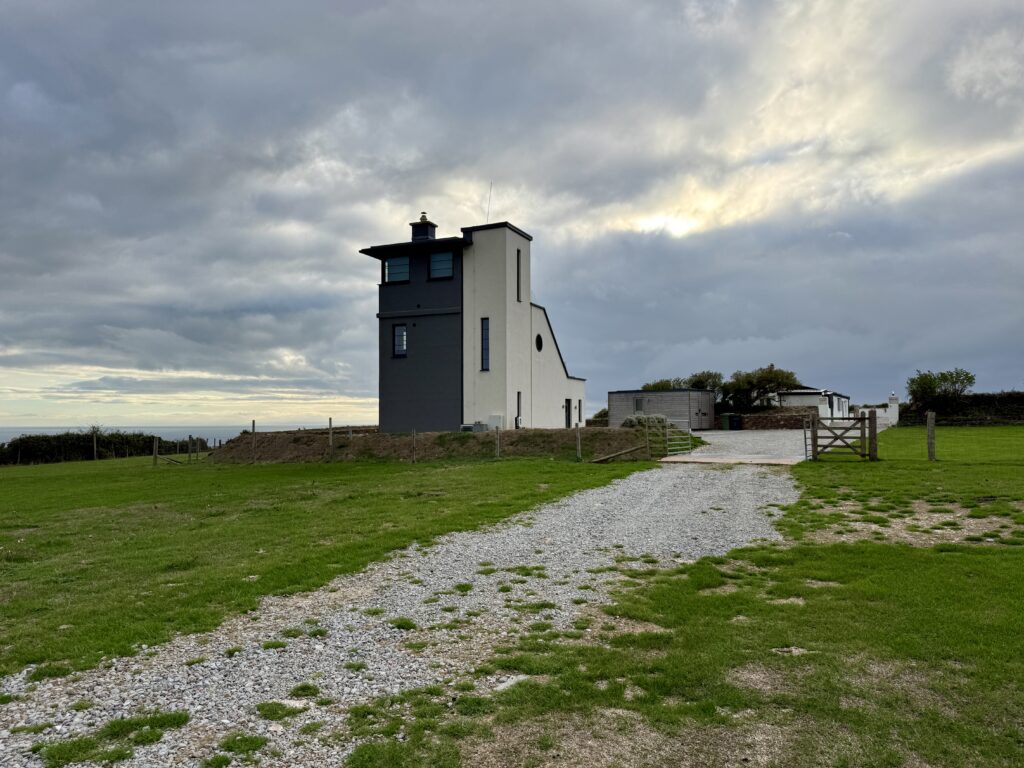
The Lookout Tower occupies a secluded position on Beer Head. (Credit: ThisIsSouthWest)
Back at the junction, continue straight ahead across the clifftop. The route climbs gently before levelling out near the lookout.
The Lookout Tower has a fascinating history. It developed from an 18th-century Napoleonic signal station and later became a 19th-century observation post used in attempts to control smuggling. It subsequently served as a coastguard lookout before being converted into private self-catering accommodation.
Nearby, the Signal House has also had several lives. It appears to have been used for livestock before becoming a coastguard and signal building and later a Customs and Excise house.
Its exact age remains uncertain. During renovation, musket balls, coastguard buttons and large blocks of local Beer stone were discovered. Stories that it dates from around 1600 or stands upon much earlier foundations remain intriguing but unproven.
Both buildings now offer private, self-catering accommodation, so walkers should stay on the public path and respect guests’ privacy.
The Lookout Tower and its near neighbour, the Signal House, may appeal to anyone searching for an unusual place to stay on Beer Head, with panoramic views across the surrounding coast and countryside.
Across the Clifftops Towards Branscombe
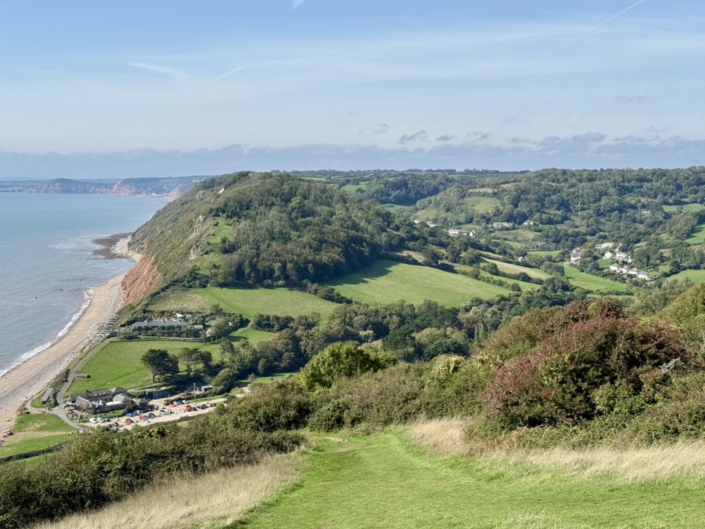
Branscombe Beach and village from the path down East Cliff. (Credit: ThisIsSouthWest)
Beyond the lookout, the path continues west across open fields. After the earlier climbs, this section feels wonderfully easy.
The route is largely level, the path is clear, and the sense of space is enormous. Sheep or cattle may be grazing in the adjoining fields, so keep dogs on leads.
Pass through the gate and continue towards East Cliff. Branscombe Beach gradually appears below, with the village stretching inland along its green valley.
Benches near the top provide a fine place to stop. The view looks across Branscombe Beach and west towards Sidmouth, with even more of the coastline visible in exceptionally clear weather.
Anyone who wants a shorter walk can turn around here. You will avoid the steep descent into Branscombe while still enjoying Beer Head and most of the clifftop views.
We think Branscombe is worth the additional effort, but there is no shame in saving your legs for another day.
Descending East Cliff
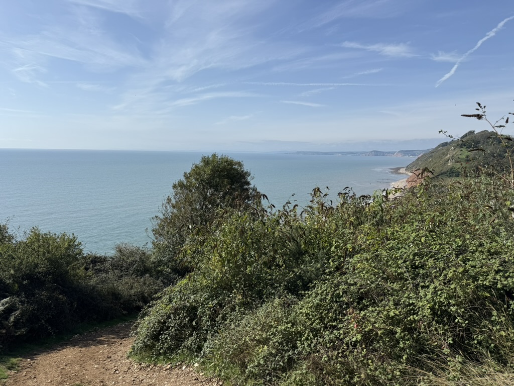
Descending East Cliff on the Beer to Branscombe walk. (Credit: ThisIsSouthWest)
The path now drops steeply down East Cliff towards Branscombe Beach.
This is the steepest section of the Beer to Branscombe walk, with a sharply descending path and several flights of steps. The route is easy to follow, but the ground can become muddy and slippery during winter, so take particular care when it is wet.
A few more benches line the descent, offering places to rest and enjoy the view.
If you return to Beer on foot, remember you will need to regain this height. The climb back up East Cliff is short but sharp, and children may find it challenging.
At the bottom, the path reaches Branscombe Beach close to the Sea Shanty Beach Café.
Branscombe Beach and the Napoli Anchor
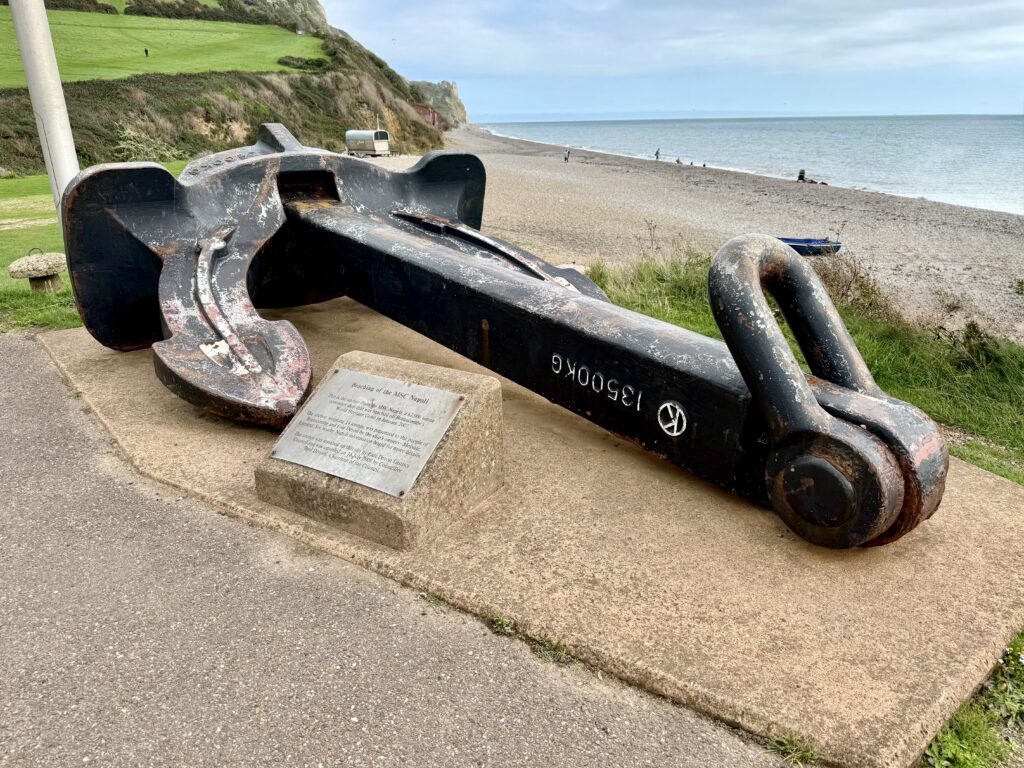
The MSC Napoli anchor overlooking Branscombe Beach. (Credit: ThisIsSouthWest)
Branscombe Beach is a long shingle beach backed by low cliffs and the entrance to the village valley.
Near the Sea Shanty stands an anchor associated with the MSC Napoli. The cargo ship got into difficulty during severe weather in January 2007 and was deliberately grounded off Branscombe to prevent it from sinking in deeper water.
More than 100 containers were lost, and items ranging from car parts and motorcycles to everyday household goods washed ashore. The incident briefly turned this quiet Devon beach into the focus of national attention.
Today the anchor provides a reminder of one of the most extraordinary episodes in Branscombe’s recent history.
Exploring Branscombe
The Masons Arms, Branscombe (Credit: ThisIsSouthWest)
It would be a shame to reach Branscombe and immediately turn around.
The village has a peaceful, timeless quality quite different from Beer. The National Trust cares for much of the surrounding land, and historic buildings are scattered along the valley rather than concentrated around a single centre.
From the beach, a gentle footpath follows the valley inland. Along the way you can visit Manor Mill, the Old Bakery and Branscombe Forge.
Manor Mill is the only surviving working mill of the three that once served the village. The Old Bakery was Devon’s last traditional working bakery, closing in 1987, and some of its historic baking equipment has been preserved.
Branscombe Forge is believed to be England’s only working thatched forge. When open, visitors can see the blacksmith at work and browse locally made ironwork.
For refreshments, the Sea Shanty is the most convenient choice beside the beach. The Masons Arms is the nearest village pub, while the Fountain Head lies farther up the valley.
Opening arrangements can be seasonal, so check before planning the day around a particular café or attraction.
Branscombe’s scattered cottages and church sit within its deep green valley. (Credit: ThisIsSouthWest)
There are several ways to return to Beer.
Walk Back Over Beer Head
The most scenic option is to climb East Cliff and retrace the outward route across Beer Head.
The Branscombe to Beer coastal walk follows the same spectacular clifftop route in the opposite direction.
We particularly recommend this route for anyone starting in Branscombe. Descending towards Beer provides a memorable view over the village and its sheltered beach.
Return via the Lookout Bridleway
On our walk, we climbed East Cliff and retraced the clifftop route to The Lookout.
Here, we turned left onto a bridleway and access track leading inland to the small informal car park at the very top of Common Hill. From the car park, follow Common Hill downhill, past Beer Head Holiday Park, and return to the centre of Beer.
This version of the walk measuredjust over 4 miles and included approximately 800 feet of ascent. Without stops, you could do it in just over 2 hours, about an hour each way.
Allow at least three hours at a comfortable pace. If you explore Branscombe, stop for lunch or spend time on the beaches, this can easily become a full day out.
Return by Bus
The Axe Valley 899 bus links Beer and Branscombe as part of its route between Seaton and Sidmouth.
In Beer, the bus stops near the village shop. In Branscombe, it stops beside the village hall and car park. We have used the service ourselves and find it a useful option for turning the walk into a one-way journey.
The service is limited, and timetables can change, so check return times before you start.
Make It a Circular Walk
A longer inland return is possible using paths around Stockham’s Hill and Mare Lane.
This creates a fuller circular walk, although it misses the pleasure of crossing Beer Head again.
Walking from Branscombe to Beer
Hooken Undercliff and the coast towards Branscombe. (Credit: ThisIsSouthWest)
The Branscombe to Beer walk is equally enjoyable.
We normally park behind Branscombe Village Hall, EX12 3DB, where parking is by donation. From here, it is roughly half a mile down the valley to Branscombe Beach. The pleasant route passes close to the Old Bakery and Manor Mill, with the Masons Arms also nearby.
The walk can include the Old Bakery, Manor Mill and, with a short variation, the Masons Arms. It is a lovely introduction to the village before tackling the coast path.
A paid ANPR-controlled car park is also available beside Branscombe Beach. The lane leading to it is narrow and can feel tortuous when traffic is busy, particularly during summer. For this reason, we generally prefer the village hall car park.
From Branscombe Beach, the path up East Cliff is obvious. The climb is a short, sharp shock, but once you reach the top, the route becomes considerably easier.
Starting in Beer means a longer but generally gentler climb. Starting in Branscombe gets you over the steepest ascent quickly. We find it difficult to recommend one direction over the other because the views and sense of space are wonderful either way.
How Difficult Is the Beer to Branscombe Walk?
We consider this a moderate walk.
Common Hill is the hardest sustained climb, while East Cliff is the steepest individual section. Most of the clifftop route is comparatively easy and should be manageable for reasonably active walkers.
The main path is well signed and difficult to lose. Look out for the left turn from Common Hill into Little Lane and, farther along, the junction for Hooken Beach.
With the lower through-route closed, walkers continuing to Branscombe should remain on the upper clifftop path.
Walking With Children
The route should suit active children who are comfortable walking uphill.
The return climb up East Cliff may be tiring, so allow extra time and breaks. The main clifftop path is wide and much of it is fenced, but children should still be supervised around cliff edges.
The full route is unsuitable for pushchairs because of steep slopes, steps, gates and uneven ground.
Walking With Dogs
This is an enjoyable dog-friendly walk.
Keep dogs on leads around sheep and cattle, and under close control near cliffs. Carry water in warm weather, and remember the Hooken Beach detour includes steep steps in both directions.
Footwear and What to Bring
We have walked between Beer and Branscombe in both winter and summer. Our most recent visit was in September, with sunny spells, comfortable temperatures and dry ground.
In settled summer weather, supportive everyday shoes may be sufficient. In winter, we recommend proper walking boots because the paths can become muddy and slippery.
Beer Head and the clifftops are exposed, with very little shelter from wind or rain. Bring clothing appropriate to the forecast and consider carrying an extra layer even when conditions seem pleasant in the villages.
Apart from water, you need little specialist equipment. If making a day of it, take whatever you need at the other end, perhaps beachwear, a picnic or warmer clothing. Food and drink are available in both villages, but some businesses open seasonally.
Mobile reception can be poor beneath the cliffs and around Branscombe Valley.
Weather and Tide Times in Beer, Devon
Beer has a mild coastal climate, although the exposed cliffs around Beer Head can be much windier than the sheltered village. Check the latest Beer Beach forecast from the Met Office or BBC Weather before travelling, particularly when planning a coastal walk.
Tide Times for Beer Beach
Tide predictions for Beer Beach are based on Lyme Regis, the nearest reporting station, approximately seven miles away. Actual times, heights and conditions at Beer may vary slightly.
Check the tide for swimming, rockpooling and fishing, but never rely on it to make the shoreline route towards Branscombe safe. The cliffs beyond Hooken Beach are unstable, so walkers should use the open route over Beer Head.
Is the Beer to Branscombe Walk Worth Doing?
Quiet and unspoilt Hooken Beach below the undercliff. (Credit: ThisIsSouthWest)
Absolutely.
The walk combines two contrasting villages with some of the finest coastal scenery in East Devon. It offers open clifftops, white chalk cliffs, quiet beaches, ancient archaeology, military history, and the remarkable landscape of Hooken Undercliff.
Beer is the busier village, with shops, fishing boats, and plenty of places to eat. Branscombe is quieter, greener and wonderfully timeless.
If you do nothing else, walk from either village to Beer Head. On a clear day, the views are stunning, and we promise they make the climb worthwhile.
Those who want an easier outing can turn around on the clifftop and retrace their steps. Ideally, though, allow enough time to visit both Beer and Branscombe. The walk is best when treated as a full day out rather than simply a route between two points.
Beer to Branscombe Walk FAQs
Practical answers about the Beer to Branscombe coastal walk, including its distance, difficulty, parking, bus service and the current route around Hooken Undercliff.
How far is the Beer to Branscombe walk?
The direct coastal route between Beer and Branscombe is approximately two miles each way. Our return route, using the bridleway near the Lookout Tower and Common Hill on the final section, measured just over four miles.
How long does it take to walk from Beer to Branscombe?
Allow about one hour of continuous walking in each direction. Our complete return walk took just over two hours without stops. We recommend allowing at least three hours, or longer if you want to explore Branscombe, visit Hooken Beach or stop for refreshments.
Can you walk from Beer to Branscombe?
Yes. A clearly signed upper clifftop route connects Beer and Branscombe via Beer Head and East Cliff. Coastal landslips can affect the lower path through Hooken Undercliff, so follow current signs and local diversions.
Is the Beer to Branscombe walk difficult?
We rate the walk as moderate. Common Hill provides the longest climb, while East Cliff above Branscombe is much steeper but relatively short. Most of the clifftop section is comparatively level and easy to follow.
Which direction is easier?
Walking from Beer involves a longer but generally gentler climb. The Branscombe to Beer walk begins with a short, steep climb up East Cliff, after which the route becomes much easier. The views are rewarding in both directions.
Is Hooken Undercliff open?
Hooken Undercliff and Hooken Beach remain accessible as a there-and-back detour from the clifftop. However, the onward lower coast path towards Branscombe was closed because of subsidence during our latest visit. Walkers continuing to Branscombe should follow the signed upper route and check current conditions.
Can you walk along Hooken Beach to Branscombe?
People do walk west along the shingle towards Branscombe, and we have done so in the past. However, warning signs highlight the risk of rockfalls, unstable cliffs and changing tides. We therefore recommend returning to the clifftop and using the signed upper path.
Is Hooken Beach worth visiting?
Yes. Hooken Beach is a beautiful and usually quiet stretch of shingle beneath the white cliffs. The steep path also passes through the remarkable Hooken Undercliff, formed by a major landslip in 1790. There are no facilities at the beach.
Is the Beer to Branscombe walk dog friendly?
Yes. Dogs are welcome, but they should be kept on leads around sheep and cattle and under close control near cliff edges. Carry water for your dog during warm weather.
Is the walk suitable for children?
The route should suit active children who are comfortable walking uphill. The climb back up East Cliff can be tiring, so allow extra time and supervise children carefully around the cliffs.
Where can I park for the Beer to Branscombe walk?
In Beer, we usually use Clapps Lane car park, EX12 3EN. Cliff Top Long Stay Car Park, also known as Beer Head Car Park, EX12 3AQ, provides a shorter starting option that avoids the steep climb up Common Hill. In Branscombe, donation parking is available behind Branscombe Village Hall, EX12 3DB.
Is there a bus between Beer and Branscombe?
Yes. The Axe Valley 899 bus connects the villages, stopping near the village shop in Beer and beside Branscombe Village Hall. Services are limited, so check the current timetable before starting a one-way walk.
Over to you … have you recently travelled to South West England? What worked for you? What advice would you give to others? Please leave your comments below or join in the discussion in our Facebook Group.
New to South West England or returning after a while? Start with our ‘Travel Basics’ – quick guides packed with tips to help you plan your trip.
Hi, I’m Les, founder of ThisIsSouthWest.com, an independent online guidebook to Cornwall, Devon, Somerset and Dorset.
Born in Devon and now based in Somerset near the Devon border, I have spent more than thirty years exploring the South West, from the Isles of Scilly and Lundy to towns, coastlines and countryside across all four counties.
I always visit the destinations I cover, take my own photographs and personally test many of the routes and transport connections featured, supported by careful research using reliable sources.
Drawing on a professional background in aviation and travel, I aim to help readers explore and enjoy South West England with confidence through practical, first-hand information, while highlighting different ways to get around.
Questions, corrections or suggestions are always welcome. Please get in touch.